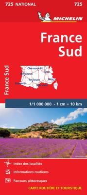
Wegenkaart - landkaart 725 Frankrijk Zuid | Michelin

0
Zoals je van Michelin mag verwachten is deze kaart zeer overzichtelijk en heeft een duidelijk helder kaartbeeld. De kaart geeft uitgebreide toeristische informatie weer. De perfecte overzichtskaart van alleen de zuidelijke helft van Frankrijk. Michelin’s annually updated coverage of France at 1:1,000,000, available as two folded maps or two differ...

Alle aanbiedingen van dit product

Verkoper
Bezorging
Prijs
DeZwerver.nl logo
DeZwerver.nl
2,95
13,95

Anderen bekeken ook

Iwari
Iwari
Iwari Evermore have they walked the world of Iwari. Evermore have they embodied its spirit and shaped its lands. They are stewards of the earth. Five Titans that make the cosmos breath. On Iwari, there are no teeming masses, no continent-wide civilizations. Humanity is in its infancy, living in scattered tribes in forest, tundra, and desert. Now we have left our ancestral homelands to explore the vast uncharted regions, encountering other fellow tribes and exchanging knowledge, culture and wisdom. In our journey, we all live in harmony with the Titans, and though distant to us, they decide our fate. And yet only we don't know if they created us, or we created them. Iwari is an abstract-like Eurogame in which players represent different tribes looking for their identity by traveling around far lands and expanding their settlements into five different regions on the board. In the game, players use cards for two different actions:1) Place tents and expand their settlements into five diffe…
48,95

Klanten-reviews van Wegenkaart - landkaart 725 Frankrijk Zuid | Michelin

Er zijn nog geen beoordelingen voor dit productBen jij de eerste die een review plaatst?

Meer over Wegenkaart - landkaart 725 Frankrijk Zuid | Michelin

Productomschrijving

Zoals je van Michelin mag verwachten is deze kaart zeer overzichtelijk en heeft een duidelijk helder kaartbeeld. De kaart geeft uitgebreide toeristische informatie weer. De perfecte overzichtskaart van alleen de zuidelijke helft van Frankrijk.

Michelin’s annually updated coverage of France at 1:1,000,000, available as two folded maps or two different format pocket atlases covering the whole country, plus as separate maps of just the northern or the southern half.   The mapping emphasizes the network of motorways and dual carriageway roads with motorway characteristics, distinguishing by colouring between charge-free and toll sections. Junctions are shown with numbers, indicating complete or limited interchanges. Other roads are classified according to their width and density of traffic. Driving distances are given on all routes except on small local roads. Scenic routes are highlighted and gradient marking shows steep roads.   Railway lines are not included. Small symbols indicate some places of interest, but the maps are not designed to highlight tourist sights or amenities. Topography is shown by relief shading, with boundaries of national/regional parks. The maps have no geographical coordinates. All the versions are indexed. Map legend includes English   Bayonne, Bordeaux, France, Lyon, Marseille, Nice, Toulouse

Productinformatie

    Verken gerelateerde categorieën

    Webshop.nl maakt gebruik van cookies. Ga je verder op onze website, ga dan akkoord met het plaatsen van cookies en de verwerking van deze data door ons en vermelde partners.