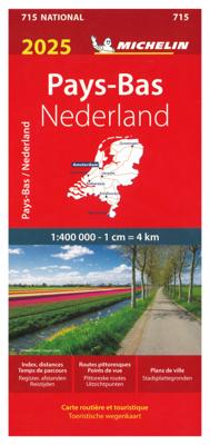
Wegenkaart - landkaart 715 Nederland 2025 | Michelin

0
Zoals je van Michelin mag verwachten is deze kaart zeer overzichtelijk en heeft een duidelijk helder kaartbeeld. De kaart geeft uitgebreid toeristische informatie weer. Met stadsplattegrond van de hoofdstad.   Netherlands at 1:400,000 from Michelin, with information on driving regulations, a distance and journey time table, plus enlargements showi...

Verkopers met dit product

Verkoper
Bezorging
Prijs
DeZwerver.nl logo
DeZwerver.nl
2,95
11,95

Anderen bekeken ook

Wegenkaart - landkaart 716 België - Luxemburg 2025 | Michelin
Zoals je van Michelin mag verwachten is deze kaart zeer overzichtelijk en heeft een duidelijk helder kaartbeeld. Klassiek en beroemd zijn de groene lijnen langs de aantrekkelijke wegen: zo wordt in een oogopslag duidelijk waar de mooiste plekjes te vinden zijn. De kaart geeft uitgebreid toeristische informatie weer.  Met stadsplattegrond van de hoofdstad.   Belgium and Luxembourg at 1:350,000 from Michelin with information on driving regulations in each country, a distance and journey time table, plus enlargements showing in greater detail road access to Antwerp, Brussels, Liège and Luxembourg City which also has a small plan of its centre.   Roads network includes local roads and is graded according to the number of lanes. Junctions show full or partial interchanges. Steep gradients, level crossings and restricted entry sections are marked; scenic routes are highlighted. Railway lines and ferry routes are included.   Relief shading is used to indicate the topography, with colouring f…
11,95
Wegenkaart - landkaart 730 Oostenrijk 2025 | Michelin
Zoals je van Michelin mag verwachten is deze kaart zeer overzichtelijk en heeft een duidelijk helder kaartbeeld. De kaart geeft uitgebreid toeristische informatie weer. Met register, afstanden en reistijden. Wegen worden naar verschillende klasse ingedeeld en - mooi van Michelin - de interessante mooie routes worden gemarkeerd met een groene streep.    Hindernissen voor automobilisten met caravans zijn gemarkeerd: steile hellingen, bergpassen of een anderzins moeilijke route. Bezienswaardigheden als een kasteel, religieus gebouw, ruine of grot is door een symbool goed te vinden. The Michelin National road map of Austria at 1:400,000 scale is ideal for route planning and touring. The map gives comprehensive coverage of national road networks showing all major motorways, dual carriageways, national & regional main roads and some single-lane roads. Also shows unsurfaced roads and tracks and major footpaths. The map is divided by grid showing latitude and longitude.     Distances between …
11,95
Wegenkaart - landkaart 743 Algerije - Tunesië | Michelin
Kaart van beroemde kaartenmakers en voor Algerije en Tunesie weer een hele goede. Uitermate goed leesbaar, prettig kleurgebruik. Zoals je van Michelin mag verwachten is deze kaart zeer overzichtelijk en heeft een duidelijk helder kaartbeeld. De kaart geeft uitgebreid toeristische informatie weer. Met register, afstanden en reistijden. Wegen worden naar verschillende klasse ingedeeld en - mooi van Michelin - de interessante mooie routes worden gemarkeerd met een groene streep.    Hindernissen voor automobilisten met caravans zijn gemarkeerd: steile hellingen, bergpassen of een anderzins moeilijke route. Bezienswaardigheden als een kasteel, religieus gebouw, ruine of grot is door een symbool goed te vinden. The Michelin National road map of Algeria & Tunisia at 1:1,000,000 scale is ideal for trip & route planning. The map gives comprehensive coverage of national road networks showing all major motorways, dual carriageways, national & regional main roads and some local roads. Also shows …
12,95
Wegenkaart - landkaart 717 Gr. H. Luxemburg 2025 | Michelin
Zoals je van Michelin mag verwachten is deze kaart zeer overzichtelijk en heeft een duidelijk helder kaartbeeld. De kaart geeft uitgebreid toeristische informatie weer. Met stadsplattegrond van de hoofdstad.   The Michelin National road map of the Grand Duchy of Luxembourg at 1:150,000 scale is ideal for trip & route planning and touring. The map gives comprehensive coverage of national road networks showing all major motorways, dual carriageways, national & regional main roads and some single-lane roads. Also shows unsurfaced roads, tracks, and major footpaths. The map is divided by grid showing latitude and longitude.   Distances between major locations are marked along roads, with total distance and several intermediate distances shown. A quick-reference chart of distances & driving times between major locations is also included. The map also includes a grid-referenced index of principal place names.   Clear, easy-to read cartography shows roads in reds, yellows and white with blac…
11,95
Wegenkaart - landkaart 732 Hongarije | Michelin
Zoals je van Michelin mag verwachten is deze kaart zeer overzichtelijk en heeft een duidelijk helder kaartbeeld. De kaart geeft uitgebreid toeristische informatie weer. Met register, afstanden en reistijden. Wegen worden naar verschillende klasse ingedeeld en - mooi van Michelin - de interessante mooie routes worden gemarkeerd met een groene streep.    Hindernissen voor automobilisten met caravans zijn gemarkeerd: steile hellingen, bergpassen of een anderzins moeilijke route. Bezienswaardigheden als een kasteel, religieus gebouw, ruine of grot is door een symbool goed te vinden.   The Michelin National road map of Hungary at 1:400,000 scale is ideal for route planning. The map gives comprehensive coverage of national road networks showing all major motorways, dual carriageways, national & regional main roads and some single-lane roads. [[Also shows unsurfaced roads and tracks and major footpaths.   Distances between major locations are marked along roads, with total distance and sever…
11,95
Wegenkaart - landkaart 754 Finland | Michelin
Zoals je van Michelin mag verwachten is deze kaart zeer overzichtelijk en heeft een duidelijk helder kaartbeeld. De kaart geeft uitgebreid toeristische informatie weer. Met register, afstanden en reistijden.   Wegen worden naar verschillende klasse ingedeeld en - mooi van Michelin - de interessante mooie routes worden gemarkeerd met een groene streep. Hindernissen voor automobilsiten met caravans zijn gemarkeerd: steile hellingen, bergpassen of een anderzins moeilijke route. Bezienswaardigheden als een kasteel, religieus gebouw, ruine of grot is door een symbool goed te vinden.   The Michelin National road map of Finland at 1:1,250,000 scale is ideal for route planning. The map gives comprehensive coverage of national road networks showing all major motorways, dual carriageways, national & regional main roads and some single-lane roads. Also shows unsurfaced roads. The map is divided by grid showing latitude and longitude.   Distances between major locations are marked along roads, wi…
11,95
Wegenkaart - landkaart 711 Scandinavië & Finland | Michelin
Zoals je van Michelin mag verwachten is deze kaart zeer overzichtelijk en heeft een duidelijk helder kaartbeeld. De kaart geeft uitgebreid toeristische informatie weer. Natuurlijk vanwege het grote gebied een behoorlijk grove schaal. Scandinavia and Finland map at 1:1,500,000 from Michelin, including the whole of Denmark, Norway, and Sweden, with enlargements showing in greater detail road networks around Helsinki, the Copenhagen - Malmo area, Oslo, Bergen, Stockholm and Gothenburg. Road network is presented graded according to the width and the number of lanes, indicating full/limited interchanges, toll barriers, driving distances, steep sections, seasonal closures, etc. The map also highlights scenic roads and tourist routes. Railway lines and ferry routes are included and local airports are marked. Symbols highlight various places of interest and mark locations of campsites. Within each country the map also shows internal administrative boundaries with names of the provinces. Topog…
11,95
Wegenkaart - landkaart 720 Polen | Michelin
Zoals je van Michelin mag verwachten is deze kaart zeer overzichtelijk en heeft een duidelijk helder kaartbeeld. De kaart geeft uitgebreid toeristische informatie weer. Met stadsplattegrond van de hoofdstad. The Michelin National road map of Poland at 1:700,000 scale is ideal for route planning. The map gives comprehensive coverage of national road networks showing all major motorways, dual carriageways, national & regional main roads and some single-lane roads. Distances between major locations are marked along roads, with total distance and several intermediate distances shown. A quick-reference chart of distances & driving times between major locations is also included. The map also includes a grid-referenced index of principal place names.   Clear, easy-to read cartography shows roads in reds, yellows and white with black outlines. Major topography is indicated with relief shading. Woodland & forest is marked with green shading. Built-up urban areas are clearly marked in yellow. A…
11,95
Wegenkaart - landkaart 726 Frankrijk Route Planning 2025 | Michelin
Uitgebreide algemene wegenkaart van Frankrijk. Naast de hoofdwegen worden ook alternatieve routes aangegeven.   A route planning map of France from Michelin, showing just the network of motorways and the connecting primary and secondary roads, with congested sections and alternative routes, all with distances and driving times.   The main map, plus the enlargements for the outskirts of Paris and Lyon, show the network of motorways (with toll barriers, names of service areas, and junction numbers indicating full or partial interchanges), dual carriageway roads, plus primary and secondary roads, all with both driving distances and journey times. Also marked are towns used as primary destinations on green road signs along the major routes, and locations of speed cameras. Particularly congested areas are clearly highlighted.   The map also shows Michelin’s recommendations for alternative routes to avoid traffic congestion in many popular holiday areas such as the Dordogne, Cevennes, Langu…
11,95
Wegenkaart - landkaart 742 Maroc - Marokko | Michelin
Kaart van beroemde kaartenmakers en voor Marokko weer een hele goede. Uitermate goed leesbaar, prettig kleurgebruik. Onder Marokko-gangers staat deze kaart zeer goed bekend. Zoals je van Michelin mag verwachten is deze kaart zeer overzichtelijk en heeft een duidelijk helder kaartbeeld. De kaart geeft uitgebreid toeristische informatie weer. Met register, afstanden en reistijden. Wegen worden naar verschillende klasse ingedeeld en - mooi van Michelin - de interessante mooie routes worden gemarkeerd met een groene streep.    Hindernissen voor automobilisten met caravans zijn gemarkeerd: steile hellingen, bergpassen of een anderzins moeilijke route. Bezienswaardigheden als een kasteel, religieus gebouw, ruine of grot is door een symbool goed te vinden.   Morocco at 1:1,000,000 on a road map from Michelin, with enlargements showing in greater detail four of the country’s most visited areas, including the High Atlas around Marrakesh and Jbel Toubkal, plus an additional map of the whole cou…
12,95

Klanten-reviews van Wegenkaart - landkaart 715 Nederland 2025 | Michelin

Er zijn nog geen beoordelingen voor dit productBen jij de eerste die een review plaatst?

Meer over Wegenkaart - landkaart 715 Nederland 2025 | Michelin

Productomschrijving

Zoals je van Michelin mag verwachten is deze kaart zeer overzichtelijk en heeft een duidelijk helder kaartbeeld. De kaart geeft uitgebreid toeristische informatie weer. Met stadsplattegrond van de hoofdstad.   Netherlands at 1:400,000 from Michelin, with information on driving regulations, a distance and journey time table, plus enlargements showing in greater detail road access to Amsterdam, The Hague and Rotterdam with the Europoort and Hoek Van Holland.   Roads network includes local roads and is graded according to the number of lanes. Junctions show full or partial interchanges. Steep gradients (!), level crossings and restricted entry sections are marked; scenic routes are highlighted. Railway lines and ferry routes are included.   Relief shading is used to indicate the topography, with colouring for forested areas. National parks are also marked. Small symbols indicate various landmarks or places of interest including campsites and youth hostels, but the map is not primarily designed to highlight tourist sights.    The map also indicates locations with street plans in Michelin’s Red Guides to Hotels and Restaurants in the Netherlands. Latitude and longitude lines are drawn at 20’ intervals. Multilingual map legend includes English. The index is next to the map.   Enlargements at 1:100,000 show in greater detail road access to Amsterdam including the Schiphol Airport, The Hague and the area around Rotterdam including the Europoort, Hoek van Holland and Delft. Also provided is basic information on the country’s driving regulations, plus a table showing driving distances and journey times between 26 main cities   Amsterdam, Eindhoven, Groningue, La Haye, Maastricht, Nimègue, Pays-Bas, Rotterdam, Utrecht

Verken gerelateerde categorieën

Webshop.nl maakt gebruik van cookies. Ga je verder op onze website, ga dan akkoord met het plaatsen van cookies en de verwerking van deze data door ons en vermelde partners.