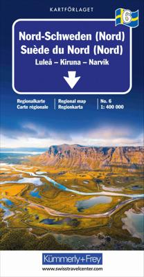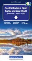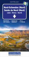
Wegenkaart - landkaart 6 Nord-Schweden - Zweden Noord | Kümmerly & Frey

0
Mooie duidelijke wegenkaart van Noord Zweden, van Lulea - Kiruna - Narvik.  Met o.a. campings, jeugdherbergen, wegnummers en bezienswaardigheden aangegeven.   Kummerly and Frey regional road map covering North Sweden. A product from this regional range is ideal for tourists, and is intended to be taken around in a glove compartment. Mapping gives ...

Verkopers met dit product

Verkoper
Bezorging
Prijs
DeZwerver.nl logo
DeZwerver.nl
2,95
14,75

Anderen bekeken ook

Nieuw
Wegenkaart - landkaart 1 Zuid Zweden | Kümmerly & Frey
Mooie duidelijke wegenkaart van Zuid Zweden, van Malmo - Vaxjo tot Kalmar.  Met o.a. campings, jeugdherbergen, wegnummers en bezienswaardigheden aangegeven. Kummerly and Frey regional road map covering South sweden. A product from this regional range is ideal for tourists, and is intended to be taken around in a glove compartment. Mapping gives at-a-glance navigation between tourist attractions within the coverage areas, so that travelling times can be easily calculated and minimised, with easily followable numbered roads so that incorrect routes are avoided.  
14,75
Nieuw
Wegenkaart - landkaart 2 Zuid Zweden (West), Southern Sweden; Karlstad Göteborg | Kümmerly & Frey
Mooie duidelijke wegenkaart van West Zweden, van Karlstad tot Göteborg. Met o.a. campings, jeugdherbergen, wegnummers en bezienswaardigheden aangegeven. Kummerly and Frey regional road map covering Karlstad to Göteborg. A product from this regional range is ideal for tourists, and is intended to be taken around in a glove compartment. Mapping gives at-a-glance navigation between tourist attractions within the coverage areas, so that travelling times can be easily calculated and minimised, with easily followable numbered roads so that incorrect routes are avoided.
14,75
Nieuw
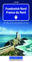
Wegenkaart - landkaart Frankreich Nord - Frankrijk Noord | Kümmerly & Frey
Mooie duidelijke wegenkaart van Noord Frankrijk. Met o.a. campings, wegnummers en bezienswaardigheden aangegeven. Die Strassenkarten von Kümmerly+Frey sind beliebte Begleiter bei der Planung einer Reise, unterwegs oder am Ziel. Die "Blauen", wie sie auch genannt werden, zeichnen sich durch ein übersichtliches Kartenbild und eine präzise Kartografie aus. Das Sortiment umfasst weit über 100 aktuelle Strassen- und Reisekarten. Alle Strassenkarten haben eines gemeinsam: Sie sind von bester Schweizer Qualität. Planen und reisen Sie mit einer blauen Strassenkarte von Kümmerly+Frey und Sie werden überrascht sein, wie viel es zu entdecken und zu erleben gibt.  In the Kümmerly+Frey Road Map France (North) at a scale of 1:600,000, you will find everything you need for orientation and inspiration.   The map shows the main areas of interest from Basel, Strasbourg, Metz, Dijon, Bourges, Paris, Le Mans, Rennes, Nantes, Rouen, Lille, Calais, Brest, etc.   Thanks to the clearly marked, easily readabl…
14,75
Nieuw
Wegenkaart - landkaart 3300 Adventure Map Finland & Northern Scandinavia - Finland en noord Scandinavië | National Geographic
Wegenkaart van Finland en noord Scandinavië met vermelding van veel bezienswaardigheden, nationale parken en attrakties. Watervast en scheurvast. Juist door deze vermeldingen onderscheidt de kaart zich van andere wegenkaarten. National Geographic's Finland and Northern Scandinavia Adventure Map is designed to meet the unique needs of adventure travelers with its detail, durability, and accuracy. Scandinavia North includes the locations of thousands of cities and towns with an index for easily locating them, plus a clearly marked road network complete with distances and designations for expressways, motorways, and more. What sets National Geographic Adventure Maps apart from traditional road maps are the hundreds of points of interest that highlight the diverse and unique destinations within northern Scandinavia. World Heritage sites, museums, amusement parks, zoos, castles, archeological sites, churches, and more are included, making it invaluable to travelers hoping to experience all…
17,50
Nieuw
Wegenkaart - landkaart 3 India - Oost | Nelles Verlag
Goede kaart van een deel van India. Aan beide kanten bedrukt. Met veel toeristische aanduidingen als nationale parken en culturele bezienswaardigheden. Prima leesbare kaart. Detailkaart: Kolkata (Calcutta) en Varanasi One of five maps in a series covering India at 1:1 500 000 scale. Folded road and tourist map of eastern India, including Nepal and southern Tibet to the north, Calcutta to the east, Visakhapatnam to the south, and Kanpur and Jabalpur on the western edge of map. Points of interest, national parks and railways are all highlighted and shaded-relief colouring clearly depicts the topography.    The map includes insets showing regional Kolkata (Calcutta) at 1:300 000 and a locator map. The legend is in English, French and German. The other titles in the series are India North, India North East, India South, and India West. Nelles also produces a map of the whole Indian Subcontinent at a scale of 1:4 500 000.   For over 20 years Nelles maps have been renowned throughout the wo…
11,95
Nieuw
Wegenkaart - landkaart - Stadsplattegrond Montreal & Southern Quebec | ITMB
Stadsplattegrond van Montreal met register. Op de achterzijde een kaart van het zuiden van Quebec. 1:12,500/1:850,000 on waterproof paper. In this third, updated, edition of Canada's third largest city, we have added a user-friendly bonus. As is common now to most of our city maps, we have included a regional map of the hinterland of the urban area, so buyers won't have to purchase a second map to explore the environs of the city being presented. In the case of Montreal, being in a huge geographic country, this means Southern Quebec which, because of its size, dictates a map of more than one to a million scale. In the European context this would be the equivalent of Paris and all of France as a 'regional' map of the surrounds of Paris - but that's France and this is Canada.   Montreal (or Mont Royale in its original) was a village called Hochelaga when the early French explorers arrived in the early 1600s. They established a trading fort and, generally speaking, maintained good relati…
13,95
Nieuw
Wegenkaart - landkaart Argentinië - Noord en Uruguay | Nelles Verlag
Goede kaart van het noorden van Argentinie met Uruguay. Aan beide kanten bedrukt. Met veel toeristische aanduidingen als nationale parken en culturele bezienswaardigheden. Prima leesbare kaart. Folded road and tourist map of Northern Argentina and Uruguay at 1:2 500 000 scale. All of Uruguay is covered and Argentina is covered from the northern border south past Bahia Blanca on the eastern coast. Places of interest and national parks are highlighted and shaded-relief colouring clearly depicts topography.    The map includes insets showing central Montevideo at 1:12 500, Tucuman at 1:30 000, Cordoba at 1:16 000, Iguacu at 1:450 000, central Buenos Aires at 1:20 000, greater Buenos Aires at 1:750 000 and a locator map. The legend is in English, German, Spanish and French.   For over 20 years Nelles maps have been renowned throughout the world for their quality, faithfulness to detail and up-to-dateness.    So that streets, ferry links, railway lines, etc are always up to date, Nelles ar…
11,95
Nieuw
Wegenkaart - landkaart Korea (Noord en Zuid) | Nelles Verlag
Goede kaart van Noord- EN Zuid Korea. Aan beide kanten bedrukt. Met veel toeristische aanduidingen als nationale parken en culturele bezienswaardigheden. Prima leesbare kaart. Folded road and tourist map of both North and South Korea at 1:1 500 000 scale. Places of interest, national parks, beaches, and ferry routes are all highlighted and shaded-relief colouring clearly depicts the topography.    The map includes an inset showing central Soul (Seoul) at 1:20 000. The legend is in English, French and German.   For over 20 years Nelles maps have been renowned throughout the world for their quality, faithfulness to detail and up-to-dateness.    So that streets, ferry links, railway lines, etc are always up to date, Nelles are continuously upgrading their maps - with the help of their international team of correspondents. Roads are provided with an exact kilometerage. Sights are highlighted extra clearly so that you don't miss any tourist attractions.   A good map must be hard-wearing an…
11,95
Nieuw
Wegenkaart - landkaart Western Africa - Afrika westen | ITMB
Een degelijke kaart met aanduidingen van o.a. nationale parken, vliegveld, benzinepomp, dirt-roads en kleine plattegrond van hoofdstad. Als overzichtskaart goed te gebruiken.   This map, at 1:3,400,000 scale is ideal for travellers crossing Africa from Europe to central and southern parts of Africa by land. It covers from the southern tip of Spain through Morocco and western Algeria on one side to Mauritania and the Bight of Benin states of West Africa, as far east as western Nigeria. As a regional map, the detail provided is unsurpassed by any other map of this part of the world. It is the most detailed map to date of the West African states of Guinea, Guinea-Bissau, Liberia, and Sierra Leone. As is always the case with Africa, road information is presented in practical terms of road quality, not road designation. This is a practical map for travellers, so information has been provided with the greatest degree of accuracy possible, given that reliable information can be extremely dif…
13,95
Nieuw
Wegenkaart - landkaart USA Southwest - zuidwest | ITMB
Een degelijke kaart met aanduidingen van o.a. nationale parken, vliegveld, benzinepomp, dirt-roads. Als overzichtskaart goed te gebruiken   We're introducing a map of the US Southwest States, notably most of California and Nevada, Arizona, most of Utah, and the western third of New Mexico and Colorado. Our regional series is at 1:1M scale. This results in instances where the name of the map may differ from the common perception. In US parlance, the 'Southwest' is often thought to be Arizona and New Mexico, whereas in reality it is southern California, Nevada, and Arizona. If one includes New Mexico, the square sheet of paper has to go so far north that one ends up including Denver. This is our compromise and we'll figure out how to deal with Texas, New Mexico, Louisiana, and Oklahoma a bit further down the line. This double-sided map covers from Reno and Sacramento in the north to Tijuana and Deming NM in the south, and from the Pacific coastline in the west to Gallop NM and Grand Jun…
13,95

Klanten-reviews van Wegenkaart - landkaart 6 Nord-Schweden - Zweden Noord | Kümmerly & Frey

Er zijn nog geen beoordelingen voor dit productBen jij de eerste die een review plaatst?

Meer over Wegenkaart - landkaart 6 Nord-Schweden - Zweden Noord | Kümmerly & Frey

Productomschrijving

Mooie duidelijke wegenkaart van Noord Zweden, van Lulea - Kiruna - Narvik.  Met o.a. campings, jeugdherbergen, wegnummers en bezienswaardigheden aangegeven.   Kummerly and Frey regional road map covering North Sweden. A product from this regional range is ideal for tourists, and is intended to be taken around in a glove compartment. Mapping gives at-a-glance navigation between tourist attractions within the coverage areas, so that travelling times can be easily calculated and minimised, with easily followable numbered roads so that incorrect routes are avoided.

Verken gerelateerde categorieën

Webshop.nl maakt gebruik van cookies. Ga je verder op onze website, ga dan akkoord met het plaatsen van cookies en de verwerking van deze data door ons en vermelde partners.