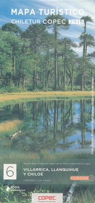
Wegenkaart - landkaart 6 Mapa turistico Villarrica, Llanquihue y Chiloé | Compass Chile

0
Deze wegenkaart van een deel van Chili is onderdeel van een serie van 9 kaarten die het hele land dekken. De kaart is gedrukt op waterafstotend papier en laat de topografie van het land heel goed zien; er staat veel meer informatie op deze kaart vergeleken met de grovere landkaarten van het hele land. Naast het gebruik als autokaart is deze kaart ...

Verkopers met dit product

Webshop
Bezorging
Prijs
DeZwerver.nl logo
DeZwerver.nl
niet bekend
14,95

Anderen bekeken ook

Nieuw
Wegenkaart - landkaart Chile - Chili | Borch
Mooie geplasticieerde kaart van Chili. Deze kaart biedt een goed overzicht van het land met detailkaarten. Our soft-laminated folded map of Chile shows: Northern Chile, Central Chile, Southern Chile & Patagonia 1:2 000 000, Torres del Paine National Park 1:240 000, Robinson Crusoe Island 1:200 000, Easter Island (Rapa Nui) 1:160 000, Punta Arenas, Antofagasta, Iquique 1:15 000, Valparaiso 1:10 000, Arica 1:16 000, La Serena 1:13 000, Vina del Mar 1:22 000, Santiago 1:20 000 and Chile administrative & time zones. Borch Maps are easy to fold, durable and water-repellent with a wipeable surface. Borch Maps show hotels, museums, monuments, markets, public transport, top sights and points of interest, useful statistics, conversion charts for temperatures, weights and measurements, climate charts showing temperatures, sunshine hours, precipitation and humidity, overview maps, time zones, and much more...   The Republic of Chile is a long and narrow coastal strip on the western side of the S…
11,50
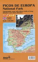
Wandelkaart Picos de Europa National Park | Adrados Ediciones
Heldere overizchtskaart van de Picos de Europa: het dekt het hele gebied op schaal 1:50.000. De wandelpaden zijn gekleurd ingetekend, berghutten staan er ook goed op. De ondergrond is topografische met hoogtelijnen.  Voor de gewone wandelingen is dit een prima kaart. Als je echt de bergen in gaat, dan zjin de 2 delen van de Picos (west en oost) van dezelfde uitgever op schaal 1:25.000 nog beter! Van de uitgever: Mapa del Parque Nacional de los Picos de Europa, representando los tres macizos y sierras periféricas con curvas de nivel cada 20 metros y tintas hipsométricas. Información toponímica y topográfica muy completa y con el itinerario del ANILLO DE PICOS incluido.   En el dorso del mapa se ofrece la reseña detallada de todas las etapas de las tres modalidades de esta Alta Ruta, en la que colabora la Asociación de Guardas de Refugios y otros establecimientos hosteleros ubicados estratégicamente de los Valles.   Las dimensiones del mapa son 98x70 centímetros (23x14 cms plegado).    …
14,95
Nieuw
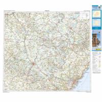
Wegenkaart - landkaart Mapa Provincial Murcia | CNIG - Instituto Geográfico Nacional
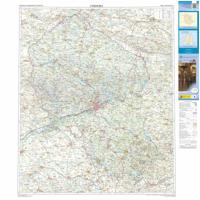
Deze kaart is zuiver gericht op de provincie als in de titel. Gebieden naast de kaart worden zonder kleur weergegeven. Ideale kaart als het gaat om het onderscheid in topografische details als hoogte, nationale parken, vegetatie en plaatsen. Met schaduwrelief wordt hoogte goed zichtbaar. Zeker geschikt voor fietsers, al heb je er soms wel veel nodig.   Nadeel is het feit dat deze kaarten niet altijd even goed up-to-date zijn. Het komt soms wel voor dat bepaalde wegen inmiddels veel groter zijn geworden dan ingetekend op de kaart. Maar dan gaat het vooral om de grotere wegen: voor kleinere details is het een prima kaart.   One of the titles in a series of contoured road maps from Spain's civilian survey organisation, each covering one administrative province, excellent in presenting the country’s topography and locations of its many national and natural parks. The maps have contours at 100-metre intervals enhanced by relief shading, plus spot heights. Additional colouring is used to in…
9,95
Nieuw
Wegenkaart - landkaart Mapa Provincial Teruel | CNIG - Instituto Geográfico Nacional
Deze kaart is zuiver gericht op de provincie als in de titel. Gebieden naast de kaart worden zonder kleur weergegeven. Ideale kaart als het gaat om het onderscheid in topografische details als hoogte, nationale parken, vegetatie en plaatsen. Met schaduwrelief wordt hoogte goed zichtbaar. Zeker geschikt voor fietsers, al heb je er soms wel veel nodig. Nadeel is het feit dat deze kaarten niet altijd even goed up-to-date zijn. Het komt soms wel voor dat bepaalde wegen inmiddels veel groter zijn geworden dan ingetekend op de kaart. Maar dan gaat het vooral om de grotere wegen: voor kleinere details is het een prima kaart. One of the titles in a series of contoured road maps from Spain's civilian survey organisation, each covering one administrative province, excellent in presenting the country’s topography and locations of its many national and natural parks. The maps have contours at 100-metre intervals enhanced by relief shading, plus spot heights. Additional colouring is used to indica…
9,95
Nieuw
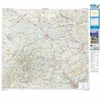
Wegenkaart - landkaart Mapa Provincial Albacete | CNIG - Instituto Geográfico Nacional
Deze kaart is zuiver gericht op de provincie als in de titel. Gebieden naast de kaart worden zonder kleur weergegeven. Ideale kaart als het gaat om het onderscheid in topografische details als hoogte, nationale parken, vegetatie en plaatsen. Met schaduwrelief wordt hoogte goed zichtbaar. Zeker geschikt voor fietsers, al heb je er soms wel veel nodig. Nadeel is het feit dat deze kaarten niet altijd even goed up-to-date zijn. Het komt soms wel voor dat bepaalde wegen inmiddels veel groter zijn geworden dan ingetekend op de kaart. Maar dan gaat het vooral om de grotere wegen: voor kleinere details is het een prima kaart. One of the titles in a series of contoured road maps from Spain's civilian survey organisation, each covering one administrative province, excellent in presenting the country’s topography and locations of its many national and natural parks. The maps have contours at 100-metre intervals enhanced by relief shading, plus spot heights. Additional colouring is used to indica…
9,95
Nieuw
Wegenkaart - landkaart Mapa Provincial Cordoba | CNIG - Instituto Geográfico Nacional
Deze kaart is zuiver gericht op de provincie als in de titel. Gebieden naast de kaart worden zonder kleur weergegeven. Ideale kaart als het gaat om het onderscheid in topografische details als hoogte, nationale parken, vegetatie en plaatsen. Met schaduwrelief wordt hoogte goed zichtbaar. Zeker geschikt voor fietsers, al heb je er soms wel veel nodig. Nadeel is het feit dat deze kaarten niet altijd even goed up-to-date zijn. Het komt soms wel voor dat bepaalde wegen inmiddels veel groter zijn geworden dan ingetekend op de kaart. Maar dan gaat het vooral om de grotere wegen: voor kleinere details is het een prima kaart. One of the titles in a series of contoured road maps from Spain's civilian survey organisation, each covering one administrative province, excellent in presenting the country’s topography and locations of its many national and natural parks. The maps have contours at 100-metre intervals enhanced by relief shading, plus spot heights. Additional colouring is used to indica…
9,95
Nieuw
Wegenkaart - landkaart Mapa Provincial Granada | CNIG - Instituto Geográfico Nacional
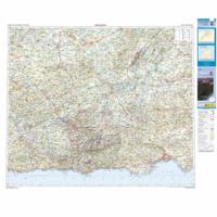
Deze kaart is zuiver gericht op de provincie als in de titel. Gebieden naast de kaart worden zonder kleur weergegeven. Ideale kaart als het gaat om het onderscheid in topografische details als hoogte, nationale parken, vegetatie en plaatsen. Met schaduwrelief wordt hoogte goed zichtbaar. Zeker geschikt voor fietsers, al heb je er soms wel veel nodig. Nadeel is het feit dat deze kaarten niet altijd even goed up-to-date zijn. Het komt soms wel voor dat bepaalde wegen inmiddels veel groter zijn geworden dan ingetekend op de kaart. Maar dan gaat het vooral om de grotere wegen: voor kleinere details is het een prima kaart. One of the titles in a series of contoured road maps from Spain's civilian survey organisation, each covering one administrative province, excellent in presenting the country’s topography and locations of its many national and natural parks. The maps have contours at 100-metre intervals enhanced by relief shading, plus spot heights. Additional colouring is used to indica…
9,95
Nieuw
Wegenkaart - landkaart Mapa Provincial Guadalajara | CNIG - Instituto Geográfico Nacional
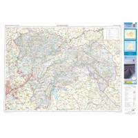
Deze kaart is zuiver gericht op de provincie als in de titel. Gebieden naast de kaart worden zonder kleur weergegeven. Ideale kaart als het gaat om het onderscheid in topografische details als hoogte, nationale parken, vegetatie en plaatsen. Met schaduwrelief wordt hoogte goed zichtbaar. Zeker geschikt voor fietsers, al heb je er soms wel veel nodig. Nadeel is het feit dat deze kaarten niet altijd even goed up-to-date zijn. Het komt soms wel voor dat bepaalde wegen inmiddels veel groter zijn geworden dan ingetekend op de kaart. Maar dan gaat het vooral om de grotere wegen: voor kleinere details is het een prima kaart. One of the titles in a series of contoured road maps from Spain's civilian survey organisation, each covering one administrative province, excellent in presenting the country’s topography and locations of its many national and natural parks. The maps have contours at 100-metre intervals enhanced by relief shading, plus spot heights. Additional colouring is used to indica…
9,95
Nieuw
Wegenkaart - landkaart Mapa Provincial Toledo | CNIG - Instituto Geográfico Nacional
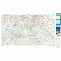
Deze kaart is zuiver gericht op de provincie als in de titel. Gebieden naast de kaart worden zonder kleur weergegeven. Ideale kaart als het gaat om het onderscheid in topografische details als hoogte, nationale parken, vegetatie en plaatsen. Met schaduwrelief wordt hoogte goed zichtbaar. Zeker geschikt voor fietsers, al heb je er soms wel veel nodig. Nadeel is het feit dat deze kaarten niet altijd even goed up-to-date zijn. Het komt soms wel voor dat bepaalde wegen inmiddels veel groter zijn geworden dan ingetekend op de kaart. Maar dan gaat het vooral om de grotere wegen: voor kleinere details is het een prima kaart. One of the titles in a series of contoured road maps from Spain's civilian survey organisation, each covering one administrative province, excellent in presenting the country’s topography and locations of its many national and natural parks. The maps have contours at 100-metre intervals enhanced by relief shading, plus spot heights. Additional colouring is used to indica…
9,95

Klanten-reviews van Wegenkaart - landkaart 6 Mapa turistico Villarrica, Llanquihue y Chiloé | Compass Chile

Er zijn nog geen beoordelingen voor dit productBen jij de eerste die een review plaatst?

Meer over Wegenkaart - landkaart 6 Mapa turistico Villarrica, Llanquihue y Chiloé | Compass Chile

Productomschrijving

Deze wegenkaart van een deel van Chili is onderdeel van een serie van 9 kaarten die het hele land dekken. De kaart is gedrukt op waterafstotend papier en laat de topografie van het land heel goed zien; er staat veel meer informatie op deze kaart vergeleken met de grovere landkaarten van het hele land. Naast het gebruik als autokaart is deze kaart ook zeer geschikt om mee te fietsen.   Elke kaart is tweezijdig met een legenda o.a. in het Engels. Het kleurgebruik is levendig, daardoor krijg je een goed beel van het terrein: met schaduwgebruik, zoutvlaktes, bergen, rivieren etc, Nationale parken en andere beschermde gebieden staan duidelijk ingetekend.    Diverse soorten wegen zijn goed te onderscheiden, afstanden tussen de grotere plaatsen, het spoorwegennet en vliegvelden vind je er ook op terug. Daarnaast worden met symbolen een groot aantal toeristische bezienswaardigheden getoond.   Gebied o.a. sector de Pucón y sus parques, termas y atractivos turísticos, Parque Nacional Villarrica, Reserva Nacional Mocho Choshuenco y Huilo Huilo, Parque Nacional Puyehue y Vicente Pérez Rosales, Chiloé con sus Iglesias Monumentos y el inicio de la Carretera Austral.

Verken gerelateerde categorieën

Webshop.nl maakt gebruik van cookies. Ga je verder op onze website, ga dan akkoord met het plaatsen van cookies en de verwerking van deze data door ons en vermelde partners.