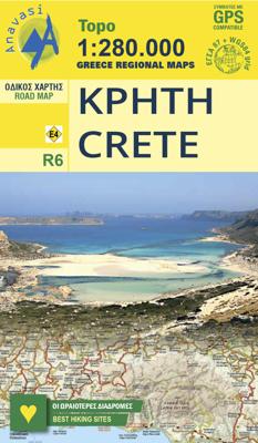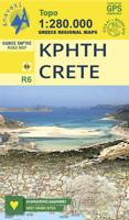
Wegenkaart - landkaart 6 Crete - Kreta | Anavasi

0
Handige kleine wegenkaart van Kreta.   Crete is a big island, and a general map is necessary to plan your travel. But to better discover Crete you need to leave the car behind, and go hiking in the wild side of the island. There are here 7 hiking destinations with pictures, map and descriptions, to inspire you to explore the Cretan countryside. Cr...

Verkopers met dit product

Verkoper
Bezorging
Prijs
DeZwerver.nl logo
DeZwerver.nl
2,95
7,95

Anderen bekeken ook

Wegenkaart - landkaart 6 Crete - Kreta | Anavasi
Handige kleine wegenkaart van Kreta.   Crete is a big island, and a general map is necessary to plan your travel. But to better discover Crete you need to leave the car behind, and go hiking in the wild side of the island. There are here 7 hiking destinations with pictures, map and descriptions, to inspire you to explore the Cretan countryside. Crete R6 is a simple and inexpensive road map, ideal for short visits or planning long routes.   Printed on plain paper.
7,95
Wegenkaart - landkaart Kreta - Crete | Borch
Mooie geplasticieerde kaart van Kreta. Deze kaart biedt een goed overzicht van dit eiland met detailkaarten.   Our soft-laminated folded map of Crete shows: Crete (West) 1:200 000, Crete (East) 1:200 000, Iraklio 1:7 000, Agios Nikolaos 1:6 000, Chania 1:10 000, Ierapetra 1:10 000, Rethimno 1:9 000, Samaria Gorge 1:90 000, Sitia 1:7 000 and Gavdos 1:200 000. Borch maps are easy to fold, durable and water-repellent with a wipeable surface. Borch Maps show hotels, museums, monuments, markets, top sights and points of interest, useful statistics, conversion charts for temperatures, weights and measurements, climate charts showing temperatures, sunshine hours, precipitation and humidity, overview maps, time zones, and much more...   Crete is more than just another Greek island, it is the fifth largest island in the Mediterranean Sea and the cradle of ancient Mediterranean civilization. By 2000 B.C. the Minoans had set up a base here for their international trade with the East, North Afric…
11,50
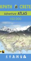
Wandelatlas Adventure Atlas Crete - Kreta | Anavasi
Gedetailleerde atlas van heel Kreta: topografische kaarten met alle noodzakelijke details als hoogtelijnen, kleurschakeringen en bergtoppen. Naast deze kenmerken is ook de E4 ingetekend, een lange afstand wandeling op Kreta van west naar oost. Met symbolen zijn cultuur-historische hoogtepunten ingetekend. Achterin een uitgebreid register. Uitgevoerd in een atlas, harde kaft, A4 formaat. The new ADVENTURE ATLAS of Crete by ANAVASI is the ultimate tool to discover the island. Find all the information you need to go hiking, canyoning, climbing, swimming on beautiful beaches, explore abandoned villages, minoan peak sanctuaries, cave-churches, byzantine and ottoman castles. Whatever you want to visit in Crete you will find it in the 52 plates of this Atlas.  
34,95
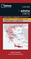
Wegenkaart - landkaart - Fietskaart 7 Crete - Kreta | Terrain maps
Gedetailleerde wegenkaart en wandelkaart met alle kleine wegen, wandelpaden, hoogtelijnen en toeristische informatie aangegeven. Alle tekst is tweetalig in Engels en Grieks en de waterproof kaart is geschikt voor gebruik met GPS.   The ideal map for planning your trip, as well as the journey itself – if you belong to the 99% of the island’s visitors, who have no intention whatsoever to take the narrowest dirt path leading to the remotest beach of the island! This map is very practical, at a scale of 1:200.000 which allows for a detailed presentation of the road network and sights without the exhaustive detail only the travelers – explorers are interested in.    We made this map based on our archival series of 1:100.00 Crete maps. We omitted all secondary dirt roads and loads of other unnecessary little roads, magnified the symbols and width of the roads for better visibility, and made colors more vibrant. All this makes for the best general map of Crete on the market!    Naturally, we…
13,50
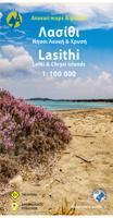
Wegenkaart - landkaart 92 Kreta oost - Lasithi | Anavasi
Gebaseerd op topografische kaarten, GPS compatible, gedrukt op watervast en scheurvast papier. Hoogtelijnen met 100 m interval, schaduwkleuren en punten met hoogte geven de topografie van het landschap aan. De kaart kent een UTM grid. Het wegennet wordt aangeduid met verschillende gradaties: grote en kleine wegen, verhard en onverhard. Toeristische bezienswaardigheden staan als zodanig aangeduid zoals thermen, kloosters, berghutten, grotten etc. Namen van steden zowel in het normale schrift als in het Grieks, met een legenda die ook in het Engels is. Van de uitgever This map includes all the information a traveler needs to discover Eastern Crete. It includes the entire road network from the biggest arteries to the smallest dirt roads, paths and trails, all the towns and villages, beaches and toponyms. In addition to the above, you will find the E4 route from Dikti to Zakros that crosses the entire inland of Eastern Crete. On the reverse side you will find sections of the E4 route with…
11,95
Wegenkaart - landkaart 3317 Adventure Map Crete - Kreta | National Geographic
Wegenkaart van Kreta met vermelding van veel bezienswaardigheden, nationale parken en attrakties. Watervast en scheurvast. Juist door deze vermeldingen onderscheidt de kaart zich van andere wegenkaarten.   National Geographic's Crete Adventure Map is designed to meet the unique needs of adventure travelers with its durability and accurate information. This folded map provides global travelers with the perfect combination of detail and perspective, highlighting hundreds of points of interest and the diverse and unique destinations within the country.   The front side of the Crete map details the eastern region of the island with the Sea of Crete to the north. The reverse side of the map shows the western region of the island with the Aegean Sea to the north and the Mediterranean Sea to the south. The map includes the locations of cities and towns with a user-friendly index, plus a clearly marked road network complete with distances and designations for major highways, main roads, and t…
17,50
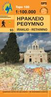
Wegenkaart - landkaart 93 Kreta centraal - midden Heraklion en Rethimnon | Anavasi
Gebaseerd op topografische kaarten, GPS compatible, gedrukt op watervast en scheurvast papier. Hoogtelijnen met 100 m interval, schaduwkleuren en punten met hoogte geven de topografie van het landschap aan. De kaart kent een UTM grid. Het wegennet wordt aangeduid met verschillende gradaties: grote en kleine wegen, verhard en onverhard. Toeristische bezienswaardigheden staan als zodanig aangeduid zoals thermen, kloosters, berghutten, grotten etc. Namen van steden zowel in het normale schrift als in het Grieks, met een legenda die ook in het Engels is. One of the three maps of the successful series of touring maps of Crete in a scale of 1:100,000 maps covering the whole island with great detail. Small additions and updating of road network, the new municipalities and some visual touches (palette relief and cover). On the reverse side of the map fully indexed settlements and cardboard folnter presentation of 10 Top points of interest on the map.  
11,95
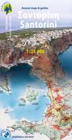
Wandelkaart - Wegenkaart - landkaart 10.24 Santorini | Anavasi
As you enter the caldera of Santorini by ferry sheer cliffs rise up dramatically, exposing richly coloured rock strata, crowned by the colored houses of the cliff-top settlements. Equally magnificent is the sunset from the heights of the caldera towards the sea and the remnants of prehistoric rounded island Strogyli, Thirasia, the New and Old Kameni. However, there is more than the visual excitement to discover and if you don’t take the time to walk the island you will have learnt little of Santorini.   The new Anavasi map will take hiking in every corner, beach and hill top of Santorini and Thirassia to discover landscapes with visible signs of the traditional rural culture, with orchards stonewalls, threshing floors, huts, chapels, inland villages with a well preserved medieval core (called Castelo), routes with wonderful vistas, lost beaches quiet even in the heart of summer.   On the reverse side of the map, there is a brief description of the 25 proposed hiking routes and a short…
10,95
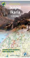
Wandelkaart - Wegenkaart - landkaart 10.51 Ikaria | Anavasi
The new Anavasi map of Ikaria on a scale of 1:35.000 figures dozens of footpaths, the complete road network and all the beaches of the island, which is also well known for its summer feasts (panigiria) and the longevity of its inhabitants. The island was named after the mythical Icarus, the young man who flew too close to the sun and plunged into the sea, close to Ikaria.   Ikaria has a well-marked network of hiking trails. The island is indeed perfect for days of hiking pleasure with lots of vegetation, deep river valleys with plenty of hidden, refreshingly cold (and clean) water pools, relatively level top plateaus and a ridge line that climbs up to about 900-1000m above sea level with amazing views and nice beaches to end the walks. Printing on waterproof, rip-proof polyart paper
10,95
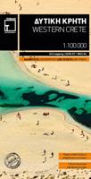
Wandelkaart - Fietskaart - Wegenkaart - landkaart 448 Western Crete - Kreta West | Terrain maps
Gedetailleerde wegenkaart en wandelkaart met alle kleine wegen, wandelpaden, hoogtelijnen en toeristische informatie aangegeven. Alle tekst is tweetalig in Engels en Grieks en de waterproof kaart is geschikt voor gebruik met GPS. Terrain’s map of Western Crete provides travelers with everything they need:    Scale of 100.000, which attributes all the information with clarity and in detail.  Map data processed within a GIS environment, resulting in great accuracy.  Double coordinate system, WGS 84 and ΕΓΣΑ 87, completely compatible with GPS.  It is printed on Polyart material, making it totally waterproof and rip-proof. You can fold it and unfold it a hundred times, fold it in irregular ways, dunk it in the sea or leave it out in the rain. This map is indestructible!  Clear symbols, easily readable fonts, rich colors and excellent arrangement of every element make the map extremely friendly to the user.  Unique wealth of information. Every village, every road (including their dis…
12,50

Klanten-reviews van Wegenkaart - landkaart 6 Crete - Kreta | Anavasi

Er zijn nog geen beoordelingen voor dit productBen jij de eerste die een review plaatst?

Meer over Wegenkaart - landkaart 6 Crete - Kreta | Anavasi

Productomschrijving

Handige kleine wegenkaart van Kreta.   Crete is a big island, and a general map is necessary to plan your travel. But to better discover Crete you need to leave the car behind, and go hiking in the wild side of the island. There are here 7 hiking destinations with pictures, map and descriptions, to inspire you to explore the Cretan countryside. Crete R6 is a simple and inexpensive road map, ideal for short visits or planning long routes.   Printed on plain paper.

Productinformatie

    Verken gerelateerde categorieën

    Webshop.nl maakt gebruik van cookies. Ga je verder op onze website, ga dan akkoord met het plaatsen van cookies en de verwerking van deze data door ons en vermelde partners.