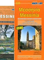
Wegenkaart - landkaart 538 Messinia | Road Editions

0
Voorzijde is de behoorlijk gedetailleerde wegenkaart van Messinia, met hoogtelijnen, hoogtes, afstanden en veel andere details.  The Perfecture of Messinia, one of the most beautiful corners of Greece, is home to innumerable treasures, which this ROAD map will help you to discover: clean beaches, thick forests, mountains trails, picturesque villag...

Verkopers met dit product

Verkoper
Bezorging
Prijs
DeZwerver.nl logo
DeZwerver.nl
2,95
10,95

Anderen bekeken ook

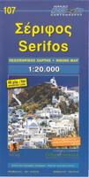
Wegenkaart - landkaart 107 Serifos | Road Editions
Gedetailleerde wegenkaart met aanduiding van de wandelwegen, lijst van hotels en toeristische informatie. Voor alle doeleinden een zeer geschikte kaart. The features that make this and every other ROAD island map unique are: *The coastline, hydrography and precision geophysical background based on data provided by the Hellenic Military Geographic Service and electronically processed by us for clarity and legibility. We have highlighted the mountain masses in shades of brown between the contour lines (at 20m intervals on this map) to outline clearly the relief of the island. *The beaches are indicated by a special symbol next to which we have noted their names, as well as all the roads and footpaths leading to them (since most people primarily visit the islands for the beaches!). We have even included a short text in which the island’s best beaches are concisely referred to, to save you going on a wild goose hunt in search of them. *The road network is mapped out with impressive and ex…
9,95
Wegenkaart - landkaart 109 Sifnos | Road Editions
Gedetailleerde wegenkaart met aanduiding van de wandelwegen, lijst van hotels en toeristische informatie. Voor alle doeleinden een zeer geschikte kaart. The features that make this and every other ROAD island map unique are: *The coastline, hydrography and precision geophysical background based on data provided by the Hellenic Military Geographic Service and electronically processed by us for clarity and legibility. We have highlighted the mountain masses in shades of brown between the contour lines (at 20m intervals on this map) to outline clearly the relief of the island. *The beaches are indicated by a special symbol next to which we have noted their names, as well as all the roads and footpaths leading to them (since most people primarily visit the islands for the beaches!). We have even included a short text in which the island’s best beaches are concisely referred to, to save you going on a wild goose hunt in search of them. *The road network is mapped out with impressive and ex…
9,95
Wegenkaart - landkaart 110 Milos Kimolos | Road Editions
Gedetailleerde wegenkaart met aanduiding van de wandelwegen, lijst van hotels en toeristische informatie. Voor alle doeleinden een zeer geschikte kaart. Though not among the top ten most popular destinations in the Aegean, these are two beautiful islands with a unique character, ideal for quiet family holidays, and nature touring, as well as for the young crowd looking for exciting summer fun. This is the best, most updated and easy to read map available of Milos and Kimolos. As all ROAD maps, it was designed following careful and exhaustive onsite research. We used the most advanced technology to precisely map the entire road networks of these two islands, we measured the distances in kilometers from intersection to intersection with precision instruments, marked all country churches, monasteries, archaeological sites and castles on these islands, as we did the beaches and the roads leading to them, the altitudes of mountain peaks, the footpaths we were able to locate and record, the…
9,95
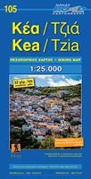
Wegenkaart - landkaart 105 Tzia - Kea | Road Editions
Gedetailleerde wegenkaart met aanduiding van de wandelwegen, lijst van hotels en toeristische informatie. Voor alle doeleinden een zeer geschikte kaart. Scheur- en watervast! The features that make this and every other ROAD island map unique are: *The coastline, hydrography and precision geophysical background based on data provided by the Hellenic Military Geographic Service and electronically processed by us for clarity and legibility. We have highlighted the mountain masses in shades of brown between the contour lines (at 100m intervals on this map) to outline clearly the relief of the island. *The beaches are indicated by a special symbol next to which we have noted their names, as well as all the roads and footpaths leading to them (since most people primarily visit the islands for the beaches!). We have even included a short text in which the island’s best beaches are concisely referred to, to save you going on a wild goose hunt in search of them. *The road network is mapped out…
9,95
Wandelkaart - Wegenkaart - landkaart Kefallonia - Kefalonia | Freytag & Berndt
Goede wegenkaart van Kefallonia / Kefalonia, waarbij ook de kleinere wegen nog goed te lezen zijn. Gedetailleerde schaal van 1:50.000. Veel toeristische symbolen voor bezienswaardigheden als grotten, tempels, opgravingen maar ook mooie stranden etc. Ook handig is de Nederlandstalige Reisgids van Kefalonia "Ontdek Kefalonia" "Ontdek Kefalonia" Explore Kefallonia, the largest of the Ionian Islands located in Greece; with this Freytag & Berndt single-sided road and leisure map. The map will allow you to travel independently, and plan your journey well.   The map also features full colour photographs of some of the scenery to be found on Kefallonia, as well as an inset showing Kefallonia's position within the nation of Greece. An inset is also provided showing a city plan of the main township on Kefallonia, Argostoli. The topography is clear, with shading showing land gradients.    As with all Freytag & Berndt maps, icons and markings are used to denote tourist information and points of i…
14,95
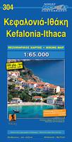
Wegenkaart - landkaart 304 Kefalonia - Ithaca | Road Editions
Goede overzichtskaart  van Kefalonia. Als wandelkaart iets minder, dan is de Anavasi beter. From Road Editions-probably the best range of maps available to cover Greece. Road Editions constantly update their data and mapping. This map of Kefalonia and Ithaca shows the Islands with unique accuracy, with data produced using the industrys most advanced techniques. The complete road networks of Kefalonia and Ithaca are shown, including forest roads, and with scenic routes shown in green. Contour lines-with coloured shading which darkens with increasing altitude-give an at-a-glance guide to the terrain. Also plenty of information such as churches gorges, peaks, caves, beaches, springs etc. Accurate distances of roads are printed midway between crossroads, and locations of refuelling sites are shown too. Streetmapping for Argostoli and Lixouri are inset at the top of the sheet. Reverse holds a list of hotels on both islands with their class, telephone/fax numbers, along with lots of tourist…
9,95
Wegenkaart - landkaart Griekenland - Greece | Terrain maps
Overzichtelijke wegenkaart van heel Grieklenland. Tweezijdig, gedrukt op waterafstotend en scheurvast papier. Met wegnummerng, mooie route-aanduiding, stranden, afstanden tussen steden en dorpen. Daarnaast ook tweetalig uitgevoerd. Detailed and updated map of Greece using G.I.S. (Geographical Information Systems) technology and the WGS84 reference system, and supplemented by a ΕΓΣΑ87 grid.    Like all of TERRAIN’s large maps, the map of Greece is printed on Polyart, which is extremely durable against folding and unfolding, does not rip, and is 100% waterproof.    Based on field research completed in 2013, this map features all the newest national motorways and their interchanges, toll stations and Motorway Service Stations.    Also depicted are Greece’s most important sights, as well as archaeological sites, castles, monasteries, National Parks and scenic routes worth exploring.    The map comes in a very practical clear double sleeve. One side contains the removable map, the other a …
13,50
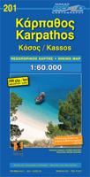
Wegenkaart - landkaart 201 Karpathos - Kassos | Road Editions
Gedetailleerde wegenkaart met aanduiding van de wandelwegen, lijst van hotels en toeristische informatie. Voor alle soorten vakanties, ook als wandel- en fietskaart goed te gebruiken. Easy to read map for Karpathos and Kassos with touristic information churches, monasteries, archaeological sites and castles as well as all the beaches, the altitudes of mountain peaks, the complete network of trails (footpaths), the lighthouses, the airport of course, and much more.
9,95
Wegenkaart - landkaart Hongarije | Freytag & Berndt
Goede wegenkaart van het hele land. Met register en enkele stadsplattegronden. De berijdbare wegen zijn goed weergeven, zowel de hoofdwegen als provinciale en lokale wegen; wegnummers worden vermeld. Afstanden tussen plaatsen zijn in kilometers op de kaart ingetekend, daarnaast worden ook op belangrijke plekken benzinepompen gemarkeerd. In het kaartbeeld wordt door middel van schaduw het reliëf weergegeven en soms enkele punten in het landschap met de daadwerkelijke hoogte. Provinciegrenzen zijn goed terug te vinden, nationale parken en reservaten ook. Met allerhande symbolen worden toeristische bezienswaardigheden weergegeven als monumenten, historisch belangrijke plekken en uitzichtpunten. In bepaalde plaatsen zijn hotels en campings te vinden, luchthavens, treinverbindingen en havens vindt u er ook op! Explore Hungary with this Freytag & Berndt road map. The best way to plan your trip, prepare your itinerary, and to travel independently in this country. As with all Freytag & Berndt…
14,95
Wandelkaart 36 Mount Othris | Road Editions
Mt Othris at 1:50,000 in a series of contoured maps from Road Editions covering popular hiking areas of Greece. All the maps have altitude coloring and spot heights - contour interval varies, as indicated in the descriptions of individual titles. Local footpaths are marked and, for road users the maps show picturesque routes, intermediate driving distances on minor roads, and locations of petrol stations and tyre repairs workshops. Boundaries of national parks and administrative regions are marked, and symbols show campsites, hotels and mountain refuges, and various landmarks and places of interest, e.g. archaeological sites, churches, etc. All place names are in both Greek and Latin alphabet. All the titles have latitude and longitude margin ticks, many also show GPS waypoints. Some maps come with a booklet or notes on the reverse side giving further information about the area and/or descriptions of hiking routes. Map legends include English. In this title: the Othris region in cen…
9,95

Klanten-reviews van Wegenkaart - landkaart 538 Messinia | Road Editions

Er zijn nog geen beoordelingen voor dit productBen jij de eerste die een review plaatst?

Meer over Wegenkaart - landkaart 538 Messinia | Road Editions

Productomschrijving

Voorzijde is de behoorlijk gedetailleerde wegenkaart van Messinia, met hoogtelijnen, hoogtes, afstanden en veel andere details. 

The Perfecture of Messinia, one of the most beautiful corners of Greece, is home to innumerable treasures, which this ROAD map will help you to discover: clean beaches, thick forests, mountains trails, picturesque villages, historic monasteries, archaelogical sites and other sites of interest.

Productinformatie

    Verken gerelateerde categorieën

    Webshop.nl maakt gebruik van cookies. Ga je verder op onze website, ga dan akkoord met het plaatsen van cookies en de verwerking van deze data door ons en vermelde partners.