Wegenkaart - landkaart 50 Miles Around London Road Map | A-Z Map Company

0
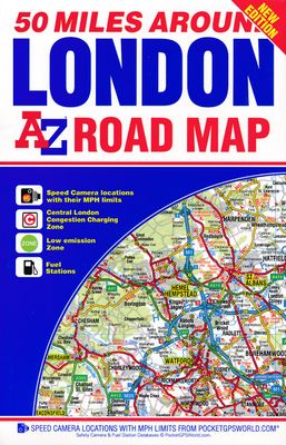
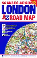
This A-Z 50 Miles around London map is a full colour, single sided, fold-out road map featuring continuous mapping extending from Rugby and Bury St. Edmunds to the south coast and from Oxford and Winchester to Margate and Felixstowe in the east.   Published at a clear 3.5 miles to 1 inch the following features are shown on the road mapping:   Mot...

Verkopers met dit product

Verkoper
Bezorging
Prijs
DeZwerver.nl logo
DeZwerver.nl
2,95
9,95

Anderen bekeken ook

Wegenkaart - landkaart 50 Miles Around London Road Map | A-Z Map Company
This A-Z 50 Miles around London map is a full colour, single sided, fold-out road map featuring continuous mapping extending from Rugby and Bury St. Edmunds to the south coast and from Oxford and Winchester to Margate and Felixstowe in the east.   Published at a clear 3.5 miles to 1 inch the following features are shown on the road mapping:   Motorways open with full junction detail, motorways under construction and proposed, service areas, primary routes and destinations, A & B roads, selected minor roads, gradients 1:5 and steeper, tolls, mileages, county boundaries, spot heights and hill shading Selected safety camera locations with maximum speed limits Selected fuel stations A wide range of ancillary and tourist information South Downs National Park boundary An index to cities, towns, villages, hamlets and locations is adjacent to the map.   Two overview maps are printed on the inside of the cover:   The London Congestion Charging Zone The Greater London Low Emission Zone
9,95
Wegenkaart - landkaart Visitors map London | A-Z Map Company
Clear and easy-to-read map of central London and surrounding area. Contains detailed mapping, presented in a handy compact format. This attractive map, ideal for both tourists and residents, and fully updated, has an extensive area of coverage and displays a wealth of detail.   Fully classified roads Congestion and ULEZ charging zones Postal districts and boundaries clearly depicted Full indexes to street names (on back of map), place names and places of interest Fully updated London underground map conveniently located on the back cover Extends from Hampstead in the north to Clapham in the south and from Hammersmith in the west to Greenwich in the east.   The perfect map for exploring London whether you are a tourist or a local.   Scale: 1:17,500 (3.6 inches to 1 mile)
12,50
Wegenkaart - landkaart Visitors map Lake District | A-Z Map Company
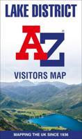
Explore the whole region and area extending from Cockermouth and Penrith in the north to Ulverston and Grange-over-Sands in the south and from the M6 in the east to the coast in the west. Published at a clear 2.45 miles to 1 inch scale, this detailed visitors map of the Lake District includes primary route destinations and selected caravan and camping sites. Plus, there is detailed informative text for visitor attractions and places of interest.   There are also 12 town centre street maps of: Ambleside, Cockermouth, Coniston, Grange-over-Sands, Grasmere, Hawkshead, Kendal, Keswick, Penrith, Ulverston, Windermere and Bowness-on-Windermere. Each town centre map includes descriptive text and useful information about its visitor attractions and places of interest. Each town plan also has a separate index, while the main road map index lists towns, villages, hamlets and locations.   The 'Index to Places of Interest' lists tourist sites by feature type. For 2024, there is also now added ele…
12,50
Wegenkaart - landkaart Visitors map Devon | A-Z Map Company
Explore the whole county of Devon extending from Taunton to Plymouth. With detailed road mapping and illustrated town plans of major cities, this feature-rich, helpful tourist guide is ideal for visitors to Devon. Published at a clear 3.33 miles to 1 inch scale (2.11 cm to 1 km), this handy map is a detailed and informative exploration of all Devon has to offer.   Highlights include:* 8 inset street maps to major cities and popular destinations, including: Exeter, Paignton, Dartmouth and Torquay, with detailed descriptions and places of interest* Locations of visitor centres and tourist information sites* Useful key to map symbols making it a clear and easy read The perfect map for exploring Devon whether you are a tourist or a local.  
11,50
Wegenkaart - landkaart Visitors map Cornwall | A-Z Map Company
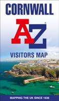
Explore the whole county and area extending into Devon as far as Great Torrington, Tavistock and Plymouth. This detailed and up-to-date map contains more than 1,000 places of interest and an index to 3,000 towns and villages. Published at a clear 2.5 miles to 1 inch scale (1.6 kms to 1 cm), a handy road map includes primary route destinations, selected caravan and camping sites, visitor attractions and places of interest.   Town centre street maps of Bodmin, Bude, Falmouth, Fowey, Launceston, Liskeard, Looe, Newquay, Padstow, Penzance,Plymouth, St. Ives and Truro are also included, plus detailed informative text for Bodmin Moor, Land’s End and Isles of Scilly. The perfect map for exploring Cornwall whether you are a local or a tourist.
12,50
Wegenkaart - landkaart Visitors map Yorkshire | A-Z Map Company
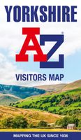
Explore the whole region of Yorkshire extending from Sheffield to Darlington. With detailed road mapping and illustrated town plans of major cities, this feature rich, helpful tourist guide is ideal for touring around Yorkshire. Published at a clear 3 miles to 1 inch scale (1.9 cm to 1 km), this handy map is a detailed and informative exploration of what Yorkshire has to offer.   Highlights include: 4 inset street maps to major cities and popular destinations, including: Bradford, Middlesborough and York, with detailed descriptions and places of interestLocations of visitor centres and tourist information sitesUseful key to map symbols making it a clear and easy read The perfect map for exploring Yorkshire whether you are a tourist or a local.
11,50
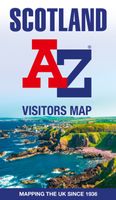
Wegenkaart - landkaart Visitors map Scotland - Schotland | A-Z Map Company
xplore the whole of Scotland from Dumfries and Galloway in the South to the Orkney Islands in the North. With detailed road mapping and illustrated town plans of major cities, this feature rich, helpful tourist guide is ideal for touring around Scotland. Published at a clear 8.7 miles to 1 inch scale (5.51 cm to 1 km), this handy map is a detailed and informative exploration of what Scotland has to offer.   Highlights include: 8 inset street maps to major cities and popular destinations, including: Edinburgh, Glasgow, Stirling, and Cairngorms National Park, with detailed descriptions and places of interestLocations of visitor centres and tourist information sitesUseful key to map symbols making it a clear and easy readMore than 700 places of interest The perfect map for exploring Scotland whether you are a tourist or a local.
11,50
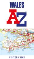
Wegenkaart - landkaart Visitors map Wales | A-Z Map Company
Explore the whole country from Cardiff and Pembrokeshire to Isle of Anglesey and Conwy, extending as far north as Liverpool. This detailed and up-to-date map contains 700 places of interest and an index to 4,000 towns and villages. Published at a clear 3.5 miles to 1 inch scale (2.2 kms to 1 cm), a handy road map includes primary route destinations, visitor attractions, ferry terminals and places of interest.   Plus, there is detailed informative text for Cardiff, Swansea and the Gower Peninsula, the Pembrokeshire Coast, Snowdonia, the North Wales Coast and Caernarfon. The perfect map for exploring Wales whether you are a local or a tourist.
10,95
Wegenkaart - landkaart 2 Road Map Britain Central Southern England | AA Publishing
Goede dubbelzijdige Wegenkaart met plaatsnamenindex van het centrale deel van het zuiden van Engeland.  Grof geschetst is het een rechthoek tussen Gloucester, Luton, London, Dorcester en Brighton. Britain’s clearest mapping from the experts at the AA, in a handy foldable map. Fully updated, this map of Central Southern England combines clear design and an easy-to-read scale with more road detail to ensure that you never lose your way. The map includes information on toll points, service areas, road numbers, motorways, dual carriageways and wide and narrow local roads. National Parks, and places of interest are also highlighted. Caravan and camping sites pinpointed on the mapping. City and town plans Easy-to-read place index name. Part of a range of 9 regional sheet maps plus 1 map covering the whole of Britain. Map Series - 1 West Country & Wales. 2 Central Southern England. 3 South East England. 4 East Anglia. 5 Midlands & Central England. 6 Wales. 7 Northern England. 8 North England…
10,95
Wegenkaart - landkaart 6 Road Map Britain Wales | AA Publishing
Goede dubbelzijdige wegenkaart met plaatsnamenindex van Wales Britain’s clearest mapping from the experts at the AA, in a handy foldable map. Fully updated, this map of Wales combines clear design and an easy-to-read scale with more road detail to ensure that you never lose your way. This map of Wales includes information on toll points, service areas, road numbers, motorways, dual carriageways and wide and narrow local roads. National Parks, and places of interest are also highlighted. Caravan and camping sites pinpointed on the mapping. City and town plans Easy-to-read place index name. Part of a range of 9 regional sheet maps plus 1 map covering the whole of Britain. Map Series - 1 West Country & Wales. 2 Central Southern England. 3 South East England. 4 East Anglia. 5 Midlands & Central England. 6 Wales. 7 Northern England. 8 North England & Scottish Borders. 9 Scotland. 10 Britain.  
10,95

Klanten-reviews van Wegenkaart - landkaart 50 Miles Around London Road Map | A-Z Map Company

Er zijn nog geen beoordelingen voor dit productBen jij de eerste die een review plaatst?

Meer over Wegenkaart - landkaart 50 Miles Around London Road Map | A-Z Map Company

Productomschrijving

This A-Z 50 Miles around London map is a full colour, single sided, fold-out road map featuring continuous mapping extending from Rugby and Bury St. Edmunds to the south coast and from Oxford and Winchester to Margate and Felixstowe in the east.   Published at a clear 3.5 miles to 1 inch the following features are shown on the road mapping:  
  • Motorways open with full junction detail, motorways under construction and proposed, service areas, primary routes and destinations, A & B roads, selected minor roads, gradients 1:5 and steeper, tolls, mileages, county boundaries, spot heights and hill shading
  • Selected safety camera locations with maximum speed limits
  • Selected fuel stations
  • A wide range of ancillary and tourist information
  • South Downs National Park boundary
  • An index to cities, towns, villages, hamlets and locations is adjacent to the map.
  Two overview maps are printed on the inside of the cover:  
  • The London Congestion Charging Zone
  • The Greater London Low Emission Zone

Productinformatie

    Verken gerelateerde categorieën

    Webshop.nl maakt gebruik van cookies. Ga je verder op onze website, ga dan akkoord met het plaatsen van cookies en de verwerking van deze data door ons en vermelde partners.