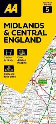
Wegenkaart - landkaart 5 Road Map Britain Midlands & Central England | AA Publishing

0
Goede dubbelzijdige wegenkaart van midden Engeland. Grof geschetst is het een rechthoek tussen Shrewsbury, Lincoln, Cambridge en Glouchester Britain’s clearest mapping from the experts at the AA, in a handy foldable map. Fully updated, this map of the Midlands & Central England combines clear design and an easy-to-read scale with more road detail ...

Verkopers met dit product

Webshop
Bezorging
Prijs
DeZwerver.nl logo
DeZwerver.nl
niet bekend
9,95

Anderen bekeken ook

Wegenkaart - landkaart 2 Road Map Britain Central Southern England | AA Publishing
Goede dubbelzijdige Wegenkaart met plaatsnamenindex van het centrale deel van het zuiden van Engeland.  Grof geschetst is het een rechthoek tussen Gloucester, Luton, London, Dorcester en Brighton. Britain’s clearest mapping from the experts at the AA, in a handy foldable map. Fully updated, this map of Central Southern England combines clear design and an easy-to-read scale with more road detail to ensure that you never lose your way. The map includes information on toll points, service areas, road numbers, motorways, dual carriageways and wide and narrow local roads. National Parks, and places of interest are also highlighted. Caravan and camping sites pinpointed on the mapping. City and town plans Easy-to-read place index name. Part of a range of 9 regional sheet maps plus 1 map covering the whole of Britain. Map Series - 1 West Country & Wales. 2 Central Southern England. 3 South East England. 4 East Anglia. 5 Midlands & Central England. 6 Wales. 7 Northern England. 8 North England…
10,95
Wegenkaart - landkaart 7 Road Map Britain Northern England | AA Publishing
Goede dubbelzijdige wegenkaart met plaatsnamenindex van noord Engeland. Grof geschetst is het een rechthoek tussen Penrith, Hartlepool, Lincoln en Chester. Britain’s clearest mapping from the experts at the AA, in a handy foldable map. Fully updated, this map of Northern England combines clear design and an easy-to-read scale with more road detail to ensure that you never lose your way. The map includes information on toll points, service areas, road numbers, motorways, dual carriageways and wide and narrow local roads. National Parks, and places of interest are also highlighted. Caravan and camping sites pinpointed on the mapping. City and town plans Easy-to-read place index name. Part of a range of 9 regional sheet maps plus 1 map covering the whole of Britain. Map Series - 1 West Country & Wales. 2 Central Southern England. 3 South East England. 4 East Anglia. 5 Midlands & Central England. 6 Wales. 7 Northern England. 8 North England & Scottish Borders. 9 Scotland. 10 Britain.  
10,95
Wegenkaart - landkaart 3 Road Map Britain South East England | AA Publishing
Goede wegenkaart van zuid oost Engeland. Grof geschetst is het een rechthoek tussen Ipswich, Dover, Southampton en Oxford. Britain’s clearest mapping from the experts at the AA, in a handy foldable map. Fully updated, this map of South East England combines clear design and an easy-to-read scale with more road detail to ensure that you never lose your way. The map includes information on toll points, service areas, road numbers, motorways, dual carriageways and wide and narrow local roads. National Parks, and places of interest are also highlighted. Caravan and camping sites pinpointed on the mapping. City and town plans Easy-to-read place index name. Part of a range of 9 regional sheet maps plus 1 map covering the whole of Britain. Map Series - 1 West Country & Wales. 2 Central Southern England. 3 South East England. 4 East Anglia. 5 Midlands & Central England. 6 Wales. 7 Northern England. 8 North England & Scottish Borders. 9 Scotland. 10 Britain.  
10,95
Wegenkaart - landkaart 6 Road Map Britain Wales | AA Publishing
Goede dubbelzijdige wegenkaart met plaatsnamenindex van Wales Britain’s clearest mapping from the experts at the AA, in a handy foldable map. Fully updated, this map of Wales combines clear design and an easy-to-read scale with more road detail to ensure that you never lose your way. This map of Wales includes information on toll points, service areas, road numbers, motorways, dual carriageways and wide and narrow local roads. National Parks, and places of interest are also highlighted. Caravan and camping sites pinpointed on the mapping. City and town plans Easy-to-read place index name. Part of a range of 9 regional sheet maps plus 1 map covering the whole of Britain. Map Series - 1 West Country & Wales. 2 Central Southern England. 3 South East England. 4 East Anglia. 5 Midlands & Central England. 6 Wales. 7 Northern England. 8 North England & Scottish Borders. 9 Scotland. 10 Britain.  
10,95
Wegenkaart - landkaart 10 Road Map Britain Britain - Groot Brittannië | AA Publishing
Goede dubbelzijdige overzichtskaart met plaatsnamenregister  van heel Engeland met Schotland erbij. Britain’s clearest mapping from the experts at the AA, in a handy foldable map. Fully updated, this map of Britain combines clear design and an easy-to-read scale with more road detail to ensure that you never lose your way. The map includes information on toll points, service areas, road numbers, motorways, dual carriageways and wide and narrow local roads. National Parks, and places of interest are also highlighted. Caravan and camping sites pinpointed on the mapping. City and town plans Easy-to-read place index name. Part of a range of 9 regional sheet maps plus 1 map covering the whole of Britain. Map Series - 1 West Country & Wales. 2 Central Southern England. 3 South East England. 4 East Anglia. 5 Midlands & Central England. 6 Wales. 7 Northern England. 8 North England & Scottish Borders. 9 Scotland. 10 Britain.    
10,95
Wegenkaart - landkaart 4 Road Map Britain East Anglia | AA Publishing
Goede dubbelzijdige wegenkaart met  plaatsnamenindex van East Anglia. Grof geschetst is het een rechthoek tussen Lincoln, Norwich, Ipswich en Luton Britain’s clearest mapping from the experts at the AA, in a handy foldable map. Fully updated, this map of East Anglia combines clear design and an easy-to-read scale with more road detail to ensure that you never lose your way. The map includes information on toll points, service areas, road numbers, motorways, dual carriageways and wide and narrow local roads. National Parks, and places of interest are also highlighted. Caravan and camping sites pinpointed on the mapping. City and town plans Easy-to-read place index name. Part of a range of 9 regional sheet maps plus 1 map covering the whole of Britain. Map Series - 1 West Country & Wales. 2 Central Southern England. 3 South East England. 4 East Anglia. 5 Midlands & Central England. 6 Wales. 7 Northern England. 8 North England & Scottish Borders. 9 Scotland. 10 Britain.  
10,95
Wegenkaart - landkaart 8 Road Map Britain North of England & Scottish Borders | AA Publishing
Goede dubbelzijdige wegenkaart met plaatsnamenindex van het noorden van Engeland en het zuiden van Schotland. Grof geschetst is het een rechthoek tussen Motherwell, Berwick-upon-Tweed, Middlesbrough en Kendal. Inclusief Isle of Man. Britain’s clearest mapping from the experts at the AA, in a handy foldable map. Fully updated, this map of North England & Scottish Borders combines clear design and an easy-to-read scale with more road detail to ensure that you never lose your way. The map includes information on toll points, service areas, road numbers, motorways, dual carriageways and wide and narrow local roads. National Parks, and places of interest are also highlighted. Caravan and camping sites pinpointed on the mapping. City and town plans Easy-to-read place index name. Part of a range of 9 regional sheet maps plus 1 map covering the whole of Britain. Map Series - 1 West Country & Wales. 2 Central Southern England. 3 South East England. 4 East Anglia. 5 Midlands & Central England. …
10,95
Wegenkaart - landkaart 9 Road Map Britain Scotland - Schotland | AA Publishing
Goede dubbelzijdige wegenkaart van Schotland met plaatsnamen index. Britain’s clearest mapping from the experts at the AA, in a handy foldable map. Fully updated, this map of Scotland combines clear design and an easy-to-read scale with more road detail to ensure that you never lose your way. The map includes information on toll points, service areas, road numbers, motorways, dual carriageways and wide and narrow local roads. National Parks, and places of interest are also highlighted. Caravan and camping sites pinpointed on the mapping. City and town plans Easy-to-read place index name. Part of a range of 9 regional sheet maps plus 1 map covering the whole of Britain. Map Series - 1 West Country & Wales. 2 Central Southern England. 3 South East England. 4 East Anglia. 5 Midlands & Central England. 6 Wales. 7 Northern England. 8 North England & Scottish Borders. 9 Scotland. 10 Britain.  
10,95
Reisgids Great Britain - Groot Brittannië | Lonely Planet
Met Engeland, Wales en Schotland. De perfecte reisgids voor zowel de georganiseerde als de zelfstandige reiziger. Naast een algemene inleiding van het land / streek vol met praktische informatie over hoe je er het beste kunt reizen: slapen, eten, vervoer, excursies ... alles kun je er in vinden. Engelstalig. Lonely Planet's local travel experts reveal all you need to know to plan the trip of a lifetime in this latest edition of our guide to Great Britain. Discover Great Britain's most popular experiences and best kept secrets from stepping into a period drama as you roam honey-hued lanes and bridges in the Cotswolds' Bourton-on-the-Water; to enjoying a wee dram at Talisker, Skye's oldest distillery; and spotting grey seals, dolphins and migratory birds on Lundy Island. Build a trip to remember with Lonely Planet's Great Britain travel guide:Our classic guidebook format contains the most comprehensive level of information for planning multi-week tripsAll-new structure and design that…
27,95
Nieuw
Spoorwegenkaart England Southeast & Midlands Rail/Road | ITMB
The shape of the UK makes it difficult to map logically. The term South East, within crowded England, is generally more restrictive than is appropriate for a map. Our definition of SE is from the English Channel north to the northern tip of East Anglia and west to Portsmouth/Reading/Peterborough. This occupies side one of the sheet. Side two consists of that complex portion of England generally called ‘The Midlands’ stretching from Cambridge/Peterborough west to the Welsh border and from Luton/Gloucester north to Manchester/Grimsby. London is, of course, prominent, but only as a main roads map. This is the most recent sectional map of the UK that ITMB has published, and was necessitated by the realization that, to see England properly, one needs a detailed enough map to show rail lines, motorways, A-type highways and B-type secondary roads, but also the tertiary level of road joining villages. The road network of England is incredibly complex and cannot be shown in proper detail witho…
13,95

Klanten-reviews van Wegenkaart - landkaart 5 Road Map Britain Midlands & Central England | AA Publishing

Er zijn nog geen beoordelingen voor dit productBen jij de eerste die een review plaatst?

Meer over Wegenkaart - landkaart 5 Road Map Britain Midlands & Central England | AA Publishing

Productomschrijving

Goede dubbelzijdige wegenkaart van midden Engeland. Grof geschetst is het een rechthoek tussen Shrewsbury, Lincoln, Cambridge en Glouchester

Britain’s clearest mapping from the experts at the AA, in a handy foldable map. Fully updated, this map of the Midlands & Central England combines clear design and an easy-to-read scale with more road detail to ensure that you never lose your way. The map includes information on toll points, service areas, road numbers, motorways, dual carriageways and wide and narrow local roads. National Parks, and places of interest are also highlighted. Caravan and camping sites pinpointed on the mapping. City and town plans Easy-to-read place index name. Part of a range of 9 regional sheet maps plus 1 map covering the whole of Britain. Map Series - 1 West Country & Wales. 2 Central Southern England. 3 South East England. 4 East Anglia. 5 Midlands & Central England. 6 Wales. 7 Northern England. 8 North England & Scottish Borders. 9 Scotland. 10 Britain.  

Verken gerelateerde categorieën

Webshop.nl maakt gebruik van cookies. Ga je verder op onze website, ga dan akkoord met het plaatsen van cookies en de verwerking van deze data door ons en vermelde partners.