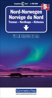
Wegenkaart - landkaart 5 Noord Noorwegen (Tromsö - Nordkapp - Kirkenes) | Kümmerly & Frey

0
Uitstekende wegenkaart met een helder, duidelijk kaartbeeld van Noorwegen van de bekende Noorse kaartenmaker Cappelen Kart. Met toeristische informatie. The maps have bold, effective relief shading with numerous spot heights and names of geographical features such as mountain ranges, glaciers, valleys, waterfalls, etc, to indicate the country’s mo...

Verkopers met dit product

Verkoper
Bezorging
Prijs
DeZwerver.nl logo
DeZwerver.nl
2,95
14,75

Anderen bekeken ook

Wegenkaart - landkaart 5 Noord Noorwegen (Tromsö - Nordkapp - Kirkenes) | Kümmerly & Frey
Uitstekende wegenkaart met een helder, duidelijk kaartbeeld van Noorwegen van de bekende Noorse kaartenmaker Cappelen Kart. Met toeristische informatie. The maps have bold, effective relief shading with numerous spot heights and names of geographical features such as mountain ranges, glaciers, valleys, waterfalls, etc, to indicate the country’s mountainous terrain. Colours show the vast forested areas and national parks are highlighted. Road network includes minor local roads, cart tracks, tolls, winter closures, steep gradients, etc. Railways, ferry connections and, in remote areas, hiking trails with walking times are also shown and local administrative boundaries are marked. The maps are particularly good at highlighting accommodation facilities, with an extensive range of symbols showing hotels, motels, campsites, youth hostels, etc., indicating different standards and categories. Other symbols show places of interest, viewpoints, bird colonies, etc. Latitude and longitude lines a…
14,75
Wegenkaart - landkaart 4 Mittel-Norwegen, Lofoten, Narvik, Broennoeysund | Kümmerly & Frey
Uitstekende wegenkaart met een helder, duidelijk kaartbeeld van Noorwegen van de bekende Noorse kaartenmaker Cappelen Kart. Met toeristische informatie. The maps have bold, effective relief shading with numerous spot heights and names of geographical features such as mountain ranges, glaciers, valleys, waterfalls, etc, to indicate the country’s mountainous terrain. Colours show the vast forested areas and national parks are highlighted. Road network includes minor local roads, cart tracks, tolls, winter closures, steep gradients, etc. Railways, ferry connections and, in remote areas, hiking trails with walking times are also shown and local administrative boundaries are marked. The maps are particularly good at highlighting accommodation facilities, with an extensive range of symbols showing hotels, motels, campsites, youth hostels, etc., indicating different standards and categories. Other symbols show places of interest, viewpoints, bird colonies, etc. Latitude and longitude lines a…
14,75
Wegenkaart - landkaart 3 Mittel-Norwegen, Alesund, Trondheim, Namsos | Kümmerly & Frey
Uitstekende wegenkaart met een helder, duidelijk kaartbeeld van Noorwegen van de bekende Noorse kaartenmaker Cappelen Kart. Met toeristische informatie. The maps have bold, effective relief shading with numerous spot heights and names of geographical features such as mountain ranges, glaciers, valleys, waterfalls, etc, to indicate the country’s mountainous terrain. Colours show the vast forested areas and national parks are highlighted. Road network includes minor local roads, cart tracks, tolls, winter closures, steep gradients, etc. Railways, ferry connections and, in remote areas, hiking trails with walking times are also shown and local administrative boundaries are marked. The maps are particularly good at highlighting accommodation facilities, with an extensive range of symbols showing hotels, motels, campsites, youth hostels, etc., indicating different standards and categories. Other symbols show places of interest, viewpoints, bird colonies, etc. Latitude and longitude lines a…
14,75
Wegenkaart - landkaart 1 Sud-Norwegen Oslo - Stavanger - Bergen | Kümmerly & Frey
Uitstekende wegenkaart met een helder, duidelijk kaartbeeld van Noorwegen van de bekende Noorse kaartenmaker Cappelen Kart. Met toeristische informatie. The maps have bold, effective relief shading with numerous spot heights and names of geographical features such as mountain ranges, glaciers, valleys, waterfalls, etc, to indicate the country’s mountainous terrain. Colours show the vast forested areas and national parks are highlighted. Road network includes minor local roads, cart tracks, tolls, winter closures, steep gradients, etc. Railways, ferry connections and, in remote areas, hiking trails with walking times are also shown and local administrative boundaries are marked. The maps are particularly good at highlighting accommodation facilities, with an extensive range of symbols showing hotels, motels, campsites, youth hostels, etc., indicating different standards and categories. Other symbols show places of interest, viewpoints, bird colonies, etc. Latitude and longitude lines a…
14,75
Wegenkaart - landkaart 2 Mittel-Norwegen, Oslo, Bergen, Alesund | Kümmerly & Frey
Uitstekende wegenkaart met een helder, duidelijk kaartbeeld van Noorwegen van de bekende Noorse kaartenmaker Cappelen Kart. Met toeristische informatie. The maps have bold, effective relief shading with numerous spot heights and names of geographical features such as mountain ranges, glaciers, valleys, waterfalls, etc, to indicate the country’s mountainous terrain. Colours show the vast forested areas and national parks are highlighted. Road network includes minor local roads, cart tracks, tolls, winter closures, steep gradients, etc. Railways, ferry connections and, in remote areas, hiking trails with walking times are also shown and local administrative boundaries are marked. The maps are particularly good at highlighting accommodation facilities, with an extensive range of symbols showing hotels, motels, campsites, youth hostels, etc., indicating different standards and categories. Other symbols show places of interest, viewpoints, bird colonies, etc. Latitude and longitude lines a…
14,75
Wegenkaart - landkaart Noorwegen - Norwegen | Kümmerly & Frey
For everyone who travels around Europe frequently and needs or wants to plan his/her route in advance we recommend the Kummerly and Frey 1:750 000 road map series. These maps provide a quick overview of the travel route, indicate distances and offer information on road classes as well as being reliable travelling companions. Large, indexed map of Norway, presenting the whole country in two panels side by side.  Clear, well-presented cartography has fine relief shading and spot heights to indicate the topography, with national parks prominently marked. Detailed presentation of the road network includes scenic routes, roads closed to traffic, seasonal closures of mountain passes, etc. Towns and places of particular interest are highlighted.
14,95
Wegenkaart - landkaart Frankreich Nord - Frankrijk Noord | Kümmerly & Frey
Mooie duidelijke wegenkaart van Noord Frankrijk. Met o.a. campings, wegnummers en bezienswaardigheden aangegeven. Die Strassenkarten von Kümmerly+Frey sind beliebte Begleiter bei der Planung einer Reise, unterwegs oder am Ziel. Die "Blauen", wie sie auch genannt werden, zeichnen sich durch ein übersichtliches Kartenbild und eine präzise Kartografie aus. Das Sortiment umfasst weit über 100 aktuelle Strassen- und Reisekarten. Alle Strassenkarten haben eines gemeinsam: Sie sind von bester Schweizer Qualität. Planen und reisen Sie mit einer blauen Strassenkarte von Kümmerly+Frey und Sie werden überrascht sein, wie viel es zu entdecken und zu erleben gibt.  In the Kümmerly+Frey Road Map France (North) at a scale of 1:600,000, you will find everything you need for orientation and inspiration.   The map shows the main areas of interest from Basel, Strasbourg, Metz, Dijon, Bourges, Paris, Le Mans, Rennes, Nantes, Rouen, Lille, Calais, Brest, etc.   Thanks to the clearly marked, easily readabl…
14,75
Wegenkaart - landkaart 6 Nord-Schweden - Zweden Noord | Kümmerly & Frey
Mooie duidelijke wegenkaart van Noord Zweden, van Lulea - Kiruna - Narvik.  Met o.a. campings, jeugdherbergen, wegnummers en bezienswaardigheden aangegeven.   Kummerly and Frey regional road map covering North Sweden. A product from this regional range is ideal for tourists, and is intended to be taken around in a glove compartment. Mapping gives at-a-glance navigation between tourist attractions within the coverage areas, so that travelling times can be easily calculated and minimised, with easily followable numbered roads so that incorrect routes are avoided.
14,75
Wegenkaart - landkaart 5 Noord Zweden | Kümmerly & Frey
Mooie duidelijke wegenkaart van Noord Zweden, gebied Östersund - Umea - Lulea  Met o.a. campings, jeugdherbergen, wegnummers en bezienswaardigheden aangegeven. Optimale Orientierung - die Regionalkarten helfen weiter Mit den Regionalkarten von Kümmerly+Frey fühlen Sie sich auch in den Ferien wie zu Hause. Sie wissen immer, wo Sie sind und wie weit es bis zur nächsten Sehenswürdigkeit ist. Die Regionalkarten sind Lizenzausgaben namhafter kartografischer Verlage. Es gibt sie von folgenden Ländern: Deutschland, Österreich, Italien, Frankreich, Spanien-Portugal, Grossbritannien, Norwegen, Schweden und Dänemark. Beachten Sie dazu die detaillierten Blattschnitte. Massstab: 1:400 000
14,75
Wandelkaart 5 Aargau - Fricktal - Hallwilersee | Kümmerly & Frey
Zeer duidelijke wandelkaart van een deel van Zwitserland. Deze kaart - gemaakt op scheur en watervast papier - is bedoeld voor de gewone en gemiddelde bergwandelaar. Ook voor huttentochten is deze zeker geschikt. Slechts voor de gevorderde wandelaar die glesjers gaat overschrijden zijn de 25.000 topografische kaarten aan te raden. Op deze 1:60.000 kaarten staan de wandelroutes in 3 soorten weergegeven: Wanderweg, Bergweg en Alpine route. De routes staan goed ingetekend en werken prima naast de vele markingen in het veld. Hoogteverschillen, overnachtingsmogelijkheden, bus routes en gps-informatie ontbreken allemaal niet op deze landkaarten.   The maps have contours at 50m or 25m intervals according to the terrain, enhanced by graphic relief and shading. An overprint distinguishes between sign-posted hiking paths, mountain path where proper walking shoes are necessary, and alpine paths requiring special equipment.   Mountain huts are marked, plus various types of accommodation: campsite…
22,50

Klanten-reviews van Wegenkaart - landkaart 5 Noord Noorwegen (Tromsö - Nordkapp - Kirkenes) | Kümmerly & Frey

Er zijn nog geen beoordelingen voor dit productBen jij de eerste die een review plaatst?

Meer over Wegenkaart - landkaart 5 Noord Noorwegen (Tromsö - Nordkapp - Kirkenes) | Kümmerly & Frey

Productomschrijving

Uitstekende wegenkaart met een helder, duidelijk kaartbeeld van Noorwegen van de bekende Noorse kaartenmaker Cappelen Kart. Met toeristische informatie.

The maps have bold, effective relief shading with numerous spot heights and names of geographical features such as mountain ranges, glaciers, valleys, waterfalls, etc, to indicate the country’s mountainous terrain. Colours show the vast forested areas and national parks are highlighted. Road network includes minor local roads, cart tracks, tolls, winter closures, steep gradients, etc. Railways, ferry connections and, in remote areas, hiking trails with walking times are also shown and local administrative boundaries are marked.

The maps are particularly good at highlighting accommodation facilities, with an extensive range of symbols showing hotels, motels, campsites, youth hostels, etc., indicating different standards and categories. Other symbols show places of interest, viewpoints, bird colonies, etc. Latitude and longitude lines are drawn at 15’ and 30’ respectively. There is no index of place names. Map legend includes English.

Productinformatie

    Verken gerelateerde categorieën

    Webshop.nl maakt gebruik van cookies. Ga je verder op onze website, ga dan akkoord met het plaatsen van cookies en de verwerking van deze data door ons en vermelde partners.