webshop.nl
Categorieën
  Sluiten

Meer MapStudio

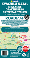
Wegenkaart - landkaart 5 Kwazulu - Natal | MapStudio

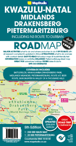
Het overzicht is soms misschien een beetje onduidelijk. maar de details in de inzetten en delen van de kaart zijn prima en voldoen goed voor het rondrijden met een eigen auto. Indexed road map of the central KZN with an extensive map of Pietremaritzburg on the reverse. The road map at 1:250,000 includes the Drakensberg range and extends from Harris...
16,95

Webshops met dit product

Webshop
Bezorging
Prijs

Anderen bekeken ook

Wegenkaart - landkaart 5 Kwazulu - Natal | MapStudio
Het overzicht is soms misschien een beetje onduidelijk. maar de details in de inzetten en delen van de kaart zijn prima en voldoen goed voor het rondrijden met een eigen auto. Indexed road map of the central KZN with an extensive map of Pietremaritzburg on the reverse. The road map at 1:250,000 includes the Drakensberg range and extends from Harrismith and the Sterkfontein Dam in the north west to uLundi in the east and Durban in the south. Road detail distinguishes tarred and un-tarred roads, indicates mountain passes and shows intermediate driving distances. Railways, airports and airfields are also included. There is no indication of the relief of the area, apart from some peak heights in highland areas. Provincial boundaries are included and reserves and conservation areas are highlighted, Symbols indicate places of interest, historical sites, battle sites, tourism offices, shopping/ eating opportunities etc. The map is annotated with brief notes on places of interest and there is …
16,95
Wegenkaart - landkaart South Africa: Swartberg & Klein-Karoo | Slingsb
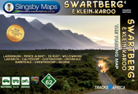
All roads from National Highways to minor gravel roads are shown; the many classifications that indi- cate the quality of each road help you plan your route No less than 28 mountain passes are shown — all are public roads! Distances are clearly shown; comprehensive 4 x 4 information GPS coordinates in DD MM SS format are provided for every road-junction All tourism facilities and accommodation establishments are shown in the out-of-town areas; there are insets of the major towns The map links to our maps of the Baviaanskloof, the Garden Route, Overberg and the Tankwa-Karoo Additional info:   Swartberg and Klein-Karoo region on a contoured and GPS compatible, double-sided, waterproof and   tear-resistant map at 1:160,000 from Slingsby Maps, with excellent topographic detail and plenty of tourist information, including street plans of ten main towns.   The map provides a very detailed picture of this mountainous terrain, with altitude colouring, shading, con- tours at 20m intervals and n…
29,95
Wegenkaart - landkaart Zambia | Infomap
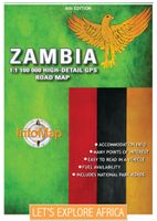
Zambia boasts some of the most beautiful, wild and pristine wilderness in Southern Africa. With 19 national parks including the world famous Kafue and South Luangwa National Parks, Zambia is an exciting wildlife and touring destination. Despite the fact that around 30% of the country being protected for wildlife conservation or management, it is still in many ways under-the-radar in terms of its tourist potential. Largely tropical and subtropical in climate, Zambia is characterized by woodland savannahs, grasslands and forests. Malaria is a concern and visitors are advised to take precautions.   Walking tours through one of the country’s national parks are a truly unforgettable experience. South Luangwa National Park is one of the best places for this, and an excellent destination for game viewing. Other sites such as the Bangweulu wetlands offer visitors a chance to see enormous herds of black lechwe. With so many wilderness areas to choose from though such as Kasanka, Lochinvar, Lowe…
15,95
Wegenkaart - landkaart 10 Western Cape Road Map | MapStudio
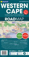
Road map of the Western Cape Province with an enlargement for the Cape Peninsula and 27 street plans of the central areas in main towns. The map is annotated numerous places of interest, vineyards, etc. GPS coordinates are provides for main road junctions. This new edition Western Cape Road Map covers the whole of the Western Cape. It features easy-to-read full colour maps with GPS co-ordinates. The map provides tourist-friendly text, highlights places of interest and lists accommodation information. This map is perfect for scenic drives and includes information boxes on activities of interest.   Coverage includes the Garden Route & Route 62, South Western Cape, Winelands and Overberg, West Coast Flower Region and Little Karoo. The map features small detailed street plans of Cape Town CBD, Montagu, Barrydale, Ladismith, Oudtshoorn, Mossel Bay, Knysna, Plettenberg Bay, Humansdorp, George, Stellenbosch, Franschhoek, Paarl, Wellington, Hermanus, Swellendam, Robertson, Ceres, Tulbagh, Lang…
16,95
Wegenkaart - landkaart Panama | ITMB
Een degelijke kaart met aanduidingen van o.a. nationale parken, vliegveld, benzinepomp, dirt-roads en kleine plattegrond van hoofdstad. Als overzichtskaart goed te gebruiken. Panama on an indexed, double-sided map from ITMB, printed on waterproof and tear-resistant plastic paper, with large, clear street plan of central Panama City highlighting various places of interest and tourist facilities, including 18 selected hotels. The map divides the country east/west, with some overlap between the two sides. Topography is shown by altitude colouring with spot heights and names of mountain ranges. Swaps, mangrove and salt marshes are marked, and national parks or protected areas and Indian Reserves highlighted. The map shows the country’s road network with locations of petrol stations and border crossings, plus railways and local airports or landing grounds. Internal administrative boundaries are shown with names of the provinces. Symbols highlight various places of interest, archaeological s…
13,95
Wegenkaart - landkaart Ethiopia Ethiopië - Eritrea | ITMB
Een degelijke kaart met aanduidingen van o.a. nationale parken, vliegveld, benzinepomp, dirt-roads en kleine plattegrond van hoofdstad. Als overzichtskaart goed te gebruiken. This is the latest updating of one of the most interesting countries in Africa. There isn’t anything brilliantly innovative to report. We have tidied up the different layers of the artwork, have updated the road system, and have added more tourist information. We have also modernized the cover design and changed the ISBN – printed on paper, single-sided, inset map of Addis Ababa. Legend Includes: roads by classification, Airports, Ports, Gasolines, Polices, Post Offices, Bus Stations, Hospitals, Schools, Universities, Buildings, Point of Interests, Bridges, Lodgings, Campsites or Huts, Museums, and many more   Double-sided map from ITMB presenting on one side a road map of Ethiopia at 1:2,000,000 accompanied by a street plan of Addis Ababa, with on the reverse Eritrea at 1:900,000 with a plan of Asmara. Both road…
13,95
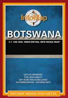
Wegenkaart - landkaart Botswana | Infomap
Goede betrouwbare kaart van Botswana. Met GPS coordinaten. Easy to read in a vehicle Practical, user-friendly scale Extensive countrywide accommodation listing and contact details Experienced-based tips and route comments Includes many off-road tracks GPS co-ordinates of intersections Border post information Many points of interest Distances, fuel points, airports Booking details for national parks Roads and tracks in the national park and reserves Inset of Tuli Block A classic. Our Botswana map, now in its 14th edition, is one of our top sellers. From more frequented destinations such as the country’s famous game parks to other lesser known ones like Tsodilo Hills – Botswana’s World Heritage site with over 4000 rock paintings – this map is a one-stop resource for both self-drive travellers and fly-in tourists alike. Use it to navigate your way from Gaborone to Maun, from Kasane down the Hunters Road to Khubu Island, from Twee Rivieren to the Kalahari, or simply use it as a…
15,95

Klanten-reviews van Wegenkaart - landkaart 5 Kwazulu - Natal | MapStudio

Er zijn nog geen beoordelingen voor dit productBen jij de eerste die een review plaatst?

Meer over Wegenkaart - landkaart 5 Kwazulu - Natal | MapStudio

Productomschrijving

Het overzicht is soms misschien een beetje onduidelijk. maar de details in de inzetten en delen van de kaart zijn prima en voldoen goed voor het rondrijden met een eigen auto. Indexed road map of the central KZN with an extensive map of Pietremaritzburg on the reverse. The road map at 1:250,000 includes the Drakensberg range and extends from Harrismith and the Sterkfontein Dam in the north west to uLundi in the east and Durban in the south. Road detail distinguishes tarred and un-tarred roads, indicates mountain passes and shows intermediate driving distances. Railways, airports and airfields are also included. There is no indication of the relief of the area, apart from some peak heights in highland areas. Provincial boundaries are included and reserves and conservation areas are highlighted, Symbols indicate places of interest, historical sites, battle sites, tourism offices, shopping/ eating opportunities etc. The map is annotated with brief notes on places of interest and there is a list of contact details for accommodation and tourism offices. On the reverse is the 1:20,000 street map of Pietermaritzburg with street index. Industrial areas, parks and built-up areas are distinguished, and symbols denote places of interest, shopping centres, places of worship, hotels, car parks, hospitals, post offices, etc. Railways and stations are also marked.

Productspecificaties

Artikelnummer(s)
Brand
MapStudio
Webshop.nl maakt gebruik van cookies. Ga je verder op onze website, ga dan akkoord met het plaatsen van cookies en de verwerking van deze data door ons en vermelde partners.