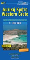
Wegenkaart - landkaart 401 Western Crete - Kreta westelijk deel | Road Editions

0
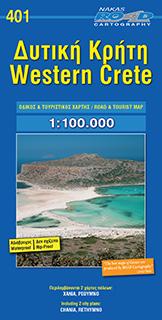
This Western Crete map by Road Cartography, has been created by G.I.S. ( Geographical Information Systems), ensuring high accuracy. The complete road network, all villages, beaches, touristic sights and many more, clearly presented in a dependable and user-friendly map. ...

Verkopers met dit product

Verkoper
Bezorging
Prijs
DeZwerver.nl logo
DeZwerver.nl
2,95
10,95

Anderen bekeken ook

Wandelkaart - Wegenkaart - landkaart 218 Skopelos | Road Editions
Gedetailleerde wegenkaart met aanduiding van de wandelwegen, lijst van hotels en toeristische informatie. Voor alle doeleinden een zeer geschikte kaart. This brand new edition of Skopelos island map, by Road Cartography, has been created by G.I.S. ( Geographical Information Systems) ensuring high accuracy. The complete road network, all villages, beaches, touristic sights and many more, clearly presented in a dependable and user-friendly map.
9,95
Wandelkaart 401 Crete - Kreta | Road Editions
Uitstekende wandelkaart van een deel van Kreta. De kaart is gedrukt op watervast en onverscheurbaar papier. hierdoor gaat deze veel langer mee!   De wandelkaart heeft alle noodzakelijke details voor wandelen of fietsen: naast de topografische informatie als hoogtelijnen, alle plaatsnamen (zowel Grieks als Europees schrift), het wegennet, rivieren en stroompjes, nationale parken etc is er ook veel informatie over de toeristische aspecten als stranden, kloosters, campings en afstanen tussen dorpen of steden.   Voor de wandelaars is relevant dat de E4, het bekende lange-afstandswandelpad, staat ingetekend alsmede andere wandelroutes. Sporadisch staan ook fietsroutes ingetekend. Road Cartography map, was created upon intensive fieldwork and using G.I.S. ( Geographical Information Systems), ensuring high accuracy. Contains every single road, trails, special routes for cycling and scenic routes, villages, attractions and plenty of other useful information. 
9,95
Wandelkaart 403 Crete - Kreta | Road Editions
Uitstekende wandelkaart van een deel van Kreta. De kaart is gedrukt op watervast en onverscheurbaar papier. hierdoor gaat deze veel langer mee!   De wandelkaart heeft alle noodzakelijke details voor wandelen of fietsen: naast de topografische informatie als hoogtelijnen, alle plaatsnamen (zowel Grieks als Europees schrift), het wegennet, rivieren en stroompjes, nationale parken etc is er ook veel informatie over de toeristische aspecten als stranden, kloosters, campings en afstanen tussen dorpen of steden.   Voor de wandelaars is relevant dat de E4, het bekende lange-afstandswandelpad, staat ingetekend alsmede andere wandelroutes. Sporadisch staan ook fietsroutes ingetekend. ROAD Cartography map, was created upon intensive fieldwork and using GIS (Geographical Information Systems) software, which results all geographic information with great accuracy. Contains every single road, trails, special routes for cycling and scenic routes, villages, attractions and plenty of other useful info…
9,95
Wandelkaart 405 Crete - Kreta | Road Editions
Uitstekende wandelkaart van een deel van Kreta. De kaart is gedrukt op watervast en onverscheurbaar papier. hierdoor gaat deze veel langer mee!   De wandelkaart heeft alle noodzakelijke details voor wandelen of fietsen: naast de topografische informatie als hoogtelijnen, alle plaatsnamen (zowel Grieks als Europees schrift), het wegennet, rivieren en stroompjes, nationale parken etc is er ook veel informatie over de toeristische aspecten als stranden, kloosters, campings en afstanen tussen dorpen of steden.   Voor de wandelaars is relevant dat de E4, het bekende lange-afstandswandelpad, staat ingetekend alsmede andere wandelroutes. Sporadisch staan ook fietsroutes ingetekend. ROAD Cartography map, was created upon intensive fieldwork and using GIS (Geographical Information Systems) software, which results all geographic information with great accuracy. Contains every single road, trails, special routes for cycling and scenic routes, villages, attractions and plenty of other useful info…
9,95
Wandelkaart 404 Crete - Kreta | Road Editions
Uitstekende wandelkaart van een deel van Kreta. De kaart is gedrukt op watervast en onverscheurbaar papier. hierdoor gaat deze veel langer mee!   De wandelkaart heeft alle noodzakelijke details voor wandelen of fietsen: naast de topografische informatie als hoogtelijnen, alle plaatsnamen (zowel Grieks als Europees schrift), het wegennet, rivieren en stroompjes, nationale parken etc is er ook veel informatie over de toeristische aspecten als stranden, kloosters, campings en afstanen tussen dorpen of steden.   Voor de wandelaars is relevant dat de E4, het bekende lange-afstandswandelpad, staat ingetekend alsmede andere wandelroutes. Sporadisch staan ook fietsroutes ingetekend. ROAD Cartography map, was created upon intensive fieldwork and using GIS (Geographical Information Systems) software, which results all geographic information with great accuracy. Contains every single road, trails, special routes for cycling and scenic routes, villages, attractions and plenty of other useful info…
9,95
Wandelkaart 406 Crete - Kreta | Road Editions
Uitstekende wandelkaart van een deel van Kreta. De kaart is gedrukt op watervast en onverscheurbaar papier. hierdoor gaat deze veel langer mee! De wandelkaart heeft alle noodzakelijke details voor wandelen of fietsen: naast de topografische informatie als hoogtelijnen, alle plaatsnamen (zowel Grieks als Europees schrift), het wegennet, rivieren en stroompjes, nationale parken etc is er ook veel informatie over de toeristische aspecten als stranden, kloosters, campings en afstanen tussen dorpen of steden. Voor de wandelaars is relevant dat de E4, het bekende lange-afstandswandelpad, staat ingetekend alsmede andere wandelroutes. Sporadisch staan ook fietsroutes ingetekend. ROAD Cartography map, was created upon intensive fieldwork and using GIS (Geographical Information Systems) software, which results all geographic information with great accuracy. Contains every single road, trails, special routes for cycling and scenic routes, villages, attractions and plenty of other useful informat…
9,95
Wandelkaart 402 Crete - Kreta | Road Editions
Uitstekende wandelkaart van een deel van Kreta. De kaart is gedrukt op watervast en onverscheurbaar papier. hierdoor gaat deze veel langer mee!   De wandelkaart heeft alle noodzakelijke details voor wandelen of fietsen: naast de topografische informatie als hoogtelijnen, alle plaatsnamen (zowel Grieks als Europees schrift), het wegennet, rivieren en stroompjes, nationale parken etc is er ook veel informatie over de toeristische aspecten als stranden, kloosters, campings en afstanen tussen dorpen of steden.   Voor de wandelaars is relevant dat de E4, het bekende lange-afstandswandelpad, staat ingetekend alsmede andere wandelroutes. Sporadisch staan ook fietsroutes ingetekend. ROAD Cartography map, was created upon intensive fieldwork and using GIS (Geographical Information Systems) software, which results all geographic information with great accuracy. Contains every single road, trails, special routes for cycling and scenic routes, villages, attractions and plenty of other useful info…
9,95
Wegenkaart - landkaart Kreta - Crete | Borch
Mooie geplasticieerde kaart van Kreta. Deze kaart biedt een goed overzicht van dit eiland met detailkaarten.   Our soft-laminated folded map of Crete shows: Crete (West) 1:200 000, Crete (East) 1:200 000, Iraklio 1:7 000, Agios Nikolaos 1:6 000, Chania 1:10 000, Ierapetra 1:10 000, Rethimno 1:9 000, Samaria Gorge 1:90 000, Sitia 1:7 000 and Gavdos 1:200 000. Borch maps are easy to fold, durable and water-repellent with a wipeable surface. Borch Maps show hotels, museums, monuments, markets, top sights and points of interest, useful statistics, conversion charts for temperatures, weights and measurements, climate charts showing temperatures, sunshine hours, precipitation and humidity, overview maps, time zones, and much more...   Crete is more than just another Greek island, it is the fifth largest island in the Mediterranean Sea and the cradle of ancient Mediterranean civilization. By 2000 B.C. the Minoans had set up a base here for their international trade with the East, North Afric…
11,50
Wegenkaart - landkaart 8 Kreta - Oostelijk deel | Road Editions
On a scale of 1:100,000, which is the most detailed scale available for a map of Crete, you will find the most detailed road network ever to have appeared on a map of Crete, a precise geophysical background (in cooperation with the Hellenic Military Geographic Service), all the island's hydrography and the greatest wealth of information of interest to the traveller: All the archaeological sites, monasteries, country chapels and castles. Nature lovers and hikers will be overjoyed by the mapping of E4 trail and all its side trails, the mountain refuges, the mountain peaks, the canyons and the gorges.
10,95
Wegenkaart - landkaart 216 Skyros | Road Editions
Gedetailleerde wegenkaart met aanduiding van de wandelwegen, lijst van hotels en toeristische informatie. Voor alle doeleinden een zeer geschikte kaart. At last, a reliable and accurate map of Skyros island is available to the demanding traveler! Although Skyros(located in the central Aegean Sea, 22 nautical miles east of Evia Prefecture) is not a popular touristic destination, ROAD Editions published this map to contribute to the touristic development of this beautiful greek island. This Skyros island map incorporates the new specifications of ROAD Editions' Greek Islands Map Series: the backside of the map is a mini travel guide in full color, with many images and all the nessesary information on the touristic sights and the individual character of this island. It also includes a complete list of the hotels and rooms to let in the island, many usefull telephone numbers, and a note on the island's history. The map of Skyros presents the complete road network of the island, against a …
9,95

Klanten-reviews van Wegenkaart - landkaart 401 Western Crete - Kreta westelijk deel | Road Editions

Er zijn nog geen beoordelingen voor dit productBen jij de eerste die een review plaatst?

Meer over Wegenkaart - landkaart 401 Western Crete - Kreta westelijk deel | Road Editions

Productomschrijving

This Western Crete map by Road Cartography, has been created by G.I.S. ( Geographical Information Systems), ensuring high accuracy. The complete road network, all villages, beaches, touristic sights and many more, clearly presented in a dependable and user-friendly map. 

Verken gerelateerde categorieën

Webshop.nl maakt gebruik van cookies. Ga je verder op onze website, ga dan akkoord met het plaatsen van cookies en de verwerking van deze data door ons en vermelde partners.