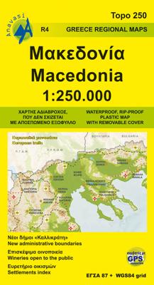
Wegenkaart - landkaart 4 Macedonia | Anavasi

0
Gedetailleerde tweetalige (Grieks/Engels) topografische wegenkaart van Griekse Macedonië met hoogtelijnen, relief, gedetailleerd wegennet met wegnummers, campings en hutten. Met ingetekende Europese en nationale lange afstandswandelpaden. Anavasi Regional Maps series (Topo250), covering half of the mainland from Konitsa to Katerini in the north an...

Verkopers met dit product

Verkoper
Bezorging
Prijs
DeZwerver.nl logo
DeZwerver.nl
2,95
11,95

Anderen bekeken ook

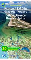
Wegenkaart - landkaart 3 Central Greece - Midden Griekenland, Thessalie en Epirus | Anavasi
Gedetailleerde tweetalige (Grieks/Engels) topografische wegenkaart van het centrale gedeelte van Griekenland - Thessalië en Epiros met hoogtelijnen, relief, gedetailleerd wegennet met wegnummers, campings en hutten. Met ingetekende Europese en nationale lange afstandswandelpaden. Anavasi Regional Maps series (Topo250), covering half of the mainland from Konitsa to Katerini in the north and from Messolongi to Thiva in the south. The map comprises all the new highways, the protected areas and Natura sites, the european and national long distance trails and a 84 pages index of settlements, mountains and mountain refuges. Double-sided roadmap and place name index, GPS compatible regional road maps printed on waterproof and tear-resistant plastic paper
11,95
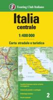
Wegenkaart - landkaart 2 Italië Centraal | Touring Club Italiano
Central Italy at 1:400,000 from the Touring Club Italiano, printed on light, waterproof and tear-resistant plastic paper; one of the titles in a series of three touring maps conveniently grouping together several popular holiday areas. The maps very effectively present the country’s topography with attractive altitude colouring, supplemented by names of numerous hill and mountain ranges, valleys, etc, plus spot heights for selected peaks. National parks and scenic routes are highlighted. National parks and scenic routes are highlighted. Grading according to the degree of importance and interest is given not only to towns, villages and historical or architectural sites, but also to holiday resorts and natural curiosities. Symbols highlight churches, monasteries, castles, palaces, ruins and archaeological sites, caves and waterfalls, etc. The maps also provide some information on accommodation, indicating selected isolated hotels, refuges, tourist villages and campsites, Road network st…
13,95
Wegenkaart - landkaart Newfoundland & Labrador | ITMB
Double-sided map of Newfoundland and Labrador Provinces at 1:800,000 and 1:1,300,000 respectively, part of a series of maps of Canadian provinces from the Vancouver-based ITMB, with topography presented by altitude colouring rather than by relief shading. Road and rail networks are shown on a clear base with numerous national or regional parks and wildlife reserves prominently marked. The Trans Canada Trail is prominently indicated; symbols highlight various places of interest, sport and recreational facilities, etc. National, provincial and time zone boundaries are displayed. The map has a latitude and longitude grid at intervals of 1º and an index of localities. Historical information is given on the outer edges of the map, with a small box showing the timeline of the provinces, dating back to the 11th century. Also included are plans of Conception bay South and St. John’s, indicating one-way streets, points of interest, and various facilities.  
13,95
Wegenkaart - landkaart 790 New Zealand - Nieuw Zeeland | Michelin
Zoals je van Michelin mag verwachten is deze kaart zeer overzichtelijk en heeft een duidelijk helder kaartbeeld. De kaart geeft uitgebreide toeristische informatie weer. De perfecte overzichtskaart!   This New Zealand map from Michelin is part of their red national map series. These are perfect for route planning as well as getting around by car once you're there. They clearly mark out major roads and also show many of the more important minor roads.    The map's simple folding design with durable paper cover, allows it to be read like a book and easily folded back together. Road numbers and intermediate distances are clearly displayed with the more scenic routes highlighted in green.   The map also features:   Political boundaries Regional and National Parks Important sights (points of interest, historic sites, etc.) Driving Times and Distances Road Safety Information A legend in multiple languages (Dutch, English, French, German and Spanish) Michelin New Zealand Map 790 is a new add…
12,95
Wegenkaart - landkaart Afrika noordwest - Africa northwest | ITMB
Een degelijke kaart met aanduidingen van o.a. nationale parken, vliegveld, benzinepomp, dirt-roads en kleine plattegrond van hoofdstad. Als overzichtskaart goed te gebruiken. This is the detailed map of Africa emanating from our continental data base and, at an scale better than Michelin's famous regional map, we feel that this version is a winner. First, it is printed double-sided with the western coastal segment on one side and the eastern half on the other. Second, we have been able to improve the accuracy of the road information enormously at the better scale, and third we are making progress in developing a new series of travel maps for Africa by publishing the first of what we hope will become a new regional map covering Africa from top to bottom, or from Cape to Cairo, as Uncle Cecil used to say. The coverage of this map is from Morocco in the west to the Libyan/Egyptian border and from Senegal and Liberia in the southwest to the Chad/Sudan border in the southeast. This is also…
13,95
Wegenkaart - landkaart Deutschland Nord - Noord Duitsland | High 5 Edition
The first water-resistant roadmap with direct access to useful additional information from the Internet   Northern Germany in a scale of 1:550,000 shown on a practical map; inclusive of the High 5 Edition app technology for calling up additional travel information and many other benefits:   practical format (11.4 x 23.5 cm) it is water-resistant (laminated/cellophane coating) contains a selection of the local index including postal codes; the entire index can be viewed using the QR-code It doesn’t matter what weather it is used in or how often it is folded, the condition of the “ROADMAP Germany North” will not deteriorate. Roads, ascents, woodland and mountain areas are easily recognisable thanks to the clear layout of the map. There is also a brief informative section about Germany (speed limits, area codes, emergency numbers, etc.)   The “Interactive Mobile ROADMAP Germany North” – a “paper backup” just in case... ... and when used in conjunction with a smartphone, it is a great …
12,95
Fietskaart Cycling guides Exmoor - North Devon | Goldeneye
Scheur- en watervast foetskaart van Exmoor en Noord Devon met ingetekende fietsroutes.   Our maps are double-sided, printed on an A2 sheet with a concertina fold. This allows for easy folding and folding, and an ease of access to the mapping. The material is rain and tear-resistant. Our early maps were designed at the scale of 2 miles to 1 inch/1:126,720. The later designs along with digitalisation are 1: 100,000. We were encouraged by the Cycle Touring Club to convert our cartography toward the cycle market (to replace the out-of-print Bartholomew series). As time and the series progressed we have added more data: The National Cycle Network routes, Regional Routes, and Traffic-Free Family Routes, as and when they are developed. These routes are in addition to the Circular Routes Goldeneye Commissioned at the outset of our publishing schedule. We are also adding to new editions; bike shops, cycle hire, and tea rooms, along with the tourist attractions already featured. Our plan is to …
12,95
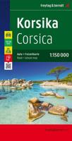
Wegenkaart - landkaart Corsica - Korsika | Freytag & Berndt
Deze bijzonder gedetailleerde Freytag & Berndt Wegenkaart van Corsica is aan één kant geprint en heeft een schaal van 1:150.000. Op deze kaart staan o.a. fietsroutes, lange afstandswandelpaden, toeristische wegen en bezienwaardigheden aangegeven. In de omslag van de kaart is een apart boekje geniet met een korte beschrijving van de TOP 10 van bezienswaardigheden, een uitgebreide index en plattegrondjes van enkele toeristische plaatsen. Explore the Mediterranean island of Corsica with this Freytag & Berndt single-sided road and leisure map. The best way to plan your trip, prepare your itinerary, and to travel independently on this region. As with all Freytag & Berndt maps, the cartography is clear and detailed with the topography shown with relief shading with plenty of spot heights.   This map features a full map of the island. Using Freytag & Berndt's icon system, important tourist information is shown. You will see icons for tourist information such as:   Picturesque towns and panor…
14,95
Wegenkaart - landkaart 175 Four Corners USA | Michelin
Bijzonder goed leesbare kaart van een deel van de Verenigde Staten - USA, in dit geval het gebied van de staten Arizona - Utah - Colorado - New Mexico, ook wel de Four Corners genoemd.  Op deze kaart zijn de Nationale Parken goed zichtbaar ingetekend met een heldere achtergrondkleur. Wegnummers, register, afstanden tussen steden en bijvoorbeeld de beroemde groene wegenaanduiding van Michelin ontbreken niet.  Met stadsplattegronden (alleen het centrum)  van Albuquerque, Colorado Springs, Denver, Phoenix, Salt Lake City en Tucson. Michelin USA Four Corners Map 175 (scale: 1:1,267,000)—part of Michelin's brand-new US regional map series with bright green covers—zooms in close for comprehensive coverage of Arizona, Colorado, New Mexico and Utah. It contains city maps for easy driving in Albuquerque, Colorado Springs, Denver, Phoenix, Salt Lake City and Tucson. Michelin star-rated sights and a selection of not-to-be-missed annual events and festivals serve as inspiration for future road tr…
10,95
Wegenkaart - landkaart 92G Lower Mainland British Columbia - Richmond and New Westminster | ITMB
Goede wegenkaart van British Columbia met topografische uitsnede van Richmond en Westminster. Topographic/Recreation Map 92G&92G2 and G3 - With the 2010 Winter Olympics bearing down on us, this very timely map presents a lovely regional map showing all of the Olympic venues (the Games are being held in Vancouver, Richmond, UBC, Whistler, and the Callaghan Valley – not just in Vancouver). The area of coverage is from Everett (just north of Seattle) in the USA to north of Pemberton, and from Victoria in the west to Chilliwack in the east on the one side, and a detailed 1:50,000 topo map of the Richmond/New Westminster/Surrey/Langley outer urban areas of Metro Vancouver. Both maps are Government of Canada NTS maps, overlaid with touristic and recreational information by ITMB, which holds the copyright on behalf of the Queen (I love being able to say that). The Lower Mainland portion is particularly useful, in that it includes the east coast of Vancouver Island, from Victoria to Nanaimo a…
13,95

Klanten-reviews van Wegenkaart - landkaart 4 Macedonia | Anavasi

Er zijn nog geen beoordelingen voor dit productBen jij de eerste die een review plaatst?

Meer over Wegenkaart - landkaart 4 Macedonia | Anavasi

Productomschrijving

Gedetailleerde tweetalige (Grieks/Engels) topografische wegenkaart van Griekse Macedonië met hoogtelijnen, relief, gedetailleerd wegennet met wegnummers, campings en hutten. Met ingetekende Europese en nationale lange afstandswandelpaden.

Anavasi Regional Maps series (Topo250), covering half of the mainland from Konitsa to Katerini in the north and from Messolongi to Thiva in the south. The map comprises all the new highways, the protected areas and Natura sites, the european and national long distance trails and a 84 pages index of settlements, mountains and mountain refuges.

Double-sided roadmap and place name index, GPS compatible regional road maps printed on waterproof and tear-resistant plastic paper

Verken gerelateerde categorieën

Webshop.nl maakt gebruik van cookies. Ga je verder op onze website, ga dan akkoord met het plaatsen van cookies en de verwerking van deze data door ons en vermelde partners.