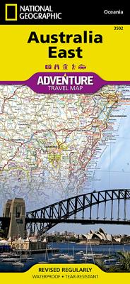
Wegenkaart - landkaart 3502 Adventure Map Australia East - Australië Oost | National Geographic

0
Wegenkaart van Australië Oost met vermelding van veel bezienswaardigheden, nationale parken en attrakties. Watervast en scheurvast. Juist door deze vermeldingen onderscheidt de kaart zich van andere wegenkaarten. National Geographic's Australia East AdventureMapis designed to meet the unique needs of adventure travelers with its durability and det...

Verkopers met dit product

Verkoper
Bezorging
Prijs
DeZwerver.nl logo
DeZwerver.nl
2,95
17,50

Anderen bekeken ook

Wegenkaart - landkaart 3502 Adventure Map Australia East - Australië Oost | National Geographic
Wegenkaart van Australië Oost met vermelding van veel bezienswaardigheden, nationale parken en attrakties. Watervast en scheurvast. Juist door deze vermeldingen onderscheidt de kaart zich van andere wegenkaarten. National Geographic's Australia East AdventureMapis designed to meet the unique needs of adventure travelers with its durability and detailed, accurate information. The map includes the locations of thousands of cities and towns with a user-friendly index, plus a clearly marked road network complete with distances and designations for major highways, main roads, plus tracks and trails for those seeking to explore more remote regions.    The Australia East AdventureMap differs from a traditional road map because it includes hundreds of points of interest that highlight diverse and unique destinations within the country. National parks, World Heritage sites, caves, archeological sites, aboriginal settlements and protected lands are included, making it an invaluable resource to …
17,50
Wegenkaart - landkaart 3501 Adventure Map Australia - Australië | National Geographic
Wegenkaart van Australië met vermelding van veel bezienswaardigheden, nationale parken en attrakties. Watervast en scheurvast. Juist door deze vermeldingen onderscheidt de kaart zich van andere wegenkaarten. National Geographic's Australia Adventure Map is designed to meet the unique needs of adventure travelers with its durability and detailed, accurate information. The map includes the locations of thousands of cities and towns with a user-friendly index, plus a clearly marked road network complete with distances and designations for major highways, main roads, and tracks and trails for those seeking to explore more remote regions.   The Australia Adventure Map differs from a traditional road map because it includes hundreds of points of interest that highlight diverse and unique destinations within the country. National parks, World Heritage sites, caves, archeological sites, aboriginal settlements, and protected lands are included, making it an invaluable resource to travelers …
17,50
Wegenkaart - landkaart Australia and Oceania | National Geographic
• Waterproof • Tear-Resistant • Reference Map   Expertly researched and designed, National Geographic's Australia and Oceania Flags & Facts Map is the authoritative map of Australia by which other reference maps are measured. The map side includeds a political map showing countries, cities and other landmarks and a physical map shows the landforms such as mountain ranges and rivers. The Flags & Facts side includes an overview map of Oceania, the section of the Pacific Ocean stretching from New Zealand to the Galapagos Islands.   Clearly defined boundaries, major cities, and physical features Hundreds of place names carefully placed to maintain legibility in heavily populated areas Includes Australia and Oceania and adjacent regions of Asia Detailed physical map of Australia with mountain ranges, plains, lakes, and rivers Flags and facts with detailed information about cultural and physcial attributes Printed in the U.S.A. on extremely durable, waterproof, and tear-resistant material T…
17,50
Wegenkaart - landkaart Planning Map Australia - Australië | Lonely Planet
Durable and waterproof, with a handy slipcase and an easy-fold format, Lonely Planet Australia Planning Map is your conveniently-sized passport to traveling with ease. Get more from your map and your trip with images and information about top country attractions, itinerary suggestions, a transport guide, planning information, themed lists and practical travel tips. With this easy-to-use, full colour navigation tool in your back pocket, you can truly get to the heart of Australia, so begin your journey now! Durable and waterproof Easy-fold format and convenient size Handy slipcase Full colour and easy-to-use Before-you-go info Beautiful imagery Tailored itineraries Can't-miss regional highlights Detailed town index Transport planner Themed lists Covers Sydney, Byron Bay, Blue Mountains, Canberra, Melbourne, Goldfields, Great Ocean Road, Murray River, Brisbane, Great Barrier Reef, Whitsundays, The Daintree, Darwin, Kakadu National Park, Uluru-Kata Tjuta National Park, Hob…
10,95
Wegenkaart - landkaart Australia - Australië | Hema Maps
Mooie, grote, duidelijke kaart van Australië met veel informatie. Oa bezinestations (ook in de outback) en een goed overzicht van de doorgaande (grote) wegen waardoor de kaart erg handig is van het plannen van uw route. Ook staan er afstanden op vermeld.   Verder staan er stadkaartjes op van het (centrum) van de belangrijkste Australische steden:   Adelaide, Brisbane, Canberra, Darwin, Hobart, Melbourne, Perth en Sydney   Hema’s iconic large map of Australia is ideal as a trip planning tool and travel companion. Marked on the map are localities, the major road network, distances and major national parks. The map also shows localities, the major road network, distances and major national parks. The visual appeal makes it perfect as a decorative map or an educational tool. On the reverse side is an overview of Australia's iconic touring regions featuring history, geology and landforms, nature, bucket-list attractions and iconic 4WD tracks.   Key Features Hema's iconic map of Austra…
17,50
Wegenkaart - landkaart Australia - Australië | Freytag & Berndt
Gedetailleerde landkaart van Australië, prima geschikt voor planning en rondtrekken. De berijdbare wegen zijn goed weergeven, zowel de hoofdwegen als provinciale en lokale wegen; wegnummers worden vermeld. Afstanden tussen plaatsen zijn in kilometers op de kaart ingetekend, daarnaast worden ook op belangrijke plekken benzinepompen gemarkeerd. In het kaartbeeld wordt door middel van schaduw het reliëf weergegeven en soms enkele punten in het landschap met de daadwerkelijke hoogte. Provinciegrenzen zijn goed terug te vinden, nationale parken en reservaten ook. Met allerhande symbolen worden toeristische bezienswaardigheden weergegeven als monumenten, historisch belangrijke plekken en uitzichtpunten. In bepaalde plaatsen zijn hotels en campings te vinden, luchthavens, treinverbindingen en havens vindt u er ook op!   Explore the Commonwealth nation of Australia with this Freytag & Berndt road map. It will allow you to plan your itinerary, and travel independently. The topography is clear …
14,95
Wegenkaart - landkaart 3319 Adventure Map Austria - Oostenrijk | National Geographic
Wegenkaart van Oostenrijk met vermelding van veel bezienswaardigheden, nationale parken en attrakties. Watervast en scheurvast. Juist door deze vermeldingen onderscheidt de kaart zich van andere wegenkaarten. National Geographic's Austria AdventureMapis designed to meet the needs of adventure travelers with its durability and detailed, accurate information. The map includes the locations of cities and towns with a user-friendly index, a clearly marked road network complete with distances and designations for roads/highways, plus secondary routes for those seeking to explore off the beaten path.    AdventureMaps differ from a traditional road map because of the specialty content that they include. Each map contains hundreds of diverse and unique recreational, ecological, cultural and historic destinations - outside of the major tourist hubs. National Geographic AdventureMaps are the perfect companion to a guidebook, yet far easier to pack!    The Austria AdventureMap is printed in the …
17,50
Wegenkaart - landkaart Australië - natuurkundig -Australia Road & Terrain | Hema Maps
Landkaart van heel Australië met nadruk op de natuurkundige aspecten, toch zijn ook de wegen goed zichtbaar. Hema’s iconic large map of Australia is coloured to reflect the country's climate zones. Marked on the map are localities, the major road network, distances and major national parks. The visual appeal makes it perfect as a decorative map or an educational tool. On the reverse side is an overview of Australia's iconic touring regions featuring history, geology and landforms, nature, bucket-list attractions and iconic 4WD tracks.   Key Features Full road and terrain hillshade map Major road networks & distances Overview of Australia's iconic touring regions Climate zones National parks Aboriginal Land Distance grid Locality Index
17,50
Wegenkaart - landkaart Australia East Coast - Oost Australie | ITMB
Wegenkaart van de oostelijke kuststreek van Australië met uitvergrotingen van Brisbane, Sydney en Melbourne en een inzet van Tasmanië.   This double-sided map begins at Australia’s northernmost point of Cape York and proceeds southward through Queensland, New South Wales, and Victoria; in essence covering the portion of the country dominated by Brisbane, Sydney, and Melbourne, all of which are included as largish inset maps. As a bonus, Tasmania is included as a large inset. The scale is generous, making the map easy to read, and while this map will not meet some expectations, 90% of all visitors to Australia concentrate all their travel within the limits of this map. 
13,95
Wegenkaart - landkaart Iconic Map Central Australia - Centraal Australië | Hema Maps
Detailkaart van een deel van Australië. Zeer goed leesbaar, met naast de topografische details veel symbolen waarmee allerhande toeristische zaken worden aangeduid als campsites, nationale parken, attracties, wandelmogelijkheden etc. This waterproof map of the Central Australia region is ideal for discovering some of Australia's most iconic landscapes. The main map covers the area around Alice Springs, including Uluru, Kata Tjuta, West MacDonnell Range, as well as the Simpson Desert and popular tracks such as the Canning Stock Route.   It also features additional information relating to permits, useful contacts and historical context surrounding some of the area's most popular tourist destinations.    PRODUCT FEATURES   GPS surveyed roads and tracks Fuel stops 4WD tracks Camping areas Historic sites Detailed inset maps
17,50

Klanten-reviews van Wegenkaart - landkaart 3502 Adventure Map Australia East - Australië Oost | National Geographic

Er zijn nog geen beoordelingen voor dit productBen jij de eerste die een review plaatst?

Meer over Wegenkaart - landkaart 3502 Adventure Map Australia East - Australië Oost | National Geographic

Productomschrijving

Wegenkaart van Australië Oost met vermelding van veel bezienswaardigheden, nationale parken en attrakties. Watervast en scheurvast. Juist door deze vermeldingen onderscheidt de kaart zich van andere wegenkaarten.

National Geographic's Australia East AdventureMapis designed to meet the unique needs of adventure travelers with its durability and detailed, accurate information. The map includes the locations of thousands of cities and towns with a user-friendly index, plus a clearly marked road network complete with distances and designations for major highways, main roads, plus tracks and trails for those seeking to explore more remote regions.    The Australia East AdventureMap differs from a traditional road map because it includes hundreds of points of interest that highlight diverse and unique destinations within the country. National parks, World Heritage sites, caves, archeological sites, aboriginal settlements and protected lands are included, making it an invaluable resource to travelers hoping to experience all the history and culture Australia has to offer. Additional travel aids include the location of airports, lighthouses and ferry routes.    The front side of the Australia East map details Queensland, the Great Barrier Reef, and more. The back side of the map details the southern portion of Queensland, including Brisbane, as well as New South Wales and Victoria. An inset map of Tasmania is also included. The Australia AdventureMap is printed in the United States on a durable synthetic paper, making it waterproof, tear-resistant and tough capable of withstanding the rigors of international travel.    Key Features:
  • Waterproof and tear-resistant
  • Detailed topography with clearly labeled natural features
  • Hundreds of points of interest, including the location of World Heritage sites, national parks and nature reserves, aboriginal settlements and protected lands, mines, archeological sites, wildlife parks and more
  • Thousands of place names with a detailed index
  • Important travel aids including airports, lighthouses, ferry routes and rail lines


Productinformatie

    Verken gerelateerde categorieën

    Webshop.nl maakt gebruik van cookies. Ga je verder op onze website, ga dan akkoord met het plaatsen van cookies en de verwerking van deze data door ons en vermelde partners.