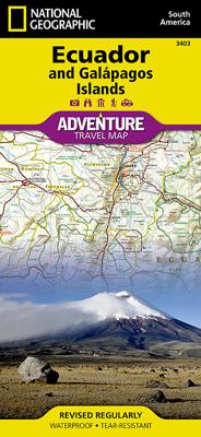
Wegenkaart - landkaart 3403 Adventure Map Ecuador & Galapagos | National Geographic

0
Wegenkaart van Galapagos en Ecuador met vermelding van veel bezienswaardigheden, nationale parken en attrakties. Watervast en scheurvast. Juist door deze vermeldingen onderscheidt de kaart zich van andere wegenkaarten. National Geographic's Ecuador and Galapagos Adventure Map is designed to meet the unique needs of adventure travelers—detailed, du...

Verkopers met dit product

Verkoper
Bezorging
Prijs
DeZwerver.nl logo
DeZwerver.nl
2,95
17,50

Anderen bekeken ook

Nieuw
Wegenkaart - landkaart 3304 Adventure Map Italy - Italië | National Geographic
Wegenkaart van Italië met vermelding van veel bezienswaardigheden, nationale parken en attrakties. Watervast en scheurvast. Juist door deze vermeldingen onderscheidt de kaart zich van andere wegenkaarten.   National Geographic's Italy Adventure Map is designed to meet the unique needs of adventure travelers—detailed, durable, and accurate. Italy includes the locations of thousands of major cities and towns with an index for easily locating them, plus a clearly marked road network complete with distances and designations for expressways, motorways, and more.   What sets National Geographic Adventure Maps apart from traditional road maps are the hundreds of points of interest that highlight the diverse and unique destinations within Italy. National parks, World Heritage sites, caves, scenic viewpoints, archeological sites, castles, palaces, churches, monasteries, and museums are included, making it invaluable to travelers hoping to experience all the history, art, and culture this amazi…
17,50
Nieuw
Wegenkaart - landkaart 3408 Adventure Map Galapagos eilanden | National Geographic
Wegenkaart van alle Galapagos eilanden met vermelding van veel bezienswaardigheden, nationale parken en attrakties. Watervast en scheurvast. Juist door deze vermeldingen onderscheidt de kaart zich van andere wegenkaarten. Waterproof, Tear-Resistant Travel Map. Resting on the Nazca tectonic plate in the eastern Pacific Ocean approximately 600 miles west of Ecuador, the actively volcanic Galapagos Islands were discovered in 1535 by the bishop of Panama, Tom¤s de Berlanga, when his ship drifted off course. In 1835, naturalist Charles Darwin, aboard the H.M.S Beagle, arrived in the Galapagos and spent 5 weeks collecting geological and biological specimens from several islands, noting his surprise at the variety of birds, tortoises, iguanas and other creatures - all without fear of humans. Darwin's short visit inspired, in part, his 1859 theory of evolution by natural selection and led to the declaration of Galapagos as a national park 100 years later in 1959. Galapagos was declared the fi…
14,95
Nieuw
Wegenkaart - landkaart 3006 Adventure Map Thailand | National Geographic
Wegenkaart van Thailand met vermelding van veel bezienswaardigheden, nationale parken en attrakties. Watervast en scheurvast. National Geographic's Thailand Adventure Map is designed to meet the unique needs of adventure travelers—detailed, durable, and accurate. Thailand includes the locations of thousands of major cities and towns with an index for easily locating them, plus a clearly marked road network complete with distances and designations for major highways, limited access highways, and more.   What sets National Geographic Adventure Maps apart from traditional road maps are the hundreds of points of interest that highlight the diverse, unique, and exotic destinations within Thailand including national parks, nature reserves, World Heritage sites, archeological sites, scenic viewpoints, Buddhist temples of interest, mosques, zoos, and monuments.     The front side of the Thailand map shows the northern half of the country and extends south to the capital city of Bangkok. Borde…
17,50
Nieuw
Wegenkaart - landkaart 3404 Adventure Map Peru | National Geographic
Wegenkaart van Peru met vermelding van veel bezienswaardigheden, nationale parken en attrakties. Watervast en scheurvast. Juist door deze vermeldingen onderscheidt de kaart zich van andere wegenkaarten. National Geographic's Peru Adventure Map is designed to meet the unique needs of adventure travelers—detailed, durable, and accurate. Peru includes the locations of thousands of towns and villages, plus a clearly marked road network complete with distances and designations for highways and roadways. Rough tracks that require four-wheel drive vehicles and paths are included for adventurers seeking to explore more remote regions.   What sets National Geographic Adventure Maps apart from traditional road maps are the hundreds of points of interest that highlight the diverse, unique, and exotic destinations within Peru including World Heritage sites, archeological sites, indigenous areas, churches, museums, and more. Users will find a variety of helpful travel aids on our map as well, incl…
17,50
Nieuw
Wegenkaart - landkaart 3204 Adventure Map South Africa - Zuid Afrika | National Geographic
Wegenkaart van Zuid Afrika met vermelding van veel bezienswaardigheden, nationale parken en attrakties. Watervast en scheurvast. Juist door deze vermeldingen onderscheidt de kaart zich van andere wegenkaarten. National Geographic’s South Africa Adventure Map is designed to meet the unique needs of adventure travelers—detailed, durable, and accurate. It includes the locations of thousands of major cities and towns with an index for easily locating them, plus a clearly marked road network complete with distances and designations for major highways, limited access highways, and more. Both paved and unpaved roads, tracks, and trails are marked for those adventurers who wish to explore less traveled routes.   What sets National Geographic Adventure Maps apart from traditional road maps are the hundreds of points-of-interest that highlight the diverse, unique, and exotic destinations within South Africa including national parks and reserves, sanctuaries, World Heritage sites, archeological …
17,50
Nieuw
Wegenkaart - landkaart 3400 Adventure Map Argentina - Argentinië | National Geographic
Wegenkaart van Argentinië met vermelding van veel bezienswaardigheden, nationale parken en attrakties. Watervast en scheurvast. Juist door deze vermeldingen onderscheidt de kaart zich van andere wegenkaarten. National Geographic's Argentina Adventure Map is designed to meet the unique needs of adventure travelers—detailed, durable, and accurate. Argentina includes the locations of thousands of major cities and towns with an index for easily locating them, plus a clearly marked road network complete with distances and designations for major highways, limited access highways, minor roads, and more.   What sets National Geographic Adventure Maps apart from traditional road maps are the hundreds of points-of-interest that highlight the diverse, unique, and exotic destinations within Argentina including national parks and preserves, World Heritage sites, archeological sites, churches of interest, scenic viewpoints, natural points of interest, and important travel aids like airports, airstr…
17,50
Nieuw
Wegenkaart - landkaart 3329 Adventure Travel Map Denmark - Denemarken | National Geographic
Wegenkaart van Denemarken met vermelding van veel bezienswaardigheden, nationale parken en attrakties. Watervast en scheurvast. Juist door deze vermeldingen onderscheidt de kaart zich van andere wegenkaarten. Denmark's more than 100 islands, the largest of which are connected by a series of long bridges and tunnels with National Geographic's Denmark Adventure Map. Designed to meet the needs of adventure travelers with its detailed, accurate information, this map includes the location of cities and towns with a user-friendly index and a clearly marked road network complete with distances and designations for motorways, major routes, and roads. In addition, side roads and tracks are shown for those seeking to explore off the beaten path. Hundreds of points of interest that highlight the diverse, unique, and exotic destinations within the country such as national parks and reserves, wildlife parks, World Heritage sites, and archeological sites. Important travel aids like airports, airfie…
17,50
Wegenkaart - landkaart 3100 Adventure Map Costa Rica | National Geographic
Zeer gedetailleerde kaart van Costa Rica met stadsplattegrond van de hoofdstad van Costa Rica. Misschien wel de beste kaart! Gedrukt op scheur- en watervast papier. Double-sided, waterproof, tear-resistant and with a street plan of central San José, the NGS Costa Rica Adventure Map was produced in cooperation with the Instituto Geográfico Nacional, Costa Rica’s national survey organization. The country is divided east/west, with a generous overlap between the two sides. Topography is shown by contours at 100m intervals, enhanced by relief shading and spot heights. Along the coast reefs, rocks and shallow water areas are marked. The map indicates various types of vegetation: forests, palm forest, mangrove, and fresh or salt water swamps. Road network includes gravel tracks and indicates roads passable only in summer. Railways and local airstrips are marked, as well as the country’s internal administrative boundaries together with names of the provinces. The map highlights seven differe…
17,50
Nieuw
Wegenkaart - landkaart 3305 Adventure Map Tuscany - Toscane | National Geographic
Wegenkaart van Toscane met vermelding van veel bezienswaardigheden, nationale parken en attrakties. Watervast en scheurvast. Juist door deze vermeldingen onderscheidt de kaart zich van andere wegenkaarten. National Geographic's Tuscany Adventure Map is designed to meet the unique needs of adventure travelers—detailed, durable, and accurate. Tuscany includes the locations of thousands of cities and towns with an index for easily locating them, plus a clearly marked road network complete with distances and designations for expressways, motorways, scenic routes, and more.   What sets National Geographic Adventure Maps apart from traditional road maps are the hundreds of points of interest that highlight the diverse and unique destinations within Tuscany. Archeological sites, menhirs and other sites of interest from monuments, palaces, and castles to churches, chapels, and monasteries are noted making this map indispensable for travelers seeking to explore the region’s rich history. Users…
17,50
Nieuw
Wegenkaart - landkaart 3025 Adventure Map Myanmar - Birma | National Geographic
Mooie, heldere kaart van Myanmar, gedrukt op scheurvast en watervast papier.   National Geographic's Myanmar (Burma) Adventure Map is designed to meet the needs of adventure travelers with its durability and detailed, accurate information. This map includes the locations of cities and towns with a user-friendly index, a clearly marked road network complete with distances and designations for roads/highways, plus secondary routes for those seeking to explore off the beaten path. Adventure Maps differ from a traditional road map because of the specialty content they include. Each map contains hundreds of diverse and unique recreational, ecological, cultural, and historic destinations — outside of the major tourist hubs. National Geographic Adventure Maps are the perfect companion to a guidebook, yet far easier to pack!   Myanmar is a country with a varied landscape. From the highest peak, Hkakabo Razi, in the Hengduan Shan mountains on the border with China to the lowlands at the mouth …
17,50

Klanten-reviews van Wegenkaart - landkaart 3403 Adventure Map Ecuador & Galapagos | National Geographic

Er zijn nog geen beoordelingen voor dit productBen jij de eerste die een review plaatst?

Meer over Wegenkaart - landkaart 3403 Adventure Map Ecuador & Galapagos | National Geographic

Productomschrijving

Wegenkaart van Galapagos en Ecuador met vermelding van veel bezienswaardigheden, nationale parken en attrakties. Watervast en scheurvast. Juist door deze vermeldingen onderscheidt de kaart zich van andere wegenkaarten.

National Geographic's Ecuador and Galapagos Adventure Map is designed to meet the unique needs of adventure travelers—detailed, durable, and accurate. Ecuador and Galapagos includes the locations of thousands of towns and villages, plus a clearly marked road network complete with distances and designations for highways, roads and more.   What sets National Geographic Adventure Maps apart from traditional road maps are the hundreds of points of interest that highlight the diverse, unique, and exotic destinations within Ecuador and the Galapagos islands including national parks and reserves, World Heritage sites, archeological sites, churches, spas, and more.   The front side of the map shows the southern half of Ecuador including the provinces of Zamora, Chinchipe, Loja, El Oro, Azuay, Canar, Santa Elena, Guayas, Chimborazo, and Morona-Santiago. Galápagos is presented separately at larger scale, providing greater detail of the islands. Travelers to these unique islands often come to experience the unusual wildlife studied by Charles Darwin. Areas noted for their beaches, surfing, diving, and fishing are marked with activity symbols for outdoor enthusiasts wishing to further explore the islands and Ecuador’s coastline. The provinces of Bolivar, Carchi, Cotopaxi, Esmeraldas, Imbabura, Los Rios, Manabi, Napo, Orellana, Tungurahua, Pastaza, Pichincha, Santo Domingo de los Tsachilas, and Sucumbios are included on the reverse side. Provincial and political borders are clearly and accurately marked with colored boundaries, as are the national parks and reserves.
Coverage highlights: Amazon Basin, Ingapirca Ruins, Andes Mountains, Cotopaxi National Park, Galapagos Islands, Avenue of Volcanoes, Quiltoa Loop, and Quito.

Verken gerelateerde categorieën

Webshop.nl maakt gebruik van cookies. Ga je verder op onze website, ga dan akkoord met het plaatsen van cookies en de verwerking van deze data door ons en vermelde partners.