webshop.nl
Categorieën
  Sluiten

Meer National Geographic

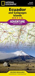
Wegenkaart - landkaart 3403 Adventure Map Ecuador & Galapagos | Nation

0
Wegenkaart van Galapagos en Ecuador met vermelding van veel bezienswaardigheden, nationale parken en attrakties. Watervast en scheurvast. Juist door deze vermeldingen onderscheidt de kaart zich van andere wegenkaarten. National Geographic's Ecuador and Galapagos Adventure Map is designed to meet the unique needs of adventure travelers—detailed, dur...

Webshops met dit product

Webshop
Bezorging
Prijs

Anderen bekeken ook

Wegenkaart - landkaart 3403 Adventure Map Ecuador & Galapagos | Nation
Wegenkaart van Galapagos en Ecuador met vermelding van veel bezienswaardigheden, nationale parken en attrakties. Watervast en scheurvast. Juist door deze vermeldingen onderscheidt de kaart zich van andere wegenkaarten. National Geographic's Ecuador and Galapagos Adventure Map is designed to meet the unique needs of adventure travelers—detailed, durable, and accurate. Ecuador and Galapagos includes the locations of thousands of towns and villages, plus a clearly marked road network complete with distances and designations for highways, roads and more.   What sets National Geographic Adventure Maps apart from traditional road maps are the hundreds of points of interest that highlight the diverse, unique, and exotic destinations within Ecuador and the Galapagos islands including national parks and reserves, World Heritage sites, archeological sites, churches, spas, and more.   The front side of the map shows the southern half of Ecuador including the provinces of Zamora, Chinchipe, Loja, …
17,50
Wegenkaart - landkaart 3408 Adventure Map Galapagos eilanden | Nationa
Wegenkaart van alle Galapagos eilanden met vermelding van veel bezienswaardigheden, nationale parken en attrakties. Watervast en scheurvast. Juist door deze vermeldingen onderscheidt de kaart zich van andere wegenkaarten. Waterproof, Tear-Resistant Travel Map. Resting on the Nazca tectonic plate in the eastern Pacific Ocean approximately 600 miles west of Ecuador, the actively volcanic Galapagos Islands were discovered in 1535 by the bishop of Panama, Tom¤s de Berlanga, when his ship drifted off course. In 1835, naturalist Charles Darwin, aboard the H.M.S Beagle, arrived in the Galapagos and spent 5 weeks collecting geological and biological specimens from several islands, noting his surprise at the variety of birds, tortoises, iguanas and other creatures - all without fear of humans. Darwin's short visit inspired, in part, his 1859 theory of evolution by natural selection and led to the declaration of Galapagos as a national park 100 years later in 1959. Galapagos was declared the fir…
14,95
Wegenkaart - landkaart 3404 Adventure Map Peru | National Geographic
Wegenkaart van Peru met vermelding van veel bezienswaardigheden, nationale parken en attrakties. Watervast en scheurvast. Juist door deze vermeldingen onderscheidt de kaart zich van andere wegenkaarten. National Geographic's Peru Adventure Map is designed to meet the unique needs of adventure travelers—detailed, durable, and accurate. Peru includes the locations of thousands of towns and villages, plus a clearly marked road network complete with distances and designations for highways and roadways. Rough tracks that require four-wheel drive vehicles and paths are included for adventurers seeking to explore more remote regions.   What sets National Geographic Adventure Maps apart from traditional road maps are the hundreds of points of interest that highlight the diverse, unique, and exotic destinations within Peru including World Heritage sites, archeological sites, indigenous areas, churches, museums, and more. Users will find a variety of helpful travel aids on our map as well, inclu…
17,50
Wegenkaart - landkaart 3024 Adventure Map Cambodia - Cambodja | Nation
Mooie, heldere kaart van Cambodja,  gedrukt op scheurvast en watervast papier. National Geographic's Cambodia Adventure Map is designed to meet the needs of adventure travelers with its durability and detailed, accurate information. This map includes the locations of cities and towns with a user-friendly index, a clearly marked road network complete with distances and designations for roads/highways, plus secondary routes for those seeking to explore off the beaten path. Adventure Maps differ from a traditional road map because of the specialty content they include. Each map contains hundreds of diverse and unique recreational, ecological, cultural, and historic destinations — outside of the major tourist hubs. National Geographic Adventure Maps are the perfect companion to a guidebook, yet far easier to pack!   Cambodia is perhaps best know to international travelers as the home of the Angkor empire for six hundred years. Angkor Wat and Angkor Thom are part of the vast temple complex …
17,50
Wegenkaart - landkaart 3329 Adventure Travel Map Denmark - Denemarken
Wegenkaart van Denemarken met vermelding van veel bezienswaardigheden, nationale parken en attrakties. Watervast en scheurvast. Juist door deze vermeldingen onderscheidt de kaart zich van andere wegenkaarten. Denmark's more than 100 islands, the largest of which are connected by a series of long bridges and tunnels with National Geographic's Denmark Adventure Map. Designed to meet the needs of adventure travelers with its detailed, accurate information, this map includes the location of cities and towns with a user-friendly index and a clearly marked road network complete with distances and designations for motorways, major routes, and roads. In addition, side roads and tracks are shown for those seeking to explore off the beaten path. Hundreds of points of interest that highlight the diverse, unique, and exotic destinations within the country such as national parks and reserves, wildlife parks, World Heritage sites, and archeological sites. Important travel aids like airports, airfiel…
17,50
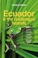
Reisgids Ecuador and the Galapagos Islands | Lonely Planet
De perfecte reisgids voor zowel de georganiseerde als de zelfstandige reiziger. Naast een algemene inleiding van het land / streek vol met praktische informatie over hoe je er het beste kunt reizen: slapen, eten, vervoer, excursies ... alles kun je er in vinden. Lonely Planet's local travel experts reveal all you need to know to plan the trip of a lifetime to Ecuador & the Galapagos.   Discover popular and off the beaten track experiences from travelling to the lower Rio Napo into the Amazon jungle to taking a dip in the paradise of a white-sand cove at Puerto Chino, and braving a spiritual cleansing from a curandero (healer) at Parroquia Puerto Limon.   Build a trip to remember with Lonely Planet's Ecuador & the Galapagos Islands travel guide:   Our classic guidebook format provides you with the most comprehensive level of information for planning multi-week trips Updated with an all new structure and design so you can navigate Ecuador & the Galapagos Islands and connect experiences t…
24,95
Wegenkaart - landkaart Ecuador | Borch
Mooie geplasticieerde kaart van Ecuador. Deze kaart biedt een goed overzicht van het land met detailkaarten.   Our soft-laminated folded map of Ecuador shows: Ecuador West 1:1 000 000, Ecuador Est 1:2 000 000, Galapagos Islands1:1 300 000, Gran Quito 1:100 000, Quito 1:20 000, Cuenca 1:17 000, Guayaquil 1:18 000, Ecuador administrative and times zones. Borch maps are easy to fold, durable and water-repellent with a wipeable surface. Borch Maps show hotels, museums, monuments, markets, public transport, top sights and points of interest, useful statistics, conversion charts for temperatures, weights and measurements, climate charts showing temperatures, sunshine hours, precipitation and humidity, overview maps, time zones, and much more...   Dominated by the towering Andean range, Ecuador is a country of magnificent highlands, dramatic slopes, dense rainforests, fertile lowlands and tranquil sandy beaches. Its immense variety of landscapes and habitats support a unique flora and fauna c…
11,50

Klanten-reviews van Wegenkaart - landkaart 3403 Adventure Map Ecuador & Galapagos | Nation

Er zijn nog geen beoordelingen voor dit productBen jij de eerste die een review plaatst?

Meer over Wegenkaart - landkaart 3403 Adventure Map Ecuador & Galapagos | Nation

Productomschrijving

Wegenkaart van Galapagos en Ecuador met vermelding van veel bezienswaardigheden, nationale parken en attrakties. Watervast en scheurvast. Juist door deze vermeldingen onderscheidt de kaart zich van andere wegenkaarten. National Geographic's Ecuador and Galapagos Adventure Map is designed to meet the unique needs of adventure travelers—detailed, durable, and accurate. Ecuador and Galapagos includes the locations of thousands of towns and villages, plus a clearly marked road network complete with distances and designations for highways, roads and more.   What sets National Geographic Adventure Maps apart from traditional road maps are the hundreds of points of interest that highlight the diverse, unique, and exotic destinations within Ecuador and the Galapagos islands including national parks and reserves, World Heritage sites, archeological sites, churches, spas, and more.   The front side of the map shows the southern half of Ecuador including the provinces of Zamora, Chinchipe, Loja, El Oro, Azuay, Canar, Santa Elena, Guayas, Chimborazo, and Morona-Santiago. Galápagos is presented separately at larger scale, providing greater detail of the islands. Travelers to these unique islands often come to experience the unusual wildlife studied by Charles Darwin. Areas noted for their beaches, surfing, diving, and fishing are marked with activity symbols for outdoor enthusiasts wishing to further explore the islands and Ecuador’s coastline. The provinces of Bolivar, Carchi, Cotopaxi, Esmeraldas, Imbabura, Los Rios, Manabi, Napo, Orellana, Tungurahua, Pastaza, Pichincha, Santo Domingo de los Tsachilas, and Sucumbios are included on the reverse side. Provincial and political borders are clearly and accurately marked with colored boundaries, as are the national parks and reserves. Coverage highlights: Amazon Basin, Ingapirca Ruins, Andes Mountains, Cotopaxi National Park, Galapagos Islands, Avenue of Volcanoes, Quiltoa Loop, and Quito.

Productspecificaties

Artikelnummer(s)
Brand
National Geographic
Webshop.nl maakt gebruik van cookies. Ga je verder op onze website, ga dan akkoord met het plaatsen van cookies en de verwerking van deze data door ons en vermelde partners.