Meer National Geographic
Meer National Geographic in Reisgidsen & talen boeken

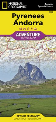
Wegenkaart - landkaart 3308 Adventure Map Pyrenees & Andorra - Pyrenee

0
Wegenkaart van de Pyreneeën en Andorra met vermelding van veel bezienswaardigheden, nationale parken en attrakties. Watervast en scheurvast. Juist door deze vermeldingen onderscheidt de kaart zich van andere wegenkaarten. National Geographic's Pyrenees and Andorra Adventure Map is designed to meet the unique needs of adventure travelers—detailed, d...

Verkopers met dit product

Sorry, dit product is momenteel niet beschikbaar

Anderen bekeken ook

Wegenkaart - landkaart 3308 Adventure Map Pyrenees & Andorra - Pyreneeën en Andorra | National Geographic
Wegenkaart van de Pyreneeën en Andorra met vermelding van veel bezienswaardigheden, nationale parken en attrakties. Watervast en scheurvast. Juist door deze vermeldingen onderscheidt de kaart zich van andere wegenkaarten. National Geographic's Pyrenees and Andorra Adventure Map is designed to meet the unique needs of adventure travelers—detailed, durable, and accurate. Pyrenees/Andorra includes the locations of thousands of major cities and towns with an index for easily locating them, plus a clearly marked road network complete with distances and designations for expressways, motorways, scenic routes, and more.   What sets National Geographic AdventureMaps apart from traditional road maps are the hundreds of points of interest that highlight the diverse and unique destinations within the Pyrenees and Andorra. National parks, World Heritage sites, scenic viewpoints, antiquity sites, museums, places of worship, zoos, castles and more are included, making it invaluable to travelers hopi…
17,50
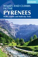
Wandelgids The Pyrenees - Pyreneeen | Cicerone
Uitputtende beschrijving van alle wandel- en klimmogelijkheden in de Pyreneeen. Ongekende diepgang in informatie over wat, waar en hoe de gebieden in elkaar zitten. Geschreven door een van de toonaangevende bergwandelaars op dit moment: Kev Reynolds. Essential guidebook of walks and climbs in the Pyrenees, one of Europe's finest mountain ranges. The guide includes 170 day walks, multi-day walks, climbing routes and mountaineering ascents, and covers all valleys and peaks on both sides of the border with France and Spain, with through routes and peaks to bag.   The guidebook divides the range into 21 sections, including Andorra, the Ordesa National Park, the Carlit Massif, Gavarnie and the Cirque du Lescun to name a few. Each area includes practical information on travel, accommodation and mountain refuges, as well sketch mapping.   Between short, half-hour walks, to 12-day treks and 25 summits, this guidebook will help any walker, climber or trekker experience the best of the Pyr…
24,95
Wegenkaart - landkaart 3307 Adventure Map Spain & Portugal - Spanje en Portugal | National Geographic
Wegenkaart van Spanje en Portugal met vermelding van veel bezienswaardigheden, nationale parken en attracties. Watervast en scheurvast. Juist door deze vermeldingen onderscheidt de kaart zich van andere wegenkaarten.   National Geographic's Spain and Portugal Adventure Map is designed to meet the unique needs of adventure travelers—detailed, durable, and accurate. Spain/Portugal includes the locations of thousands of major cities and towns with an index for easily locating them, plus a clearly marked road network complete with distances and designations for expressways, motorways, and more.   What sets National Geographic Adventure Maps apart from traditional road maps are the hundreds of points of interest that highlight the diverse and unique destinations within Spain/Portugal. National parks, World Heritage sites, caves, scenic viewpoints, archeological sites, museums, castles, churches, monasteries, and ruins are included, making it invaluable to travelers hoping to experience all…
17,50
Wandelkaart Trekking map Central Pyrenees - Pyreneeën | TerraQuest
Uitstekende wandelkaart van een deel van de Pyreneën. Alle noodzakelijke gegevens staan er op, de kaart is gebaseerd op topografische kaarten en voorzien van ingetekende wandelroutes. De kaart is geplastificeerd. Voor een uitsnede welk gebied deze kaart dekt. This is the 1:50,000 trekking map for the Central Pyrenees covering Lourdes, Trebons and Capvern on the north edge of the map and down to Monte Perdido in the south.   Terraquest say 'TerraQuest maps are designed and developed primarily for tourists preparing for treks to remote corners of the world. Our proven map laminating technology allows you to freely use the maps even in harsh conditions, while appreciating the clear and easy-to-read information compiled by our team of qualified cartographers. The distinctive feature of terraQuest laminated maps is the manufacturing method. Due to a special lamination process and patented map joining techniques, the maps easily adjust to your choice of format , even for one-hand use only. …
18,50
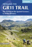
Wandelgids GR 11 Spaanse Pyreneeen - Through the Spanish Pyrenees | Cicerone
Uitstekende wandelgids van dit geweldige gebied. goed beschreven met veel praktische informatie om de route te kunnen lopen, inclusief redelijke kaarten. Beschrijving van de GR 11, het lange afstandswandelpad aan de Spaanse kant van de Pyreneeën. Aanbevolen wandelkaarten Schaal 1:50.000 Wandelkaart Senda Pirenaica GR11 | Editorial Alpina - Set van 21 kaarten Of Wandelkaarten van Rando Pyreneeën - 10 losse kaarten This comprehensive guidebook to the magnificent GR11 trail, which runs 820km from the Atlantic to the Mediterranean, provides everything trekkers will need to take up the challenge - detailed route description, excellent photographs, lots of background information and unique, custom-produced maps. This glorious traverse of the Pyrenees, on the Spanish side, is a serious challenge - passing over a succession of high alpine passes where boulderfields, scree slopes and occasional snowfields may need to be crossed. It is presented in 47 stages of 8-31km.    It is well waymarked a…
23,95
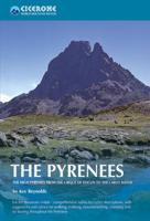
Wandelgids - Klimgids - Klettersteiggids The Pyrenees | Cicerone
Prachtige en volledige wandel- en klimgids van de Hoge Pyreneën in Frankrijk, Andorra en Spanje. Per deelgebied worden m.b.v. duidelijke kaartjes en route informatie de verschillende tochten beschreven. Geschikt voor iedere bergwandelaar. Er is informatie over accomodatie in opgenomen, evenals allerlei praktische en gebiedsinformatie. First in a new series of mountain guides by Cicerone Press, this illustrated book covers the high Pyrenees from the Cirque de Lescun in the west to the Carlit massif and Cerdagne east of Andorra. With introductory chapters on the region, detailed descriptions of long-distance routes and treks, and plenty of prectical travel detail. An extensive introduction gives all the practical advice and information needed for planning a trip. It offers a background to the mountains and their exploration, and provides a snapshot of the range with sections that help the reader focus on specific areas of activity, and suggests where best to exercise that activity. It a…
33,95
Wegenkaart - landkaart 3314 Adventure Map Southern France - Zuid Frankrijk | National Geographic
Wegenkaart van Frankrijk Zuid met vermelding van veel bezienswaardigheden, nationale parken en attrakties. Watervast en scheurvast. Juist door deze vermeldingen onderscheidt de kaart zich van andere wegenkaarten. National Geographic's Southern France Adventure Map is designed to meet the unique needs of adventure travelers with its durability and accurate information. Each folded map provides global travelers with the perfect combination of detail and perspective, highlighting the area’s terrain and best locations for adventure activities like snorkeling, surfing, fishing, and more. Adventure Maps include hundreds of points of interest that highlight diverse and unique destinations within the region. The map includes the locations of thousands of cities and towns with a user-friendly index, plus a clearly marked road network complete with distances and designations for major highways, main roads, and tracks and trails for those seeking to explore more remote regions.   The front side …
17,50
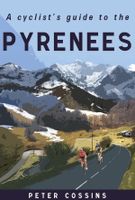
Fietsgids A Cyclist's Guide to the Pyrenees | Great Northern Books
Where do you turn when you want to ride in the mountains, to follow in the wheeltracks of professional racers by climbing the famous passes of the Tour de France? There are several books and websites that highlight these renowned ascents, detailing their location, length and every little change in gradient. But how do you go about finding a route that links these passes together, that describes not only where they are and what they're like to ride, but highlights which is the best side to tackle them from and which roads to avoid?Award-winning author Peter Cossins's new series of guides to riding in the Western Europe's high mountains will provide these details - and much more. Inspired by Alfred Wainwright's walking guides to the Lake District, they are intended as the bible for any cyclist riding in Europe's most stunning terrain.   The first in the series is The Roads, Cols and Passes of the Pyrenees, which is duefor publication by Great Northern Books in June 2020. Featuring 120 r…
23,95
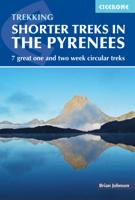
Wandelgids Shorter Treks in the Pyrenees | Cicerone
Uitstekende wandelgids van dit geweldige gebied. Goed beschreven met veel praktische informatie om de route te kunnen lopen, inclusief redelijke kaarten. A guidebook to seven circular treks exploring the Pyrenees of France and Spain. Seven 1 or 2 week routes in dramatic mountain scenery, including the Pic du Midi d'Ossau, Vignemale, Ordesa Canyon, Gavernie, Puigmal and Canigou. Using mostly waymarked mountain paths, with some boulderfield or easy scrambling, the treks are designed with accommodation in mountain refuges or mountain villages at the end of each stage, though there are plenty of options to camp for those who prefer to backpack. Detailed descriptions for each stage of the route are accompanied by sketch maps and elevation profiles, and there are notes on planning, equipment and access. The Pyrenees stretch 400km from Atlantic to Mediterranean, forming a barrier rising to over 3000m between France and Spain. The steep rolling hills of the Basque Country give way to the sp…
23,95
Wandelgids GR10 trail, Pyrenees - Pyreneeen | Cicerone
Engelstalige beschrijving van de mooiste wandeltocht in de Pyreneeen. De gids voldoet aan alle verwachtingen die je kunt hebben. Wel heb je voor de zwaardere gedeelte voor de zekerheid goede kaarten nodig ...... Guidebook to the GR10, a 955km trek across the French Pyrenees from Hendaye on the Atlantic Coast to the Mediterranean coast at Banyuls-sur-Mer. Described in 55-day stages, the route can be completed in its entirety, or in shorter sections using the bus and rail links found throughout the Pyrenees.   Step by step route descriptions are accompanied by 1:100,000 mapping and gradient profiles. Useful practical information is also included such as when to go, getting there and back, camping, accessing fuel and water, plus handy equipment tips and more.   The easiest, oldest and most popular of the three long-distance routes that traverse the mountain range, the GR10 is well waymarked and follows good mountain paths. For many walkers, the highlight of the route is the magnificent w…
26,50

Klanten-reviews van Wegenkaart - landkaart 3308 Adventure Map Pyrenees & Andorra - Pyrenee

Er zijn nog geen beoordelingen voor dit productBen jij de eerste die een review plaatst?

Meer over Wegenkaart - landkaart 3308 Adventure Map Pyrenees & Andorra - Pyrenee

Productomschrijving

Wegenkaart van de Pyreneeën en Andorra met vermelding van veel bezienswaardigheden, nationale parken en attrakties. Watervast en scheurvast. Juist door deze vermeldingen onderscheidt de kaart zich van andere wegenkaarten. National Geographic's Pyrenees and Andorra Adventure Map is designed to meet the unique needs of adventure travelers—detailed, durable, and accurate. Pyrenees/Andorra includes the locations of thousands of major cities and towns with an index for easily locating them, plus a clearly marked road network complete with distances and designations for expressways, motorways, scenic routes, and more.   What sets National Geographic AdventureMaps apart from traditional road maps are the hundreds of points of interest that highlight the diverse and unique destinations within the Pyrenees and Andorra. National parks, World Heritage sites, scenic viewpoints, antiquity sites, museums, places of worship, zoos, castles and more are included, making it invaluable to travelers hoping to experience all the history, art, and culture the region has to offer. Beaches and yachting harbors dot Spain and France’s Mediterranean coastlines while the location of golf courses, camping sites, waterfalls, caves, and ski areas make it easy to enjoy the region’s abundant outdoor activities. Users will find a variety of helpful travel aids on our map as well, including the location of airports, airfields, railroads, lighthouses, and petrol stations.     The front side of the Pyrenees/Andorra map shows the country of Andorra and the eastern half of the Pyrenees including the cities of Narbonne, Carcassone, Pamiers, St-Gaudens, St-Girons, Perpignan in France, and Balaguer, Manresa, and Figueres in Spain. The reverse side of the map stretches from the city of Biarritz on the Bay of Biscay eastward to include Pamplona and Huesca, Spain, and Pau, Tarbes, and the famed pilgrimage site of Lourdes, France.

Productinformatie

    Productspecificaties

    Artikelnummer(s)
    Brand
    National Geographic

    Verken gerelateerde categorieën

    Webshop.nl maakt gebruik van cookies. Ga je verder op onze website, ga dan akkoord met het plaatsen van cookies en de verwerking van deze data door ons en vermelde partners.