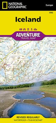
Wegenkaart - landkaart 3302 Adventure Map Iceland - IJsland | National Geographic

0
Wegenkaart van IJsland met vermelding van veel bezienswaardigheden, nationale parken en attrakties. Watervast en scheurvast. Juist door deze vermeldingen onderscheidt de kaart zich van andere wegenkaarten. National Geographic's Iceland Adventure Map is designed to meet the unique needs of adventure travelers—detailed, durable, and accurate. Icelan...

Verkopers met dit product

Verkoper
Bezorging
Prijs
DeZwerver.nl logo
DeZwerver.nl
2,95
17,50

Anderen bekeken ook

Wegenkaart - landkaart 3302 Adventure Map Iceland - IJsland | National Geographic
Wegenkaart van IJsland met vermelding van veel bezienswaardigheden, nationale parken en attrakties. Watervast en scheurvast. Juist door deze vermeldingen onderscheidt de kaart zich van andere wegenkaarten. National Geographic's Iceland Adventure Map is designed to meet the unique needs of adventure travelers—detailed, durable, and accurate. Iceland includes the locations of thousands of cities and towns with an index for easily locating them, plus a clearly marked road network complete with distances and designations for expressways, motorways, and more. Transportation within and beyond the country is made easier with the locations of airports, airfields, railroads, ferry routes, and lighthouses. What sets National Geographic Adventure Maps apart from traditional road maps are the hundreds of points of interest that highlight the diverse and unique destinations within Iceland. Outdoor activities abound on the island and activity symbols note popular locations to ski, golf, camp, fish,…
17,50
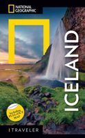
Reisgids IJsland - Iceland | National Geographic
National Geographic Traveler: Iceland is the lighthouse to follow if you do not want to miss anything of the unique and incredible atmosphere, from the northern lights to the capital, Reykjavik, which comes to life in the long summer nights of the Arctic Circle. Enjoy the fishing ports of the southern peninsula; admire the volcanoes, glaciers, and waterfalls of the south; explore the mysterious eastern lands; be fascinated by the rich wild nature up north; or venture among the spectacular bird-populated cliffs and glaciers of the Westfjords.  
26,50
Reisgids Iceland - IJsland | Bradt Travel Guides
Voor vele landen net zo goed, zo niet beter dan de Planet. Beduidend soberder uitgevoerd, maar ook met veel informatie voor backpackers en met veel kaartmateriaal. Een aanrader! This new, thoroughly updated fifth edition of Bradt’s award-winning Iceland guide remains the most in-depth guide available to one of the few countries in the world that has no mosquitoes, no ants, no Starbucks and no MacDonalds. Featuring honest, practical information from an author who has repeatedly visited the country over twenty years and is familiar with its language, history and culture, Bradt’s Iceland has won the Lowell Thomas Award (the highest travel writing award available in the United States) and provides more context for individual places than any other guidebook, plus frank, investigative hotel and restaurant reviews that hide nothing.   This latest edition covers everything you would expect, from the Northern Lights to snow mobiling, dog sledding, visiting West Fjords, Iceland’s remotest co…
24,95
Wegenkaart - landkaart IJsland - Iceland | ITMB
Iceland is not only a lovely country to visit, it is one of our most popular titles. This is a relatively minor updating, designed to keep our artwork fresh and up to date. We have retained the cover picture of 'the' geyser that gave its name to all naturally occurring fountains of water that explode out of bedrock at regular intervals, as it so perfectly represents this beautiful country. As with previous versions, this map is printed on plastic for durability. The plastic is waterproof as well, which is not a big issue in Iceland, but the map can be used as an umbrella in the event of a sudden shower.   Legend Includes: Roads by classification, Airports, Gas stations, Emergency Huts, Ferry routes, Car Ferry Routes, Points of Interest, Museums, monuments, Ruins, Churches, Hot Spring, Caves, Campsites, Youth Hotels, Hotels, National Parks, World Heritage Sites, Universities, Lighthouses, Golf Courses, Fishing Spots, Skiing, Waterfalls, Geysers, Swimming Pools and much more
13,95
Wegenkaart - landkaart 3202 Adventure Map Egypt - Egypte | National Geographic
Wegenkaart van Egypte met vermelding van veel bezienswaardigheden, nationale parken en attrakties. Watervast en scheurvast. Juist door deze vermeldingen onderscheidt de kaart zich van andere wegenkaarten. National Geographic's Egypt Adventure Map is designed to meet the unique needs of adventure travelers with its detail, durability, and accuracy. The map includes the locations of thousands of cities and towns with an index for easily locating them, plus a clearly marked road network complete with distances and designations for expressways, major roadways, and more. Transportation within and beyond the country is made easier with the locations of airports, airfields, railroads, ferry routes, lighthouses, harbors, border crossings, and police control points.   What sets National Geographic Adventure Maps apart from traditional road maps are the hundreds of points of interest that highlight the diverse, unique, and exotic destinations within Egypt. In addition to typical sites of intere…
17,50
Wegenkaart - landkaart 3000 Adventure Map Nepal | National Geographic
Wegenkaart van Nepal met vermelding van veel bezienswaardigheden, nationale parken en attrakties. Watervast en scheurvast. National Geographic's Nepal Adventure Map is the most authoritative map for touring the country. Each waterproof and tear-resistant map provides travelers with the perfect combination of detail and perspective, highlighting points of interest for those venturing outside city centers.   This durable, folded map includes the locations of cities and towns with a user-friendly index, plus a clearly marked road network complete with distances and designations for major highways, main roads, and tracks and trails for those seeking to explore more remote regions.   The front side offers a detailed topographic and trekking map of central and eastern Nepal, including border regions with China and India. Mountaineers will stay on course with marked trails through the Himalayan Range, including Everest (the tallest mountain in the world), and the surrounding national parks a…
17,50
Wegenkaart - landkaart 3116 Adventure Map Jamaica | National Geographic
Wegenkaart van Jamaica met vermelding van veel bezienswaardigheden, nationale parken en attrakties. Watervast en scheurvast. Juist door deze vermeldingen onderscheidt de kaart zich van andere wegenkaarten. National Geographic's Jamaica Adventure Map is designed to meet the needs of adventure travelers with its detailed and accurate information. This map includes the locations of cities and towns with a user-friendly index, a clearly marked road network complete with distances and designations for roads/highways, plus secondary routes for those seeking to explore off the beaten path. Adventure Maps differ from a traditional road map because of the specialty content they include. Each map contains hundreds of diverse and unique recreational, ecological, cultural, and historic destinations — outside of the major tourist hubs. National Geographic Adventure Maps are the perfect companion to a guidebook.   The Jamaica Adventure Map covers the entire island nation in one easy to use map. The…
17,50
Wegenkaart - landkaart 3203 Adventure Map Morocco - Marokko | National Geographic
Wegenkaart van Marokko met vermelding van veel bezienswaardigheden, nationale parken en attrakties. Watervast en scheurvast. Juist door deze vermeldingen onderscheidt de kaart zich van andere wegenkaarten. National Geographic's Morocco Adventure Map is designed to meet the unique needs of adventure travelers—detailed, durable, and accurate. Morocco includes the locations of thousands of cities and towns with an index for easily locating them, plus a clearly marked road network complete with distances and designations for motorways, dual carriageways, major roadways, and more. Transportation within and beyond the country is made easier with the location of airports, airfields, railroads, ferry routes, river crossings, lighthouses, harbors, border crossings, and petrol stations. What sets National Geographic Adventure Maps apart from traditional road maps are the hundreds of points of interest that highlight the diverse, unique, and exotic destinations within Morocco. In addition to typ…
17,50
Wegenkaart - landkaart 3020 Adventure Map Java | National Geographic
Wegenkaart van Java met vermelding van veel bezienswaardigheden, nationale parken en attrakties. Watervast en scheurvast. National Geographic's Java Adventure Map is designed to meet the unique needs of adventure travelers to this Indonesian island with its durability and accurate information. Each folded map provides global travelers with the perfect combination of detail and perspective, highlighting the area’s terrain and best locations for adventure activities like snorkeling, surfing, fishing, and more. Adventure Maps include hundreds of points of interest that highlight diverse and unique destinations within the country.   The map includes the locations of thousands of cities and towns with a user-friendly index, plus a clearly marked road network complete with distances and designations for major highways, main roads, and tracks and trails for those seeking to explore more remote regions.   Key Features: Waterproof and tear-resistant Detailed interpretive information and loca…
17,50
Wegenkaart - landkaart Adventure map Iceland - IJsland | TerraQuest
De kracht zit hem in het feit dat deze kaart in delen is geplastificeerd en daardoor ook - ondanks de plastic laag - makkelijk in delen is te vouwen.  Van het gebeid Skogar - Landmannalaugar is een detailkaart 1:75.000 ingevoegd. Terraquest say 'TerraQuest maps are designed and developed primarily for tourists preparing for treks to remote corners of the world. Our proven map laminating technology allows you to freely use the maps even in harsh conditions, while appreciating the clear and easy-to-read information compiled by our team of qualified cartographers. The distinctive feature of terraQuest laminated maps is the manufacturing method. Due to a special lamination process and patented map joining techniques, the maps easily adjust to your choice of format , even for one-hand use only. They are exceptionally durable and may be folded repeatedly. You can also add and erase your own notes directly onto the map with an erasable pen without damage to the map'
12,50

Klanten-reviews van Wegenkaart - landkaart 3302 Adventure Map Iceland - IJsland | National Geographic

Er zijn nog geen beoordelingen voor dit productBen jij de eerste die een review plaatst?

Meer over Wegenkaart - landkaart 3302 Adventure Map Iceland - IJsland | National Geographic

Productomschrijving

Wegenkaart van IJsland met vermelding van veel bezienswaardigheden, nationale parken en attrakties. Watervast en scheurvast. Juist door deze vermeldingen onderscheidt de kaart zich van andere wegenkaarten.

National Geographic's Iceland Adventure Map is designed to meet the unique needs of adventure travelers—detailed, durable, and accurate. Iceland includes the locations of thousands of cities and towns with an index for easily locating them, plus a clearly marked road network complete with distances and designations for expressways, motorways, and more. Transportation within and beyond the country is made easier with the locations of airports, airfields, railroads, ferry routes, and lighthouses. What sets National Geographic Adventure Maps apart from traditional road maps are the hundreds of points of interest that highlight the diverse and unique destinations within Iceland. Outdoor activities abound on the island and activity symbols note popular locations to ski, golf, camp, fish, and swim. Travelers will find plenty to explore in Iceland’s cities as well, including World Heritage sites, museums, churches, and other points of interest.   Iceland’s western half is shown on the front side of the map including the cities of Reykjavik, Hafnarfjordur, Kopavogur, Gardabaer, Mossfellsbaer, Keflavik, Borgarnes, Stykkisholmur, and Siglufjordur. The reverse side of the map covers the eastern portion of the country showing the cities of Akureyri, Egilsstadir, Eskifjordur, Neskaupstadur, Husavik, and Hofn.   Popular places included on the map Reykjavik, Kopavogur, Hafnarfjordur, Gardabaer, Mossfellsbaer, Vatnajokull National Park, Akureyri, Thingvellir National Park, Vatnsfjordur Nature Reserve, Egilsstadir, Hofn, Thjorsarver Nature Reserve, Geitland Nature Reserve, Blue Lagoon Thermal Spa, Eskifjrdur, Reykjanesfolkvangur Nature Reserve, Gullfoss & Geysir, Skaftafell National Park, Neskaupstadur, Husavik.  

Productinformatie

    Verken gerelateerde categorieën

    Webshop.nl maakt gebruik van cookies. Ga je verder op onze website, ga dan akkoord met het plaatsen van cookies en de verwerking van deze data door ons en vermelde partners.