Wegenkaart - landkaart 3300 Adventure Map Finland & Northern Scandinavia - Finland en noord Scandinavië | National Geographic

0
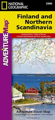
Wegenkaart van Finland en noord Scandinavië met vermelding van veel bezienswaardigheden, nationale parken en attrakties. Watervast en scheurvast. Juist door deze vermeldingen onderscheidt de kaart zich van andere wegenkaarten. National Geographic's Finland and Northern Scandinavia Adventure Map is designed to meet the unique needs of adventure tra...

Verkopers met dit product

Verkoper
Bezorging
Prijs
DeZwerver.nl logo
DeZwerver.nl
2,95
17,50

Anderen bekeken ook

Wegenkaart - landkaart 3300 Adventure Map Finland & Northern Scandinavia - Finland en noord Scandinavië | National Geographic
Wegenkaart van Finland en noord Scandinavië met vermelding van veel bezienswaardigheden, nationale parken en attrakties. Watervast en scheurvast. Juist door deze vermeldingen onderscheidt de kaart zich van andere wegenkaarten. National Geographic's Finland and Northern Scandinavia Adventure Map is designed to meet the unique needs of adventure travelers with its detail, durability, and accuracy. Scandinavia North includes the locations of thousands of cities and towns with an index for easily locating them, plus a clearly marked road network complete with distances and designations for expressways, motorways, and more. What sets National Geographic Adventure Maps apart from traditional road maps are the hundreds of points of interest that highlight the diverse and unique destinations within northern Scandinavia. World Heritage sites, museums, amusement parks, zoos, castles, archeological sites, churches, and more are included, making it invaluable to travelers hoping to experience all…
17,50
Wegenkaart - landkaart 711 Scandinavië & Finland | Michelin
Zoals je van Michelin mag verwachten is deze kaart zeer overzichtelijk en heeft een duidelijk helder kaartbeeld. De kaart geeft uitgebreid toeristische informatie weer. Natuurlijk vanwege het grote gebied een behoorlijk grove schaal. Scandinavia and Finland map at 1:1,500,000 from Michelin, including the whole of Denmark, Norway, and Sweden, with enlargements showing in greater detail road networks around Helsinki, the Copenhagen - Malmo area, Oslo, Bergen, Stockholm and Gothenburg. Road network is presented graded according to the width and the number of lanes, indicating full/limited interchanges, toll barriers, driving distances, steep sections, seasonal closures, etc. The map also highlights scenic roads and tourist routes. Railway lines and ferry routes are included and local airports are marked. Symbols highlight various places of interest and mark locations of campsites. Within each country the map also shows internal administrative boundaries with names of the provinces. Topog…
11,95
Wegenkaart - landkaart Scandinavia - Scandinavië | ITMB
Een degelijke wegenkaart met aanduidingen van o.a. nationale parken, vliegveld. Als overzichtskaart goed te gebruiken. This is a new title for ITMB, providing detailed coverage of almost all of what most of us consider to be the Scandinavian countries. Only the southernmost portions of Denmark had to be left off. The map is double-sided, with Denmark and most of Norway and Sweden on one side and their balances and Finland on the reverse side. The road network, particularly the motorways and A-type roads shown up very well. Secondary roads show well and also are easy to see. Rail lines are present as well as ferry routes, of which there are many. The area of Scandinavia is so large in the European context that little attention has been paid to the region. When mapping a large area such as this is, it is difficult to show every detail. We have done our best and included all world heritage sites, major churches, castles, some campsites, and as many touristic attractions as could be fitte…
13,95
Wegenkaart - landkaart 3306 Adventure Map Spain Northern - Noord Spanje | National Geographic
Wegenkaart van Noord Spanje met vermelding van veel bezienswaardigheden, nationale parken en attrakties. Watervast en scheurvast. Juist door deze vermeldingen onderscheidt de kaart zich van andere wegenkaarten. National Geographic's Northern Spain Adventure Map is designed to meet the unique needs of adventure travelers—detailed, durable, and accurate. Northern Spain includes the locations of thousands of major cities and towns with an index for easily locating them, plus a clearly marked road network complete with distances and designations for expressways, motorways, and more. St. James Way, one of the most important Christian pilgrimages during medieval times, is noted for travelers seeking to retrace to route to the Cathedral of Santiago de Compostela in Galicia where the remains of the apostle Saint James are believed to be buried.   What sets National Geographic Adventure Maps apart from traditional road maps are the hundreds of points of interest that highlight the diverse and …
17,50
Reisgids Scandinavia - Scandinavië | Insight Guides
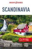
Dé gids als het gaat om achtergrondinformatie en prachtige foto’s. Door het formaat en gewicht niet zo zeer om mee te nemen, als wel om thuis voor en na de reis uitgebreid te lezen. Kwalitatief van een hoog niveau! Insight Guide to Scandinavia is a pictorial travel guide in a magazine style providing answers to the key questions before or during your trip: deciding when to go to Scandinavia, choosing what to see, from exploring postcard-pretty Bergen to discovering Finland's A°land archipelago or creating a travel plan to cover key places like Copenhagen, Oslo, Helsinki and Stockholm. This is an ideal travel guide for travellers seeking inspiration, in-depth cultural and historical information about Scandinavia as well as a great selection of places to see during your trip.   The Insight Guide Scandinavia covers: Copenhagen, Zealand, Bornholm, Funen, Jutland, Greenland, The Faroe Islands, Oslo, Bergen, Norway's Northwest Coast, Norway's Far North, Stockholm, Gotland, Sweden's West …
25,95
Reisgids Scandinavia - Scandinavië | Lonely Planet
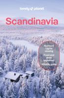
Ontdek het beste van Denemarken, Finland, de Faroer eilanden, IJsland, Noorwegen en Zweden met deze gids! De perfecte reisgids voor zowel de georganiseerde als de zelfstandige reiziger. Naast een algemene inleiding van het land / streek vol met praktische informatie over hoe je er het beste kunt reizen: slapen, eten, vervoer, excursies ... alles kun je er in vinden. Engelstalig.  Lonely Planet's local travel experts reveal all you need to know to plan the trip of a lifetime in this latest edition of our guide to Scandinavia.   Discover Scandinavia's most popular experiences and best kept secrets from joining an eco boat trip to see endangered ringed seals in Saimaa; to spotting the aurora borealis on a ski trip in the mountains around Iceland’s Akureyri; and visiting quiet Sigtuna–Sweden's oldest town–home to church ruins and pretty, winding lanes.   Build a trip to remember with Lonely Planet's Scandinavia travel guide:   Our classic guidebook format contains the most compre…
27,95
Wegenkaart - landkaart 3301 Adventure Map Southern Sweden & Norway | Zuid Zweden en Noorwegen | National Geographic
Wegenkaart van Zuid Zweden en Noorewegen met vermelding van veel bezienswaardigheden, nationale parken en attrakties. Watervast en scheurvast. Juist door deze vermeldingen onderscheidt de kaart zich van andere wegenkaarten. National Geographic's Southern Sweden and Norway Adventure Map is designed to meet the unique needs of adventure travelers—detailed, durable, and accurate. Southern Sweden and Norway includes the locations of thousands of cities and towns with an index for easily locating them, plus a clearly marked road network complete with distances and designations for expressways, motorways, and more. Transportation within and beyond the country is made easier with the locations of airports, airfields, railroads, ferry routes, lighthouses, harbors, and international border checkpoints. What sets National Geographic Adventure Maps apart from traditional road maps are the hundreds of points of interest that highlight the diverse and unique destinations within Southern Sweden and…
17,50
Wegenkaart - landkaart 3202 Adventure Map Egypt - Egypte | National Geographic
Wegenkaart van Egypte met vermelding van veel bezienswaardigheden, nationale parken en attrakties. Watervast en scheurvast. Juist door deze vermeldingen onderscheidt de kaart zich van andere wegenkaarten. National Geographic's Egypt Adventure Map is designed to meet the unique needs of adventure travelers with its detail, durability, and accuracy. The map includes the locations of thousands of cities and towns with an index for easily locating them, plus a clearly marked road network complete with distances and designations for expressways, major roadways, and more. Transportation within and beyond the country is made easier with the locations of airports, airfields, railroads, ferry routes, lighthouses, harbors, border crossings, and police control points.   What sets National Geographic Adventure Maps apart from traditional road maps are the hundreds of points of interest that highlight the diverse, unique, and exotic destinations within Egypt. In addition to typical sites of intere…
17,50
Wegenkaart - landkaart 3500 Adventure Map New Zealand - Nieuw Zeeland | National Geographic
Wegenkaart van Nieuw Zeeland met vermelding van veel bezienswaardigheden, nationale parken en attrakties. Watervast en scheurvast. Juist door deze vermeldingen onderscheidt de kaart zich van andere wegenkaarten. National Geographic's New Zealand Adventure Map is designed to meet the unique needs of adventure travelers—detailed, durable, and accurate. The map includes the locations of thousands of major cities and towns with an index for easily locating them, plus a clearly marked road network complete with distances and designations for major highways, toll roads, limited access highways and more.   What sets National Geographic Adventure Maps apart from traditional road maps are the hundreds of points-of-interest that highlight the diverse, unique, and exotic destinations within New Zealand including National Parks and Preserves, World Heritage Sites, Archeological sites, ski areas, beaches, golf courses, camping areas, waterfalls, natural points of interest and important travel aids…
17,50
Wegenkaart - landkaart 3203 Adventure Map Morocco - Marokko | National Geographic
Wegenkaart van Marokko met vermelding van veel bezienswaardigheden, nationale parken en attrakties. Watervast en scheurvast. Juist door deze vermeldingen onderscheidt de kaart zich van andere wegenkaarten. National Geographic's Morocco Adventure Map is designed to meet the unique needs of adventure travelers—detailed, durable, and accurate. Morocco includes the locations of thousands of cities and towns with an index for easily locating them, plus a clearly marked road network complete with distances and designations for motorways, dual carriageways, major roadways, and more. Transportation within and beyond the country is made easier with the location of airports, airfields, railroads, ferry routes, river crossings, lighthouses, harbors, border crossings, and petrol stations. What sets National Geographic Adventure Maps apart from traditional road maps are the hundreds of points of interest that highlight the diverse, unique, and exotic destinations within Morocco. In addition to typ…
17,50

Klanten-reviews van Wegenkaart - landkaart 3300 Adventure Map Finland & Northern Scandinavia - Finland en noord Scandinavië | National Geographic

Er zijn nog geen beoordelingen voor dit productBen jij de eerste die een review plaatst?

Meer over Wegenkaart - landkaart 3300 Adventure Map Finland & Northern Scandinavia - Finland en noord Scandinavië | National Geographic

Productomschrijving

Wegenkaart van Finland en noord Scandinavië met vermelding van veel bezienswaardigheden, nationale parken en attrakties. Watervast en scheurvast. Juist door deze vermeldingen onderscheidt de kaart zich van andere wegenkaarten.

National Geographic's Finland and Northern Scandinavia Adventure Map is designed to meet the unique needs of adventure travelers with its detail, durability, and accuracy. Scandinavia North includes the locations of thousands of cities and towns with an index for easily locating them, plus a clearly marked road network complete with distances and designations for expressways, motorways, and more. What sets National Geographic Adventure Maps apart from traditional road maps are the hundreds of points of interest that highlight the diverse and unique destinations within northern Scandinavia. World Heritage sites, museums, amusement parks, zoos, castles, archeological sites, churches, and more are included, making it invaluable to travelers hoping to experience all the history, art, and culture the region has to offer. National parks and reserves, winter sports resorts, and campsites are plentiful in the region for those wishing to explore northern Scandinavia’s picturesque mountains, extensive coastlines, fjords, and ancient forests.   The southern half of the region is shown on the front side of the map spanning from Finland’s southern tip to the city of Rovaniemi in the north. Sweden’s eastern coast is included from the city of Umea north to Jokkmokk. The reverse side of the map covers the northern half of the region from Norway’s island of Vega north to the far reaches of its Norwegian and Barents Sea coasts. Northern Sweden is shown from Hemavan to the country’s northern borders with Norway and Finland. The northern portion of Finland is included from Salla to the border with Norway.  


Popular places included on the map: Helsinki, Koli National Park, Lake Pielinen, Espoo, Turku, Oulanka National Park, Rovaniemi, Lemmenjoki National Park, Pallas-Yllästunturi National Park, Urho Kekkonen National Park, Tampere, Vantaa, Tromso, Saltfjellet-Svartisen National Park, Hammerfest, Harstad, Narvik, Bode, Padjelanta National Park, Sarek National Park, Stora Sjofallet, Galivare, Umea, Skelleftea, Lulea, Kiruna.

Productinformatie

    Verken gerelateerde categorieën

    Webshop.nl maakt gebruik van cookies. Ga je verder op onze website, ga dan akkoord met het plaatsen van cookies en de verwerking van deze data door ons en vermelde partners.