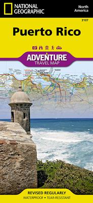
Wegenkaart - landkaart 3107 Adventure Map Puerto Rico | National Geographic

0
Wegenkaart van Puerto Rico met vermelding van veel bezienswaardigheden, nationale parken en attrakties. Watervast en scheurvast. Juist door deze vermeldingen onderscheidt de kaart zich van andere wegenkaarten. Like all Adventure maps, Puerto Rico contains detailed topographic information, plus useful traveling tips, and regional information. Print...

Verkopers met dit product

Verkoper
Bezorging
Prijs
DeZwerver.nl logo
DeZwerver.nl
2,95
17,50

Anderen bekeken ook

Wegenkaart - landkaart 3107 Adventure Map Puerto Rico | National Geographic
Wegenkaart van Puerto Rico met vermelding van veel bezienswaardigheden, nationale parken en attrakties. Watervast en scheurvast. Juist door deze vermeldingen onderscheidt de kaart zich van andere wegenkaarten. Like all Adventure maps, Puerto Rico contains detailed topographic information, plus useful traveling tips, and regional information. Printed on the same waterproof, tear-resistant material as our Trails Illustrated maps—our adventure series maps will stand up to rigorous travel, and contain the navigation aids necessary for backcountry use with GPS or compass.
17,50
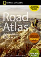
Wegenatlas Adventure Edition USA - Amerika - Canada - Mexico - Puerto Rico | A3-Formaat | Ringband | National Geographic
Duidelijk leesbare wegenatlas van de USA, Mexico, Canada, en Puerto Rico, met groot register en ook kleine plattegronden van centra van belangrijke steden. Ook met informatie over nationale parken en avontuurlijke bestemmingen. Duidelijke kaarten in stevig ringband model.   National Geographic's Road Atlas: Adventure Edition, is the ideal companion for the next time you hit the road. Includes up-to-date road maps for all 50 U.S. States, plus Canada, Mexico, and Puerto Rico. Major cities and metropolitan areas are shown in detail with inset maps that include popular attractions, infrastructure and points-of-interest.   Setting this atlas apart from all other road atlases are the inclusion of detailed maps and guidebook-like recommendations on the top 100 destinations for adventure, plus the top 24 most visited National Parks. An additional resources section provides contact information for local tourism offices, plus a place name index to help easily locate a specific city.   The …
32,95
Wegenkaart - landkaart 3402 Adventure Map Chile - Chili | National Geographic
Wegenkaart van Chili met vermelding van veel bezienswaardigheden, nationale parken en attrakties. Watervast en scheurvast. Juist door deze vermeldingen onderscheidt de kaart zich van andere wegenkaarten.   National Geographic's Chile Adventure Map is designed to meet the unique needs of adventure travelers—detailed, durable, and accurate. Chile includes the locations of thousands of major cities and towns with an index for easily locating them, plus a clearly marked road network complete with distances and designations for major highways, toll roads, limited access highways and more.   What sets National Geographic Adventure Maps apart from traditional road maps are the hundreds of points-of-interest that highlight the diverse, unique, and exotic destinations within Chile including National Parks and Preserves, World Heritage Sites, Archeological sites, ski areas, beaches, waterfalls, natural points of interest and important travel aids like airports, airstrips, rail lines, lighthouse…
17,50
Wegenkaart - landkaart 3406 Adventure Map Bolivia | National Geographic
Wegenkaart van Bolivia met vermelding van veel bezienswaardigheden, nationale parken en attrakties. Watervast en scheurvast. Juist door deze vermeldingen onderscheidt de kaart zich van andere wegenkaarten. National Geographic's Bolivia Adventure Map is designed to meet the unique needs of adventure travelers with its durability and accurate information. Each folded map provides global travelers with the perfect combination of detail and perspective, highlighting the area’s terrain and best locations for adventure activities like snorkeling, surfing, fishing, and more. Adventure Maps include hundreds of points of interest that highlight diverse and unique destinations within the country.   The map includes the locations of thousands of cities and towns with a user-friendly index, plus a clearly marked road network complete with distances and designations for major highways, main roads, and tracks and trails for those seeking to explore more remote regions.   Key Features: Waterproof a…
17,50
Wegenkaart - landkaart 3110 Adventure Map Guatemala | National Geographic
Wegenkaart van Guatemala met vermelding van veel bezienswaardigheden, nationale parken en attrakties. Watervast en scheurvast. Juist door deze vermeldingen onderscheidt de kaart zich van andere wegenkaarten.   National Geographic's Guatemala Adventure Map is designed to meet the unique needs of adventure travelers with its durability and accurate information. Each folded map provides global travelers with the perfect combination of detail and perspective, highlighting the area’s terrain and best locations for adventure activities like snorkeling, surfing, fishing, and more. Adventure Maps include hundreds of points of interest that highlight diverse and unique destinations within the country.   The map includes the locations of thousands of towns and natural features with a user-friendly index, plus a clearly marked road network complete with distances and designations for major highways, main roads, and tracks and trails for those seeking to explore more remote regions.   Key F…
17,50
Wegenkaart - landkaart 3105 Adventure Map Northern Yucatan Peninsula - Yucatan schiereiland noord | National Geographic
Wegenkaart van Yucatan schiereiland noord met vermelding van veel bezienswaardigheden, nationale parken en attrakties. Watervast en scheurvast. Juist door deze vermeldingen onderscheidt de kaart zich van andere wegenkaarten. The Northern Yucatan Peninsula and Maya Sites map includes: Detailed city inset maps of Cancún and Mérida with locations of attractions and key infrastructure Maya site locations with detailed Maya site inset maps and information for Chichén Itzá, Ek’ Balam, Tulum, El Rey, Uxmal, Cobá, and San Gervasio Detailed descriptions, photographs, and site maps of important Maya buildings and history Popular Yucatán resort towns Isla Mujeres, Cancun, Playa del Carmen, Akumal, Cozumel, Puerto Aventuras, and Tulum Popular adventure travel recreation points of interest Detailed road network UNESCO World Heritage sites
17,50
Wegenkaart - landkaart 3405 Adventure Map Colombia | National Geographic
Wegenkaart van Colombia met vermelding van veel bezienswaardigheden, nationale parken en attrakties. Watervast en scheurvast. Juist door deze vermeldingen onderscheidt de kaart zich van andere wegenkaarten.   National Geographic's Colombia Adventure Map is designed to meet the unique needs of adventure travelers with its durability and accurate information. Each folded map provides global travelers with the perfect combination of detail and perspective, highlighting the area’s terrain and best locations for adventure activities like snorkeling, surfing, fishing, and more. Adventure Maps include hundreds of points of interest that highlight diverse and unique destinations within the country.   The map includes the locations of thousands of cities and towns with a user-friendly index, plus a clearly marked road network complete with distances and designations for major highways, main roads, and tracks and trails for those seeking to explore more remote regions.   Key Features: Waterpro…
17,50
Wegenkaart - landkaart 3313 Adventure Map France - Frankrijk | National Geographic
Wegenkaart van Frankrijk met vermelding van veel bezienswaardigheden, nationale parken en attrakties. Watervast en scheurvast. Juist door deze vermeldingen onderscheidt de kaart zich van andere wegenkaarten. National Geographic's France Adventure Map is designed to meet the unique needs of adventure travelers with its durability and accurate information. Each folded map provides global travelers with the perfect combination of detail and perspective, highlighting the area’s terrain and best locations for adventure activities like snorkeling, surfing, fishing, and more. Adventure Maps include hundreds of points of interest that highlight diverse and unique destinations within the country. The map includes the locations of thousands of cities and towns with a user-friendly index, plus a clearly marked road network complete with distances and designations for major highways, main roads, and tracks and trails for those seeking to explore more remote regions. Adventure Maps are printed in …
17,50
Wegenkaart - landkaart 3116 Adventure Map Jamaica | National Geographic
Wegenkaart van Jamaica met vermelding van veel bezienswaardigheden, nationale parken en attrakties. Watervast en scheurvast. Juist door deze vermeldingen onderscheidt de kaart zich van andere wegenkaarten. National Geographic's Jamaica Adventure Map is designed to meet the needs of adventure travelers with its detailed and accurate information. This map includes the locations of cities and towns with a user-friendly index, a clearly marked road network complete with distances and designations for roads/highways, plus secondary routes for those seeking to explore off the beaten path. Adventure Maps differ from a traditional road map because of the specialty content they include. Each map contains hundreds of diverse and unique recreational, ecological, cultural, and historic destinations — outside of the major tourist hubs. National Geographic Adventure Maps are the perfect companion to a guidebook.   The Jamaica Adventure Map covers the entire island nation in one easy to use map. The…
17,50
Wegenkaart - landkaart 3315 Adventure Map Corsica | National Geographic
Wegenkaart van Corsica met vermelding van veel bezienswaardigheden, nationale parken en attrakties. Watervast en scheurvast. Juist door deze vermeldingen onderscheidt de kaart zich van andere wegenkaarten. National Geographic's Corsica Adventure Map is designed to meet the unique needs of adventure travelers with its durability and accurate information. Each folded map provides global travelers with the perfect combination of detail and perspective, highlighting the area’s terrain and best locations for adventure activities like snorkeling, surfing, fishing, and more. Adventure Maps include hundreds of points of interest that highlight diverse and unique destinations within the country.   The map includes the locations of thousands of cities and towns with a user-friendly index, plus a clearly marked road network complete with distances and designations for major highways, main roads, and tracks and trails for those seeking to explore more remote regions. The front side of the Corsica…
17,50

Klanten-reviews van Wegenkaart - landkaart 3107 Adventure Map Puerto Rico | National Geographic

Er zijn nog geen beoordelingen voor dit productBen jij de eerste die een review plaatst?

Meer over Wegenkaart - landkaart 3107 Adventure Map Puerto Rico | National Geographic

Productomschrijving

Wegenkaart van Puerto Rico met vermelding van veel bezienswaardigheden, nationale parken en attrakties. Watervast en scheurvast. Juist door deze vermeldingen onderscheidt de kaart zich van andere wegenkaarten.

Like all Adventure maps, Puerto Rico contains detailed topographic information, plus useful traveling tips, and regional information. Printed on the same waterproof, tear-resistant material as our Trails Illustrated maps—our adventure series maps will stand up to rigorous travel, and contain the navigation aids necessary for backcountry use with GPS or compass.

Productinformatie

    Verken gerelateerde categorieën

    Webshop.nl maakt gebruik van cookies. Ga je verder op onze website, ga dan akkoord met het plaatsen van cookies en de verwerking van deze data door ons en vermelde partners.