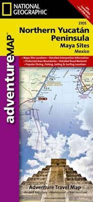
Wegenkaart - landkaart 3105 Adventure Map Northern Yucatan Peninsula - Yucatan schiereiland noord | National Geographic

0
Wegenkaart van Yucatan schiereiland noord met vermelding van veel bezienswaardigheden, nationale parken en attrakties. Watervast en scheurvast. Juist door deze vermeldingen onderscheidt de kaart zich van andere wegenkaarten. The Northern Yucatan Peninsula and Maya Sites map includes: Detailed city inset maps of Cancún and Mérida with locations of...

Verkopers met dit product

Verkoper
Bezorging
Prijs
DeZwerver.nl logo
DeZwerver.nl
2,95
17,50

Anderen bekeken ook

Wegenkaart - landkaart 3105 Adventure Map Northern Yucatan Peninsula - Yucatan schiereiland noord | National Geographic
Wegenkaart van Yucatan schiereiland noord met vermelding van veel bezienswaardigheden, nationale parken en attrakties. Watervast en scheurvast. Juist door deze vermeldingen onderscheidt de kaart zich van andere wegenkaarten. The Northern Yucatan Peninsula and Maya Sites map includes: Detailed city inset maps of Cancún and Mérida with locations of attractions and key infrastructure Maya site locations with detailed Maya site inset maps and information for Chichén Itzá, Ek’ Balam, Tulum, El Rey, Uxmal, Cobá, and San Gervasio Detailed descriptions, photographs, and site maps of important Maya buildings and history Popular Yucatán resort towns Isla Mujeres, Cancun, Playa del Carmen, Akumal, Cozumel, Puerto Aventuras, and Tulum Popular adventure travel recreation points of interest Detailed road network UNESCO World Heritage sites
17,50
Wegenkaart - landkaart Mexico Yucatan Peninsula | ITMB
Een degelijke kaart met aanduidingen van o.a. nationale parken, vliegveld, benzinepomp, dirt-roads en kleine plattegrond van hoofdstad. Als overzichtskaart goed te gebruiken.   This is a modest upgrading, with little change over the previous edition; same cover, same ISBN, same price. We ran out of copies faster than expected and found few changes necessary to make to the artwork. Yucatan is one of those parts of Mexico seemingly unaffected by the Drug Wars, which appear to be tapering off in any case, and is as popular as ever.   Legend Includes: Roads by classification, International Airports, Domestic Airports, Lighthouses, Points of Interest, Archaeological Sites, Beaches, Caves, Gas Stations, Reefs, National Parks, Swamps, Mangroves, Temples, Camp Ground, Museums, Forts, Shipwrecks, Sinkholes, Border Crossings, Harbours, Churches, Monasteries, Mines, Other Archaeological Remains, Trailer Parks, Airstrip, Viewpoints, Cultural World Heritage, Fishing, Paragliding, Diving, Sailing, …
13,95
Wegenkaart - landkaart Yucatan | Borch
Mooie geplasticieerde kaart van Yucatan. Deze kaart biedt een goed overzicht van dit deel van Mexico met detailkaarten.   Our soft-laminated map of Yucatan includes: Yucatán 1:1 000 000, Guatemala  North 1:1 000 000, Yucatán Peninsula 1:2 500 000, Campeche 1:10 000, Mérida Centre 1:10 000, Mérida 1:100 000, Cancún & Isla Mujeres 1:100 000, Palenque 1:5 000, Tulúm 1:3 750, Tikal 1:6 200, Uxmal 1:5 500, Chichén-Itzá 1:6 500, Cozumel Island 1:250 000, Mexico administrative & time zones, interesting statistics, conversion chart for temperatures, weights and measures, climate chart with temperatures, sunshine hours, precipitation and humidity, and shows top sights, temples and much more.   The peninsula of Yucatan is located on the easternmost tip of Mexico and faces toward Cuba. After the city states of Chichén Itzá, Uxmal and Labná were founded in ca. 600 B.C. the Mayan civilization, whose mysterious grandeur manifests itself best in the stone pyramid of El Castillo in Chichén Itzá, flou…
11,50
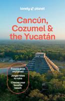
Reisgids Cancun, Cozumel and the Yucatan - Mexico | Lonely Planet
De perfecte reisgids voor zowel de georganiseerde als de zelfstandige reiziger. Naast een algemene inleiding van het land / streek vol met praktische informatie over hoe je er het beste kunt reizen: slapen, eten, vervoer, excursies ... alles kun je er in vinden. Engelstalig. Lonely Planet. Few Mexican destinations can dazzle you with ancient Maya ruins, azure Caribbean and Gulf of Mexico waters and colonial cities all in one fell swoop. Actually, there’s only one – the Yucatán. Lonely Planet is your passport to Cancun, Cozumel & the Yucatan, with amazing travel experiences and the best planning advice.   Swim in the caverns at Cenotes de Cuzamá, savor the flavors of Yucatecan cuisine, or top off a visit to Tulum Ruins with a dip in the azure waters below; all with your trusted travel com-panion. Get to the heart of Cancun, Cozumel & the Yucatan and begin your journey now!   Inside Lonely Planet’s Cancun, Cozumel & the Yucatan Travel Guide:   Colour maps and images throughout H…
22,50
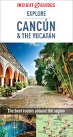
Reisgids Explore Cancun & the Yucatan | Insight Guides
Een pocketversie van de alom gewaardeerde Insight Guides. Boordevol informatie over Cancun en Yucatan.   Experience the best of Cancún and the Yucatán with this indispensably practical Insight Explore Guide. From making sure you don't miss out on must-see attractions like Chichén Itzá, to discovering hidden gems, including the region's cenotes (sinkholes) and idyllic beaches, the easy-to-follow, ready-made walking routes will help you plan your trip, save you time, and enhance your exploration of this fascinating/thrilling region.   · Practical and packed with inspirational insider information, this will make the ideal on-the-move companion to your trip to Cancún and the Yucatán  · Enjoy over 15 irresistible Best Routes to walk, from Cancún itself to the Riviera Maya. · Features concise insider information about landscape, history, food and drink, and entertainment options · Invaluable maps: each Best Route is accompanied by a detailed full-colour map, while the large pull-out map pro…
13,95
Wegenkaart - landkaart 3306 Adventure Map Spain Northern - Noord Spanje | National Geographic
Wegenkaart van Noord Spanje met vermelding van veel bezienswaardigheden, nationale parken en attrakties. Watervast en scheurvast. Juist door deze vermeldingen onderscheidt de kaart zich van andere wegenkaarten. National Geographic's Northern Spain Adventure Map is designed to meet the unique needs of adventure travelers—detailed, durable, and accurate. Northern Spain includes the locations of thousands of major cities and towns with an index for easily locating them, plus a clearly marked road network complete with distances and designations for expressways, motorways, and more. St. James Way, one of the most important Christian pilgrimages during medieval times, is noted for travelers seeking to retrace to route to the Cathedral of Santiago de Compostela in Galicia where the remains of the apostle Saint James are believed to be buried.   What sets National Geographic Adventure Maps apart from traditional road maps are the hundreds of points of interest that highlight the diverse and …
17,50
Wegenkaart - landkaart 3000 Adventure Map Nepal | National Geographic
Wegenkaart van Nepal met vermelding van veel bezienswaardigheden, nationale parken en attrakties. Watervast en scheurvast. National Geographic's Nepal Adventure Map is the most authoritative map for touring the country. Each waterproof and tear-resistant map provides travelers with the perfect combination of detail and perspective, highlighting points of interest for those venturing outside city centers.   This durable, folded map includes the locations of cities and towns with a user-friendly index, plus a clearly marked road network complete with distances and designations for major highways, main roads, and tracks and trails for those seeking to explore more remote regions.   The front side offers a detailed topographic and trekking map of central and eastern Nepal, including border regions with China and India. Mountaineers will stay on course with marked trails through the Himalayan Range, including Everest (the tallest mountain in the world), and the surrounding national parks a…
17,50
Wegenkaart - landkaart 3106 Adventure Map Belize | National Geographic
Wegenkaart van Belize met vermelding van veel bezienswaardigheden, nationale parken en attrakties. Watervast en scheurvast. Juist door deze vermeldingen onderscheidt de kaart zich van andere wegenkaarten. National Geographics Belize Adventure Map details the countrys numerous protected areas including its National Parks, preserves, wildlife sanctuaries, archeological reserves, marine reserves, spawning grounds and private reserves. UNESCO World Heritage sites and the locations of archeological ruins are highlighted, along with the locations of popular places for diving, surfing, fishing, and more. A detailed road network, plus inset maps of Belize City and San Pedro, including the location of key infrastructure and pointsof-interest, make the Belize AdventureMap ideal for touring both urban and remote destinations. The reverse of the Belize AdventureMap contains detailed interpretive information to Belize's Blue Hole, the ruins of Tikal in Guatemala, The Barrier Reef System, plus info…
17,50
Wegenkaart - landkaart 3103 Adventure Map Baja California North - Baja Californië Noord | National Geographic
Wegenkaart van Baja Californië Noord met vermelding van veel bezienswaardigheden, nationale parken en attrakties. Watervast en scheurvast. Juist door deze vermeldingen onderscheidt de kaart zich van andere wegenkaarten. National Geographic’s Baja North Adventure Map combines detailed terrain with local information on the entire State of Baja California. Together with the Baja South Adventure Map, it covers the entire Baja peninsula and includes detailed insets of Tijuana, Mexicali, Ensenada, La Paz, San Jose Del Cabo, Cabo San Lucas, and the Cabo Resort Corridor. Coverage Highlights: Federally Protected Areas, including parks and reserves, provided by the Nature Conservancy of Mexico; detailed road network, ferry routes, and mileage charts; UNESCO World Heritage Sites; historic mission locations; popular diving, surfing, fishing, snorkeling, whale watching, and scenic viewpoint locations; detailed terrain with shaded relief; useful travel information
17,50
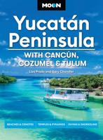
Reisgids Yucatán Peninsula: With Cancún, Cozumel & Tulum | Moon Travel Guides
Experience stunning Maya ruins, dreamy beaches, and epic outdoor thrills, from cenote-diving to kiteboarding, with Moon Yucatán Peninsula. Inside you'll find: Flexible itineraries including a ten-day eco-adventure and a two-week road trip across the whole peninsula Strategic advice for road-trippers, foodies, wellness seekers, outdoor adventurers, honeymooners, families, and more The top outdoor activities: Kayak through lush mangrove forests, or sign up for a mountain bike tour through the jungle for a peek at hidden ruins, remote beaches, and dazzling marine life. Spend a day relaxing on the beach, dive into crystal-clear cenotes, or try standup paddle-boarding Unique, local experiences: Peruse the markets, museums, and churches of Mérida or Tulum, or take a short walk from the shore to visit jaw-dropping Maya ruins. Find the best spots to fill up on authentic salbute and panucho, and stay up late for live music, cocktails, and fire dancers on the beach Honest advice from Yuc…
27,95

Klanten-reviews van Wegenkaart - landkaart 3105 Adventure Map Northern Yucatan Peninsula - Yucatan schiereiland noord | National Geographic

Er zijn nog geen beoordelingen voor dit productBen jij de eerste die een review plaatst?

Meer over Wegenkaart - landkaart 3105 Adventure Map Northern Yucatan Peninsula - Yucatan schiereiland noord | National Geographic

Productomschrijving

Wegenkaart van Yucatan schiereiland noord met vermelding van veel bezienswaardigheden, nationale parken en attrakties. Watervast en scheurvast. Juist door deze vermeldingen onderscheidt de kaart zich van andere wegenkaarten.

The Northern Yucatan Peninsula and Maya Sites map includes:
  • Detailed city inset maps of Cancún and Mérida with locations of attractions and key infrastructure
  • Maya site locations with detailed Maya site inset maps and information for Chichén Itzá, Ek’ Balam, Tulum, El Rey, Uxmal, Cobá, and San Gervasio
  • Detailed descriptions, photographs, and site maps of important Maya buildings and history
  • Popular Yucatán resort towns Isla Mujeres, Cancun, Playa del Carmen, Akumal, Cozumel, Puerto Aventuras, and Tulum
  • Popular adventure travel recreation points of interest
  • Detailed road network
  • UNESCO World Heritage sites

Productinformatie

    Verken gerelateerde categorieën

    Webshop.nl maakt gebruik van cookies. Ga je verder op onze website, ga dan akkoord met het plaatsen van cookies en de verwerking van deze data door ons en vermelde partners.