webshop.nl
Categorieën
  Sluiten

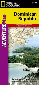
Wegenkaart - landkaart 3102 Adventure Map Dominican Republic | National Geographic

Wegenkaart van Dominicaanse Republiek met vermelding van veel bezienswaardigheden, nationale parken en attrakties. Watervast en scheurvast. Juist door deze vermeldingen onderscheidt de kaart zich van andere wegenkaarten. The Dominican Republic is the second largest nation in the Caribbean, occupying two-thirds of the stunning island of Hispaniola. ...
17,50

Webshops met dit product

Webshop
Bezorging
Prijs

Anderen bekeken ook

Wegenkaart - landkaart Adventure Map Jamaica | National Geographic
Wegenkaart van Jamaica met vermelding van veel bezienswaardigheden, nationale parken en attrakties. Watervast en scheurvast. Juist door deze vermeldingen onderscheidt de kaart zich van andere wegenkaarten. National Geographic's Jamaica Adventure Map is designed to meet the needs of adventure travelers with its detailed and accurate information. This map includes the locations of cities and towns with a user-friendly index, a clearly marked road network complete with distances and designations for roads/highways, plus secondary routes for those seeking to explore off the beaten path. Adventure Maps differ from a traditional road map because of the specialty content they include. Each map contains hundreds of diverse and unique recreational, ecological, cultural, and historic destinations — outside of the major tourist hubs. National Geographic Adventure Maps are the perfect companion to a guidebook.   The Jamaica Adventure Map covers the entire island nation in one easy to use map. The …
17,50
Wegenkaart - landkaart 3117 Adventure Map Alaska | National Geographic
Wegenkaart van Alaska met vermelding van veel bezienswaardigheden, nationale parken en attrakties. Watervast en scheurvast. Alaska is a land so vast that is boggles the imagination. It is so large that it could easily contain the next three largest states: Texas, California, and Montana and still have room left over. Despite its large size Alaska has very few inhabitants making it the state with the lowest population density. Alaska is known for its dramatic, diverse terrain of wide-open spaces, mountains and forests, with abundant wildlife and many small towns.   A majority of Alaska, sixty percent, is owned and managed by the Federal Government. These lands are open to the public and offer a wide range of activities from sightseeing in Denali National Park to river-running and fishing on one of many wild rivers. Many vistors to Alaska choose to arrive via cruise ship through the famous Inside Passage. The Alaska Adventure Map shows all of these features and more from the temperate ra…
17,50
Wegenkaart - landkaart 3322 Adventure Map Czech Republic - Tsjechië | National Geographic
Wegenkaart van Tsjechië met vermelding van veel bezienswaardigheden, nationale parken en attrakties. Watervast en scheurvast. Juist door deze vermeldingen onderscheidt de kaart zich van andere wegenkaarten. National Geographic's Czech Republic Adventure Map is designed to meet the unique needs of adventure travelers with its durability and accurate information. Each folded map provides global travelers with the perfect combination of detail and perspective, highlighting the area’s terrain and best locations for adventure activities like snorkeling, surfing, fishing, and more. Adventure Maps include hundreds of points of interest that highlight diverse and unique destinations within the country.   The map includes the locations of thousands of cities and towns with a user-friendly index, plus a clearly marked road network complete with distances and designations for major highways, main roads, and tracks and trails for those seeking to explore more remote regions.   Key Features: Water…
17,50
Wegenkaart - landkaart 3208 Adventure Map Israel | National Geographic
Wegenkaart van Isreal met vermelding van veel bezienswaardigheden, nationale parken en attrakties. Watervast en scheurvast. Juist door deze vermeldingen onderscheidt de kaart zich van andere wegenkaarten. National Geographic's Israel Adventure Map is designed to meet the unique needs of adventure travelers with its durability and accurate information. This folded map provides global travelers with the perfect combination of detail and perspective, highlighting hundreds of points of interest and the diverse and unique destinations within the country.   The map includes the locations of cities and towns with a user-friendly index, plus a clearly marked road network complete with distances and designations for major highways, main roads, and tracks and trails for those seeking to explore more remote regions. The front side of the Israel map details the northern region of the country, from its border with Lebanon to the north, to Syria and Jordan to the east and the Mediterranean Sea to th…
17,50
Wegenkaart - landkaart 3006 Adventure Map Thailand | National Geographic
Wegenkaart van Thailand met vermelding van veel bezienswaardigheden, nationale parken en attrakties. Watervast en scheurvast. National Geographic's Thailand Adventure Map is designed to meet the unique needs of adventure travelers—detailed, durable, and accurate. Thailand includes the locations of thousands of major cities and towns with an index for easily locating them, plus a clearly marked road network complete with distances and designations for major highways, limited access highways, and more.   What sets National Geographic Adventure Maps apart from traditional road maps are the hundreds of points of interest that highlight the diverse, unique, and exotic destinations within Thailand including national parks, nature reserves, World Heritage sites, archeological sites, scenic viewpoints, Buddhist temples of interest, mosques, zoos, and monuments.     The front side of the Thailand map shows the northern half of the country and extends south to the capital city of Bangkok. Border…
17,50
Wegenkaart - landkaart 3011 Adventure Map India | National Geographic
Wegenkaart van India met vermelding van veel bezienswaardigheden, nationale parken en attrakties. Watervast en scheurvast.   National Geographic's India Adventure Map is designed to meet the unique needs of adventure travelers with its durability and detailed, accurate information. The map includes the locations of thousands of cities and towns with a user-friendly index, as well as a clearly marked road network complete with distances and designations for highways, major routes and secondary roads.   The India Adventure Map differs from a traditional road map for it includes hundreds of points of interest that highlight diverse and unique destinations in the region. The map features UNESCO World Heritage sites, national parks, archaeological sites, nature reserves, Hindu and Buddhist temples, and other points of interest, making it an invaluable resource to travelers hoping to experience all the history and culture India has to offer. Additional travel aids include the location of air…
17,50
Wegenkaart - landkaart 3202 Adventure Map Egypt - Egypte | National Geographic
Wegenkaart van Egypte met vermelding van veel bezienswaardigheden, nationale parken en attrakties. Watervast en scheurvast. Juist door deze vermeldingen onderscheidt de kaart zich van andere wegenkaarten. National Geographic's Egypt Adventure Map is designed to meet the unique needs of adventure travelers with its detail, durability, and accuracy. The map includes the locations of thousands of cities and towns with an index for easily locating them, plus a clearly marked road network complete with distances and designations for expressways, major roadways, and more. Transportation within and beyond the country is made easier with the locations of airports, airfields, railroads, ferry routes, lighthouses, harbors, border crossings, and police control points.   What sets National Geographic Adventure Maps apart from traditional road maps are the hundreds of points of interest that highlight the diverse, unique, and exotic destinations within Egypt. In addition to typical sites of interes…
17,50
Wegenkaart - landkaart 3404 Adventure Map Peru | National Geographic
Wegenkaart van Peru met vermelding van veel bezienswaardigheden, nationale parken en attrakties. Watervast en scheurvast. Juist door deze vermeldingen onderscheidt de kaart zich van andere wegenkaarten. National Geographic's Peru Adventure Map is designed to meet the unique needs of adventure travelers—detailed, durable, and accurate. Peru includes the locations of thousands of towns and villages, plus a clearly marked road network complete with distances and designations for highways and roadways. Rough tracks that require four-wheel drive vehicles and paths are included for adventurers seeking to explore more remote regions.   What sets National Geographic Adventure Maps apart from traditional road maps are the hundreds of points of interest that highlight the diverse, unique, and exotic destinations within Peru including World Heritage sites, archeological sites, indigenous areas, churches, museums, and more. Users will find a variety of helpful travel aids on our map as well, inclu…
17,50
Wegenkaart - landkaart 3203 Adventure Map Morocco - Marokko | National Geographic
Wegenkaart van Marokko met vermelding van veel bezienswaardigheden, nationale parken en attrakties. Watervast en scheurvast. Juist door deze vermeldingen onderscheidt de kaart zich van andere wegenkaarten. National Geographic's Morocco Adventure Map is designed to meet the unique needs of adventure travelers—detailed, durable, and accurate. Morocco includes the locations of thousands of cities and towns with an index for easily locating them, plus a clearly marked road network complete with distances and designations for motorways, dual carriageways, major roadways, and more. Transportation within and beyond the country is made easier with the location of airports, airfields, railroads, ferry routes, river crossings, lighthouses, harbors, border crossings, and petrol stations. What sets National Geographic Adventure Maps apart from traditional road maps are the hundreds of points of interest that highlight the diverse, unique, and exotic destinations within Morocco. In addition to typi…
17,50
Wegenkaart - landkaart 3000 Adventure Map Nepal | National Geographic
Wegenkaart van Nepal met vermelding van veel bezienswaardigheden, nationale parken en attrakties. Watervast en scheurvast. National Geographic's Nepal Adventure Map is the most authoritative map for touring the country. Each waterproof and tear-resistant map provides travelers with the perfect combination of detail and perspective, highlighting points of interest for those venturing outside city centers.   This durable, folded map includes the locations of cities and towns with a user-friendly index, plus a clearly marked road network complete with distances and designations for major highways, main roads, and tracks and trails for those seeking to explore more remote regions.   The front side offers a detailed topographic and trekking map of central and eastern Nepal, including border regions with China and India. Mountaineers will stay on course with marked trails through the Himalayan Range, including Everest (the tallest mountain in the world), and the surrounding national parks an…
17,50

Klanten-reviews van Wegenkaart - landkaart 3102 Adventure Map Dominican Republic | National Geographic

Er zijn nog geen beoordelingen voor dit productBen jij de eerste die een review plaatst?

Meer over Wegenkaart - landkaart 3102 Adventure Map Dominican Republic | National Geographic

Productomschrijving

Wegenkaart van Dominicaanse Republiek met vermelding van veel bezienswaardigheden, nationale parken en attrakties. Watervast en scheurvast. Juist door deze vermeldingen onderscheidt de kaart zich van andere wegenkaarten. The Dominican Republic is the second largest nation in the Caribbean, occupying two-thirds of the stunning island of Hispaniola. Visitors can try their hand at windsurfing or kiteboarding, observe humpback whales, go whitewater rafting, or lounge on one of the many sugar-white beaches. The Dominican Republic Adventure Map features Pico Duarte, the highest point in the Caribbean (10,417 feet), as well as detailed map insets of the metropolitan and colonial areas of the capital city, Santo Domingo.   Side one features a large-scale, easy-to-read topographic map of the entire country that includes points of interest and photos throughout.   Side two features information about the Samana Peninsula, Del Este National Park, Lake Enriquillo (at 144 feet below sea level, the lowest point in the Caribbean) and many other national parks and preserves.
Webshop.nl maakt gebruik van cookies. Ga je verder op onze website, ga dan akkoord met het plaatsen van cookies en de verwerking van deze data door ons en vermelde partners.