webshop.nl
Categorieën
  Sluiten

Meer Road Editions

Wegenkaart - landkaart 304 Kefalonia - Ithaca | Road Editions

0
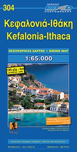
Goede overzichtskaart  van Kefalonia. Als wandelkaart iets minder, dan is de Anavasi beter. From Road Editions-probably the best range of maps available to cover Greece. Road Editions constantly update their data and mapping. This map of Kefalonia and Ithaca shows the Islands with unique accuracy, with data produced using the industrys most advance...

Webshops met dit product

Webshop
Bezorging
Prijs

Anderen bekeken ook

Wegenkaart - landkaart 304 Kefalonia - Ithaca | Road Editions
Goede overzichtskaart  van Kefalonia. Als wandelkaart iets minder, dan is de Anavasi beter. From Road Editions-probably the best range of maps available to cover Greece. Road Editions constantly update their data and mapping. This map of Kefalonia and Ithaca shows the Islands with unique accuracy, with data produced using the industrys most advanced techniques. The complete road networks of Kefalonia and Ithaca are shown, including forest roads, and with scenic routes shown in green. Contour lines-with coloured shading which darkens with increasing altitude-give an at-a-glance guide to the terrain. Also plenty of information such as churches gorges, peaks, caves, beaches, springs etc. Accurate distances of roads are printed midway between crossroads, and locations of refuelling sites are shown too. Streetmapping for Argostoli and Lixouri are inset at the top of the sheet. Reverse holds a list of hotels on both islands with their class, telephone/fax numbers, along with lots of tourist …
8,95
Wandelkaart Kefalonia & Ithaca | Discovery Walking Guides
Scheur- en watervaste wandelkaart van Kefalonia en Ithaka met hoogtelijnen en graden. Kefalonia was popularised and made famous by "Captain Corelli's Mandolin". For your best adventures, use the best map. Water-proof, split-proof, tear-proof, adventure-proof.   Kefalonia & Ithaca Tour & Trail Super-Durable Map is simply the toughest, most accurate, easy to read, easy to use map of the island you can buy at any price. A large 960mm by 690mm double sided map sheet has both Kefalonia and Ithaca at 1:40,000 scale with the North-West of Kefalonia on the cover side and the South-East of Kefalonia with neighbouring island Ithaca on the reverse. A generous common overlap of Kefalonia reduces the need to turn the map over when navigating.   Our special concertina map fold makes your map easy to open and easy to refold to its 230mm by 120mm pocket size. Our legendary 'Tour & Trail' level of detail ranges from major roads to secondary roads to minor roads to streets and narrow country roads, plus…
15,95
Wandelkaart - Wegenkaart - landkaart Kefallonia - Kefalonia | Freytag
Goede wegenkaart van Kefallonia / Kefalonia, waarbij ook de kleinere wegen nog goed te lezen zijn. Gedetailleerde schaal van 1:50.000. Veel toeristische symbolen voor bezienswaardigheden als grotten, tempels, opgravingen maar ook mooie stranden etc. Ook handig is de Nederlandstalige Reisgids van Kefalonia "Ontdek Kefalonia" "Ontdek Kefalonia" Explore Kefallonia, the largest of the Ionian Islands located in Greece; with this Freytag & Berndt single-sided road and leisure map. The map will allow you to travel independently, and plan your journey well.   The map also features full colour photographs of some of the scenery to be found on Kefallonia, as well as an inset showing Kefallonia's position within the nation of Greece. An inset is also provided showing a city plan of the main township on Kefallonia, Argostoli. The topography is clear, with shading showing land gradients.    As with all Freytag & Berndt maps, icons and markings are used to denote tourist information and points of in…
14,95
Wegenkaart - landkaart 107 Serifos | Road Editions
Gedetailleerde wegenkaart met aanduiding van de wandelwegen, lijst van hotels en toeristische informatie. Voor alle doeleinden een zeer geschikte kaart. The features that make this and every other ROAD island map unique are: *The coastline, hydrography and precision geophysical background based on data provided by the Hellenic Military Geographic Service and electronically processed by us for clarity and legibility. We have highlighted the mountain masses in shades of brown between the contour lines (at 20m intervals on this map) to outline clearly the relief of the island. *The beaches are indicated by a special symbol next to which we have noted their names, as well as all the roads and footpaths leading to them (since most people primarily visit the islands for the beaches!). We have even included a short text in which the island’s best beaches are concisely referred to, to save you going on a wild goose hunt in search of them. *The road network is mapped out with impressive and exe…
8,25
Wegenkaart - landkaart 216 Skyros | Road Editions
Gedetailleerde wegenkaart met aanduiding van de wandelwegen, lijst van hotels en toeristische informatie. Voor alle doeleinden een zeer geschikte kaart. At last, a reliable and accurate map of Skyros island is available to the demanding traveler! Although Skyros(located in the central Aegean Sea, 22 nautical miles east of Evia Prefecture) is not a popular touristic destination, ROAD Editions published this map to contribute to the touristic development of this beautiful greek island. This Skyros island map incorporates the new specifications of ROAD Editions' Greek Islands Map Series: the backside of the map is a mini travel guide in full color, with many images and all the nessesary information on the touristic sights and the individual character of this island. It also includes a complete list of the hotels and rooms to let in the island, many usefull telephone numbers, and a note on the island's history. The map of Skyros presents the complete road network of the island, against a g…
8,95
Wegenkaart - landkaart 109 Sifnos | Road Editions
Gedetailleerde wegenkaart met aanduiding van de wandelwegen, lijst van hotels en toeristische informatie. Voor alle doeleinden een zeer geschikte kaart. The features that make this and every other ROAD island map unique are: *The coastline, hydrography and precision geophysical background based on data provided by the Hellenic Military Geographic Service and electronically processed by us for clarity and legibility. We have highlighted the mountain masses in shades of brown between the contour lines (at 20m intervals on this map) to outline clearly the relief of the island. *The beaches are indicated by a special symbol next to which we have noted their names, as well as all the roads and footpaths leading to them (since most people primarily visit the islands for the beaches!). We have even included a short text in which the island’s best beaches are concisely referred to, to save you going on a wild goose hunt in search of them. *The road network is mapped out with impressive and exe…
8,95

Klanten-reviews van Wegenkaart - landkaart 304 Kefalonia - Ithaca | Road Editions

Er zijn nog geen beoordelingen voor dit productBen jij de eerste die een review plaatst?

Meer over Wegenkaart - landkaart 304 Kefalonia - Ithaca | Road Editions

Productomschrijving

Goede overzichtskaart  van Kefalonia. Als wandelkaart iets minder, dan is de Anavasi beter. From Road Editions-probably the best range of maps available to cover Greece. Road Editions constantly update their data and mapping. This map of Kefalonia and Ithaca shows the Islands with unique accuracy, with data produced using the industrys most advanced techniques. The complete road networks of Kefalonia and Ithaca are shown, including forest roads, and with scenic routes shown in green. Contour lines-with coloured shading which darkens with increasing altitude-give an at-a-glance guide to the terrain. Also plenty of information such as churches gorges, peaks, caves, beaches, springs etc. Accurate distances of roads are printed midway between crossroads, and locations of refuelling sites are shown too. Streetmapping for Argostoli and Lixouri are inset at the top of the sheet. Reverse holds a list of hotels on both islands with their class, telephone/fax numbers, along with lots of tourist information, and historical data.

Productspecificaties

Artikelnummer(s)
Brand
Road Editions
Webshop.nl maakt gebruik van cookies. Ga je verder op onze website, ga dan akkoord met het plaatsen van cookies en de verwerking van deze data door ons en vermelde partners.