Wegenkaart - landkaart 304 Kefalonia - Ithaca | Road Editions
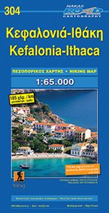
Goede overzichtskaart van Kefalonia. Als wandelkaart iets minder, dan is de Anavasi beter. From Road Editions-probably the best range of maps available to cover Greece. Road Editions constantly update their data and mapping. This map of Kefalonia and Ithaca shows the Islands with unique accuracy, with data produced using the industrys most advanced techniques. The complete road networks of Kefalonia and Ithaca are shown, including forest roads, and with scenic routes shown in green. Contour lines-with coloured shading which darkens with increasing altitude-give an at-a-glance guide to the terrain. Also plenty of information such as churches gorges, peaks, caves, beaches, springs etc. Accurate distances of roads are printed midway between crossroads, and locations of refuelling sites are shown too. Streetmapping for Argostoli and Lixouri are inset at the top of the sheet. Reverse holds a list of hotels on both islands with their class, telephone/fax numbers, along with lots of tourist …
8,95


