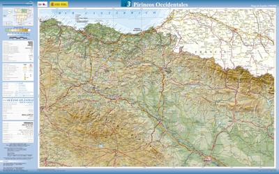
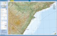
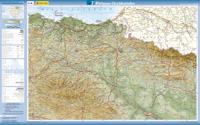
Wegenkaart - landkaart 3 Pirineos Occidentales - Westelijke Pyreneeën | CNIG - Instituto Geográfico Nacional1

0

Verkopers met dit product

Verkoper
Bezorging
Prijs
DeZwerver.nl logo
DeZwerver.nl
2,95
7,95

Anderen bekeken ook

Wegenkaart - landkaart 145 Pirineos Centrales - Spaanse Pyreneeën | Michelin
Speciale serie van Michelin met de naam ZOOM. Deze kaarten bedekken een deel van Spanje op behoorlijk gedetailleerd nivo. Er zijn nauwelijks andere kaarten die deze mate van detail halen. Voor toeristische hoogtepunten en vele andere zaken worden symbolen gebruikt die voor zich speken. Er is een legenda en van de streek zijn van de belangrijkste steden een kleine maar bruikbare plattegrond bijgevoegd. Vanwege de schaal - 1:150.000 - is deze kaart niet alleen voor de auto maar zeker ook voor de fiets zeer geschikt. Helaas dekt de serie niet het hele land. Aragon, Béarn, Bigorre, Lourdes, Pyrénées, Pyrénées Centrales
10,95
Wegenkaart - landkaart Kosovo & Westelijke Balkan | ITMB
Kosovo is the country that shouldn’t exist, but does. When Yugoslavia fells to pieces after Tito died, Kosovo was lumped in with Serbia but was very unhappy with being a part of an Eastern Orthodox regime. It broke away, resulting in genocidal fighting until the Americans stepped in and stopped the fighting. The region was then placed under a European Union control in the faint hope that it would merge with Albania, or Montenegro, but it didn’t. Relations with Serbia are still quite strained, but Kosovo is still surviving as a mountainous Balkan state. Fought over for centuries by Turks and Serbs, Kosovo is emerging as a small but touristic European country. This is definitely an off-the-beaten-path travel destination! The second side of the sheet provides an excellent regional coverage for the Western Balkans, essentially Slovenia, Croatia, Montenegro, Serbia, and reasonably large tracks of land for Hungary, Albania, and North Macedonia, showing the growing number of wilderness parks…
13,95
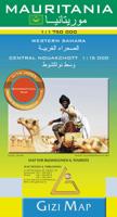
Wegenkaart - landkaart Mauritania - Mauritanië en Westelijke Sahara | Gizi Map
Tweetalig Mauritania and Western Sahara with excellent topographic information on an indexed map with a street plan of central Nouakchot. Vivid altitude colouring with graphics for deserts, flood plains and salt flats shows the terrain. Oases, water wells and numerous spot heights are marked and the map provides plenty of names of geographical features: peaks, mountain chains and rock outcrops, plains, etc.    Road network shows distances on main roads and includes dirt tracks. The map also shows locations of local airfields and the route of the iron ore railway line from the mines at Zouérat to the coast. Symbols highlight various places of tourist interest including world heritage sites, forts and archaeological remains, national parks and protected areas, beaches, etc.   Names of main towns and important geographical features are also given in Arabic. Internal administrative boundaries are shown with names of the provinces. The map had latitude and longitude lines at intervals of 1…
15,95
Wegenkaart - landkaart 3327 Adventure Map Western Balkans - Westelijke Balkan | National Geographic
Wegenkaart van de Westelijke Balkan met vermelding van veel bezienswaardigheden en attrakties. Watervast en scheurvast. Juist door deze vermeldingen onderscheidt de kaart zich van andere wegenkaarten. Landen: Slovenië, Kroatië, Bosnië Herzegovina, Montenegro, Albanië, Servië,  Kosovo, and Macedonië.   The Western Balkans region, an adventure playground and rising star of Europe, is loaded with Old World traditions, slow food culture, ancient towns, and rarely visited villages. The area stretches from the Adriatic Sea in the west, up and over mountain ranges, raging rivers, tectonic lakes, steep gorges, and thousands of miles of paths, trails, and routes. Discover eight countries—all with their special brand of Balkan magic: Slovenia, Croatia, Bosnia and Herzegovina, Montenegro, Albania, Serbia, Kosovo, and Macedonia.   National Geographic's Western Balkans Adventure Map will meet the needs of travelers with its detailed and accurate information. The map includes the locations of UNESC…
17,50

Klanten-reviews van Wegenkaart - landkaart 3 Pirineos Occidentales - Westelijke Pyreneeën | CNIG - Instituto Geográfico Nacional1

Er zijn nog geen beoordelingen voor dit productBen jij de eerste die een review plaatst?

Meer over Wegenkaart - landkaart 3 Pirineos Occidentales - Westelijke Pyreneeën | CNIG - Instituto Geográfico Nacional1

Productinformatie

    Verken gerelateerde categorieën

    Webshop.nl maakt gebruik van cookies. Ga je verder op onze website, ga dan akkoord met het plaatsen van cookies en de verwerking van deze data door ons en vermelde partners.