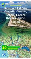
Wegenkaart - landkaart 3 Central Greece - Midden Griekenland, Thessalie en Epirus | Anavasi

0
Gedetailleerde tweetalige (Grieks/Engels) topografische wegenkaart van het centrale gedeelte van Griekenland - Thessalië en Epiros met hoogtelijnen, relief, gedetailleerd wegennet met wegnummers, campings en hutten. Met ingetekende Europese en nationale lange afstandswandelpaden. Anavasi Regional Maps series (Topo250), covering half of the mainlan...

Verkopers met dit product

Verkoper
Bezorging
Prijs
DeZwerver.nl logo
DeZwerver.nl
2,95
11,95

Anderen bekeken ook

Wegenkaart - landkaart 3 Central Greece - Midden Griekenland, Thessalie en Epirus | Anavasi
Gedetailleerde tweetalige (Grieks/Engels) topografische wegenkaart van het centrale gedeelte van Griekenland - Thessalië en Epiros met hoogtelijnen, relief, gedetailleerd wegennet met wegnummers, campings en hutten. Met ingetekende Europese en nationale lange afstandswandelpaden. Anavasi Regional Maps series (Topo250), covering half of the mainland from Konitsa to Katerini in the north and from Messolongi to Thiva in the south. The map comprises all the new highways, the protected areas and Natura sites, the european and national long distance trails and a 84 pages index of settlements, mountains and mountain refuges. Double-sided roadmap and place name index, GPS compatible regional road maps printed on waterproof and tear-resistant plastic paper
11,95
Wegenkaart - landkaart 4 Macedonia | Anavasi
Gedetailleerde tweetalige (Grieks/Engels) topografische wegenkaart van Griekse Macedonië met hoogtelijnen, relief, gedetailleerd wegennet met wegnummers, campings en hutten. Met ingetekende Europese en nationale lange afstandswandelpaden. Anavasi Regional Maps series (Topo250), covering half of the mainland from Konitsa to Katerini in the north and from Messolongi to Thiva in the south. The map comprises all the new highways, the protected areas and Natura sites, the european and national long distance trails and a 84 pages index of settlements, mountains and mountain refuges. Double-sided roadmap and place name index, GPS compatible regional road maps printed on waterproof and tear-resistant plastic paper
11,95
Wegenatlas Central Greece - Centraal Griekenland | Anavasi
Gedetailleerde atlas van het centrale gedeelte van Griekenland, 16 bladzijdes met 1/250.000 en 219 blz. 1/50.000, hoogtelijnen ,tweetalig met grid GGR87 en WGS84 en een uitgebreid register.   Zeer geschikt voor de wandelaar en de fietser ;  de wandelroutes E4 en 022 staan ingetekend.   Qua jaartal van uitgave een tikkie oud, maar op dit gedetailleerd nivo in Centraal Griekenland is nog nauwelijks wat veranderd.    The map background includes all available cartographic information and allows accurate geographic reference for each topic: hiking, monuments, place names, geography. Geophysical relief, complete hydrography  and place names. Greek, English and German Introduction. Legend in 4 languages (Greek, English, French, German). Bilingual edition: Greek and Latin letters on maps, indexes in Greek and latin characters in settlements, religious and archaeological monuments. Hardcover edition.  
26,95
Wegenkaart - landkaart - Fietskaart 4 Touring Map Thessaly - central Greece, centraal Griekenland | Terrain maps
Landkaart van een deel van Griekenland met zeer veel plaatsen, kleine wegen, hoogtelijnen en toeristische informatie in symbolen aangegeven, met plaatsnamenregister - schaal 1:200.000. De kaart wordt veel gebruikt door fietsers vanwege de mate van detail, is watervast en GPS-geschikt. We walked all trails. We drove all roads. We sailed around each and every island. We recorded every single sight. And we proudly present the best maps ever made for travelers of Greece. Terrain maps are the only maps featuring:   100% field research Waterproof, rip-proof Polyart paper Highly detailed coastline mapping Climbing, biking, diving and canyoning information The new era in cartography is here. It was made for you, the demanding traveler, explorer, and nature lover. Forget about compromises and pseudo-maps. Travel with the best. Travel with Terrain.
13,50
Fietskaart - Wegenkaart - landkaart 3 Touring Map Epirus en westelijk (grieks) Macedonié - Griekenland | Terrain maps
Landkaart van een deel van Griekenland met zeer veel plaatsen, kleine wegen, hoogtelijnen en toeristische informatie in symbolen aangegeven, met plaatsnamenregister - schaal 1:200.000. De kaart wordt veel gebruikt door fietsers vanwege de mate van detail, is watervast en GPS-geschikt.   Detailed and updated map of Epirus including a large part of western Macedonia, as well as the islands of Corfu, Paxi, Antipaxi, Erikoussa, Mathraki and Othoni. It uses G.I.S. (Geographical Information Systems) technology and the WGS84 reference system, supplemented by a ΕΓΣΑ87 grid.    Like all of TERRAIN’s large maps, the map of Epirus is printed on Polyart, which is extremely durable against folding and unfolding, does not rip, and is 100% waterproof.    Based on field research completed in 2013, this map features all the newest national motorways, their interchanges, toll stations and Motorway Service Stations, as well as Egnatia motorway, its interchanges and vertical axes, and the border cro…
13,50
Wegenkaart - landkaart 93 Kreta centraal - midden Heraklion en Rethimnon | Anavasi
Gebaseerd op topografische kaarten, GPS compatible, gedrukt op watervast en scheurvast papier. Hoogtelijnen met 100 m interval, schaduwkleuren en punten met hoogte geven de topografie van het landschap aan. De kaart kent een UTM grid. Het wegennet wordt aangeduid met verschillende gradaties: grote en kleine wegen, verhard en onverhard. Toeristische bezienswaardigheden staan als zodanig aangeduid zoals thermen, kloosters, berghutten, grotten etc. Namen van steden zowel in het normale schrift als in het Grieks, met een legenda die ook in het Engels is. One of the three maps of the successful series of touring maps of Crete in a scale of 1:100,000 maps covering the whole island with great detail. Small additions and updating of road network, the new municipalities and some visual touches (palette relief and cover). On the reverse side of the map fully indexed settlements and cardboard folnter presentation of 10 Top points of interest on the map.  
11,95
Wegenkaart - landkaart 2 Peloponnese - Peloponnesos | Anavasi
De nieuwe editie van de kaart van de Peloponnesus komt met veel verbeteringen. De grotere schaal maakt het veel leesbaarder en laat gedetailleerde informatie van de kaart zien: Uitgebreid weg- en vestigingsnetwerk. Tal van archeologische sites die voor het eerst op een kaart worden gepubliceerd. Stranden, kamperen, jachthavens, berghutten en de loop van de E4 en de belangrijkste nationale paden 31, 32 en 33. En een innovatie: 10 suggesties voor unieke sites om te bezoeken aan de zijkant van de kaart. Road and touring map of the Peloponnese in scale 1:200 000. On the map find ideas for 10 top nature destinations. Planning a road trip in the Peloponnese? This is the map to take with you. It shows all road categories, to the last dirt road. Every settlement, stating their original name, when known. Plenty of archaeological sites published for the first time on a map. Beaches, camping, marinas, mountain refuges and the course of the E4 and the major national paths 31, 32 and 33. Map corre…
11,95
Wegenkaart - landkaart 92 Kreta oost - Lasithi | Anavasi
Gebaseerd op topografische kaarten, GPS compatible, gedrukt op watervast en scheurvast papier. Hoogtelijnen met 100 m interval, schaduwkleuren en punten met hoogte geven de topografie van het landschap aan. De kaart kent een UTM grid. Het wegennet wordt aangeduid met verschillende gradaties: grote en kleine wegen, verhard en onverhard. Toeristische bezienswaardigheden staan als zodanig aangeduid zoals thermen, kloosters, berghutten, grotten etc. Namen van steden zowel in het normale schrift als in het Grieks, met een legenda die ook in het Engels is. Van de uitgever This map includes all the information a traveler needs to discover Eastern Crete. It includes the entire road network from the biggest arteries to the smallest dirt roads, paths and trails, all the towns and villages, beaches and toponyms. In addition to the above, you will find the E4 route from Dikti to Zakros that crosses the entire inland of Eastern Crete. On the reverse side you will find sections of the E4 route with…
11,95
Wegenkaart - landkaart 1 Griekenland | Anavasi
Kaart van Griekenland bijgewerkt - Uitgebreide thematische informatie - Duurzaam Het ultieme hulpmiddel voor reizigers die Griekenland willen verkennen en leren kennen. Nieuwe snelwegen en hoofdwegverbindingen. Luchthavens, veerverbindingen, spoorwegen en georganiseerde jachthavens. Alle belangrijke bezienswaardigheden, archeologische vindplaatsen, kloosters, kastelen, grotten, skigebieden, thermale baden, nationale parken, UNESCO Werelderfgoed, geoparken Alle langeafstandsroutes, zoals de Europese en Nationale routes die Griekenland doorkruisen, maar ook de lange routes zoals de Menalo-route, Epirus-route, Nestos-Rodopi-route etc. (Van de achterkant van de versie)
12,50

Klanten-reviews van Wegenkaart - landkaart 3 Central Greece - Midden Griekenland, Thessalie en Epirus | Anavasi

Er zijn nog geen beoordelingen voor dit productBen jij de eerste die een review plaatst?

Meer over Wegenkaart - landkaart 3 Central Greece - Midden Griekenland, Thessalie en Epirus | Anavasi

Productomschrijving

Gedetailleerde tweetalige (Grieks/Engels) topografische wegenkaart van het centrale gedeelte van Griekenland - Thessalië en Epiros met hoogtelijnen, relief, gedetailleerd wegennet met wegnummers, campings en hutten. Met ingetekende Europese en nationale lange afstandswandelpaden.

Anavasi Regional Maps series (Topo250), covering half of the mainland from Konitsa to Katerini in the north and from Messolongi to Thiva in the south. The map comprises all the new highways, the protected areas and Natura sites, the european and national long distance trails and a 84 pages index of settlements, mountains and mountain refuges.

Double-sided roadmap and place name index, GPS compatible regional road maps printed on waterproof and tear-resistant plastic paper

Productinformatie

    Verken gerelateerde categorieën

    Webshop.nl maakt gebruik van cookies. Ga je verder op onze website, ga dan akkoord met het plaatsen van cookies en de verwerking van deze data door ons en vermelde partners.