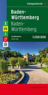
Wegenkaart - landkaart 3 Baden-Württemberg | Freytag & Berndt

0
Goede wegenkaart van een deel van Duitsland. Helder kleurgebruik, tweezijdig waardoor meer gedetailleerd met veel toeristische informatie. Met register.   The map highlights picturesque towns and national parks, with a range of symbols marking campsites, youth hostels, museums, spas, various landmarks and places of interest. As with all Freytag & ...

Verkopers met dit product

Verkoper
Bezorging
Prijs
DeZwerver.nl logo
DeZwerver.nl
2,95
14,95

Anderen bekeken ook

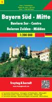
Wegenkaart - landkaart 1 Beieren zuid - Bayern sud | Freytag & Berndt
Goede wegenkaart van een deel van Duitsland. Helder kleurgebruik, tweezijdig waardoor meer gedetailleerd met veel toeristische informatie. Met register. Explore the central-south of Bavaria with this Freytag&Berndt double-sided road map. The best way to plan your trip, prepare your itinerary, and to travel independently in this part of Regensburg, Nurnberg, Augsburg, Munich (Munchen), Garmisch-Partenkirschen and Passau.   The map highlights picturesque towns and national parks, with a range of symbols marking campsites, youth hostels, museums, spas, various landmarks and places of interest. As with all Freytag & Berndt maps the cartography is clear and detailed with the topography shown by relief shading with plenty of spot heights.   A localities index with postcodes is in a small booklet attached to the cover and the legend is in various languages including English.
14,95
Wegenkaart - landkaart 5 Hessen | Freytag & Berndt
Goede wegenkaart van een deel van Duitsland. Helder kleurgebruik, tweezijdig waardoor meer gedetailleerd met veel toeristische informatie. Met register.   The map highlights picturesque towns and national parks, with a range of symbols marking campsites, youth hostels, museums, spas, various landmarks and places of interest. As with all Freytag & Berndt maps the cartography is clear and detailed with the topography shown by relief shading with plenty of spot heights.   A localities index with postcodes is in a small booklet attached to the cover and the legend is in various languages including English
14,95
Wegenkaart - landkaart 6 Thüringen | Freytag & Berndt
Goede wegenkaart van een deel van Duitsland. Helder kleurgebruik, tweezijdig waardoor meer gedetailleerd met veel toeristische informatie. Met register.   The map highlights picturesque towns and national parks, with a range of symbols marking campsites, youth hostels, museums, spas, various landmarks and places of interest. As with all Freytag & Berndt maps the cartography is clear and detailed with the topography shown by relief shading with plenty of spot heights.   A localities index with postcodes is in a small booklet attached to the cover and the legend is in various languages including English
14,95
Wegenkaart - landkaart 10 Sachsen-Anhalt | Freytag & Berndt
Goede wegenkaart van een deel van Duitsland. Helder kleurgebruik, tweezijdig waardoor meer gedetailleerd met veel toeristische informatie. Met register.   The map highlights picturesque towns and national parks, with a range of symbols marking campsites, youth hostels, museums, spas, various landmarks and places of interest. As with all Freytag & Berndt maps the cartography is clear and detailed with the topography shown by relief shading with plenty of spot heights.   A localities index with postcodes is in a small booklet attached to the cover and the legend is in various languages including English
14,95
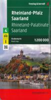
Wegenkaart - landkaart 4 Rheinland-Pfalz - Saarland | Freytag & Berndt
Uitstekende wegenkaart van Rheinland Pfalz en Saarland in Duitsland met schaal 1:200.000. Goede wegenkaart van een deel van Duitsland. Helder kleurgebruik, tweezijdig waardoor meer gedetailleerd met veel toeristische informatie. Met register.   The map highlights picturesque towns and national parks, with a range of symbols marking campsites, youth hostels, museums, spas, various landmarks and places of interest. As with all Freytag & Berndt maps the cartography is clear and detailed with the topography shown by relief shading with plenty of spot heights.   A localities index with postcodes is in a small booklet attached to the cover and the legend is in various languages including English
14,95
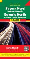
Wegenkaart - landkaart 2 Beieren Noord- Bayern nord | Freytag & Berndt
Goede wegenkaart van een deel van Duitsland. Helder kleurgebruik, tweezijdig waardoor meer gedetailleerd met veel toeristische informatie. Met register.   The map highlights picturesque towns and national parks, with a range of symbols marking campsites, youth hostels, museums, spas, various landmarks and places of interest. As with all Freytag & Berndt maps the cartography is clear and detailed with the topography shown by relief shading with plenty of spot heights.   A localities index with postcodes is in a small booklet attached to the cover and the legend is in various languages including English
14,95
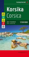
Wegenkaart - landkaart Corsica - Korsika | Freytag & Berndt
Deze bijzonder gedetailleerde Freytag & Berndt Wegenkaart van Corsica is aan één kant geprint en heeft een schaal van 1:150.000. Op deze kaart staan o.a. fietsroutes, lange afstandswandelpaden, toeristische wegen en bezienwaardigheden aangegeven. In de omslag van de kaart is een apart boekje geniet met een korte beschrijving van de TOP 10 van bezienswaardigheden, een uitgebreide index en plattegrondjes van enkele toeristische plaatsen. Explore the Mediterranean island of Corsica with this Freytag & Berndt single-sided road and leisure map. The best way to plan your trip, prepare your itinerary, and to travel independently on this region. As with all Freytag & Berndt maps, the cartography is clear and detailed with the topography shown with relief shading with plenty of spot heights.   This map features a full map of the island. Using Freytag & Berndt's icon system, important tourist information is shown. You will see icons for tourist information such as:   Picturesque towns and panor…
14,95
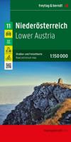
Wegenkaart - landkaart Niederösterreich | Freytag & Berndt
Uitstekende overzichtskaart, tweezijdig, met register, met veel details, alle berijdbare wegen etc.    Top 10 Tips" Map in a series of detailed road maps at 1:150,000 from Freytag & Berndt, covering popular tourist regions of Italy and highlighting each area's top 10 sights, all with brief descriptions in the accompanying booklets which also provide street plan(s) of main town(s) in the region.   Relief is portrayed by hill-shading without distracting from other detail. Road network shows minor roads and selected cart tracks, and includes information indispensable for happy holiday driving: motorway service stations and motels, gradients on steep roads, restricted entry for cars or caravans and seasonal closures, routes not recommended for caravans, scenic roads and special tourist routes, etc. Railways, cable cars, and ferry connections also shown, as well as selected long--distance hiking trails.   Picturesque towns are highlighted and 10 selected places of interest are prominently …
14,95
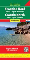
Wegenkaart - landkaart Kroatië Noord - Croatia North - Kroatien Nord | Freytag & Berndt
Bijzonder gedetailleerde wegenkaart van deel van Kroatië met alle belangrijke aanduidingen en toeristische symbolen. Met register en aanduiding van campings en afstanden. De berijdbare wegen zijn goed weergeven, zowel de hoofdwegen als provinciale en lokale wegen; wegnummers worden vermeld. Afstanden tussen plaatsen zijn in kilometers op de kaart ingetekend, daarnaast worden ook op belangrijke plekken benzinepompen gemarkeerd.   In het kaartbeeld wordt door middel van schaduw het reliëf weergegeven en soms enkele punten in het landschap met de daadwerkelijke hoogte. Provinciegrenzen zijn goed terug te vinden, nationale parken en reservaten ook. Met allerhande symbolen worden toeristische bezienswaardigheden weergegeven als monumenten, historisch belangrijke plekken en uitzichtpunten. In bepaalde plaatsen zijn hotels en campings te vinden, luchthavens, treinverbindingen en havens vindt u er ook op!   Explore the northern territories of Croatia with this Freytag & Berndt double-sided r…
14,95
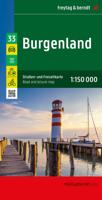
Wegenkaart - landkaart 33 Burgenland - Oostenrijk | Freytag & Berndt
Uitstekende overzichtskaart, tweezijdig, met register, met veel details, alle berijdbare wegen etc.    Top 10 Tips" Map in a series of detailed road maps at 1:150,000 from Freytag & Berndt, covering popular tourist regions of Italy and highlighting each area's top 10 sights, all with brief descriptions in the accompanying booklets which also provide street plan(s) of main town(s) in the region.   Relief is portrayed by hill-shading without distracting from other detail. Road network shows minor roads and selected cart tracks, and includes information indispensable for happy holiday driving: motorway service stations and motels, gradients on steep roads, restricted entry for cars or caravans and seasonal closures, routes not recommended for caravans, scenic roads and special tourist routes, etc. Railways, cable cars, and ferry connections also shown, as well as selected long--distance hiking trails.   Picturesque towns are highlighted and 10 selected places of interest are prominently …
14,95

Klanten-reviews van Wegenkaart - landkaart 3 Baden-Württemberg | Freytag & Berndt

Er zijn nog geen beoordelingen voor dit productBen jij de eerste die een review plaatst?

Meer over Wegenkaart - landkaart 3 Baden-Württemberg | Freytag & Berndt

Productomschrijving

Goede wegenkaart van een deel van Duitsland. Helder kleurgebruik, tweezijdig waardoor meer gedetailleerd met veel toeristische informatie. Met register.   The map highlights picturesque towns and national parks, with a range of symbols marking campsites, youth hostels, museums, spas, various landmarks and places of interest. As with all Freytag & Berndt maps the cartography is clear and detailed with the topography shown by relief shading with plenty of spot heights.   A localities index with postcodes is in a small booklet attached to the cover and the legend is in various languages including English

Verken gerelateerde categorieën

Webshop.nl maakt gebruik van cookies. Ga je verder op onze website, ga dan akkoord met het plaatsen van cookies en de verwerking van deze data door ons en vermelde partners.