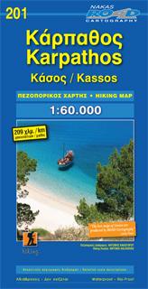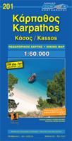
Wegenkaart - landkaart 201 Karpathos - Kassos | Road Editions

0
Gedetailleerde wegenkaart met aanduiding van de wandelwegen, lijst van hotels en toeristische informatie. Voor alle soorten vakanties, ook als wandel- en fietskaart goed te gebruiken. Easy to read map for Karpathos and Kassos with touristic information churches, monasteries, archaeological sites and castles as well as all the beaches, the altitude...

Verkopers met dit product

Verkoper
Bezorging
Prijs
DeZwerver.nl logo
DeZwerver.nl
2,95
9,95

Anderen bekeken ook

Wegenkaart - landkaart 201 Karpathos - Kassos | Road Editions
Gedetailleerde wegenkaart met aanduiding van de wandelwegen, lijst van hotels en toeristische informatie. Voor alle soorten vakanties, ook als wandel- en fietskaart goed te gebruiken. Easy to read map for Karpathos and Kassos with touristic information churches, monasteries, archaeological sites and castles as well as all the beaches, the altitudes of mountain peaks, the complete network of trails (footpaths), the lighthouses, the airport of course, and much more.
9,95
Wandelkaart 345 Karpathos - Kasos | Terrain maps
Gedetailleerde wegenkaart en wandelkaart met alle kleine wegen, wandelpaden, hoogtelijnen en toeristische informatie aangegeven. Alle tekst is tweetalig in Engels en Grieks en de waterproof kaart is geschikt voor gebruik met GPS. This is a great map because: • It is the first GIS map of the island, meaning that this is the first time Karpathos and Kasos are mapped with a topographic precision in proportion to the map scale. • It is waterproof and rip-proof. You can fold and unfold it a thousand times, fold it in irregular ways, dunk it in the sea or leave it out in the rain. This map is indestructible! • It features the most complete road network. No matter which corner of the island on the SKAI map of Karpathos you compare with any other map on the market, you will see that it features many more roads –most importantly, they are depicted with accuracy. • It features the trails of Karpathos and Kasos for the first time, with total precision since the cartographers of TERRAIN walked th…
11,95
Wegenkaart - landkaart 110 Milos Kimolos | Road Editions
Gedetailleerde wegenkaart met aanduiding van de wandelwegen, lijst van hotels en toeristische informatie. Voor alle doeleinden een zeer geschikte kaart. Though not among the top ten most popular destinations in the Aegean, these are two beautiful islands with a unique character, ideal for quiet family holidays, and nature touring, as well as for the young crowd looking for exciting summer fun. This is the best, most updated and easy to read map available of Milos and Kimolos. As all ROAD maps, it was designed following careful and exhaustive onsite research. We used the most advanced technology to precisely map the entire road networks of these two islands, we measured the distances in kilometers from intersection to intersection with precision instruments, marked all country churches, monasteries, archaeological sites and castles on these islands, as we did the beaches and the roads leading to them, the altitudes of mountain peaks, the footpaths we were able to locate and record, the…
9,95
Wandelkaart 10.50 Karpathos | Anavasi
Zeer goede kaart van Karpathos. Topografische details zijn goed uitgewerkt, zeer leesbare kaart met ook nog eens alle toeristisch interessante punten. Karpathos, a mountainous island with rugged terrain and magnificent landscapes, is one of the most authentic places in Greece. It has endless sandy beaches in the south and secluded coves with emerald-blue waters in the north. The more developped south of the island is popular to surfers while the north still keeps folkways alive especially in the magical village of Olymbos, perched on a saddle between two mountains and two seas. Off the northern tip of Kárpathos, separated from it by a narrow channel is the uninhabited island of Sariá with old agricultural settlements and remains of medieval houses at Palatia. This new detailed map of Anavasi proposes 12 hiking trails in the north and 6 in the south and presents the major highlights of the island.
9,95
Wegenkaart - landkaart 216 Skyros | Road Editions
Gedetailleerde wegenkaart met aanduiding van de wandelwegen, lijst van hotels en toeristische informatie. Voor alle doeleinden een zeer geschikte kaart. At last, a reliable and accurate map of Skyros island is available to the demanding traveler! Although Skyros(located in the central Aegean Sea, 22 nautical miles east of Evia Prefecture) is not a popular touristic destination, ROAD Editions published this map to contribute to the touristic development of this beautiful greek island. This Skyros island map incorporates the new specifications of ROAD Editions' Greek Islands Map Series: the backside of the map is a mini travel guide in full color, with many images and all the nessesary information on the touristic sights and the individual character of this island. It also includes a complete list of the hotels and rooms to let in the island, many usefull telephone numbers, and a note on the island's history. The map of Skyros presents the complete road network of the island, against a …
9,95
Wandelgids Rhodos, Karpathos, Kos and southern Dodecanese | Graf editions
Engelstaige wandelgids. Rhodos, Karpathos, Kos en de zuidelijke Dodekanesos. van de uitgever   This book describes the loveliest old walking trails. With precise descriptions and route photos of outstanding points for better orientation. And lots of interesting facts worth knowing about the Dodecanese Islands. It is made for island hoppers who want to drift through the island world by ship and who would also like to hike and swim in this ancient cultural landscape. Ten to twelve islands, among them very small ones, are described in each book, except for Walking on Naxos and Walking on Samos with only one island respectively.   The walks are carefully selected so that places of cultural significance as well as lonesome beaches can be found along the way. Exploring the remaining ancient mule tracks and marble plated roads make the walks especially enjoyable. Each walk is characterized by a precise and plain text as well as a detailed map. Six to four photos of distinctive places a…
19,50
Wegenkaart - landkaart 107 Serifos | Road Editions
Gedetailleerde wegenkaart met aanduiding van de wandelwegen, lijst van hotels en toeristische informatie. Voor alle doeleinden een zeer geschikte kaart. The features that make this and every other ROAD island map unique are: *The coastline, hydrography and precision geophysical background based on data provided by the Hellenic Military Geographic Service and electronically processed by us for clarity and legibility. We have highlighted the mountain masses in shades of brown between the contour lines (at 20m intervals on this map) to outline clearly the relief of the island. *The beaches are indicated by a special symbol next to which we have noted their names, as well as all the roads and footpaths leading to them (since most people primarily visit the islands for the beaches!). We have even included a short text in which the island’s best beaches are concisely referred to, to save you going on a wild goose hunt in search of them. *The road network is mapped out with impressive and ex…
9,95
Wegenkaart - landkaart 109 Sifnos | Road Editions
Gedetailleerde wegenkaart met aanduiding van de wandelwegen, lijst van hotels en toeristische informatie. Voor alle doeleinden een zeer geschikte kaart. The features that make this and every other ROAD island map unique are: *The coastline, hydrography and precision geophysical background based on data provided by the Hellenic Military Geographic Service and electronically processed by us for clarity and legibility. We have highlighted the mountain masses in shades of brown between the contour lines (at 20m intervals on this map) to outline clearly the relief of the island. *The beaches are indicated by a special symbol next to which we have noted their names, as well as all the roads and footpaths leading to them (since most people primarily visit the islands for the beaches!). We have even included a short text in which the island’s best beaches are concisely referred to, to save you going on a wild goose hunt in search of them. *The road network is mapped out with impressive and ex…
9,95

Klanten-reviews van Wegenkaart - landkaart 201 Karpathos - Kassos | Road Editions

Er zijn nog geen beoordelingen voor dit productBen jij de eerste die een review plaatst?

Meer over Wegenkaart - landkaart 201 Karpathos - Kassos | Road Editions

Productomschrijving

Gedetailleerde wegenkaart met aanduiding van de wandelwegen, lijst van hotels en toeristische informatie. Voor alle soorten vakanties, ook als wandel- en fietskaart goed te gebruiken.

Easy to read map for Karpathos and Kassos with touristic information churches, monasteries, archaeological sites and castles as well as all the beaches, the altitudes of mountain peaks, the complete network of trails (footpaths), the lighthouses, the airport of course, and much more.

Productinformatie

    Verken gerelateerde categorieën

    Webshop.nl maakt gebruik van cookies. Ga je verder op onze website, ga dan akkoord met het plaatsen van cookies en de verwerking van deze data door ons en vermelde partners.