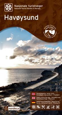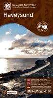
Wegenkaart - landkaart 20017 Nasjonale Turistveger Havøysund | Nordeca

0
Speciale map met daarin een wegenkaart van een Nationale Toerist Route in Noorwegen. Naast een gedetailleerde landkaart van schaal 1: 50.000 met hoogtelijnen en toeristische aanduidingen staat op de achterzijde toeristische informatie, alsmede adressen voor eten, drinken en overnachting.   De kaart beschrijft spectaculaire uitzichtpunten, natuurfe...

Verkopers met dit product

Verkoper
Bezorging
Prijs
DeZwerver.nl logo
DeZwerver.nl
2,95
29,95

Anderen bekeken ook

Wegenkaart - landkaart 20008 Nasjonale Turistveger Sognefjellet | Nordeca
Speciale map met daarin een wegenkaart van een Nationale Toerist Route in Noorwegen. Naast een gedetailleerde landkaart van schaal 1: 80.000 met hoogtelijnen en toeristische aanduidingen staat op de achterzijde toeristische informatie, alsmede adressen voor eten, drinken en overnachting.   De kaart beschrijft spectaculaire uitzichtpunten, natuurfenomenen, attracties, accommodaties, horeca en bezienswaardigheden langs de Nationale Toeristenweg. De teksten op de kaart zijn drietalig: Noors, Engels en Duits.   En elke map is ook nog eens voorzien van 5 XL-ansichtkaarten van het gebied. Als aandenken of om te versturen.   This journey along a route that has connected Norway between east and west for centuries includes Northern Europes highest mountain pass, at 1 434 metres above sea level. The Sognefjell road starts in the lush cultural landscape of Bøverdalen valley in the east and crosses the mountain plateau, with panoramic views of glaciers and towering mountains, before descending th…
29,95
Wegenkaart - landkaart 20006 Nasjonale Turistveger Valdresflye | Nordeca
Speciale map met daarin een wegenkaart van een Nationale Toerist Route in Noorwegen. Naast een gedetailleerde landkaart van schaal 1: 50.000 met hoogtelijnen en toeristische aanduidingen staat op de achterzijde toeristische informatie, alsmede adressen voor eten, drinken en overnachting.   De kaart beschrijft spectaculaire uitzichtpunten, natuurfenomenen, attracties, accommodaties, horeca en bezienswaardigheden langs de Nationale Toeristenweg. De teksten op de kaart zijn drietalig: Noors, Engels en Duits.   The road across the Valdresflye plateau offers sweeping views of mountains and open expanses, from which it seems to swoop into the Jotunheimen massif like the beginning of an endless journey. To the north, you can catch a view of the Jotunheimen National Park, where the mountains are steeper and wilder than to the south, where the landscape widens into serene, rolling hills. Here, cultural landscapes dominate, with mountain pastures and a number of tourist lodges that have long tr…
29,95
Wegenkaart - landkaart 20002 Nasjonale Turistveger Ryfylke | Nordeca
Speciale map met daarin een wegenkaart van een Nationale Toerist Route in Noorwegen. Naast een gedetailleerde landkaart van schaal 1: 50.000 met hoogtelijnen en toeristische aanduidingen staat op de achterzijde toeristische informatie, alsmede adressen voor eten, drinken en overnachting.   De kaart beschrijft spectaculaire uitzichtpunten, natuurfenomenen, attracties, accommodaties, horeca en bezienswaardigheden langs de Nationale Toeristenweg. De teksten op de kaart zijn drietalig: Noors, Engels en Duits.   En elke map is ook nog eens voorzien van 5 XL-ansichtkaarten van het gebied. Als aandenken of om te versturen.   This route through constantly changing scenery brings you from lush fjords to stark mountains. The drive through the Ryfylke region is a varied one, with small towns and communities interspersed among flourishing farmland and a versatile business and industrial base. Sauda, which is famous for its smelting industry, is situated between mountain peaks and waterfalls inne…
29,95
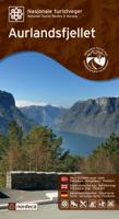
Wegenkaart - landkaart 20005 Nasjonale Turistveger Aurlandsfjellet | Nordeca
Speciale map met daarin een wegenkaart van een Nationale Toerist Route in Noorwegen. Naast een gedetailleerde landkaart van schaal 1: 50.000 met hoogtelijnen en toeristische aanduidingen staat op de achterzijde toeristische informatie, alsmede adressen voor eten, drinken en overnachting.   De kaart beschrijft spectaculaire uitzichtpunten, natuurfenomenen, attracties, accommodaties, horeca en bezienswaardigheden langs de Nationale Toeristenweg. De teksten op de kaart zijn drietalig: Noors, Engels en Duits.   En elke map is ook nog eens voorzien van 5 XL-ansichtkaarten van het gebied. Als aandenken of om te versturen.   This drive takes you from one fjord to the next via a high mountain crossing with snow along the road most of the summer. The viewing platform at Stegastein, a natural place to make a stop, provides a dizzying view of the fjord landscape. The Nærøyfjord, a designated World Heritage Site, offers breath-taking scenery. The Flåm railway line and the Aurlandsdalen valley, ot…
29,95
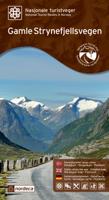
Wegenkaart - landkaart 20009 Nasjonale Turistveger Gamle Strynefjellsvegen | Nordeca
Speciale map met daarin een wegenkaart van een Nationale Toerist Route in Noorwegen. Naast een gedetailleerde landkaart van schaal 1: 50.000 met hoogtelijnen en toeristische aanduidingen staat op de achterzijde toeristische informatie, alsmede adressen voor eten, drinken en overnachting.   De kaart beschrijft spectaculaire uitzichtpunten, natuurfenomenen, attracties, accommodaties, horeca en bezienswaardigheden langs de Nationale Toeristenweg. De teksten op de kaart zijn drietalig: Noors, Engels en Duits.   En elke map is ook nog eens voorzien van 5 XL-ansichtkaarten van het gebied. Als aandenken of om te versturen.   This road between eastern and western Norway, which dates back over 100 years, is an experience in its own right. Old stone walls meticulously crafted by hand and long rows of guard stones define the character of the road leading across the mountain plateau. In the olden days, many routes through the mountains were used for transport on foot and on horseback, but the jou…
29,95
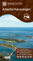
Wegenkaart - landkaart 20012 Nasjonale Turistveger Atlanterhavsveien | Nordeca
Speciale map met daarin een wegenkaart van een Nationale Toerist Route in Noorwegen. Naast een gedetailleerde landkaart van schaal 1: 50.000 met hoogtelijnen en toeristische aanduidingen staat op de achterzijde toeristische informatie, alsmede adressen voor eten, drinken en overnachting.   De kaart beschrijft spectaculaire uitzichtpunten, natuurfenomenen, attracties, accommodaties, horeca en bezienswaardigheden langs de Nationale Toeristenweg. De teksten op de kaart zijn drietalig: Noors, Engels en Duits.   En elke map is ook nog eens voorzien van 5 XL-ansichtkaarten van het gebied. Als aandenken of om te versturen.   Atlanterhavsvegen is a superb manifestation of successful interaction between people and nature. The seven bridges that arch between the islets and skerries on the edge of the ocean, providing magnificent views for travellers, are an outstanding feat of engineering. In 2005, Atlanterhavsvegen was awarded the distinction of being named Norway's Architectural Monument of t…
29,95
Wegenkaart - landkaart 04 Mpumalanga, Kruger National Park & Panorama Route | MapStudio
Toeristische wegenkaart met veel aanduidingen van interessante punten. Heldere kaart, goed leesbaar. speciaal stukje Africa: Mpumalanga, Kruger National Park and Panorama Route Road Map covers the entire Kruger National Park, includes a detailed exploring map of Mpumalanga and the Panorama Route, plans of camps in the Kruger National Park and is up-to-date with all research compiled and updated in Africa   Detailed streetmaps and site maps with text and photography of Pilgrims Rest, Mashishing (Lydenburg), Dullstroom, Sudwala Caves, eMakhazeni (Belfast), eNtokozweni (Machadodorp), White River, Sabie, eMgwenya (Waterval Boven), Hazyview, Mbombela (Nelspruit) and Barberton   Easy-to-use map symbols showing hotel, lodges, rest camps, campsites, concession areas, bush camps, private rest camps and lodges, caravan facilities, caves, lookout points, waterholes, hides and much more. Information on hiking, trekking, walking and fly-fishing areas. Along with an alphabetised index, enlarged map…
16,95
Wegenkaart - landkaart Kgalagadi - Tourist Map of Kgalagadi Transfrontier Park Botswana | Shell
Zeer bijzondere landkaart van het grensgebied van Botswana en Zuid Afrika. Uitermate handig zijn de GPS coordinaten van de meest belangrijke punten als campings of uitzichtpunten. De kaart is gebaseerd op een luchtfoto, waarbij alle details zijn ingetekend. The map: The map consists of a large map of the entire Park on the front of the map. On the back is enlargements of six maps - the South African side, Mabuasehube, Swart Pan area, Gemsbok Wilderness Trail, Mabuasehube Wilderness Trail and of the Kaa Kalahari Concession. Satellite images were used and the roads were tracked by GPS. There are 168 GPS coordinates on this map. Establishment of a Transfrontier Park: On the 7 th of April 1999 Botswana and South Africa signed a bilateral agreement in which they agreed to manage their adjacent national parks, Gemsbok National Park in Botswana and Kalahari Gemsbok National Park in South Africa, as a single ecological unit – the Kgalagadi Transfrontier Park. It is the first formally declared…
17,50
Fietskaart 10 Cycling guides North York Moors | Goldeneye
Scheur- en watervast foetskaart van de North York Moors  met ingetekende fietsroutes.   Our maps are double-sided, printed on an A2 sheet with a concertina fold. This allows for easy folding and folding, and an ease of access to the mapping. The material is rain and tear-resistant. Our early maps were designed at the scale of 2 miles to 1 inch/1:126,720. The later designs along with digitalisation are 1: 100,000. We were encouraged by the Cycle Touring Club to convert our cartography toward the cycle market (to replace the out-of-print Bartholomew series). As time and the series progressed we have added more data: The National Cycle Network routes, Regional Routes, and Traffic-Free Family Routes, as and when they are developed. These routes are in addition to the Circular Routes Goldeneye Commissioned at the outset of our publishing schedule. We are also adding to new editions; bike shops, cycle hire, and tea rooms, along with the tourist attractions already featured. Our plan is to m…
14,95
Wegenkaart - landkaart 738 Roemenië - Roemenie | Michelin
Zoals je van Michelin mag verwachten is deze kaart zeer overzichtelijk en heeft een duidelijk helder kaartbeeld. De kaart geeft uitgebreid toeristische informatie weer. Met register, afstanden en reistijden. Wegen worden naar verschillende klasse ingedeeld en - mooi van Michelin - de interessante mooie routes worden gemarkeerd met een groene streep.    Hindernissen voor automobilisten met caravans zijn gemarkeerd: steile hellingen, bergpassen of een anderzins moeilijke route. Bezienswaardigheden als een kasteel, religieus gebouw, ruine of grot is door een symbool goed te vinden.   The Michelin national road map of Romania at 1:750,000 scale is best suited to trip & route planning. The map gives comprehensive coverage of national road networks showing major motorways, dual carriageways, national & regional main roads and some smaller local roads. Unsurfaced roads and tracks and some major footpaths are also shown. The map shows useful motoring information for motorways and major roads …
11,95

Klanten-reviews van Wegenkaart - landkaart 20017 Nasjonale Turistveger Havøysund | Nordeca

Er zijn nog geen beoordelingen voor dit productBen jij de eerste die een review plaatst?

Meer over Wegenkaart - landkaart 20017 Nasjonale Turistveger Havøysund | Nordeca

Productomschrijving

Speciale map met daarin een wegenkaart van een Nationale Toerist Route in Noorwegen. Naast een gedetailleerde landkaart van schaal 1: 50.000 met hoogtelijnen en toeristische aanduidingen staat op de achterzijde toeristische informatie, alsmede adressen voor eten, drinken en overnachting.   De kaart beschrijft spectaculaire uitzichtpunten, natuurfenomenen, attracties, accommodaties, horeca en bezienswaardigheden langs de Nationale Toeristenweg. De teksten op de kaart zijn drietalig: Noors, Engels en Duits.   En elke map is ook nog eens voorzien van 5 XL-ansichtkaarten van het gebied. Als aandenken of om te versturen.   National Tourist Route Havøysund takes you to the far north. The route follows the Arctic Ocean and meanders through a rugged landscape of cliffs and untamed nature where the bare mountains touch the ocean's edge. The fishing village of Havøysund offers an intriguing opportunity to visit a vibrant community on the coast of Finnmark. Along this weather-beaten coastline, fisheries have provided the region with its industrial basis. From Havøysund, visitors can catch a boat to the islands of Rolvsøy and Ingøy and to Fruholmen lighthouse, further out into the Arctic Ocean. The area provides excellent opportunities for deep-sea fishing. Hjelmsøystauren rock, with one of Europe's largest bird colonies, is also well worth a visit. National Tourist Route Havøysund runs from Kokelv to Havøysund over a total distance of 66 kilometres (County Road 889). The coastal liner Hurtigruten calls at Havøysund every day of the week, giving you the opportunity to design your own round trip and see several National Tourist Routes.   Fakta: - Eksklusiv innpakning - Unikt innhold - Flotte og illustrative bilder - Tre språk(norsk, engelsk og tysk) - Bilder og informasjon rett i kartet - Egne postkort medfølger

Productinformatie

    Verken gerelateerde categorieën

    Webshop.nl maakt gebruik van cookies. Ga je verder op onze website, ga dan akkoord met het plaatsen van cookies en de verwerking van deze data door ons en vermelde partners.