Wegenkaart - landkaart 2 Peloponnese - Peloponnesos | Anavasi

0
De nieuwe editie van de kaart van de Peloponnesus komt met veel verbeteringen. De grotere schaal maakt het veel leesbaarder en laat gedetailleerde informatie van de kaart zien: Uitgebreid weg- en vestigingsnetwerk. Tal van archeologische sites die voor het eerst op een kaart worden gepubliceerd. Stranden, kamperen, jachthavens, berghutten en de lo...

Verkopers met dit product

Verkoper
Bezorging
Prijs
DeZwerver.nl logo
DeZwerver.nl
2,95
11,95

Anderen bekeken ook

Nieuw
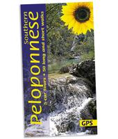
Wandelgids southern Peloponnese - Peloponnessos | Sunflower books
Wandelgids: vele dagtochten worden degelijk beschreven met openbaar vervoer informatie, goede routebeschrijvingen en kaartmateriaal. Tevens enkele autotochten. Deze gids staat goed bekend! Engelstalig 5 car tours (each with picnic suggestions), 50 long and short walks 152 pages + 2 touring maps (eastern and western Peloponnese), 1:50,000 topo maps   There are hidden landscapes throughout mainland Greece, but the region which packs the most variety into the smallest space is the Peloponnese. From the beaches of Arcadia to the fir forests of Mt Parnon, from the olive groves of Kalamata to the pyramidal peak of Prophet Elijah, from classical Sparta to medieval Mani, this compact semi-island has it all. Though the ancients called it ‘the island of Pelops’, after their mythical king, this three-fingered landmass is joined to the mainland by a narrow isthmus at Corinth. Only in the 19th century was a canal finally cut through the isthmus, but it retains the cultural diversity and spectacula…
21,95
Nieuw
Wegenkaart - landkaart - Fietskaart 6 Touring Map Peloponnese - Peloponnesos | Terrain maps
Scheur- en watervaste wegenkaart van de Peloponnesos.De plaatsnamen op de kaart zijn in het Grieks en het Engels. This is the best map of Peloponnese on the market in every respect. Here’s what makes it so special:  Excellent map composition and spatial distribution. The scale of 1:200.00 is extremely demanding in regards to map composition. If you squeeze in too much information you get a user-unfriendly, chaotic map. If you make it too roomy, you get a substandard map unable to satisfy demanding travelers. TERRAIN’s map of Peloponnese is the map with the most ‘practiced’ composition, and the final result is impressive: all roads, villages and sights that a 1:200.00 scale can ‘tolerate’ are so meticulously placed on the map that using it is a piece of cake!  G.I.S. mapping technology in two geodetic reference systems (ΕΓΣΑ 87 and WGS 84.)  Waterproof Polyart paper, which doesn’t rip. You can fold and unfold your map as many times as you want, in any shape or form, and it’s indestr…
13,50
Nieuw
Wandelkaart 8.5 Mainalo - Menalon Trail - Peloponnesos | Anavasi
De Menalon trail staat ingetekend op deze kaart. Uitstekende topografische kaarten van een deel van Griekenland: zonder meer hele goede kaarten voor wandeltochten in een onbekend stuk Griekenland! Ze zijn gedrukt op scheurvast en watervast papier op een schaal van 1:40.000 met een UTM grid voor GPS gebruikers. Op de meeste kaarten is geven de hoogtelijnen een interval van 20m. aan. Met schaduwkleuren, punten met hoogtemeters, bronnen, riviertjes en landgebruik geven ze de topografie van het land goed weer. Lokale voetpaden, herbergen en berghutten zijn duidelijk weergegeven. De wegen zijn in gradaties getekend: verhard en onverhard, groot en klein, met afstanden en benzinepompen. Toeristische bezienswaardigheden als kloosters, grotten, kerken etc staan ingetekend. Achterop de kaart worden suggesties gegeven voor wandelroutes met wandeltijd in uren. Van de uitgever Hiking map for Mainalo, Lousios, Farmakas and Artemisio mountains in a scale of 1:40.000   The Mainalo - Artemisio Hiking …
11,95
Nieuw
Wegenatlas Peloponnese | Anavasi
Paperback, 237-page road atlas of the Peloponnese with detailed contoured mapping at 1;50,000 showing place names in Greek and Roman alphabets and providing a 2km UTM grid for GPS use. The main section of the atlas has 178 pages of detailed maps with contours at 100m intervals, altitude colouring and relief shading to provide a vivid representation of the terrain. Nearly all names: town and villages, geographical features, etc., are given in both Greek and Roman alphabets, with just minor local churches shown in Greek only. Names of most archeological sites and many other places of interest are given in Greek and in English. Road classification has 10 different grades, from toll motorways to minor dirt roads in poor condition and 4WD tracks. Intermediate driving distances are shown on main and secondary roads. The maps also indicate locations of petrol stations (with names of oil companies) and tire repairs facilities. Local footpaths are also marked, with the E4 trans-European long-d…
26,95
Nieuw
Reisgids Greece: The Peloponnese - Griekenland: Peloponnesos | Bradt Travel Guides
Voor vele landen net zo goed, zo niet beter dan de Planet. Beduidend soberder uitgevoerd, maar ook met veel informatie voor backpackers en met veel kaartmateriaal. Een aanrader! Engels. This new, thoroughly updated fifth edition of Bradt's Greece: The Peloponnese with Athens, Delphi and Kythira remains the only dedicated guidebook to the southern part of the Greek mainland. It provides more detailed coverage than any other rival guide, making it indispensable for independent and group travellers visiting a fascinating area slightly smaller than Wales. It also incorporates focussed mini-guides to the Greek capital of Athens and the world-famous site of Delphi.   The Peloponnese contains a huge diversity of cultural landscapes, from sleepy, white-washed villages to Byzantine churches, medieval fortresses and ancient archaeological sites such as Olympia and Mycenae. In addition to a long Mediterranean coast lined with classic white sandy beaches, the peninsula incorporates towering mount…
27,50
Nieuw
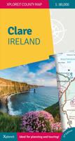
Wegenkaart - landkaart - Fietskaart Clare (Ierland) | Xploreit Maps
Mooie geplastificeerde en scheurvaste kaart van de County Clare met index. This Xploreit map is an essential companion for your next trip to County Clare. Whatever your location in the county, a quick scan of the map will reveal all the local attractions including the best drives, cycle routes and walks in the area.  It is fully revised and now includes the Clare section of the long-distance Euro Velo Atlantic Cycle Route. From Loop Head, with its famous lighthouse, you can follow West Clare’s wild and rugged coast as it rises to the spectacular Cliffs of Moher and meets The Burren, the unique limestone pavement of the northern uplands. East Clare has numerous walking and sightseeing opportunities also, with Lough Derg and Slieve Bernagh as highlights. Convenient and informative, this touring map will help you discover ancient megalithic tombs, imposing castles, sparkling lakes, golden beaches and the many charming towns and villages dotted around ‘The Banner County’. Topography is sh…
23,50
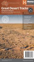
Wegenkaart - landkaart Great Desert Tracks Simpson Desert - Simpson woestijn | Hema Maps
Detailkaart van een deel van Australië. Zeer goed leesbaar, met naast de topografische details veel symbolen waarmee allerhande toeristische zaken worden aangeduid als campsites, nationale parken, attracties, wandelmogelijkheden etc. Hema's Great Desert Tracks maps are essential for anyone travelling in the Australian outback. The mapping features roads and 4WD tracks field-checked by the Hema Map Patrol, Points of Interest for remote area travellers and touring information for learning more about the region and planning your journey.   Discover the Simpson Desert with detailed mapping, relevant points of interest and essential touring information for the journey. One side of the map covers the desert at a scale of 1:500,000, while the other is at 1:1,000,000 for planning purposes. Marked on the mapping are roads and 4WD tracks checked by the Hema Map Patrol, distance markers, topographical relief and touring points of interest including 24-hour fuel, camping areas and caravan park…
17,50
Wegenkaart - landkaart Switzerland - Zwitserland | Marco Polo
Marco Polo Switzerland Map: the ideal map for your trip   Let the Marco Polo Switzerland Road Map guide you around the Switzerland. Discover quaint mountain villages, shimmering lakes, high peaks, stunning waterfalls and exquisite cities with this highly durable, detailed, touring map of Switzerland. It folds away easily and is always on standby to help when you're stuck. Perfect touring map - the scale is 1 : 275 000 ideal to help you tour the region by car or RV Easy to use - the superbly clear mapping in strong colors and easy to read text will help you navigate the country like a local   Durable, tear-resistant map - designed to withstand the rigors of the road, the map is printed on tear-resistant, water repellent and writeable paper Highlights included - major sights and key points of interest are marked on the map by numbered stars. Further information about these key sights can be downloaded via a QR code where you’ll find a brief description to help you pick the best places t…
14,95
Reisgids Marco Polo ENG Lake District | MairDumont
Handige en overzichtelijke, kleine reisgids voor een eerste kennismaking met de vakantiebestemming. Globale uitklapkaart achterin, makkelijk binnenzakformaat. Marco Polo Pocket Guide Lake District: the Travel Guide with Insider Tips Explore the Lake District with this handy, pocket-sized, authoritative guide, packed with Insider Tips. Discover boutique hotels, authentic restaurants, the region's trendiest places, and get tips on shopping and what to do on a limited budget. There are plenty of ideas for travel with kids, and a summary of all the festivals and events that take place. Let Marco Polo show you all this beautiful corner of Britain has to offer... From the highest peaks to the deepest lakes, picture perfect villages, sweeping panoramic views, hilltop walks, literary locations, country pubs and bustling market towns - welcome to the Lake District. England's largest National Park, and now World Heritage Site, the Lake District offers a perfect retreat to the countryside... Thi…
11,50
Nieuw
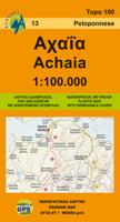
Wegenkaart - landkaart 13 Achaia - deel Peloponnesos | Anavasi
Gebaseerd op topografische kaarten, GPS compatible, gedrukt op watervast en scheurvast papier. Hoogtelijnen met 100 m interval, schaduwkleuren en punten met hoogte geven de topografie van het landschap aan. De kaart kent een UTM grid. Het wegennet wordt aangeduid met verschillende gradaties: grote en kleine wegen, verhard en onverhard. Toeristische bezienswaardigheden staan als zodanig aangeduid zoals thermen, kloosters, berghutten, grotten etc. Namen van steden zowel in het normale schrift als in het Grieks, met een legenda die ook in het Engels is. Blessed with all the natural wealth of the Peloponnese, Achaia's fertile plains and welcoming mountains are popular destinations for touring all the year round. On the new edition the trail E4 and 31 (from Patras to Ancient Olympia) are marked. On the inner side of the detachable folder there is a small plan of the capital city of Achaia, Patras with highlights of the most important sites.
9,95

Klanten-reviews van Wegenkaart - landkaart 2 Peloponnese - Peloponnesos | Anavasi

Er zijn nog geen beoordelingen voor dit productBen jij de eerste die een review plaatst?

Meer over Wegenkaart - landkaart 2 Peloponnese - Peloponnesos | Anavasi

Productomschrijving

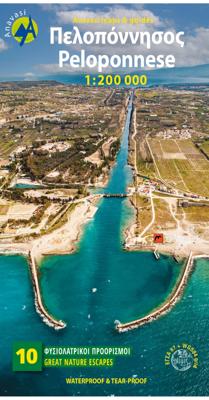
De nieuwe editie van de kaart van de Peloponnesus komt met veel verbeteringen. De grotere schaal maakt het veel leesbaarder en laat gedetailleerde informatie van de kaart zien: Uitgebreid weg- en vestigingsnetwerk. Tal van archeologische sites die voor het eerst op een kaart worden gepubliceerd. Stranden, kamperen, jachthavens, berghutten en de loop van de E4 en de belangrijkste nationale paden 31, 32 en 33. En een innovatie: 10 suggesties voor unieke sites om te bezoeken aan de zijkant van de kaart.

Road and touring map of the Peloponnese in scale 1:200 000. On the map find ideas for 10 top nature destinations. Planning a road trip in the Peloponnese? This is the map to take with you. It shows all road categories, to the last dirt road. Every settlement, stating their original name, when known. Plenty of archaeological sites published for the first time on a map. Beaches, camping, marinas, mountain refuges and the course of the E4 and the major national paths 31, 32 and 33. Map correction in East Peloponnese road network. Touring ideas in the Peloponnese Discover the region of Messinia at the southwest of the Peloponnese: Touring in Messinia Touring in Voidokilia - Palaiokastro Discover Mani, the middle leg of the Peloponnese: The cobble stone path of Biliovo in Exo Mani Touring in Mani - Cape Tainaro Hike in Neda gorge - Figalia area Discover the area of Arcadia: Hiking ideas in Mainalo Hiking in Lousios Canyon Discover the area of Achaia: Hiking in Vouraikos Canyon in Chelmos Discover the area of Korinthos and Argolida: Touring in Lake Stymphalia Touring in Methana

Verken gerelateerde categorieën

Webshop.nl maakt gebruik van cookies. Ga je verder op onze website, ga dan akkoord met het plaatsen van cookies en de verwerking van deze data door ons en vermelde partners.