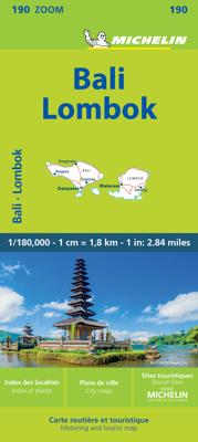
Wegenkaart - landkaart 190 Bali - Lombok | Michelin

0
Zoals gewend van Michelin een zeer leesbare kaart met alle gewenste details. Alle berijdbare wegen staan duidelijk ingetekend, groene lijnen geven de mooiste stukken aan. Inclusief plattegronden van het centrum van Denpasar, Kuta en Mataram The Michelin Bali-Lombok Road and Tourist ZOOM Map 190 includes an index of place names, tourist sites from ...

Verkopers met dit product

Verkoper
Bezorging
Prijs
DeZwerver.nl logo
DeZwerver.nl
2,95
10,95

Anderen bekeken ook

Wegenkaart - landkaart 190 Bali - Lombok | Michelin
Zoals gewend van Michelin een zeer leesbare kaart met alle gewenste details. Alle berijdbare wegen staan duidelijk ingetekend, groene lijnen geven de mooiste stukken aan. Inclusief plattegronden van het centrum van Denpasar, Kuta en Mataram The Michelin Bali-Lombok Road and Tourist ZOOM Map 190 includes an index of place names, tourist sites from the Michelin travel guides and city map insets of Denpasar, Kuta, and Mataram. The scale is 1:180,000 (1 cm = 1.8 km, ) Bali, Indonésie, Lombok
10,95
Wegenkaart - landkaart Bali & Lombok | Nelles Verlag
Goede wegenkaart van Bali & Lombok. Aan beide kanten bedrukt. Met veel toeristische aanduidingen als nationale parken en culturele bezienswaardigheden. Prima leesbare kaart. One of six maps in a series covering Indonesia, this is a folded road and tourist map of the two Indonesian islands of Bali and Lombok at 1:180 000 scale. Parks, beaches, and places of interest are all highlighted and shaded-relief coloyring clearly depicts the topography.    The map includes insets showing Ubud and it's surroundings at 1:33 000, Denpasar at 1:20 000, Kuta at 1:20 000, Lovina Beach at 1:30 000, Sanur at 1:35 000, Nusa Dua at 1:50 000, the Gili Islands at 1:55 000, Mataram at 1:50 000 and an overview locator map. The legend is in English, French and German.   For over 20 years Nelles maps have been renowned throughout the world for their quality, faithfulness to detail and up-to-dateness.    So that streets, ferry links, railway lines, etc are always up to date, Nelles are continuously upgrading th…
10,95
Wegenkaart - landkaart Bali & Lombok | ITMB
Goede kaart met op de ene zijde Bali, schaal 1:145.000 en op de andere kant Lombok, schaal 1:130.000 Lombok may not be as well-known as Bali, but both Indonesian islands are prime tourist destinations. This edition includes new inset maps of Denpasar, the main city in Bali, as well as maps of the Kuta-Legan and Sanur beach resort areas, and of the northern city of Singaraja. The Lombok map on the reverse side includes a map of Mataram, the principal city and a special inset showing the three Gili Islands off the west coast, with their dozens of resort hotels. Legend Includes: Roads by classification, Airports, Turtle Reserve Area, Bird Sanctuary, Hospitals, Hotels, Park Headquarters, World Heritage, Volcano, Habour, Police Stations, Viewpoints, Beaches, Gas Stations, Mines and much more.  
13,95
Wegenkaart - landkaart Bali - Lombok - Komodo | Freytag & Berndt
Goede duidelijke wegenkaart aan twee kanten bedrukt. Alle details staan er op! Met toeristische informatie, Nationale Parken en een index. Detailed, double-sided road map of Bali, Lombok and Komodo islands. Clearly shows the national road network and selected provincial and local roads, with each class of road clearly indicated and road numbers shown. Intermediate driving distances between locations are shown in kilometres alongside the road, motorway filling stations are shown and motorway junctions are indicated. Topography is shown with relief shading and some spot heights, and colour shading is used to indicate land types such as forests or marshland. International and provincial boundaries are clearly marked, as are National Parks, nature reserves and restricted military areas. Symbols indicate various sights & locations of tourist interest, such as churches, leisure & sports destinations, panoramas & viewing points, monuments and historic sites. Some hotels and campsites are mar…
14,95
Wegenkaart - landkaart 3005 Adventure Map Bali - Lombok - Komodo | National Geographic
Wegenkaart van Bali, Lombok en Komodo met vermelding van veel bezienswaardigheden, nationale parken en attrakties. Watervast en scheurvast. Juist door deze vermeldingen onderscheidt de kaart zich van andere wegenkaarten. National Geographic's Bali, Lombok, and Komodo Adventure Map is designed to meet the unique needs of adventure travelers to these Indonesian islands with its durability and accurate information. Each folded map provides global travelers with the perfect combination of detail and perspective, highlighting the area’s terrain and best locations for adventure activities like snorkeling, surfing, fishing, and more. Adventure Maps include hundreds of points of interest that highlight diverse and unique destinations within the country.   The map includes the locations of thousands of cities and towns with a user-friendly index, plus a clearly marked road network complete with distances and designations for major highways, main roads, and tracks and trails for those seeking t…
17,50
Wegenkaart - landkaart 353 Lombardije - Lombardia | Michelin
De Michelin kaart is actueel, gedetailleerd, nauwkeurig, praktisch en internationaal.    De Lokale Michelin streekkaart biedt u: nauwkeurige en toeristische informatie over een streek of regio, een plaatsnamenregister om uw route gedetailleerd uit te stippelen, een nog waarheidsgetrouwere weergave van de topografie door het satellietbeeld en een selectie van de mooiste plekken.   From Michelin's yellow Local series of Europe maps comes this map of Lombardia 1:200 000, showing excellent detail in this region of Italy. The map has the usual excellent road detail characteristic of Michelin maps, with everything from motorways down to rough tracks and footpaths marked out clearly. The number of lanes is indicated on most roads, with intermediate road distances, European route numbers and tolled roads also shown.   The map includes highly detailed relief shading that's derived from satellite photos, with plenty of spot heights also. View points, scenic routes, religious and historic buildi…
10,95
Wegenkaart - landkaart 740 Mauritius - Rodrigues | Michelin
Mooie, goed leesbare kaart van de eilanden Mauritius en Rodrigues, met een klein register, een kleine kaart van Port Louis en met de bekende Michelin aanduidingen als mooie wegen en bezienswaardigheden. The Michelin Mauritius Rodrigues Road and Tourist Map 740 includes an index of place names including tourist sites from the Michelin Green Guides and city map insets of Port, Louis, Mahébourg, and Port Mathurin. The scale is 1:80,000 (1 cm = 800 m, 1 inch = 1.26 miles) Mahébourg, Maurice, Pamplemousses, Port Louis, Port Mathurin, Rodrigues, Tamarin
12,95
Wegenkaart - landkaart 763 Peru | Michelin
Zoals je van Michelin mag verwachten is deze kaart zeer overzichtelijk en heeft een duidelijk helder kaartbeeld. De kaart geeft uitgebreide toeristische informatie weer. De perfecte overzichtskaart! (Edition updated in 2022), MICHELIN National Map Peru will give you an overall picture of your journey thanks to its clear and accurate mapping scale 1/1,500,000. Our National Map Series will help you easily plan your safe and enjoyable journey thanks to a comprehensive key, a complete name index as well a clever time & distance chart. Michelin's driving information will help you navigate safely in all circumstances. In addition, some MICHELIN National Maps are cross-referenced with the MICHELIN Green Guide highlighting destinations worth stopping for! With MICHELIN National Maps, find more than just your way! MICHELIN NATIONAL MAPS feature: * Up-to-date mapping * A scale adapted to the size of the country * A clear and comprehensive key * Distance and time chart * Place name index * Drivi…
12,95
Wegenkaart - landkaart 801 Malta | Michelin
Edition updated in 2025), Malta is an archipelago in the central Mediterranean between Sicily and the North African coast. It's a nation known for historic sites related to a succession of rulers including the Romans, Moors, Knights of Saint John, French and British. It has numerous fortresses, megalithic temples and the al Saflieni Hypogeum, a subterranean complex of halls and burial chambers dating to circa 4000 B.C. MICHELIN National Map Malta will give you an overall picture of your journey thanks to its clear and accurate mapping scale 1:50,000. Our map will help you easily plan your safe and enjoyable journey in Malta thanks to a comprehensive key, a complete name index as well a clever time & distance chart. Includes a City map of Valletta. Our National Map Series will help you easily plan your safe and enjoyable journey thanks to a comprehensive key, a complete name index as well a clever time & distance chart. Michelin's driving information will help you navigate safely in al…
11,95
Wegenkaart - landkaart 544 Thuringen - Sachsen | Michelin
Zoals je van Michelin mag verwachten is deze kaart zeer overzichtelijk en heeft een duidelijk helder kaartbeeld. De kaart geeft uitgebreid toeristische informatie weer. Part of the orange regional series from Michelin, this Germany Mideast map shows this part of Germany in excellent detail. Primary & secondary road networks are clearly marked out with indications of the number of lanes, intermediate distances and various possible road obstacles or things you should know including steep hills, height limits, toll barriers, prohibited roads and roads subject to restrictions.   The map also includes small insets with street plans of Dresden, Leipzig and Erfurt, showing road names, one way streets and various places of interest (tourist sights, hospitals, parking, railway stations, etc.). Scenic routes on the map are marked out in green and an extensive index of place names is included.   The map also features:   Administrative boundaries Railways, Airports and Ferry Services Important si…
11,95

Klanten-reviews van Wegenkaart - landkaart 190 Bali - Lombok | Michelin

Er zijn nog geen beoordelingen voor dit productBen jij de eerste die een review plaatst?

Meer over Wegenkaart - landkaart 190 Bali - Lombok | Michelin

Productomschrijving

Zoals gewend van Michelin een zeer leesbare kaart met alle gewenste details. Alle berijdbare wegen staan duidelijk ingetekend, groene lijnen geven de mooiste stukken aan. Inclusief plattegronden van het centrum van Denpasar, Kuta en Mataram

The Michelin Bali-Lombok Road and Tourist ZOOM Map 190 includes an index of place names, tourist sites from the Michelin travel guides and city map insets of Denpasar, Kuta, and Mataram. The scale is 1:180,000 (1 cm = 1.8 km, )

Bali, Indonésie, Lombok

Productinformatie

    Verken gerelateerde categorieën

    Webshop.nl maakt gebruik van cookies. Ga je verder op onze website, ga dan akkoord met het plaatsen van cookies en de verwerking van deze data door ons en vermelde partners.