webshop.nl
Categorieën
  Sluiten

Meer Michelin

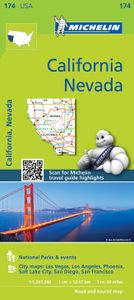
Wegenkaart - landkaart 174 California - Californie - Nevada | Michelin

Bijzonder goed leesbare kaart van een deel van de Verenigde Staten - USA, in dit geval het gebied van de staten Californie en Nevada.   Op deze kaart zijn de Nationale Parken goed zichtbaar ingetekend met een heldere achtergrondkleur. Wegnummers, register, afstanden tussen steden en bijvoorbeeld de beroemde groene wegenaanduiding van Michelin ontbr...
9,95

Webshops met dit product

Webshop
Bezorging
Prijs

Anderen bekeken ook

Wegenkaart - landkaart 174 California - Californie - Nevada | Michelin
Bijzonder goed leesbare kaart van een deel van de Verenigde Staten - USA, in dit geval het gebied van de staten Californie en Nevada.   Op deze kaart zijn de Nationale Parken goed zichtbaar ingetekend met een heldere achtergrondkleur. Wegnummers, register, afstanden tussen steden en bijvoorbeeld de beroemde groene wegenaanduiding van Michelin ontbreken niet.    Met stadsplattegronden (alleen het centrum)  van Las Vegas, Los Angeles, Phoenix, Salt Lake City, San Diego en San Francisco   Michelin USA California, Nevada Map 174 (scale: 1:1,267,000)—part of Michelin's brand-new US regional map series with bright green covers—zooms in close for comprehensive coverage of California and Nevada, as well as western Utah and Arizona. It contains city maps for easy driving in Las Vegas, Los Angeles, Phoenix, Salt Lake City, San Diego and San Francisco. Michelin star-rated sights and a selection of not-to-be-missed annual events and festivals serve as inspiration for future road trips. Outdoor ent…
9,95
Wegenkaart - landkaart 3119 California - Nevada | National Geographic
Mooie kaart van de bekende kaartenmaker National Geographic. Veel details door kleurgebruik. De wegen zijn met kleuren verdeeld in drukke en minder drukke, de wegnummers zijn goed terug te vinden. De kaart onderscheidt zich van andere series door de hoeveelheid topografische details als counties, plaatsnamen en waterwegen en het bevat een register waarin het eenvoudig zoeken is. Daarnaast is de kaart gedrukt op scheur- en watervast papier. The United States California and Nevada Adventure Map will guide you through two of the most spectacular and diverse states in the country. California and Nevada contain Yosemite and Sequoia & Kings Canyon National Parks, Death Valley and the Mohave Desert, the Sierra Nevada Mountains, Lake Tahoe, and dozens of magnificent National Monuments, Forests, and Wilderness Areas. The map includes the cities of Los Angeles, San Francisco, San Diego, and Las Vegas as well as the breathtaking Pacific coast of California. It covers western Utah and Arizona, inc…
17,50
Wegenkaart - landkaart Southwest-USA - Zuidwest USA | Borch
Mooie geplasticieerde kaart van het Zuidwesten van de USA. Deze kaart biedt een goed overzicht van het land met detailkaarten.   Our soft-laminated folded map of the American Southwest shows: American Southwest 1:3 000 000, Phoenix 1:20 000, San Francisco Bay Area 1:400 000, San Francisco 1:15 000, Greater Los Angeles 1:250 000, San Diego 1:125 000, San Diego Downtown 1:25 000, Las Vegas - The Strip 1:22 000, Grand Canyon National Park 1:250 000, USA administrative & time zones. Borch Maps show hotels, museums, monuments, markets, public transport, top sights and points of interest, useful statistics, conversion charts for temperatures, weights and measurements, climate charts showing temperatures, sunshine hours, precipitation and humidity, overview maps, time zones, and much more...   From the panoramas of San Francisco and the buzz of megametropolis Los Angeles to the charm of San Diego on the Mexican border - the Californian coast boasts sun, beautiful beaches, stunning scenery and…
11,50
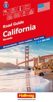
Wegenkaart - landkaart 05 Californië, California - Nevada | Hallwag
Uitstekende wegenkaart waarbij de Europese kleurstelling de kaart zeer prettig leesbaar maken i.v.m. met Amerikaanse kaartenmakers. Deze kaart is eenzijdig bedrukt. Op de kaart is informatie te vinden waar allerlei voorzieningen te vinden zijn (d.m.v. symbolen), zoals campings, picknickplaatsen, informatiecentra, luchthavens enz. Bij de kaart zit een apart boekje met een aantal kleine stadsplattegronden, informatie over Nationale Parken en overige informatie voor toeristen.   Met Californie, Nevada, Far West USA.   These new, region by region "USA Road Guides", on a scale of 1 : 1 mio, provide up-to-date, detailed road maps with lots of tourist information. Transit and city maps, as well as detailed maps of national parks, are included in the map layout. The map package also includes a mileage chart with travelling times between major cities, and a brochure with an index of places, travel information from A to Z, top attractions and travel tips.   Plaatsen op de kaart: Los Angeles Sa…
14,50
Wegenkaart - landkaart 175 Four Corners USA | Michelin
Bijzonder goed leesbare kaart van een deel van de Verenigde Staten - USA, in dit geval het gebied van de staten Arizona - Utah - Colorado - New Mexico, ook wel de Four Corners genoemd.  Op deze kaart zijn de Nationale Parken goed zichtbaar ingetekend met een heldere achtergrondkleur. Wegnummers, register, afstanden tussen steden en bijvoorbeeld de beroemde groene wegenaanduiding van Michelin ontbreken niet.  Met stadsplattegronden (alleen het centrum)  van Albuquerque, Colorado Springs, Denver, Phoenix, Salt Lake City en Tucson. Michelin USA Four Corners Map 175 (scale: 1:1,267,000)—part of Michelin's brand-new US regional map series with bright green covers—zooms in close for comprehensive coverage of Arizona, Colorado, New Mexico and Utah. It contains city maps for easy driving in Albuquerque, Colorado Springs, Denver, Phoenix, Salt Lake City and Tucson. Michelin star-rated sights and a selection of not-to-be-missed annual events and festivals serve as inspiration for future road tri…
9,95
Wandelgids - Fietsgids Hiking and Cycling the California Missions Trai
Guidebook to hiking or cycling the 800 mile (1289km) California Missions Trail between San Francisco Bay and San Diego. The pilgrimage trail takes in 21 historic Spanish missions and can be completed in 50-60 walking days or 2-3 weeks cycling. With 1:100,000 mapping, route description, and details of accommodation and facilities for each stage. Ancient footpaths became connecting routes between the Spanish missions, pueblos, and presidios in the period 1769 to 1823. Over time these routes became automobile roadways and were marked with bells starting in 1906 to promote and preserve the El Camino Real. Today, the California Missions Trail follows a pedestrian route through urban cities and historic towns, through forest paths and country lanes, to each of the twenty-one historic Spanish missions. The 800-mile California Missions Trail leads walkers and cyclists through some of the most scenic and historic sites of one of America's most beautiful states. The 21 missions, founded 200-250 …
26,50

Klanten-reviews van Wegenkaart - landkaart 174 California - Californie - Nevada | Michelin

Er zijn nog geen beoordelingen voor dit productBen jij de eerste die een review plaatst?

Meer over Wegenkaart - landkaart 174 California - Californie - Nevada | Michelin

Productomschrijving

Bijzonder goed leesbare kaart van een deel van de Verenigde Staten - USA, in dit geval het gebied van de staten Californie en Nevada.   Op deze kaart zijn de Nationale Parken goed zichtbaar ingetekend met een heldere achtergrondkleur. Wegnummers, register, afstanden tussen steden en bijvoorbeeld de beroemde groene wegenaanduiding van Michelin ontbreken niet.    Met stadsplattegronden (alleen het centrum)  van Las Vegas, Los Angeles, Phoenix, Salt Lake City, San Diego en San Francisco   Michelin USA California, Nevada Map 174 (scale: 1:1,267,000)—part of Michelin's brand-new US regional map series with bright green covers—zooms in close for comprehensive coverage of California and Nevada, as well as western Utah and Arizona. It contains city maps for easy driving in Las Vegas, Los Angeles, Phoenix, Salt Lake City, San Diego and San Francisco. Michelin star-rated sights and a selection of not-to-be-missed annual events and festivals serve as inspiration for future road trips. Outdoor enthusiasts can choose from multiple national parks for scenery and activities: Bryce Canyon, Channel Islands, Death Valley, Grand Canyon, Great Basin, Joshua Tree, Kings Canyon, Lassen Volcanic, Pinnacles, Redwood, Sequoia, Yosemite and Zion. The QR code on the front cover offers even more travel information on destinations through Michelin's ViaMichelin website. The map includes a comprehensive index, a distance chart, and a multi-language legend in English and Spanish. Those traveling for business or pleasure, as well as locals traveling farther afield, will appreciate Michelin's high standard of clear and accurate mapping and the additional information on parks, events and points of interest to make the journey more enjoyable.   Californie, Las Vegas, Los Angeles, Nevada, Phoenix, San Diego, San Francisco

Productspecificaties

Artikelnummer(s)
Brand
Michelin
Webshop.nl maakt gebruik van cookies. Ga je verder op onze website, ga dan akkoord met het plaatsen van cookies en de verwerking van deze data door ons en vermelde partners.