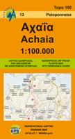
Wegenkaart - landkaart 13 Achaia - deel Peloponnesos | Anavasi

0
Gebaseerd op topografische kaarten, GPS compatible, gedrukt op watervast en scheurvast papier. Hoogtelijnen met 100 m interval, schaduwkleuren en punten met hoogte geven de topografie van het landschap aan. De kaart kent een UTM grid. Het wegennet wordt aangeduid met verschillende gradaties: grote en kleine wegen, verhard en onverhard. Toeristisch...

Verkopers met dit product

Verkoper
Bezorging
Prijs
DeZwerver.nl logo
DeZwerver.nl
2,95
9,95

Anderen bekeken ook

Wegenkaart - landkaart 2 Peloponnese - Peloponnesos | Anavasi
De nieuwe editie van de kaart van de Peloponnesus komt met veel verbeteringen. De grotere schaal maakt het veel leesbaarder en laat gedetailleerde informatie van de kaart zien: Uitgebreid weg- en vestigingsnetwerk. Tal van archeologische sites die voor het eerst op een kaart worden gepubliceerd. Stranden, kamperen, jachthavens, berghutten en de loop van de E4 en de belangrijkste nationale paden 31, 32 en 33. En een innovatie: 10 suggesties voor unieke sites om te bezoeken aan de zijkant van de kaart. Road and touring map of the Peloponnese in scale 1:200 000. On the map find ideas for 10 top nature destinations. Planning a road trip in the Peloponnese? This is the map to take with you. It shows all road categories, to the last dirt road. Every settlement, stating their original name, when known. Plenty of archaeological sites published for the first time on a map. Beaches, camping, marinas, mountain refuges and the course of the E4 and the major national paths 31, 32 and 33. Map corre…
11,95
Wegenkaart - landkaart - Fietskaart 6 Touring Map Peloponnese - Peloponnesos | Terrain maps
Scheur- en watervaste wegenkaart van de Peloponnesos.De plaatsnamen op de kaart zijn in het Grieks en het Engels. This is the best map of Peloponnese on the market in every respect. Here’s what makes it so special:  Excellent map composition and spatial distribution. The scale of 1:200.00 is extremely demanding in regards to map composition. If you squeeze in too much information you get a user-unfriendly, chaotic map. If you make it too roomy, you get a substandard map unable to satisfy demanding travelers. TERRAIN’s map of Peloponnese is the map with the most ‘practiced’ composition, and the final result is impressive: all roads, villages and sights that a 1:200.00 scale can ‘tolerate’ are so meticulously placed on the map that using it is a piece of cake!  G.I.S. mapping technology in two geodetic reference systems (ΕΓΣΑ 87 and WGS 84.)  Waterproof Polyart paper, which doesn’t rip. You can fold and unfold your map as many times as you want, in any shape or form, and it’s indestr…
13,50
Wegenkaart - landkaart 92 Kreta oost - Lasithi | Anavasi
Gebaseerd op topografische kaarten, GPS compatible, gedrukt op watervast en scheurvast papier. Hoogtelijnen met 100 m interval, schaduwkleuren en punten met hoogte geven de topografie van het landschap aan. De kaart kent een UTM grid. Het wegennet wordt aangeduid met verschillende gradaties: grote en kleine wegen, verhard en onverhard. Toeristische bezienswaardigheden staan als zodanig aangeduid zoals thermen, kloosters, berghutten, grotten etc. Namen van steden zowel in het normale schrift als in het Grieks, met een legenda die ook in het Engels is. Van de uitgever This map includes all the information a traveler needs to discover Eastern Crete. It includes the entire road network from the biggest arteries to the smallest dirt roads, paths and trails, all the towns and villages, beaches and toponyms. In addition to the above, you will find the E4 route from Dikti to Zakros that crosses the entire inland of Eastern Crete. On the reverse side you will find sections of the E4 route with…
11,95
Reisgids Reise-Taschenbuch Peloponnes - Peloponnesos | Dumont
Goede, fraai ogende gids, handzaam formaat en toch behoorlijk uitgebreid over de Peloponnessos. Deze serie reisgidsen zijn algemene reisgidsen en bevatten een brede selectie aan bezienswaardigheden, excursies, achtergronden, praktische tips en een uitneembare kaart. Über das Buch In der griechischen Region Peloponnes, zwischen der Großstadt Patras im Nordwesten und der kargen Halbinsel Máni im Süden, erwarten uns erstaunliche Entdeckungen und unerwartete Erlebnisse. Hier blieben viele Traditionen der Griechen noch fast unberührt erhalten. Zwischen langen Sandstränden, wild-einsamen Bergregionen wie dem Parnon und vielen romantischen Landstädtchen gibt es unendlich viele Möglichkeiten zur Entschleunigung: alte Orte wie Náfplio mit Bilderbuchflair, historische Burgen der Kreuzritter, antike Ruinen wie Olympia, Korinth oder Mykene - also fast eine echte Zeitreise. Natururlauber können sich an feinsandigen Stränden, auf Berg-Trails, in grünen Tälern voller Wasserfälle und sogar auf dem …
22,50
Wegenkaart - landkaart 93 Kreta centraal - midden Heraklion en Rethimnon | Anavasi
Gebaseerd op topografische kaarten, GPS compatible, gedrukt op watervast en scheurvast papier. Hoogtelijnen met 100 m interval, schaduwkleuren en punten met hoogte geven de topografie van het landschap aan. De kaart kent een UTM grid. Het wegennet wordt aangeduid met verschillende gradaties: grote en kleine wegen, verhard en onverhard. Toeristische bezienswaardigheden staan als zodanig aangeduid zoals thermen, kloosters, berghutten, grotten etc. Namen van steden zowel in het normale schrift als in het Grieks, met een legenda die ook in het Engels is. One of the three maps of the successful series of touring maps of Crete in a scale of 1:100,000 maps covering the whole island with great detail. Small additions and updating of road network, the new municipalities and some visual touches (palette relief and cover). On the reverse side of the map fully indexed settlements and cardboard folnter presentation of 10 Top points of interest on the map.  
11,95
Wegenkaart - landkaart 751 Thailand | Michelin
De Michelin kaart van Thailand is een overzichtelijke landkaart waarop de toeristische sites staan aangeduid. De kaart heeft een plaatsnamenregister en een stadsplattegrond van Bangkok. De plaatsnamen staan op de kaart en in de index in het Nederlands en in het Thais. Thailand at 1:370,000 on an indexed road map from Michelin with street plans of central Bangkok and an enlargement for the capital’s environs. All place names on the map are shown in both Thai and Latin alphabet and the index is in both scripts. Road network emphasizes main routes but also clearly presents local roads, all with road numbers easy to read. Driving distances are shown on primary routes and main connecting roads; steep gradients, viewpoints, toll barriers and border crossings are marked; scenic routes are highlighted. Railway lines are included and domestic airports are marked. Symbols indicate various places of interest.  Topography is shown by relief shading with colouring for forested areas. National park…
12,95
Wegenatlas Peloponnese | Anavasi
Paperback, 237-page road atlas of the Peloponnese with detailed contoured mapping at 1;50,000 showing place names in Greek and Roman alphabets and providing a 2km UTM grid for GPS use. The main section of the atlas has 178 pages of detailed maps with contours at 100m intervals, altitude colouring and relief shading to provide a vivid representation of the terrain. Nearly all names: town and villages, geographical features, etc., are given in both Greek and Roman alphabets, with just minor local churches shown in Greek only. Names of most archeological sites and many other places of interest are given in Greek and in English. Road classification has 10 different grades, from toll motorways to minor dirt roads in poor condition and 4WD tracks. Intermediate driving distances are shown on main and secondary roads. The maps also indicate locations of petrol stations (with names of oil companies) and tire repairs facilities. Local footpaths are also marked, with the E4 trans-European long-d…
26,95
Reisgids Greece: The Peloponnese - Griekenland: Peloponnesos | Bradt Travel Guides
Voor vele landen net zo goed, zo niet beter dan de Planet. Beduidend soberder uitgevoerd, maar ook met veel informatie voor backpackers en met veel kaartmateriaal. Een aanrader! Engels. This new, thoroughly updated fifth edition of Bradt's Greece: The Peloponnese with Athens, Delphi and Kythira remains the only dedicated guidebook to the southern part of the Greek mainland. It provides more detailed coverage than any other rival guide, making it indispensable for independent and group travellers visiting a fascinating area slightly smaller than Wales. It also incorporates focussed mini-guides to the Greek capital of Athens and the world-famous site of Delphi.   The Peloponnese contains a huge diversity of cultural landscapes, from sleepy, white-washed villages to Byzantine churches, medieval fortresses and ancient archaeological sites such as Olympia and Mycenae. In addition to a long Mediterranean coast lined with classic white sandy beaches, the peninsula incorporates towering mount…
27,50
Wegenkaart - landkaart Pilbara and the Coral Coast | Hema Maps
Detailkaart van een deel van Australië. Zeer goed leesbaar, met naast de topografische details veel symbolen waarmee allerhande toeristische zaken worden aangeduid als campsites, nationale parken, attracties, wandelmogelijkheden etc. One of the last great frontiers in Australia, the Pilbara is real 4WD country. This map has been field-checked using Hema's GPS mapping system and includes tracks and roads that have never before appeared on maps. The information side of the map presents all the points of interest, the history, and all the important information a person needs to know in order to safely traverse this remote countryside. Detailed, indexed road map with cartography similar to Hema’s excellent coverage of Australia’s interior in the “Great Desert Tracks” series: road information distinguishes between tracks plotted by the publishers themselves with GPS and those complied from the country’s topographic survey data. Topography is shown by relief shading, with colours and graphi…
17,50
Wegenkaart - landkaart Brisbane to Cairns | Hema Maps
Detailkaart van een deel van Australië. Zeer goed leesbaar, met naast de topografische details veel symbolen waarmee allerhande toeristische zaken worden aangeduid als campsites, nationale parken, attracties, wandelmogelijkheden etc. An easy-to-follow map that shows both the coastal and inland routes from Brisbane to Cairns. Roadside rest areas, intermediate distances, and a quick-find distance chart are also shown. The map shows all the popular tourist destinations along the Queensland coast. Routes between Brisbane with Cairns in a series of touring maps connecting Australia’s main centres of population along some of the most spectacular routes such as the Great Ocean Road or the Savannah Way. The maps highlight 24-hour fuel supplies, roadside rest areas, camping facilities, places of interest, etc., and include distance charts and, in some titles, city maps. Road network indicates unsurfaced roads and tracks. The maps also show railway lines. There is no topographical information b…
17,50

Klanten-reviews van Wegenkaart - landkaart 13 Achaia - deel Peloponnesos | Anavasi

Er zijn nog geen beoordelingen voor dit productBen jij de eerste die een review plaatst?

Meer over Wegenkaart - landkaart 13 Achaia - deel Peloponnesos | Anavasi

Productomschrijving

Gebaseerd op topografische kaarten, GPS compatible, gedrukt op watervast en scheurvast papier. Hoogtelijnen met 100 m interval, schaduwkleuren en punten met hoogte geven de topografie van het landschap aan. De kaart kent een UTM grid.

Het wegennet wordt aangeduid met verschillende gradaties: grote en kleine wegen, verhard en onverhard. Toeristische bezienswaardigheden staan als zodanig aangeduid zoals thermen, kloosters, berghutten, grotten etc. Namen van steden zowel in het normale schrift als in het Grieks, met een legenda die ook in het Engels is.

Blessed with all the natural wealth of the Peloponnese, Achaia's fertile plains and welcoming mountains are popular destinations for touring all the year round. On the new edition the trail E4 and 31 (from Patras to Ancient Olympia) are marked. On the inner side of the detachable folder there is a small plan of the capital city of Achaia, Patras with highlights of the most important sites.

Productinformatie

    Verken gerelateerde categorieën

    Webshop.nl maakt gebruik van cookies. Ga je verder op onze website, ga dan akkoord met het plaatsen van cookies en de verwerking van deze data door ons en vermelde partners.