webshop.nl
Categorieën
  Sluiten

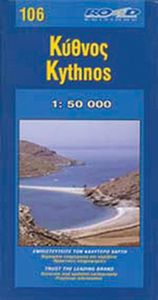
Wegenkaart - landkaart 106 Kythnos | Road Editions

Gedetailleerde wegenkaart met aanduiding van de wandelwegen, lijst van hotels en toeristische informatie. Voor alle doeleinden een zeer geschikte kaart. It was published in 2003, based on data of that same year. The geophysical background was provided by the Hellenic Military Geographic Service and there are contour lines at 20m intervals as well a...
8,25

Webshops met dit product

Webshop
Bezorging
Prijs

Anderen bekeken ook

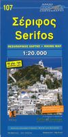
Wegenkaart - landkaart 107 Serifos | Road Editions
Gedetailleerde wegenkaart met aanduiding van de wandelwegen, lijst van hotels en toeristische informatie. Voor alle doeleinden een zeer geschikte kaart. The features that make this and every other ROAD island map unique are: *The coastline, hydrography and precision geophysical background based on data provided by the Hellenic Military Geographic Service and electronically processed by us for clarity and legibility. We have highlighted the mountain masses in shades of brown between the contour lines (at 20m intervals on this map) to outline clearly the relief of the island. *The beaches are indicated by a special symbol next to which we have noted their names, as well as all the roads and footpaths leading to them (since most people primarily visit the islands for the beaches!). We have even included a short text in which the island’s best beaches are concisely referred to, to save you going on a wild goose hunt in search of them. *The road network is mapped out with impressive and exe…
8,25
Wegenkaart - landkaart 109 Sifnos | Road Editions
Gedetailleerde wegenkaart met aanduiding van de wandelwegen, lijst van hotels en toeristische informatie. Voor alle doeleinden een zeer geschikte kaart. The features that make this and every other ROAD island map unique are: *The coastline, hydrography and precision geophysical background based on data provided by the Hellenic Military Geographic Service and electronically processed by us for clarity and legibility. We have highlighted the mountain masses in shades of brown between the contour lines (at 20m intervals on this map) to outline clearly the relief of the island. *The beaches are indicated by a special symbol next to which we have noted their names, as well as all the roads and footpaths leading to them (since most people primarily visit the islands for the beaches!). We have even included a short text in which the island’s best beaches are concisely referred to, to save you going on a wild goose hunt in search of them. *The road network is mapped out with impressive and exe…
8,95
Wegenkaart - landkaart 105 Tzia - Kea | Road Editions
Gedetailleerde wegenkaart met aanduiding van de wandelwegen, lijst van hotels en toeristische informatie. Voor alle doeleinden een zeer geschikte kaart. Scheur- en watervast! The features that make this and every other ROAD island map unique are: *The coastline, hydrography and precision geophysical background based on data provided by the Hellenic Military Geographic Service and electronically processed by us for clarity and legibility. We have highlighted the mountain masses in shades of brown between the contour lines (at 100m intervals on this map) to outline clearly the relief of the island. *The beaches are indicated by a special symbol next to which we have noted their names, as well as all the roads and footpaths leading to them (since most people primarily visit the islands for the beaches!). We have even included a short text in which the island’s best beaches are concisely referred to, to save you going on a wild goose hunt in search of them. *The road network is mapped out …
8,95
Wandelkaart 217 Skiathos | Road Editions
Gedetailleerde wegenkaart met aanduiding van de wandelwegen, lijst van hotels en toeristische informatie. Voor alle doeleinden een zeer geschikte kaart.   The features that make this and every other ROAD island map unique are: *The coastline, hydrography and precision geophysical background based on data provided by the Hellenic Military Geographic Service and electronically processed by us for clarity and legibility. We have highlighted the mountain masses in shades of brown between the contour lines (at 20m intervals on this map) to outline clearly the relief of the island. *The beaches are indicated by a special symbol next to which we have noted their names, as well as all the roads and footpaths leading to them (since most people primarily visit the islands for the beaches!). We have even included a short text in which the island’s best beaches are concisely referred to, to save you going on a wild goose hunt in search of them. *The road network is mapped out with impressive and e…
8,95
Wegenkaart - landkaart Kgalagadi - Tourist Map of Kgalagadi Transfrontier Park Botswana | Shell
Zeer bijzondere landkaart van het grensgebied van Botswana en Zuid Afrika. Uitermate handig zijn de GPS coordinaten van de meest belangrijke punten als campings of uitzichtpunten. De kaart is gebaseerd op een luchtfoto, waarbij alle details zijn ingetekend. The map: The map consists of a large map of the entire Park on the front of the map. On the back is enlargements of six maps - the South African side, Mabuasehube, Swart Pan area, Gemsbok Wilderness Trail, Mabuasehube Wilderness Trail and of the Kaa Kalahari Concession. Satellite images were used and the roads were tracked by GPS. There are 168 GPS coordinates on this map. Establishment of a Transfrontier Park: On the 7 th of April 1999 Botswana and South Africa signed a bilateral agreement in which they agreed to manage their adjacent national parks, Gemsbok National Park in Botswana and Kalahari Gemsbok National Park in South Africa, as a single ecological unit – the Kgalagadi Transfrontier Park. It is the first formally declared …
17,50
Wegenkaart - landkaart Spitsbergen Svalbard | ITMB
North of Norway exists one of the northernmost communities in the world, an archipelago of islands called Svalbard in Norwegian, and better known as Spitsbergen in English. Until now, it has only been available in map format from the Norwegian Arctic Institute, and then only with difficulty. Side one shows the various islands as an entity. There is only one town of any size in the islands, called Longyearbyen, although there is a more northerly town called Pyramiden and an isolated community on the west coast called Alesund. This is true high Arctic adventure travel; one does not come here unprepared! Most of the islands are uninhabited and largely ice-covered. Edge Island, for example, is a large nature reserve, and Prins Karl Forland is a national park. We have translated land area names into English and placed the Norwegian names in brackets, but have tried leaving the Norwegian names in place wherever possible to assist with local usage. This is one of those ‘off the beaten path’ t…
13,95
Wegenkaart - landkaart Yemen - Jemen | Gizi Map
Yemen, including the Gulf of Aden, at 1:1,250,000 on an excellent and informative map from Gizi Maps, with a street plan of central Sana’a and enlargements of the environs of the capital and Aden, plus the Aden Peninsula.   The map has the publisher’s characteristic bold altitude colouring and plenty of names of various mountain chains, peaks, deserts, etc. Graphics indicate swamps, salt flats, wadis, deserts, lava flows, water wells, oasis, etc, to provide a vivid picture of the country’s topography. Names of the larger towns, provinces and many geographical features are given in both Latin and Arabic alphabets; all other place names are shown only transliterated.   Coverage extends southward to the northern coastline of the Horn of Africa, including the whole of Djibouti and most of Eritrea. Within the Gulf of Aden the Internationally Recommended Transit Corridor (IRTC) is marked, as well as other ferry and shipping routes including those leading to the Socotra Archipelago and in the…
15,95
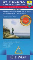
Wandelkaart - Wegenkaart - landkaart St Helena & Dependencies | Gizi Map
Met name door het kleurgebruik een mooie kaart: heel duidelijk wordt het landschap weergegeven. Daarnaast veel topografische details.  St. Helena at 1:35,000 from Gizi Map, with the other islands of the British Overseas Territories in the Atlantic: Tristan da Cunha, plus Ascension, Inaccessible and Gough Islands at 1:75,000, with superb cartography and places of interest.    The map excellently presents the topography of all the islands, with bright colouring and vivid relief shading, accompanied by spot heights and names of many peaks, valleys and other geographic features. Small settlements and many individual buildings are shown, roads and local tracks are marked. On St. Helena hiking trails are also highlighted and local administrative boundaries are marked.    The map indicates locations with tourist accommodation and prominently shows various places of interest. Special highlighting marks sites associated with Napoleon’s exile on St Helena and the map also shows the boundary of t…
15,95
Wegenkaart - landkaart Cuba | Freytag & Berndt
Uitstekende kaart van Cuba. Met index, toeristische informatie en afstanden in kilometers.De berijdbare wegen zijn goed weergeven, zowel de hoofdwegen als provinciale en lokale wegen; wegnummers worden vermeld. Afstanden tussen plaatsen zijn in kilometers op de kaart ingetekend. In het kaartbeeld wordt door middel van schaduw het reliëf weergegeven en soms enkele punten in het landschap met de daadwerkelijke hoogte. Provinciegrenzen zijn goed terug te vinden, nationale parken en reservaten ook. Met allerhande symbolen worden toeristische bezienswaardigheden weergegeven als monumenten, historisch belangrijke plekken en uitzichtpunten. In bepaalde plaatsen zijn hotels en campings te vinden, luchthavens, treinverbindingen en havens vindt u er ook op! Overview map with street plans of Havana, Cienfuegos, Camagüey and Santiago de Cuba, plus enlargements of the Playa del Este area east of the capital and the Varadero Peninsula. The main map presents the island’s topography by bold relief sha…
14,95
Wegenkaart - landkaart - Wandelkaart Jasper National Park (Alberta) | Gem Trek Maps
Waterproof and tear-resistant map for Jasper National Park in the Canadian Rockies.   Whether you are a first-time visitor or a long-time local, you’ll find Gem Trek’s Jasper National Park Map to be an invaluable tool. Researched and designed by locals, and printed in Canada, this map features accurate cartography and subtly colored relief that puts the mountainous region in perspective. The map is printed on high-quality synthetic waterproof paper that can be folded and refolded hundreds of times.   The 1:250,000 scale is ideal for discovering the very best of Jasper National Park. Highlights and our recommended hiking trails are marked by numbered stars, then cross-referenced on the reverse side with descriptions. Also included are all mountains and their elevations, along with natural features such as waterfalls, hot springs, and glaciers.   In addition to descriptions for the top highlights and most popular hiking trails, the reverse side has inset maps for the town of Jasper…
16,95

Klanten-reviews van Wegenkaart - landkaart 106 Kythnos | Road Editions

Er zijn nog geen beoordelingen voor dit productBen jij de eerste die een review plaatst?

Meer over Wegenkaart - landkaart 106 Kythnos | Road Editions

Productomschrijving

Gedetailleerde wegenkaart met aanduiding van de wandelwegen, lijst van hotels en toeristische informatie. Voor alle doeleinden een zeer geschikte kaart. It was published in 2003, based on data of that same year. The geophysical background was provided by the Hellenic Military Geographic Service and there are contour lines at 20m intervals as well as a full hydrography (all ravines and dry torrents are visible). As in all ROAD maps, all beaches are illustrated in blue with their names, as are all location names of villages and settlements and of course the precise distances in kilometers from intersection to intersection. This map introduces an innovation in that the locations of the early Cycladic (or protocycladic) metal smelting centres are indicated by a special symbol (the locals call these locations 'skouries' or 'rust marks') and it is especially worthwhile to see them. On the back of the map, there are photographs of characteristic Kythnos landscapes, historical data and information for tourists and a listing of the accommodations available on the island.

Verken gerelateerde categorieën

Webshop.nl maakt gebruik van cookies. Ga je verder op onze website, ga dan akkoord met het plaatsen van cookies en de verwerking van deze data door ons en vermelde partners.