Productomschrijving
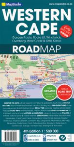
Road map of the Western Cape Province with an enlargement for the Cape Peninsula and 27 street plans of the central areas in main towns. The map is annotated numerous places of interest, vineyards, etc. GPS coordinates are provides for main road junctions. This new edition Western Cape Road Map covers the whole of the Western Cape. It features easy-to-read full colour maps with GPS co-ordinates. The map provides tourist-friendly text, highlights places of interest and lists accommodation information. This map is perfect for scenic drives and includes information boxes on activities of interest. Coverage includes the Garden Route & Route 62, South Western Cape, Winelands and Overberg, West Coast Flower Region and Little Karoo. The map features small detailed street plans of Cape Town CBD, Montagu, Barrydale, Ladismith, Oudtshoorn, Mossel Bay, Knysna, Plettenberg Bay, Humansdorp, George, Stellenbosch, Franschhoek, Paarl, Wellington, Hermanus, Swellendam, Robertson, Ceres, Tulbagh, Langebaan and Beaufort West. Barrydale, Beaufort West, Bella vista, Bellville, Betty's Bay, Bo-wadrif, Bonnievale, Bredasdorp, Caledon, cape town, Cederberg, Ceres, Clanwilliam, Darling, De Kelders, Durbanville, Fishhoek, Franshoek, Ganadendal, garden route, Geodverwacht, George, Greyton, Hermanus, Hottentotskloof, Knysna, Kommetjie, Kuilsriver, Ladismith, Lainsburg, Lambert's bay, Langebaan, Malmesbury, Matjiesfontein, McGregor, Milnerton, MitchellsPlain, Montagu, Mossel Bay, Muizenburg, Noordhoek, Oudtshoorn, Paarl, Plettenburg Bay, Prince Alfred, Riviersonderend, road map, road maps, Robertson, Rouxpas, Simons Town, Stellenbosch, Sutherland, Swellendam, The Baths, Touws River, Tulbagh, Tweefontein, Vanrhynsdorp, Wellington, Western Cape, Western Cape Road Map, Worcester

