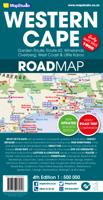
Wegenkaart - landkaart 10 Western Cape Road Map | MapStudio

0
Road map of the Western Cape Province with an enlargement for the Cape Peninsula and 27 street plans of the central areas in main towns. The map is annotated numerous places of interest, vineyards, etc. GPS coordinates are provides for main road junctions. This new edition Western Cape Road Map covers the whole of the Western Cape. It features eas...

Verkopers met dit product

Verkoper
Bezorging
Prijs
DeZwerver.nl logo
DeZwerver.nl
2,95
16,95

Anderen bekeken ook

Wegenkaart - landkaart 10 Western Cape Road Map | MapStudio
Road map of the Western Cape Province with an enlargement for the Cape Peninsula and 27 street plans of the central areas in main towns. The map is annotated numerous places of interest, vineyards, etc. GPS coordinates are provides for main road junctions. This new edition Western Cape Road Map covers the whole of the Western Cape. It features easy-to-read full colour maps with GPS co-ordinates. The map provides tourist-friendly text, highlights places of interest and lists accommodation information. This map is perfect for scenic drives and includes information boxes on activities of interest.   Coverage includes the Garden Route & Route 62, South Western Cape, Winelands and Overberg, West Coast Flower Region and Little Karoo. The map features small detailed street plans of Cape Town CBD, Montagu, Barrydale, Ladismith, Oudtshoorn, Mossel Bay, Knysna, Plettenberg Bay, Humansdorp, George, Stellenbosch, Franschhoek, Paarl, Wellington, Hermanus, Swellendam, Robertson, Ceres, Tulbagh, Lan…
16,95
Wegenkaart - landkaart 02 Garden route & Route 62 Road Map | MapStudio
Wegenkaart van een deel van Zuid Afrika met inzetten van de meest belangrijke gebieden. Het overzicht is soms misschien een beetje onduidelijk. maar de details in de inzetten en delen van de kaart zijn prima en voldoen goed voor het rondrijden met een eigen auto. This newly updated Garden Route & Route 62 Road Map is a detailed road map of the Garden Route which covers the N2 from Riviersonderend to Port Elizabeth, Route 62 section from Montagu to Jeffrey’s Bay.   Includes information boxes on activities and places of interest that include watersports, bird watching, horse trails, canoe trails, 4×4 trails, hiking, arts & crafts, mountain biking, wine estates and much more. Full colour photos of various regions, places of interest sites, national parks reserves. Includes a detailed 1 : 20 000 street maps of Montagu, Barrydale, Ladysmith, Oudtshoorn, Mossel Bay, Knysna, Plettenberg Bay, Humansdorp, Jeffreys Bay, George. Includes GPS co-ordinates at major intersections.
16,95
Wegenkaart - landkaart 01 Kaapstad - Cape Town and Surrounding Attractions | MapStudio
Het overzicht is soms misschien een beetje onduidelijk. maar de details in de inzetten en delen van de kaart zijn prima en voldoen goed voor het rondrijden met een eigen auto. Double-sided map, with a general road map on one side, plus numerous street plans and descriptions of four special routes on the reverse. The main map covers an area within reach as day trips from Cape Town, extending east to Swellendam and north to Langebaan. Road classification includes unsurfaced roads, intermediate driving distances on main and secondary roads, toll routes with gates, and mountain passes. Railways are shown with local stations. An impression of relief is provided by elevation tinting (perhaps somewhat confusing for regular map users - the higher the altitude, the greener the colour!), spot heights for main peaks, and names of mountain ranges. Nature and forest reserves, plus salt pans and marshes are indicated. Symbols mark local airfields, historical sites, caravan parks, many wine estates,…
16,95
Wegenkaart - landkaart SC1-SC2 Cape Town to Montagu | Tracks4Africa
We start in Cape Town in the west and move along the southern coast through the Overberg, Winelands, Garden Route, Klein Karoo R62, Baviaanskloof to eventually arrive in the Addo National Park up to Gqeberha (Port Elizabeth) in the east.   The maps are highly detailed and well researched. Our map scale is 1:200 000 which allows us to show a lot of detail including minor gravel roads, hiking trails, farm boundaries and points of interest which are relevant to self-drive tourists.   The size of the paper is kept small enough to allow this to be the perfect road tripping map. We use Duraflex paper and print two maps per sheet of A1 paper, making this a four-sheet series. Each map sheet is individually packed in a plastic protective sleeve.   The maps are perfect for day drives, overlanding or just doing road trips in your sedan, 4WD or motorbike along our beautiful southern coast, Klein Karoo and parts of the proper Karoo. Mountain passes form a prominent feature in this area, and these …
29,95
Wegenkaart - landkaart - Stadsplattegrond Bloemfontein | MapStudio
Uitgebreide stadsplattegrond van Bloemfontein  en directe omgeving. The Bloemfontein Street Map is a 1st edition street map providing coverage of Bloemfontein and surrounds, plus includes the latest interchange layouts, names and route numbers. The main map is at a 1:25 000 street-level scale and includes a detailed Bloemfontein map.   The map features reserves, parks and fields; golf courses, sports fields and stadiums; retail areas and shopping malls; intersection layouts, route numbers and interchange names; places of interest, historic sites and hotels; suburb names with boundaries; schools and sporting venue locations; a detailed index booklet with all street names and suburbs; industrial areas; hospitals and clinic locations; police station locations; wine estates and heritage sites; traffic light positions; bird sanctuaries; detailed sport symbols for sport venues; parks and public open-areas; post office and library locations.   Coverage Extent: Batho, Brandwag, Fichardt Park,…
7,95
Reisgids Ultimate Guide to food, wine & adventure - Cape Town and the Western Cape | MapStudio
Welcome to the Western Cape. Cape Town is a bustling melting pot of cultures, tastes and experiences for young and old. You will find state-of-the-art shopping malls, open-air markets, delis and more.   A world of natural beauty lies beyond the boundaries of the city in the greater Western Cape regions: the Cape West Coast, the Cape Karoo, Garden Route and Klein Karoo, Cape Winelands and the Cape Overberg.   Each region is worth exploring and has its own unique charm. You will uncover and discover diverse culinary delights, award-winning wine estates, nature in full bloom, wide-open spaces and deserts, azure water and white sandy beaches, and world-class experiences that will make your journey truly unforgettable.   The people of the Western Cape - the locals make our destination beautiful and they are ready and waiting to share their stories with you.   The Ultimate Guide to Cape Town and the Western Cape is a complete guide with up-t0-date maps to guide you through your stay in the …
24,95
Wegenkaart - landkaart SC3-SC4 Swellendam to Mossel Bay | Tracks4Africa
The Cape to Addo map series covers the southern parts of the Western Cape of South Africa in a series of eight highly detailed maps, printed on four sheets of A1 durable paper.   We start in Cape Town in the west and move along the southern coast through the Overberg, Winelands, Garden Route, Klein Karoo R62, Baviaanskloof to eventually arrive in the Addo National Park up to Gqeberha (Port Elizabeth) in the east.   The maps are highly detailed and well researched. Our map scale is 1:200 000 which allows us to show a lot of detail including minor gravel roads, hiking trails, farm boundaries and points of interest which are relevant to self-drive tourists.   The size of the paper is kept small enough to allow this to be the perfect road tripping map. We use Duraflex paper and print two maps per sheet of A1 paper, making this a four-sheet series. Each map sheet is individually packed in a plastic protective sleeve.   The maps are perfect for day drives, overlanding or just doing road tri…
29,95
Wegenkaart - landkaart 04 Mpumalanga, Kruger National Park & Panorama Route | MapStudio
Toeristische wegenkaart met veel aanduidingen van interessante punten. Heldere kaart, goed leesbaar. speciaal stukje Africa: Mpumalanga, Kruger National Park and Panorama Route Road Map covers the entire Kruger National Park, includes a detailed exploring map of Mpumalanga and the Panorama Route, plans of camps in the Kruger National Park and is up-to-date with all research compiled and updated in Africa   Detailed streetmaps and site maps with text and photography of Pilgrims Rest, Mashishing (Lydenburg), Dullstroom, Sudwala Caves, eMakhazeni (Belfast), eNtokozweni (Machadodorp), White River, Sabie, eMgwenya (Waterval Boven), Hazyview, Mbombela (Nelspruit) and Barberton   Easy-to-use map symbols showing hotel, lodges, rest camps, campsites, concession areas, bush camps, private rest camps and lodges, caravan facilities, caves, lookout points, waterholes, hides and much more. Information on hiking, trekking, walking and fly-fishing areas. Along with an alphabetised index, enlarged map…
16,95
Wegenkaart - landkaart Explorer Map Nullarbor Plain - Western Map | Hema Maps
This map is part of Hema's new Nullarbor Plain Map Series and covers the area from Kalgoorlie to Border Village and its surrounds.   Truly one of the worlds great adventure drives, Australia's semi-arid Nullarbor Plain stretches some 1,256 kilometres (781 miles) via the Eyre Highway and links the cities of Adelaide and Perth (or vice versa depending on your direction). The length of this journey is so large we needed to stretch it over two maps; East from Port Pirie to Border Village in South Australia and the Western sheet from Border Village to Kalgoorlie.    While all the key sites and facilities along the Eyre Highway are listed this map allows you to broaden your horizon and consider some of the other attractions off the Highway, including; the various Nullarbor caves, iconic beaches across the Great Australian Bight and thousands of kilometres of 4WD tracks (including Old Coach Road (by permit)), all field-checked by the Hema Map Patrol for superior accuracy.   This map combines…
17,50
Wegenkaart - landkaart South West Western Australia | Hema Maps
Hema's South West Western Australia Map features unequalled road and track information for this picturesque corner in Australia's largest state. A regional map for discovering South West Western Australia (WA). On the reverse side of the map are detailed inset maps of Nambung National Park, Avon Valley National Park, Lane Poole Reservation, the South West Corner, Stirling Range National Park, D, Entrecastreaux National Park and Albany Coast. Also included is tourist information for the Coral Coast, Perth, Avon Valley, the Great Southern Region, Peel, Blackwood River Valley, the Southern Forests, the Margaret River region and the Southern Coast.   The southwestern portion of Western Australia has a spectacular coastline, great surfing beaches, flowing rivers, tall forests, wineries, farms, quaint towns, bustling cities and numerous other attractions. While forest communities remain quiet, the coastal area from Bunbury to Margaret River and Augusta bursts at the seams on long weekend…
17,50

Klanten-reviews van Wegenkaart - landkaart 10 Western Cape Road Map | MapStudio

Er zijn nog geen beoordelingen voor dit productBen jij de eerste die een review plaatst?

Meer over Wegenkaart - landkaart 10 Western Cape Road Map | MapStudio

Productomschrijving

Road map of the Western Cape Province with an enlargement for the Cape Peninsula and 27 street plans of the central areas in main towns. The map is annotated numerous places of interest, vineyards, etc. GPS coordinates are provides for main road junctions.

This new edition Western Cape Road Map covers the whole of the Western Cape. It features easy-to-read full colour maps with GPS co-ordinates. The map provides tourist-friendly text, highlights places of interest and lists accommodation information. This map is perfect for scenic drives and includes information boxes on activities of interest.   Coverage includes the Garden Route & Route 62, South Western Cape, Winelands and Overberg, West Coast Flower Region and Little Karoo. The map features small detailed street plans of Cape Town CBD, Montagu, Barrydale, Ladismith, Oudtshoorn, Mossel Bay, Knysna, Plettenberg Bay, Humansdorp, George, Stellenbosch, Franschhoek, Paarl, Wellington, Hermanus, Swellendam, Robertson, Ceres, Tulbagh, Langebaan and Beaufort West.

Barrydale, Beaufort West, Bella vista, Bellville, Betty's Bay, Bo-wadrif, Bonnievale, Bredasdorp, Caledon, cape town, Cederberg, Ceres, Clanwilliam, Darling, De Kelders, Durbanville, Fishhoek, Franshoek, Ganadendal, garden route, Geodverwacht, George, Greyton, Hermanus, Hottentotskloof, Knysna, Kommetjie, Kuilsriver, Ladismith, Lainsburg, Lambert's bay, Langebaan, Malmesbury, Matjiesfontein, McGregor, Milnerton, MitchellsPlain, Montagu, Mossel Bay, Muizenburg, Noordhoek, Oudtshoorn, Paarl, Plettenburg Bay, Prince Alfred, Riviersonderend, road map, road maps, Robertson, Rouxpas, Simons Town, Stellenbosch, Sutherland, Swellendam, The Baths, Touws River, Tulbagh, Tweefontein, Vanrhynsdorp, Wellington, Western Cape, Western Cape Road Map, Worcester


Productinformatie

    Verken gerelateerde categorieën

    Webshop.nl maakt gebruik van cookies. Ga je verder op onze website, ga dan akkoord met het plaatsen van cookies en de verwerking van deze data door ons en vermelde partners.