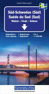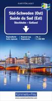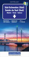
Wegenkaart - landkaart 1 Zuid Zweden | Kümmerly & Frey

0
Mooie duidelijke wegenkaart van Zuid Zweden, van Malmo - Vaxjo tot Kalmar.  Met o.a. campings, jeugdherbergen, wegnummers en bezienswaardigheden aangegeven. Kummerly and Frey regional road map covering South sweden. A product from this regional range is ideal for tourists, and is intended to be taken around in a glove compartment. Mapping gives at...

Verkopers met dit product

Verkoper
Bezorging
Prijs
DeZwerver.nl logo
DeZwerver.nl
2,95
14,75

Anderen bekeken ook

Nieuw
Wegenkaart - landkaart 2 Zuid Zweden (West), Southern Sweden; Karlstad Göteborg | Kümmerly & Frey
Mooie duidelijke wegenkaart van West Zweden, van Karlstad tot Göteborg. Met o.a. campings, jeugdherbergen, wegnummers en bezienswaardigheden aangegeven. Kummerly and Frey regional road map covering Karlstad to Göteborg. A product from this regional range is ideal for tourists, and is intended to be taken around in a glove compartment. Mapping gives at-a-glance navigation between tourist attractions within the coverage areas, so that travelling times can be easily calculated and minimised, with easily followable numbered roads so that incorrect routes are avoided.
14,75
Nieuw
Wegenkaart - landkaart 6 Nord-Schweden - Zweden Noord | Kümmerly & Frey
Mooie duidelijke wegenkaart van Noord Zweden, van Lulea - Kiruna - Narvik.  Met o.a. campings, jeugdherbergen, wegnummers en bezienswaardigheden aangegeven.   Kummerly and Frey regional road map covering North Sweden. A product from this regional range is ideal for tourists, and is intended to be taken around in a glove compartment. Mapping gives at-a-glance navigation between tourist attractions within the coverage areas, so that travelling times can be easily calculated and minimised, with easily followable numbered roads so that incorrect routes are avoided.
14,75
Fietskaart 01 Cycling guides Cornwall | Goldeneye
Our maps are double-sided, printed on an A2 sheet with a concertina fold. This allows for easy folding and folding, and an ease of access to the mapping. The material is rain and tear-resistant. Our early maps were designed at the scale of 2 miles to 1 inch/1:126,720. The later designs along with digitalisation are 1: 100,000. We were encouraged by the Cycle Touring Club to convert our cartography toward the cycle market (to replace the out-of-print Bartholomew series). As time and the series progressed we have added more data: The National Cycle Network routes, Regional Routes, and Traffic-Free Family Routes, as and when they are developed. These routes are in addition to the Circular Routes Goldeneye Commissioned at the outset of our publishing schedule. We are also adding to new editions; bike shops, cycle hire, and tea rooms, along with the tourist attractions already featured. Our plan is to make available digital versions for cell phones and tablets and to update, on an annual b…
15,95
Nieuw
Wegenkaart - landkaart 3 India - Oost | Nelles Verlag
Goede kaart van een deel van India. Aan beide kanten bedrukt. Met veel toeristische aanduidingen als nationale parken en culturele bezienswaardigheden. Prima leesbare kaart. Detailkaart: Kolkata (Calcutta) en Varanasi One of five maps in a series covering India at 1:1 500 000 scale. Folded road and tourist map of eastern India, including Nepal and southern Tibet to the north, Calcutta to the east, Visakhapatnam to the south, and Kanpur and Jabalpur on the western edge of map. Points of interest, national parks and railways are all highlighted and shaded-relief colouring clearly depicts the topography.    The map includes insets showing regional Kolkata (Calcutta) at 1:300 000 and a locator map. The legend is in English, French and German. The other titles in the series are India North, India North East, India South, and India West. Nelles also produces a map of the whole Indian Subcontinent at a scale of 1:4 500 000.   For over 20 years Nelles maps have been renowned throughout the wo…
11,95
Nieuw
Wegenkaart - landkaart Wales & south of England - Zuid Engeland | ITMB
Een degelijke kaart met aanduidingen van o.a. nationale parken, vliegveld, benzinepompen. We are gradually increasing the scales for our data of Great Britain and this is our latest effort. Most visitors to the UK fly into one of London's four airports and combine a visit to the city with an opportunity to travel to various destinations within striking distance of London. England is so incredibly rich in heritage and scenic attractions that it is extremely difficult to portray the country as a map of the entire entity. As a result, England lends itself nicely to be divided into a central/northern portion and a southern portion. To fit areas as diverse as Cornwall and Norwich on one sheet, one needs to have a vertical frame, with Devon/Cornwall up to the top of Wales on one side and Wiltshire to Kent up to York (admittedly, not normally considered to be part of 'southern', but vertically, that's what happens. At this scale, all of southern England and all of Wales can be shown in good …
13,95
Nieuw
Wegenkaart - landkaart - Stadsplattegrond Montreal & Southern Quebec | ITMB
Stadsplattegrond van Montreal met register. Op de achterzijde een kaart van het zuiden van Quebec. 1:12,500/1:850,000 on waterproof paper. In this third, updated, edition of Canada's third largest city, we have added a user-friendly bonus. As is common now to most of our city maps, we have included a regional map of the hinterland of the urban area, so buyers won't have to purchase a second map to explore the environs of the city being presented. In the case of Montreal, being in a huge geographic country, this means Southern Quebec which, because of its size, dictates a map of more than one to a million scale. In the European context this would be the equivalent of Paris and all of France as a 'regional' map of the surrounds of Paris - but that's France and this is Canada.   Montreal (or Mont Royale in its original) was a village called Hochelaga when the early French explorers arrived in the early 1600s. They established a trading fort and, generally speaking, maintained good relati…
13,95
Nieuw
Wegenkaart - landkaart Korea (Noord en Zuid) | Nelles Verlag
Goede kaart van Noord- EN Zuid Korea. Aan beide kanten bedrukt. Met veel toeristische aanduidingen als nationale parken en culturele bezienswaardigheden. Prima leesbare kaart. Folded road and tourist map of both North and South Korea at 1:1 500 000 scale. Places of interest, national parks, beaches, and ferry routes are all highlighted and shaded-relief colouring clearly depicts the topography.    The map includes an inset showing central Soul (Seoul) at 1:20 000. The legend is in English, French and German.   For over 20 years Nelles maps have been renowned throughout the world for their quality, faithfulness to detail and up-to-dateness.    So that streets, ferry links, railway lines, etc are always up to date, Nelles are continuously upgrading their maps - with the help of their international team of correspondents. Roads are provided with an exact kilometerage. Sights are highlighted extra clearly so that you don't miss any tourist attractions.   A good map must be hard-wearing an…
11,95
Nieuw
Wegenkaart - landkaart Africa central and south - Afrika zuid en centraal | ITMB
This title is in our series of regional titles for Africa at 1:3,400,000 scale. All of Africa is available as a continental sheet at 1:5M scale and as regional titles at 1:3.8M and 1:3.4M, based on GIS data. This is a milestone for ITMB and the realization of a dream that began in 1993. However, the work is still only in its early stages. This map covers that portion of the continent that old Africa hands always referred to as 'central', meaning the Rhodesias and Nyasaland � now known as Zambia, Malawi, and Zimbabwe.   By its shape, generous portions of the southern portions of DEM Congo, the eastern third of Angola, the northern half of Mozambique, and Botswana's Okavunga Delta are included on the one side. The second side covers South Africa, Lesotho, Swaziland, the rest of Botswana, and southern Namibia in great detail. This is an excellent map for anyone visiting the larger region of the southern third of Africa. As with our other regional titles, this is a work in progress. The n…
13,95
Nieuw
Wegenkaart - landkaart Frankreich Nord - Frankrijk Noord | Kümmerly & Frey
Mooie duidelijke wegenkaart van Noord Frankrijk. Met o.a. campings, wegnummers en bezienswaardigheden aangegeven. Die Strassenkarten von Kümmerly+Frey sind beliebte Begleiter bei der Planung einer Reise, unterwegs oder am Ziel. Die "Blauen", wie sie auch genannt werden, zeichnen sich durch ein übersichtliches Kartenbild und eine präzise Kartografie aus. Das Sortiment umfasst weit über 100 aktuelle Strassen- und Reisekarten. Alle Strassenkarten haben eines gemeinsam: Sie sind von bester Schweizer Qualität. Planen und reisen Sie mit einer blauen Strassenkarte von Kümmerly+Frey und Sie werden überrascht sein, wie viel es zu entdecken und zu erleben gibt.  In the Kümmerly+Frey Road Map France (North) at a scale of 1:600,000, you will find everything you need for orientation and inspiration.   The map shows the main areas of interest from Basel, Strasbourg, Metz, Dijon, Bourges, Paris, Le Mans, Rennes, Nantes, Rouen, Lille, Calais, Brest, etc.   Thanks to the clearly marked, easily readabl…
14,75
Nieuw
Wegenkaart - landkaart Wales & southwest England | ITMB
Een degelijke kaart met aanduidingen van o.a. nationale parken, vliegveld, benzinepompen. Finally, we have been able to create our own map of the lovely country of Wales. I use the word ‘country’ in its truest sense, as Wales was invaded and taken over by the English centuries ago. Regardless, the Welsh language and Welsh culture continue to flourish, although English is commonly spoken. We have visited Wales on several occasions and find that the attractions are so numerous that we could never see them all. There are too many castles to count, but some of the best preserved in the British Isles are in Wales, notable Caernarfon, but nearby Harlech is a World Heritage Site. St, David’s must be one of the smallest and loveliest cathedrals in the world, and Tintern Abbey ruins among the most poignant anywhere. We took Johnny to Abergavenny for lunch in March, not that it made any difference; he just pined for a McDonalds. This map is double-sided, with Wales on one side and the West Coun…
13,95

Klanten-reviews van Wegenkaart - landkaart 1 Zuid Zweden | Kümmerly & Frey

Er zijn nog geen beoordelingen voor dit productBen jij de eerste die een review plaatst?

Meer over Wegenkaart - landkaart 1 Zuid Zweden | Kümmerly & Frey

Productomschrijving

Mooie duidelijke wegenkaart van Zuid Zweden, van Malmo - Vaxjo tot Kalmar.  Met o.a. campings, jeugdherbergen, wegnummers en bezienswaardigheden aangegeven.

Kummerly and Frey regional road map covering South sweden. A product from this regional range is ideal for tourists, and is intended to be taken around in a glove compartment. Mapping gives at-a-glance navigation between tourist attractions within the coverage areas, so that travelling times can be easily calculated and minimised, with easily followable numbered roads so that incorrect routes are avoided.


Verken gerelateerde categorieën

Webshop.nl maakt gebruik van cookies. Ga je verder op onze website, ga dan akkoord met het plaatsen van cookies en de verwerking van deze data door ons en vermelde partners.