Wegenkaart - landkaart 1 Cyclades - Argosaronic islands | Anavasi

0
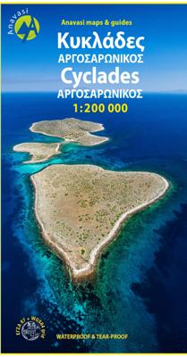
Gedetailleerde tweetalige (Grieks/Engels) topografische wegenkaart van de Cycladen met relief, gedetailleerd wegennet met wegnummers, campings en hutten.   Cyclades - Argosaronic islands  [R1] is a new map covering the areas of Attica with the Argosaronic islands of Salamina, Aegina, Ydra and Poros and all the Cyclades islands, printed on 2 sides ...

Verkopers met dit product

Verkoper
Bezorging
Prijs
DeZwerver.nl logo
DeZwerver.nl
2,95
11,95

Anderen bekeken ook

Nieuw
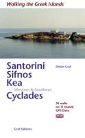
Wandelgids Santorini, Sifnos, Kea - Western and Southern Cyclades | Graf editions
Wandelen op de Griekse Eilanden met deze klein formaat Engelstalige wandelgids Anafi, Folegandros, Ios, Kea, Kimolos, Kithnos, Milos, Santorini, Thirassia, Serifos, Sifnos, Sikinos, bij elke uitgebreid beschreven dagwandeltocht is een gedetailleerde routekaart afgebeeld en foto's ter orientering van de moeilijke, verwarrende trajecten. Van de uitgever This book describes the loveliest old walking trails. With precise descriptions, detailed maps, exact times, GPS points and photos of outstanding places for better orientation. And lots of useful knowledge about the "Islands of Light." It is made for island hoppers who want to drift through the island world by ship and who would also like to hike and swim in this ancient cultural landscape.   The concept „Greek Islands“ conjures up images of white cubical houses twined around with red bougainvillea, unevenly paved alleys below bright blue church domes, dilapidated windmills on top of stormy mountain ridges, shady groves with old gnarl…
19,50
Nieuw
Wegenkaart - landkaart Jersey - Guernsey - Sark - Alderney (Kanaaleilanden) | ITMB
Goede detailkaart van alle kanaaleilanden. Het is zo gedetailleerd dat zelfs straatnamen er op staan. De kaart is ook nog eens geplastificeerd en daarmee scheur- en watervast.  ITMB is pleased to re-introduce the Channel Islands map area after a lengthy hiatus of preparing new artwork. The first version of this part of Europe was licensed artwork by a local firm in Jersey, and upon running out of copies of the printed map, we opted to prepare fresh artwork of our own to continue this interesting corner of the continent to continue to be available. The islands, collectively known in English as the Channel Islands, are one of those anomalies that make Europe so attractive. They are part of Great Britain, but not part of the UK; hence, they are not part of the EU. They are self-governing entities ‘owned’ by the Queen in her role of being Duchess of Normandy. This is, of course, merely a hereditary situation, but the islands were the personal possessions of William the Conqueror in 1066, …
14,50
Nieuw
Wandelkaart 10.36 Lesser Cyclades | Anavasi
GPS-compatible map of the island of Naxos and 5 small Cyclades (Irakleia, Schinousa, Pano Koufonisi, Kato Koufonisi and Donousa). This map is printed on light, waterproof and tear-resistant laminated paper. The map presents a plan of the most important cities. The suggestions for hiking are indicated. The road network indicates the undeveloped minor routes and the tracks in poor condition The road distances are indicated on the main roads and the locations of the service stations are indicated. A series of symbols highlight the various places of interest, including archaeological sites, beaches, etc. All the names are in Greek and Latin alphabet.   The Lesser or Small Cyclades are made up of more than 30 islands and rocks. The main inhabited islands are Iraklia, Schinousa, Donousa, Pano Koufonisi. The waters around them are very attractive and walking is inevitable as there are few roads. Donoussa has the best combination of paths and beaches, Iraklia is more suitable for hikers, Schi…
10,95
Nieuw
Reisgids The Greek Islands - Griekse eilanden | Rough Guides
Ideal for independent travellers, this guidebook to the Greek Islands, written by destination experts, combines must-see sights with hidden gems and offers essential tips for both planning and on-the-ground adventures. It's sustainably printed to ensure environmental responsibility.   Inside this Greek Islands travel book, you'll find:   - Regional deep dive - coverage of key regions, offering a rich selection of places and experiences, and honest reviews of each one - Itinerary samples - designed for various durations and interests - Practical information - tips on how to get there and get around, use public transport, beat the crowds, save time and money, travel responsibly and more - Expert recommendations - insider advice on where to eat, drink, and stay, alongside tips for nightlife and outdoor activities - Seasonal tips - when to go to the Greek Islands, climate details, and festival highlights to plan your perfect trip - Must-See pick - a curated selection of not-to-miss sights…
22,50
Fotoboek Cyclades | teNeues
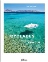
- The first and only comprehensive illustrated book on the Cyclades Islands, portraying all the islands in all seasons - Not your typical travel book capturing only the tourist hotspots of the islands, but a book that captures the land and people, the soul of the archipelago The first comprehensive illustrated book on the Cyclades archipelago, which also includes the well-known islands of Santorini, Naxos, Paros and Mykonos. The islands are currently among the trendiest travel destinations in the world. There is no Hollywood or Instagram star who has not been photographed in front of the white cities of the Greek islands. This illustrated book attempts to capture the islands' attitude to life in an undisguised way. In doing so, the volume does not aim at the big tourist hotspots and Instagram shots that can be seen everywhere else, but would like to capture the Greek island world as a whole - with all its discrepancies. Lonely bays and half-ruined towns stand next to the glossy world …
44,95
Nieuw
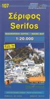
Wegenkaart - landkaart 107 Serifos | Road Editions
Gedetailleerde wegenkaart met aanduiding van de wandelwegen, lijst van hotels en toeristische informatie. Voor alle doeleinden een zeer geschikte kaart. The features that make this and every other ROAD island map unique are: *The coastline, hydrography and precision geophysical background based on data provided by the Hellenic Military Geographic Service and electronically processed by us for clarity and legibility. We have highlighted the mountain masses in shades of brown between the contour lines (at 20m intervals on this map) to outline clearly the relief of the island. *The beaches are indicated by a special symbol next to which we have noted their names, as well as all the roads and footpaths leading to them (since most people primarily visit the islands for the beaches!). We have even included a short text in which the island’s best beaches are concisely referred to, to save you going on a wild goose hunt in search of them. *The road network is mapped out with impressive and ex…
9,95
Nieuw
Wegenkaart - landkaart South Pacific Cruising & Samoa | ITMB
Een overzichtskaart van de zuidelijke Stille Oceaan met de cruise routes tussen de verschillende eilanden aangegeven. Op de achterzijde een overzichtskaart van Samoa This is a new venture for ITMB. Cruising is a rapidly-growing segment of the travel industry, experiencing double-digit growth rates annually. Obviously, this is a thriving market. In conjunction with several cruise ship lines, we have prepared a map of the South Pacific Ocean, which extends southwards from Hawai'i to the southern tip of New Zealand and eastwards from central Australia/Papua New Guinea to the Pitcairn Islands. Thus, it does not include the popular South East Asia and China coast routes. We think this has to change at a time when 25,000,000 people are travelling by cruise ships. At the same time, we must keep coverage area relevant for those end users of the artwork. Even at 1:12M, most of the area covered is water, with island countries such as Fiji, Tonga, Kiribati, Tahiti, and the Cook Islands being vis…
13,95
Nieuw
Wegenkaart - landkaart 8 Touring Map Cyclades | Terrain maps
Gedetailleerde wegenkaart met toeristische informatie aangegeven. Alle tekst is tweetalig in Engels en Grieks en de waterproof kaart is geschikt voor gebruik met GPS. Detailed and updated map of the Cyclades islands using G.I.S. (Geographical Information Systems) technology and the WGS84 reference system, supplemented by a ΕΓΣΑ87 grid.    Like all of TERRAIN’s large maps, the map of Cyclades is printed on Polyart, which is extremely durable against folding and unfolding, does not rip, and is 100% waterproof.    Based on field research completed in 2013, this map features all Cycladic islands and their beaches, ports, sea connections, airports, and all the important sights. It’s the ideal map for planning your visit to the Cycladic islands, especially if you’re sailing.
13,50
Nieuw
Wandelgids Canary Islands Walks | Sunflower books
Wandelgids: vele dagtochten worden degelijk beschreven met openbaar vervoer informatie, goede routebeschrijvingen en kaartmateriaal. Tevens enkele autotochten. Deze gids staat goed bekend! Engelstalig. Het geeft wandelingen verspreidt over alle 9 eilanden.  The go-to travel guide for discovering the best walks on the Canary Islands. Strap on your boots and discover the Canary Islands on foot with the Sunflower Canary Islands Walks travel guide. The Sunflower Canary Islands Walks guide is indispensable for walking and hiking on all 7 Canary Islands - Tenerife, Gran Canaria, Lanzarote, Fuerteventura, La Palma, La Gomera and El Hierro. This pocket-sized full-colour guide describes walks on each of the main islands and all are illustrated with photographs and large-scale topographical maps. Sunflower is the renowned publisher of the 'Landscapes' guides and have been dubbed the 'blue Bibles' by the Sunday Times but, unlike the 'Landscapes' series, this guide focuses on the walks - the most…
24,95
Nieuw
Wegenkaart - landkaart 109 Sifnos | Road Editions
Gedetailleerde wegenkaart met aanduiding van de wandelwegen, lijst van hotels en toeristische informatie. Voor alle doeleinden een zeer geschikte kaart. The features that make this and every other ROAD island map unique are: *The coastline, hydrography and precision geophysical background based on data provided by the Hellenic Military Geographic Service and electronically processed by us for clarity and legibility. We have highlighted the mountain masses in shades of brown between the contour lines (at 20m intervals on this map) to outline clearly the relief of the island. *The beaches are indicated by a special symbol next to which we have noted their names, as well as all the roads and footpaths leading to them (since most people primarily visit the islands for the beaches!). We have even included a short text in which the island’s best beaches are concisely referred to, to save you going on a wild goose hunt in search of them. *The road network is mapped out with impressive and ex…
9,95

Klanten-reviews van Wegenkaart - landkaart 1 Cyclades - Argosaronic islands | Anavasi

Er zijn nog geen beoordelingen voor dit productBen jij de eerste die een review plaatst?

Meer over Wegenkaart - landkaart 1 Cyclades - Argosaronic islands | Anavasi

Productomschrijving

Gedetailleerde tweetalige (Grieks/Engels) topografische wegenkaart van de Cycladen met relief, gedetailleerd wegennet met wegnummers, campings en hutten.   Cyclades - Argosaronic islands  [R1] is a new map covering the areas of Attica with the Argosaronic islands of Salamina, Aegina, Ydra and Poros and all the Cyclades islands, printed on 2 sides with overlap. A very useful map, especially for island-hoppers, with short text for each island presenting the main monuments, outstanding beaches and hiking trails on each island. Printed on waterproof, polyart paper

Verken gerelateerde categorieën

Webshop.nl maakt gebruik van cookies. Ga je verder op onze website, ga dan akkoord met het plaatsen van cookies en de verwerking van deze data door ons en vermelde partners.