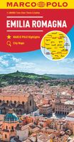
Wegenkaart - landkaart 06 Emilia Romagna | Marco Polo

0
Uitstekende deelkaart van Italie met als basis een bijna topografische ondergrond. Mooie wegen staan met groen weergegeven en groot voordeel boven de Michelin en Kummerley/Frey series is het feit dat er -weliswaar klein - campings op staan ingetekend. Zeer leesbare kaart, met register en alle noodzakelijke informatie. The series is particularly go...

Verkopers met dit product

Verkoper
Bezorging
Prijs
DeZwerver.nl logo
DeZwerver.nl
niet bekend
12,95

Anderen bekeken ook

Wegenkaart - landkaart 02 Lombardei - Lombardije | Marco Polo
Uitstekende deelkaart van Italie met als basis een bijna topografische ondergrond. Mooie wegen staan met groen weergegeven en groot voordeel boven de Michelin en Kummerley/Frey series is het feit dat er -weliswaar klein - campings op staan ingetekend. Zeer leesbare kaart, met register en alle noodzakelijke informatie. The series is particularly good for identifying geographical features: mountain and hill chains, valleys, national parks, etc. Picturesque towns and places of interest are given star rating, and other tourist information includes campsites and youth hostels, landmarks, recreational facilities etc. Latitude and longitude grid is drawn at intervals of 10'. Each title comes with a booklet which contains a street plan of the central area in the region’s main city, plus an extensive index of place names, including geographical features. Also provided are a table with distances and traveling times and main traffic and speed regulations. Map legend and all information include E…
14,95
Nieuw
Wegenkaart - landkaart 10 Abruzzen - Molise | Marco Polo
Uitstekende deelkaart van Italie met als basis een bijna topografische ondergrond. Mooie wegen staan met groen weergegeven en groot voordeel boven de Michelin en Kummerley/Frey series is het feit dat er -weliswaar klein - campings op staan ingetekend. Zeer leesbare kaart, met register en alle noodzakelijke informatie. The series is particularly good for identifying geographical features: mountain and hill chains, valleys, national parks, etc. Picturesque towns and places of interest are given star rating, and other tourist information includes campsites and youth hostels, landmarks, recreational facilities etc. Latitude and longitude grid is drawn at intervals of 10'. Each title comes with a booklet which contains a street plan of the central area in the region’s main city, plus an extensive index of place names, including geographical features. Also provided are a table with distances and traveling times and main traffic and speed regulations. Map legend and all information include E…
14,95
Wegenkaart - landkaart 05 Ligurien - Ligurië | Marco Polo
Uitstekende deelkaart van Italie met als basis een bijna topografische ondergrond. Mooie wegen staan met groen weergegeven en groot voordeel boven de Michelin en Kummerley/Frey series is het feit dat er -weliswaar klein - campings op staan ingetekend. Zeer leesbare kaart, met register en alle noodzakelijke informatie. The series is particularly good for identifying geographical features: mountain and hill chains, valleys, national parks, etc. Picturesque towns and places of interest are given star rating, and other tourist information includes campsites and youth hostels, landmarks, recreational facilities etc. Latitude and longitude grid is drawn at intervals of 10'. Each title comes with a booklet which contains a street plan of the central area in the region’s main city, plus an extensive index of place names, including geographical features. Also provided are a table with distances and traveling times and main traffic and speed regulations. Map legend and all information include E…
14,95
Wegenkaart - landkaart 15 Sardinien - Sardinië | Marco Polo
Uitstekende deelkaart van Italie met als basis een bijna topografische ondergrond. Mooie wegen staan met groen weergegeven en groot voordeel boven de Michelin en Kummerley/Frey series is het feit dat er -weliswaar klein - campings op staan ingetekend. Zeer leesbare kaart, met register en alle noodzakelijke informatie. The series is particularly good for identifying geographical features: mountain and hill chains, valleys, national parks, etc. Picturesque towns and places of interest are given star rating, and other tourist information includes campsites and youth hostels, landmarks, recreational facilities etc. Latitude and longitude grid is drawn at intervals of 10'. Each title comes with a booklet which contains a street plan of the central area in the region’s main city, plus an extensive index of place names, including geographical features. Also provided are a table with distances and traveling times and main traffic and speed regulations. Map legend and all information include E…
14,95
Wegenkaart - landkaart 13 Kalabrien - Calabrië | Marco Polo
Uitstekende deelkaart van Italie met als basis een bijna topografische ondergrond. Mooie wegen staan met groen weergegeven en groot voordeel boven de Michelin en Kummerley/Frey series is het feit dat er -weliswaar klein - campings op staan ingetekend. Zeer leesbare kaart, met register en alle noodzakelijke informatie. The series is particularly good for identifying geographical features: mountain and hill chains, valleys, national parks, etc. Picturesque towns and places of interest are given star rating, and other tourist information includes campsites and youth hostels, landmarks, recreational facilities etc. Latitude and longitude grid is drawn at intervals of 10'. Each title comes with a booklet which contains a street plan of the central area in the region’s main city, plus an extensive index of place names, including geographical features. Also provided are a table with distances and traveling times and main traffic and speed regulations. Map legend and all information include E…
14,95
Wegenkaart - landkaart 09 Latium - Lazio | Marco Polo
Uitstekende deelkaart van Italie met als basis een bijna topografische ondergrond. Mooie wegen staan met groen weergegeven en groot voordeel boven de Michelin en Kummerley/Frey series is het feit dat er -weliswaar klein - campings op staan ingetekend. Zeer leesbare kaart, met register en alle noodzakelijke informatie. The series is particularly good for identifying geographical features: mountain and hill chains, valleys, national parks, etc. Picturesque towns and places of interest are given star rating, and other tourist information includes campsites and youth hostels, landmarks, recreational facilities etc. Latitude and longitude grid is drawn at intervals of 10'. Each title comes with a booklet which contains a street plan of the central area in the region’s main city, plus an extensive index of place names, including geographical features. Also provided are a table with distances and traveling times and main traffic and speed regulations. Map legend and all information include E…
14,95
Wegenkaart - landkaart 04 Veneto - Friaul - Garda meer | Marco Polo
Uitstekende deelkaart van Italie met als basis een bijna topografische ondergrond. Mooie wegen staan met groen weergegeven en groot voordeel boven de Michelin en Kummerley/Frey series is het feit dat er -weliswaar klein - campings op staan ingetekend. Zeer leesbare kaart, met register en alle noodzakelijke informatie. The series is particularly good for identifying geographical features: mountain and hill chains, valleys, national parks, etc. Picturesque towns and places of interest are given star rating, and other tourist information includes campsites and youth hostels, landmarks, recreational facilities etc. Latitude and longitude grid is drawn at intervals of 10'. Each title comes with a booklet which contains a street plan of the central area in the region’s main city, plus an extensive index of place names, including geographical features. Also provided are a table with distances and traveling times and main traffic and speed regulations. Map legend and all information include E…
14,95
Wegenkaart - landkaart D9 Sachsen | Marco Polo
Goede wegenkaart van een deel van Duitsland,met schaal 1:200.000: meer details dan de Michelin wegenkaarten van Duitsland. Deze kaarten hebben een register, een tabel met afstanden tussen steden, enkele centrumkaarten van de meest belangrijke steden, vermelding van o.a. campings aan de hand van symbolen alsmede de bezienswaardigheden. Ook benzinepompen worden bijvoorbeeld vermeld! The maps retain the publisher’s traditional cartography of this series, boldly stressing main roads and motorways in strong colours and selected towns in large letters, but also showing minor roads and villages in considerable detail. Road information includes toll roads, traffic restrictions and seasonal closures, gradient marking for steep roads, scenic routes, etc. Motorway services clearly indicate types of facilities available there. Railway network includes narrow gauge and tourist lines, cable car lines, and chair lifts. The series is particularly good for identifying geographical features: mountain a…
13,95
Wegenkaart - landkaart D6 Hessen | Marco Polo
Goede wegenkaart van een deel van Duitsland,met schaal 1:200.000: meer details dan de Michelin wegenkaarten van Duitsland. Deze kaarten hebben een register, een tabel met afstanden tussen steden, enkele centrumkaarten van de meest belangrijke steden, vermelding van o.a. campings aan de hand van symbolen alsmede de bezienswaardigheden. Ook benzinepompen worden bijvoorbeeld vermeld! The maps retain the publisher’s traditional cartography of this series, boldly stressing main roads and motorways in strong colours and selected towns in large letters, but also showing minor roads and villages in considerable detail. Road information includes toll roads, traffic restrictions and seasonal closures, gradient marking for steep roads, scenic routes, etc. Motorway services clearly indicate types of facilities available there. Railway network includes narrow gauge and tourist lines, cable car lines, and chair lifts. The series is particularly good for identifying geographical features: mountain a…
13,95
Wegenkaart - landkaart D2 Mecklenburg Vorpommern | Marco Polo
Goede wegenkaart van een deel van Duitsland,met schaal 1:200.000: meer details dan de Michelin wegenkaarten van Duitsland. Deze kaarten hebben een register, een tabel met afstanden tussen steden, enkele centrumkaarten van de meest belangrijke steden, vermelding van o.a. campings aan de hand van symbolen alsmede de bezienswaardigheden. Ook benzinepompen worden bijvoorbeeld vermeld! The maps retain the publisher’s traditional cartography of this series, boldly stressing main roads and motorways in strong colours and selected towns in large letters, but also showing minor roads and villages in considerable detail. Road information includes toll roads, traffic restrictions and seasonal closures, gradient marking for steep roads, scenic routes, etc. Motorway services clearly indicate types of facilities available there. Railway network includes narrow gauge and tourist lines, cable car lines, and chair lifts. The series is particularly good for identifying geographical features: mountain a…
14,95

Klanten-reviews van Wegenkaart - landkaart 06 Emilia Romagna | Marco Polo

Er zijn nog geen beoordelingen voor dit productBen jij de eerste die een review plaatst?

Meer over Wegenkaart - landkaart 06 Emilia Romagna | Marco Polo

Productomschrijving

Uitstekende deelkaart van Italie met als basis een bijna topografische ondergrond. Mooie wegen staan met groen weergegeven en groot voordeel boven de Michelin en Kummerley/Frey series is het feit dat er -weliswaar klein - campings op staan ingetekend. Zeer leesbare kaart, met register en alle noodzakelijke informatie.

The series is particularly good for identifying geographical features: mountain and hill chains, valleys, national parks, etc. Picturesque towns and places of interest are given star rating, and other tourist information includes campsites and youth hostels, landmarks, recreational facilities etc. Latitude and longitude grid is drawn at intervals of 10'.

Each title comes with a booklet which contains a street plan of the central area in the region’s main city, plus an extensive index of place names, including geographical features. Also provided are a table with distances and traveling times and main traffic and speed regulations. Map legend and all information include English.


Verken gerelateerde categorieën

Webshop.nl maakt gebruik van cookies. Ga je verder op onze website, ga dan akkoord met het plaatsen van cookies en de verwerking van deze data door ons en vermelde partners.