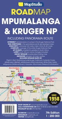
Wegenkaart - landkaart 04 Mpumalanga, Kruger National Park & Panorama Route | MapStudio

0
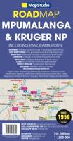
Toeristische wegenkaart met veel aanduidingen van interessante punten. Heldere kaart, goed leesbaar. speciaal stukje Africa: Mpumalanga, Kruger National Park and Panorama Route Road Map covers the entire Kruger National Park, includes a detailed exploring map of Mpumalanga and the Panorama Route, plans of camps in the Kruger National Park and is u...

Verkopers met dit product

Verkoper
Bezorging
Prijs
DeZwerver.nl logo
DeZwerver.nl
2,95
16,95

Anderen bekeken ook

Wegenkaart - landkaart 04 Mpumalanga, Kruger National Park & Panorama Route | MapStudio
Toeristische wegenkaart met veel aanduidingen van interessante punten. Heldere kaart, goed leesbaar. speciaal stukje Africa: Mpumalanga, Kruger National Park and Panorama Route Road Map covers the entire Kruger National Park, includes a detailed exploring map of Mpumalanga and the Panorama Route, plans of camps in the Kruger National Park and is up-to-date with all research compiled and updated in Africa   Detailed streetmaps and site maps with text and photography of Pilgrims Rest, Mashishing (Lydenburg), Dullstroom, Sudwala Caves, eMakhazeni (Belfast), eNtokozweni (Machadodorp), White River, Sabie, eMgwenya (Waterval Boven), Hazyview, Mbombela (Nelspruit) and Barberton   Easy-to-use map symbols showing hotel, lodges, rest camps, campsites, concession areas, bush camps, private rest camps and lodges, caravan facilities, caves, lookout points, waterholes, hides and much more. Information on hiking, trekking, walking and fly-fishing areas. Along with an alphabetised index, enlarged map…
16,95
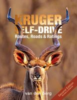
Reisgids Kruger National Park Self-Drive: Routes, Roads & Ratings | HPH Publishing
Kruger Self-Drive - Routes, Roads and Ratings is not only the first comprehensive guide to all roads in Kruger National Park, but also suggests routes to drive from every camp. The book rates every single road in Kruger according to the probability of predator and antelope sightings, scenic beauty and birding opportunities. The road descriptions feature a write-up of the vegetation, game viewing opportunities and history where applicable, as well as images taken on that specific road. In addition, the book boasts an A2, full-size pull-out map featuring the roads and routes of Kruger National Park. The appendix section features the most common mammals, reptiles, birds and plants found in the Park. The revised Second Edition contains new maps and photographs.
52,50
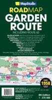
Wegenkaart - landkaart 02 Garden route & Route 62 Road Map | MapStudio
Wegenkaart van een deel van Zuid Afrika met inzetten van de meest belangrijke gebieden. Het overzicht is soms misschien een beetje onduidelijk. maar de details in de inzetten en delen van de kaart zijn prima en voldoen goed voor het rondrijden met een eigen auto. This newly updated Garden Route & Route 62 Road Map is a detailed road map of the Garden Route which covers the N2 from Riviersonderend to Port Elizabeth, Route 62 section from Montagu to Jeffrey’s Bay.   Includes information boxes on activities and places of interest that include watersports, bird watching, horse trails, canoe trails, 4×4 trails, hiking, arts & crafts, mountain biking, wine estates and much more. Full colour photos of various regions, places of interest sites, national parks reserves. Includes a detailed 1 : 20 000 street maps of Montagu, Barrydale, Ladysmith, Oudtshoorn, Mossel Bay, Knysna, Plettenberg Bay, Humansdorp, Jeffreys Bay, George. Includes GPS co-ordinates at major intersections.
16,95
Vogelgids Guide to birds of the Kruger National Park | Struik Nature
Uitgebreide vogelgids van het Krugerpark. Heldere foto's, verspreidingskaarten en een duideijke tekst.  The Kruger National Park, one of the largest and best-known conservation areas in the world, supports a remarkable diversity of birds. This attractive and handy field guide lists more than 500 species that have been recorded here, and provides full-colour photographs, detailed distribution maps and succinct information on 400 of these – all the species that a visitor is likely to encounter in the park. An informative introduction describes the park’s underlying geology, vegetation types, climate and rainfall, and how these dictate bird distributions within the area.
18,50
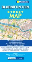
Wegenkaart - landkaart - Stadsplattegrond Bloemfontein | MapStudio
Uitgebreide stadsplattegrond van Bloemfontein  en directe omgeving. The Bloemfontein Street Map is a 1st edition street map providing coverage of Bloemfontein and surrounds, plus includes the latest interchange layouts, names and route numbers. The main map is at a 1:25 000 street-level scale and includes a detailed Bloemfontein map.   The map features reserves, parks and fields; golf courses, sports fields and stadiums; retail areas and shopping malls; intersection layouts, route numbers and interchange names; places of interest, historic sites and hotels; suburb names with boundaries; schools and sporting venue locations; a detailed index booklet with all street names and suburbs; industrial areas; hospitals and clinic locations; police station locations; wine estates and heritage sites; traffic light positions; bird sanctuaries; detailed sport symbols for sport venues; parks and public open-areas; post office and library locations.   Coverage Extent: Batho, Brandwag, Fichardt Park,…
7,95
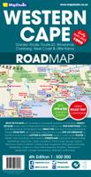
Wegenkaart - landkaart 10 Western Cape Road Map | MapStudio
Road map of the Western Cape Province with an enlargement for the Cape Peninsula and 27 street plans of the central areas in main towns. The map is annotated numerous places of interest, vineyards, etc. GPS coordinates are provides for main road junctions. This new edition Western Cape Road Map covers the whole of the Western Cape. It features easy-to-read full colour maps with GPS co-ordinates. The map provides tourist-friendly text, highlights places of interest and lists accommodation information. This map is perfect for scenic drives and includes information boxes on activities of interest.   Coverage includes the Garden Route & Route 62, South Western Cape, Winelands and Overberg, West Coast Flower Region and Little Karoo. The map features small detailed street plans of Cape Town CBD, Montagu, Barrydale, Ladismith, Oudtshoorn, Mossel Bay, Knysna, Plettenberg Bay, Humansdorp, George, Stellenbosch, Franschhoek, Paarl, Wellington, Hermanus, Swellendam, Robertson, Ceres, Tulbagh, Lan…
16,95
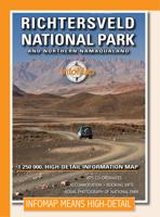
Wegenkaart - landkaart Richtersveld National Park and Northern Namaqualand | Infomap
Wegenkaart met toeristische informatie en geschikt voor gebruik met GPS   The original InfoMap! Now in its 8th edition this map remains as popular as ever. For those who don’t know, the Richtersveld National Park is a 160 000 hectare national park found on the banks of the Orange River in South Africa’s Northern Cape. It is the only mountain desert park in Southern Africa and is one of the few national parks in which you are not confined to your car. Dry, arid with a feeling of isolation, life in the park is influenced by the mist created by the cold Atlantic Ocean. Known to the local Nama people as ‘malmokkie’ it brings moisture to an otherwise parched land. Despite its lack of rainfall the area is rich in flora containing many species, like the Halfmens, which exist nowhere else on earth.   The area has long been a favorite for botanists, photographers, lovers of remote places and 4×4 enthusiasts who flock to this corner of South Africa for its unique character, isolation and fee…
15,95
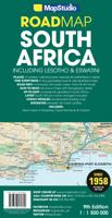
Wegenkaart - landkaart Zuid-Afrika - South Africa, Lesotho & Swaziland | MapStudio
Duidelijke overzichtskaart van Zuid Afrika, Lesotho en Swaziland. Met gedetailleerde kaarten van de regio's Gauteng, Kaapse Schiereiland en Durban. South Africa Lesotho and Swaziland map is a  new edition which includes major and minor routes with route markers, tourist regions and has an index to place names.   Content includes places of interest, mountain passes, topography, national parks & reserves, historic sites, railway lines & stations, route numbers, distance table and the latest toll routes and all route classifications.   Coverage includes a detailed map of South Africa at a scale of 1 : 1 500 000 along with detailed area maps of Gauteng, Durban and Cape Peninsula.
16,95
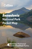
Wegenkaart - landkaart National Park Pocket Map Snowdonia | Collins
Duidelijke pocket wandelkaart met belangrijke toeristische informatie, bezienswaardigheden, campeerplekken e.d.   Handy little full colour map and guide of Snowdonia National Park. Detailed mapping and visitor information to the National Park along with a selection of photographs. Map at a scale of 1:119 000 (1.2cm to 1km, 1.9 miles to 1 inch).   This small map with additional text and photographs gives a great overview of the Snowdonia National Park, and is the perfect companion for exploring this beautiful area of North Wales.   Clear, detailed mapping Key park, tourist and travel information Ideal for planning visits to the National Park Index to help locate and plan your trip Information on historic railways, stargazing, mountain biking and places of interest
7,95
Wegenkaart - landkaart National Park Pocket Map Exmoor | Collins
Handige kleine kaart van dit Nationaal Park. De kaart geeft een goed en helder overzicht van het gebied met alle plaatsen, doorgaande wandelpaden (alhoewel grof van schaal), bezienswaardigheden etc. Met een register en aanvullende tekst onder de kaart is het een mooi overzicht wat je waar kunt gaan doen. Handy little full colour map and guide of Exmoor National Park. Detailed mapping and visitor information to the National Park along with a selection of photographs.   This small map with additional text and photographs gives a great overview of the Exmoor National Park, and is the perfect companion for exploring this beautiful area of southwest England.   Clear, detailed mapping Key park, tourist and travel information Ideal for planning visits to the National Park Index to help locate and plan your trip
7,95

Klanten-reviews van Wegenkaart - landkaart 04 Mpumalanga, Kruger National Park & Panorama Route | MapStudio

Er zijn nog geen beoordelingen voor dit productBen jij de eerste die een review plaatst?

Meer over Wegenkaart - landkaart 04 Mpumalanga, Kruger National Park & Panorama Route | MapStudio

Productomschrijving

Toeristische wegenkaart met veel aanduidingen van interessante punten. Heldere kaart, goed leesbaar. speciaal stukje Africa:

Mpumalanga, Kruger National Park and Panorama Route Road Map covers the entire Kruger National Park, includes a detailed exploring map of Mpumalanga and the Panorama Route, plans of camps in the Kruger National Park and is up-to-date with all research compiled and updated in Africa   Detailed streetmaps and site maps with text and photography of Pilgrims Rest, Mashishing (Lydenburg), Dullstroom, Sudwala Caves, eMakhazeni (Belfast), eNtokozweni (Machadodorp), White River, Sabie, eMgwenya (Waterval Boven), Hazyview, Mbombela (Nelspruit) and Barberton   Easy-to-use map symbols showing hotel, lodges, rest camps, campsites, concession areas, bush camps, private rest camps and lodges, caravan facilities, caves, lookout points, waterholes, hides and much more. Information on hiking, trekking, walking and fly-fishing areas. Along with an alphabetised index, enlarged map of the Sudwala Caves and full-colour images, this road map is a great holiday reference.   Key selling points • Ideal Mpumalanga, Kruger National Park & Panorama Route touring map • 11 detailed town plans • Detailed Kruger National Park map • Key tourist information   Barberton, Berg-en-dal, Bosbokrand, Bushman, Crocodile Bridge, Drakensberg, Dullstroom, eMakhanzeni, eMgwenya, eNtokozweni, GaMametsa, Game Reserve, Hamilton's, Hartebeesvlakte, Hazyview, Hendriksdal, Klipspruit, Krokodilspoortberge, kruger national park, Kruger National Park & Panorama Route Road Map, Letaba, Lower Sabie, Malelane, Mashishing, Matibidi, Mbombela, Mopani, Mpumalanga, Mpumalanga and Kruger National Park, National Parks, Nature Reserve, Numbi, Olifants, Orpen, Panorama, Panorama Route Road Map, Paul Kruger, Phabeni, Pilgrims rest, Pretoriuskop, Punda Maria, Rietfontein, road maps, Rusplaas, SAbi sand game reserve, Sabie and White river, Satara, Shingwedzi, Skukuza, Steenkampsberg, Sudwala Caves, Vaalhoek, Wonderfontein

Productinformatie

    Verken gerelateerde categorieën

    Webshop.nl maakt gebruik van cookies. Ga je verder op onze website, ga dan akkoord met het plaatsen van cookies en de verwerking van deze data door ons en vermelde partners.