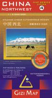
Wegenkaart - landkaart 4 China Noordwest - Northwest China | Gizi Map

0
Mooie overzichtskaart van alleen noord west China met Urumqi centraal gelegen. Fraai kleurgebruik voor hoogte en reliëf. De kaart is tweetalig en heeft een groot aantal plaatsen, topografisch zonder meer goed. Gebied: de Sinkiang (Xinjiang) Autonomie Regio. De kaart grenst aan de Russische en Mongoolse grens tot aan het begin van Tibet, and westel...

Verkopers met dit product

Verkoper
Bezorging
Prijs
DeZwerver.nl logo
DeZwerver.nl
2,95
15,95

Anderen bekeken ook

Wegenkaart - landkaart 4 China Noordwest - Northwest China | Gizi Map
Mooie overzichtskaart van alleen noord west China met Urumqi centraal gelegen. Fraai kleurgebruik voor hoogte en reliëf. De kaart is tweetalig en heeft een groot aantal plaatsen, topografisch zonder meer goed. Gebied: de Sinkiang (Xinjiang) Autonomie Regio. De kaart grenst aan de Russische en Mongoolse grens tot aan het begin van Tibet, and westelijk naar Lake Balqash in Kazakhstan, tot Gilgit op de Karakoram Highway, en tot Srinagar in India, inclusief de betwiste Aksay Chin regio. Bold altitude colouring, with spot heights and names of mountain ranges and other geographical features, provides an excellent picture of the terrain. The maps show various categories of roads including selected tracks, with intermediate driving distances marked on many routes. Railways, shipping and ferry lines, and local airports are also shown. Province boundaries are indicated and national parks are highlighted. Symbols marks landmarks and features such as tombs, monasteries, churches, temples, ruins, …
15,95
Wegenkaart - landkaart 3013 Adventure Map India Northwest - Noordwest | National Geographic
Wegenkaart van Noordwest India met vermelding van veel bezienswaardigheden, nationale parken en attrakties. Watervast en scheurvast. National Geographic's India Northwest Adventure Map is designed to meet the unique needs of adventure travelers with its durability and detailed, accurate information. The map includes the locations of thousands of cities and towns with a user-friendly index, as well as a clearly marked road network complete with distances and designations for highways, major routes and secondary roads.   The India Northwest Adventure Map differs from a traditional road map for it includes hundreds of points of interest that highlight diverse and unique destinations in the region. The map features UNESCO World Heritage sites, national parks, archaeological sites, wildlife sanctuaries, Hindu, Buddhist and Sikh temples, forts, palaces and other points of interest, making it an invaluable resource to travelers hoping to experience all the history and culture India has to of…
17,50
Wegenkaart - landkaart 2 Centraal China | Gizi Map
Mooie overzichtskaart van alleen Centraal China met fraai kleurgebruik voor hoogte en reliëf. De kaart is tweetalig en heeft een groot aantal plaatsen, topografisch zonder meer goed. Gebied: centraal en oost China, van Shenyang in het noordoosten tot Chongqing in het zuiden en Yiayuguan in het westen, inclusief de Chinese Muur. Bold altitude colouring, with spot heights and names of mountain ranges and other geographical features, provides an excellent picture of the terrain. The maps show various categories of roads including selected tracks, with intermediate driving distances marked on many routes. Railways, shipping and ferry lines, and local airports are also shown. Province boundaries are indicated and national parks are highlighted. Symbols marks landmarks and features such as tombs, monasteries, churches, temples, ruins, UNESCO sites including the Great Wall, and other places of interest.  
15,95
Wegenkaart - landkaart 1 China South - China Zuid | Gizi Map
Mooie overzichtskaart van alleen Zuid China met fraai kleurgebruik voor hoogte en reliëf. De kaart is tweetalig en heeft een groot aantal plaatsen, topografisch zonder meer goed. Het gebied betreft zuid-oosten van China en Taiwan, van Nanjing en Shanghai in het noorden tot Hainan Island en het noorden van Vietnam en Laos. Bold altitude colouring, with spot heights and names of mountain ranges and other geographical features, provides an excellent picture of the terrain. The maps show various categories of roads including selected tracks, with intermediate driving distances marked on many routes. Railways, shipping and ferry lines, and local airports are also shown. Province boundaries are indicated and national parks are highlighted. Symbols marks landmarks and features such as tombs, monasteries, churches, temples, ruins, UNESCO sites including the Great Wall, and other places of interest.  
15,95
Wegenkaart - landkaart 3 Noord oost China - northeast China | Gizi Map
Mooie overzichtskaart van alleen Noordoost China met fraai kleurgebruik voor hoogte en reliëf. De kaart is tweetalig en heeft een groot aantal plaatsen, topografisch zonder meer goed. Gebied: noordoost China en oost Mongolia, van Beijing en Tianjin, en zuid van Pyongyang in noord Korea. De kaart heeft aandacht voor de Chinese muurl en de Muur van Genghis Khan. Bold altitude colouring, with spot heights and names of mountain ranges and other geographical features, provides an excellent picture of the terrain. The maps show various categories of roads including selected tracks, with intermediate driving distances marked on many routes. Railways, shipping and ferry lines, and local airports are also shown. Province boundaries are indicated and national parks are highlighted. Symbols marks landmarks and features such as tombs, monasteries, churches, temples, ruins, UNESCO sites including the Great Wall, and other places of interest.  
15,95
Wegenkaart - landkaart Afrika noordwest - Africa northwest | ITMB
Een degelijke kaart met aanduidingen van o.a. nationale parken, vliegveld, benzinepomp, dirt-roads en kleine plattegrond van hoofdstad. Als overzichtskaart goed te gebruiken. This is the detailed map of Africa emanating from our continental data base and, at an scale better than Michelin's famous regional map, we feel that this version is a winner. First, it is printed double-sided with the western coastal segment on one side and the eastern half on the other. Second, we have been able to improve the accuracy of the road information enormously at the better scale, and third we are making progress in developing a new series of travel maps for Africa by publishing the first of what we hope will become a new regional map covering Africa from top to bottom, or from Cape to Cairo, as Uncle Cecil used to say. The coverage of this map is from Morocco in the west to the Libyan/Egyptian border and from Senegal and Liberia in the southwest to the Chad/Sudan border in the southeast. This is also…
13,95
Wegenkaart - landkaart 1 Noordwest USA - Northwest USA | Borch
Mooie geplasticieerde kaart van het Noordwesten van de USA. Deze kaart biedt een goed overzicht van het land met detailkaarten. Our soft-laminated map of USA Northwest - USA 1 includes: Pacific Northwest 1:3 000 000, San Francisco 1:15 000, San Francisco Bay Area 1:400 000, San Francisco & Region 1:1 000 000, Seattle 1:13 000 and Greater Seattle 1:350 000, Seattle & Region 1:1 000 000,  Portland 1:20 000, Denver & Region 1:1 000 000, Salt Lake City & Region 1:1 000 000, Yellowstone National Park 1:1 000 000, USA administrative & time zones, interesting statistics, conversion chart for temperatures, weights and measures, climate chart with temperatures, sunshine hours, precipitation and humidity and much more.   The beautiful landscape of Oregon and Washington includes rugged coastline, mountain ranges, lakes, rivers, rich farmland and burgeoning wine country, as well as the magnificent cities of Portland and Seattle with their bustling cosmopolitan flair. While Seattle is renowned as …
11,50
Wegenkaart - landkaart China Administrative Map | Gizi Map
This folded, political map of China shows provinces in different colors. Map features province boundaries, major cities, airports, waterways, ports and the Great Wall. Inset of Pearl River Delta. Legend in 5 languages: English, German, French, Italian, and Chinese. Scale is 1:6.5 million. A basic political map of the country, with colours clearly distinguishing the provinces. Major towns and rivers are identified and the great wall is marked. Symbols depict airports and ports. Manes are written in Roman and Chinese script. An inset shows Hong Kong and the Pearl River Delta region at 1:1,000,000
15,95
Wegenkaart - landkaart Yemen - Jemen | Gizi Map
Yemen, including the Gulf of Aden, at 1:1,250,000 on an excellent and informative map from Gizi Maps, with a street plan of central Sana’a and enlargements of the environs of the capital and Aden, plus the Aden Peninsula.   The map has the publisher’s characteristic bold altitude colouring and plenty of names of various mountain chains, peaks, deserts, etc. Graphics indicate swamps, salt flats, wadis, deserts, lava flows, water wells, oasis, etc, to provide a vivid picture of the country’s topography. Names of the larger towns, provinces and many geographical features are given in both Latin and Arabic alphabets; all other place names are shown only transliterated.   Coverage extends southward to the northern coastline of the Horn of Africa, including the whole of Djibouti and most of Eritrea. Within the Gulf of Aden the Internationally Recommended Transit Corridor (IRTC) is marked, as well as other ferry and shipping routes including those leading to the Socotra Archipelago and in th…
15,95
Wegenkaart - landkaart India | Gizi Map
Natuurkundige wegenkaart van India met ook veel aandacht voor het wegennet en plaatsen, achterop de kaart staat een uitgebreid register. A detailed and attractive general map showing relief through altitude tinting, with an inset administrative map also included. Coverage extends beyond India to include the whole of Nepal, Bangladesh and large sections of Myanmar, Pakistan and Afghanistan. The Maldives, Andaman & Nicobar Islands and Eastern India (Assam & surroundings) are shown in insets. Selected peak heights are indicated and some terrain features such as salt flats, glaciers & swamps are distinguished. Several categories of roads are distinguished, including selected minor roads and tracks, with intermediate driving distances marked on many routes. Railways, shipping routes, airports and ports are marked and administrative region boundaries (and disputed frontiers) are shown. Symbols denote major places of worship, palaces, temples, beach resorts, antiquities, archeological sites,…
15,95

Klanten-reviews van Wegenkaart - landkaart 4 China Noordwest - Northwest China | Gizi Map

Er zijn nog geen beoordelingen voor dit productBen jij de eerste die een review plaatst?

Meer over Wegenkaart - landkaart 4 China Noordwest - Northwest China | Gizi Map

Productomschrijving

Mooie overzichtskaart van alleen noord west China met Urumqi centraal gelegen. Fraai kleurgebruik voor hoogte en reliëf. De kaart is tweetalig en heeft een groot aantal plaatsen, topografisch zonder meer goed.

Gebied: de Sinkiang (Xinjiang) Autonomie Regio. De kaart grenst aan de Russische en Mongoolse grens tot aan het begin van Tibet, and westelijk naar Lake Balqash in Kazakhstan, tot Gilgit op de Karakoram Highway, en tot Srinagar in India, inclusief de betwiste Aksay Chin regio.

Bold altitude colouring, with spot heights and names of mountain ranges and other geographical features, provides an excellent picture of the terrain. The maps show various categories of roads including selected tracks, with intermediate driving distances marked on many routes. Railways, shipping and ferry lines, and local airports are also shown. Province boundaries are indicated and national parks are highlighted. Symbols marks landmarks and features such as tombs, monasteries, churches, temples, ruins, UNESCO sites including the Great Wall, and other places of interest.


Productinformatie

    Verken gerelateerde categorieën

    Webshop.nl maakt gebruik van cookies. Ga je verder op onze website, ga dan akkoord met het plaatsen van cookies en de verwerking van deze data door ons en vermelde partners.