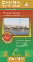
Wegenkaart - landkaart 3 Noord oost China - northeast China | Gizi Map

0
Mooie overzichtskaart van alleen Noordoost China met fraai kleurgebruik voor hoogte en reliëf. De kaart is tweetalig en heeft een groot aantal plaatsen, topografisch zonder meer goed. Gebied: noordoost China en oost Mongolia, van Beijing en Tianjin, en zuid van Pyongyang in noord Korea. De kaart heeft aandacht voor de Chinese muurl en de Muur van ...

Verkopers met dit product

Verkoper
Bezorging
Prijs
DeZwerver.nl logo
DeZwerver.nl
2,95
15,95

Anderen bekeken ook

Wegenkaart - landkaart 3 Noord oost China - northeast China | Gizi Map
Mooie overzichtskaart van alleen Noordoost China met fraai kleurgebruik voor hoogte en reliëf. De kaart is tweetalig en heeft een groot aantal plaatsen, topografisch zonder meer goed. Gebied: noordoost China en oost Mongolia, van Beijing en Tianjin, en zuid van Pyongyang in noord Korea. De kaart heeft aandacht voor de Chinese muurl en de Muur van Genghis Khan. Bold altitude colouring, with spot heights and names of mountain ranges and other geographical features, provides an excellent picture of the terrain. The maps show various categories of roads including selected tracks, with intermediate driving distances marked on many routes. Railways, shipping and ferry lines, and local airports are also shown. Province boundaries are indicated and national parks are highlighted. Symbols marks landmarks and features such as tombs, monasteries, churches, temples, ruins, UNESCO sites including the Great Wall, and other places of interest.  
15,95
Wegenkaart - landkaart 4 China Noordwest - Northwest China | Gizi Map
Mooie overzichtskaart van alleen noord west China met Urumqi centraal gelegen. Fraai kleurgebruik voor hoogte en reliëf. De kaart is tweetalig en heeft een groot aantal plaatsen, topografisch zonder meer goed. Gebied: de Sinkiang (Xinjiang) Autonomie Regio. De kaart grenst aan de Russische en Mongoolse grens tot aan het begin van Tibet, and westelijk naar Lake Balqash in Kazakhstan, tot Gilgit op de Karakoram Highway, en tot Srinagar in India, inclusief de betwiste Aksay Chin regio. Bold altitude colouring, with spot heights and names of mountain ranges and other geographical features, provides an excellent picture of the terrain. The maps show various categories of roads including selected tracks, with intermediate driving distances marked on many routes. Railways, shipping and ferry lines, and local airports are also shown. Province boundaries are indicated and national parks are highlighted. Symbols marks landmarks and features such as tombs, monasteries, churches, temples, ruins, …
15,95
Wegenkaart - landkaart 2 Centraal China | Gizi Map
Mooie overzichtskaart van alleen Centraal China met fraai kleurgebruik voor hoogte en reliëf. De kaart is tweetalig en heeft een groot aantal plaatsen, topografisch zonder meer goed. Gebied: centraal en oost China, van Shenyang in het noordoosten tot Chongqing in het zuiden en Yiayuguan in het westen, inclusief de Chinese Muur. Bold altitude colouring, with spot heights and names of mountain ranges and other geographical features, provides an excellent picture of the terrain. The maps show various categories of roads including selected tracks, with intermediate driving distances marked on many routes. Railways, shipping and ferry lines, and local airports are also shown. Province boundaries are indicated and national parks are highlighted. Symbols marks landmarks and features such as tombs, monasteries, churches, temples, ruins, UNESCO sites including the Great Wall, and other places of interest.  
15,95
Wegenkaart - landkaart 1 China South - China Zuid | Gizi Map
Mooie overzichtskaart van alleen Zuid China met fraai kleurgebruik voor hoogte en reliëf. De kaart is tweetalig en heeft een groot aantal plaatsen, topografisch zonder meer goed. Het gebied betreft zuid-oosten van China en Taiwan, van Nanjing en Shanghai in het noorden tot Hainan Island en het noorden van Vietnam en Laos. Bold altitude colouring, with spot heights and names of mountain ranges and other geographical features, provides an excellent picture of the terrain. The maps show various categories of roads including selected tracks, with intermediate driving distances marked on many routes. Railways, shipping and ferry lines, and local airports are also shown. Province boundaries are indicated and national parks are highlighted. Symbols marks landmarks and features such as tombs, monasteries, churches, temples, ruins, UNESCO sites including the Great Wall, and other places of interest.  
15,95
Wegenkaart - landkaart 3012 Adventure Map India Northeast - Noordoost | National Geographic
Wegenkaart van Noordoost India met vermelding van veel bezienswaardigheden, nationale parken en attrakties. Watervast en scheurvast.   National Geographic's India Northeast Adventure Map is designed to meet the unique needs of adventure travelers with its durability and detailed, accurate information. The map includes the locations of thousands of cities and towns with a user-friendly index, as well as a clearly marked road network complete with distances and designations for highways, major routes and secondary roads.   The India Northeast Adventure Map differs from a traditional road map for it includes hundreds of points of interest that highlight the diverse and unique destinations found in this region. The map features UNESCO World Heritage sites, archaeological sites, wildlife sanctuaries, Hindu and Buddhist temples, forts, ruins, caves and other points of interest, making it an invaluable resource to travelers hoping to experience all the history and culture this part of India …
17,50
Wegenkaart - landkaart 5 Noordoost USA - Northeast USA | Borch
Mooie geplasticieerde kaart van het Noordoosten van de USA. Deze kaart biedt een goed overzicht van het land met detailkaarten.   Our soft-laminated folded map of Northeast-USA - New York & Great Lakes shows: Northeast USA 1:3 000 000, Greater Boston 1:1 000 000, Central East Coast 1:1 000 000, Boston 1: 14 000, New York City 1:20 000, Washington DC 1:15 000, USA administrative & time zones. Borch maps are easy to fold, durable and water-repellent with a wipeable surface. Borch Maps show hotels, museums, monuments, markets, public transport, top sights and points of interest, useful statistics, conversion charts for temperatures, weights and measurements, climate charts showing temperatures, sunshine hours, precipitation and humidity, overview maps, time zones, and much more...   From Philadelphia's Independence Park to Boston's Freedom Trail, New York's Federal Hall to Washington's Capitol Hill, from the Potomac to the "honeymooners' paradise" of Niagara Falls, New England and the mi…
11,50
Wegenkaart - landkaart Bhutan & Northeast India | ITMB
Een degelijke kaart met aanduidingen van o.a. nationale parken, vliegveld, benzinepomp, dirt-roads en kleine plattegronden van Thimphu, Paro en Calcutta. Als overzichtskaart goed te gebruiken.   De ene kant van de kaart heeft Bhutan erop staan, met een schaal van 1:35.000. De andere kant van de kaart omvat noordoost India. Schaal 1:1.300.000    Bhutan is a beautiful mountainous country, squeezed between India and China. It is not a part of the world experiencing significant change, and this version is pretty much the same as our previous one, although updated with minor changes. Printed double-sided, with Northeast India on the other side.   Legend Includes: Roads by classification, Express Way, National Highway, Major Highway, Secondary Road, Other road/track, Railway, Ferry Route , State Boundary, Undefined Boundary, River and Lake, Glacier, Desert/ swamp, Mountain peak, Pass, Historical Site, Monument, Bhuddist Monument, Radio Tower, Post Office, Police Station, Hospital, Library, …
13,95
Wegenkaart - landkaart Sikkim & India Northeast | ITMB
Een degelijke kaart met aanduidingen van o.a. nationale parken, vliegveld, benzinepomp, dirt-roads en kleine plattegrond van Calcutta. Beschrijft de punt van India tussen Nepal en Buthan. De ene zijde van de kaart omvat Sikkim, schaal 1:135.000. De andere zijde van de kaart omvat Noordoost India, ten dele Nepal, Myanmar en China, schaal 1: 1.500.000. Kaart van Calcutta en Calcutta met omgeving.   Sikkim is an autonomous state between India and Chinese-controlled Tibet, much as Bhutan. It is a wonderful, mountainous country to visit, with reasonably good goads going far to the north, well into the Himalayas, and interesting temples/pagodas to see, as well as the fabulous Fam Rong Lho Wildlife Sanctuary. As anyone visiting this remote state needs to pass through the northeastern area of India to reach Sikkim, we have include a complete, detailed map of Bengal, Bihar, Meghalaya, and the Assam states as well as of the portion of Nepal abutting Sikkim, and an inset map of Kolkata. The map …
13,95
Wegenkaart - landkaart China Administrative Map | Gizi Map
This folded, political map of China shows provinces in different colors. Map features province boundaries, major cities, airports, waterways, ports and the Great Wall. Inset of Pearl River Delta. Legend in 5 languages: English, German, French, Italian, and Chinese. Scale is 1:6.5 million. A basic political map of the country, with colours clearly distinguishing the provinces. Major towns and rivers are identified and the great wall is marked. Symbols depict airports and ports. Manes are written in Roman and Chinese script. An inset shows Hong Kong and the Pearl River Delta region at 1:1,000,000
15,95

Klanten-reviews van Wegenkaart - landkaart 3 Noord oost China - northeast China | Gizi Map

Er zijn nog geen beoordelingen voor dit productBen jij de eerste die een review plaatst?

Meer over Wegenkaart - landkaart 3 Noord oost China - northeast China | Gizi Map

Productomschrijving

Mooie overzichtskaart van alleen Noordoost China met fraai kleurgebruik voor hoogte en reliëf. De kaart is tweetalig en heeft een groot aantal plaatsen, topografisch zonder meer goed.

Gebied: noordoost China en oost Mongolia, van Beijing en Tianjin, en zuid van Pyongyang in noord Korea. De kaart heeft aandacht voor de Chinese muurl en de Muur van Genghis Khan.

Bold altitude colouring, with spot heights and names of mountain ranges and other geographical features, provides an excellent picture of the terrain. The maps show various categories of roads including selected tracks, with intermediate driving distances marked on many routes. Railways, shipping and ferry lines, and local airports are also shown. Province boundaries are indicated and national parks are highlighted. Symbols marks landmarks and features such as tombs, monasteries, churches, temples, ruins, UNESCO sites including the Great Wall, and other places of interest.


Productinformatie

    Verken gerelateerde categorieën

    Webshop.nl maakt gebruik van cookies. Ga je verder op onze website, ga dan akkoord met het plaatsen van cookies en de verwerking van deze data door ons en vermelde partners.