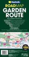
Wegenkaart - landkaart 02 Garden route & Route 62 Road Map | MapStudio

0
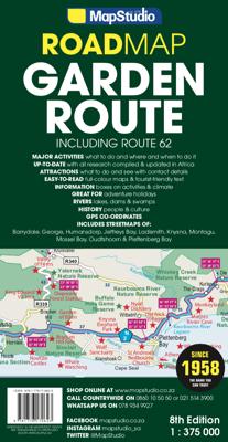
Wegenkaart van een deel van Zuid Afrika met inzetten van de meest belangrijke gebieden. Het overzicht is soms misschien een beetje onduidelijk. maar de details in de inzetten en delen van de kaart zijn prima en voldoen goed voor het rondrijden met een eigen auto. This newly updated Garden Route & Route 62 Road Map is a detailed road map of the Gar...

Verkopers met dit product

Webshop
Bezorging
Prijs
DeZwerver.nl logo
DeZwerver.nl
2,95
16,95

Anderen bekeken ook

Wegenkaart - landkaart Garden Route | Zuid Afrika | Slingsby Maps
Brand new 11th edition of the FIRST and still the BEST Garden Route map … Now thoroughly updated. From Witsand and Heidelberg in the west, this ALL-NEW map has been extended eastwards through Mossel Bay, George, Knysna and Plett to include JEFFERYS BAY and the GAMTOOS RIVER MOUTH – with fully updated Tourism info AND a greatly improved scale!   The Garden Route is so much more than a scenic national road. Explore the intriguing winding side roads and you’ll discover places with names like Whiskey Creek, De Vlugt, Phantom Pass and Noetzie. In these lit- tle known by ways, you can find old goldmines, traces of elephants, magical forest walks, castles on beaches and old passes.   Water and tear resistant in plastic sleeve.   Features:   This is a relief-shaded double-sided map covering the whole of the Western Cape’s official Garden Route Tourism Region, from Heidelberg in the west to Jeffery’s Bay in the east It includes the Tsitsikamma and Outeniqua Mountains and the Langkloof to …
29,50
Nieuw
Wegenkaart - landkaart South Africa: Swartberg & Klein-Karoo | Slingsby Maps
All roads from National Highways to minor gravel roads are shown; the many classifications that indi- cate the quality of each road help you plan your route No less than 28 mountain passes are shown — all are public roads! Distances are clearly shown; comprehensive 4 x 4 information GPS coordinates in DD MM SS format are provided for every road-junction All tourism facilities and accommodation establishments are shown in the out-of-town areas; there are insets of the major towns The map links to our maps of the Baviaanskloof, the Garden Route, Overberg and the Tankwa-Karoo Additional info:   Swartberg and Klein-Karoo region on a contoured and GPS compatible, double-sided, waterproof and   tear-resistant map at 1:160,000 from Slingsby Maps, with excellent topographic detail and plenty of tourist information, including street plans of ten main towns.   The map provides a very detailed picture of this mountainous terrain, with altitude colouring, shading, con- tours at 20m intervals and …
29,95
Wegenkaart - landkaart Garden Route | Collins
Full color, informative map of South Africa’s popular Garden Route. With detailed mapping and tourist information, this map is a perfect guide to traveling along the southern coast of South Africa.   Main features of this map include:   Clear comprehensive mapping Tourist routes, attractions and places of interest clearly marked Images of top sights along the route accompanied by textual descriptions Suggested itineraries Detailed index of places of interest and place names Essential for those planning an adventure along South Africa’s Garden Route.
19,95
Wegenkaart - landkaart Pocket Map Wild Atlantic Way | Collins
Handy full-colour map of Ireland’s Wild Atlantic Way with a high level of detail. Clear mapping of the full 2500 km (over 1500 miles) route, showing the road network and places of interest.   Clear, detailed Collins road mapping is presented in a handy format ideal for the pocket or handbag. It is excellent value and very detailed for its size, covering the whole of the Wild Atlantic Way.   Ideal for tourists, locals, hikers and adventurers. Places of interest marked, including famous film locations.   This map includes: • Clear mapping at a scale of 8.7 miles to 1 inch • National Tourist Routes showing best routes through the most scenic areas • Places of interest include film locations such as Star Wars • Tourist and signature locations clearly marked • Suggested itineraries • Detailed place names index • Ideal companion to a sat-nav – it enables route planning and route sense-checking
7,95
Wegenkaart - landkaart Visitors map Lake District | A-Z Map Company
Explore the whole region and area extending from Cockermouth and Penrith in the north to Ulverston and Grange-over-Sands in the south and from the M6 in the east to the coast in the west. Published at a clear 2.45 miles to 1 inch scale, this detailed visitors map of the Lake District includes primary route destinations and selected caravan and camping sites. Plus, there is detailed informative text for visitor attractions and places of interest.   There are also 12 town centre street maps of: Ambleside, Cockermouth, Coniston, Grange-over-Sands, Grasmere, Hawkshead, Kendal, Keswick, Penrith, Ulverston, Windermere and Bowness-on-Windermere. Each town centre map includes descriptive text and useful information about its visitor attractions and places of interest. Each town plan also has a separate index, while the main road map index lists towns, villages, hamlets and locations.   The 'Index to Places of Interest' lists tourist sites by feature type. For 2024, there is also now added ele…
12,50
Wegenkaart - landkaart Touring Map of Scotland - Schotland | Collins
Best-selling map of Scotland. More than 1,000 places of tourist interest plotted and named on the map. The features have been plotted onto an up-to-date and attractive Collins map of Scotland.   A clear, easy to follow road map with colour classified roads. Ideal for tourists with hundreds of distinctive tourist symbols and tourist information centres all shown.   This map includes: • The whole of Scotland on a double sided sheet at 5 miles to 1 inch • Over 25 categories of tourist information shown on the map including youth hostels, picnic sites and ferries as well as the more obvious tourist sites such as castles, wildlife parks and museums • Detailed town centre maps of Edinburgh, Glasgow, Aberdeen, Dundee, Inverness and Perth • New places of interest including Japanese Garden (near Dollar), Macallan Distillery Centre, Moat Brae (Dumfries) and Scottish Submarine Centre (Helensburgh) • Road updates include the new Dalry bypass, Maybole bypass under construction, A9 dualling section…
9,95
Wegenkaart - landkaart Pocket Map Skye | Collins
Handy little full colour Collins map of Skye with a high level of detail. Clear mapping of the Isle of Skye showing the road network, ferries and places of interest. Map at a scale of 1:175 000 (3 miles to 1 inch).   Clear, detailed, full colour Collins road mapping is presented in a handy format ideal for the pocket or handbag. It is excellent value and covers the whole of the Isle of Skye. This map includes:* Scotland route map* Caravan and camping sites* Tourist locations* Ferry links* Listing of major places to visit, with additional details for Dunvegan Castle, Old Man of Storr and Loch Coruisk* Detailed place names index
7,95
Wegenkaart - landkaart Visitors map Cornwall | A-Z Map Company
Explore the whole county and area extending into Devon as far as Great Torrington, Tavistock and Plymouth. This detailed and up-to-date map contains more than 1,000 places of interest and an index to 3,000 towns and villages. Published at a clear 2.5 miles to 1 inch scale (1.6 kms to 1 cm), a handy road map includes primary route destinations, selected caravan and camping sites, visitor attractions and places of interest.   Town centre street maps of Bodmin, Bude, Falmouth, Fowey, Launceston, Liskeard, Looe, Newquay, Padstow, Penzance,Plymouth, St. Ives and Truro are also included, plus detailed informative text for Bodmin Moor, Land’s End and Isles of Scilly. The perfect map for exploring Cornwall whether you are a local or a tourist.
12,50
Wegenkaart - landkaart Visitors map Wales | A-Z Map Company
Explore the whole country from Cardiff and Pembrokeshire to Isle of Anglesey and Conwy, extending as far north as Liverpool. This detailed and up-to-date map contains 700 places of interest and an index to 4,000 towns and villages. Published at a clear 3.5 miles to 1 inch scale (2.2 kms to 1 cm), a handy road map includes primary route destinations, visitor attractions, ferry terminals and places of interest.   Plus, there is detailed informative text for Cardiff, Swansea and the Gower Peninsula, the Pembrokeshire Coast, Snowdonia, the North Wales Coast and Caernarfon. The perfect map for exploring Wales whether you are a local or a tourist.
10,95
Wegenkaart - landkaart Canada West | Insight Guides
Insight Travel Map Canada West:This detailed travel map is all you need to plan your route and navigate your way around Canada West, and also includes area highlights, top attractions, places of interest, street plans, and a fabulous free app. * Travel Map Canada West is drawn to a scale of 1:4 million, and shows the entire country, complete with a comprehensive index* Ideal for planning your route, and on-the-road-exploring* Includes free app, with top travel tips, and additional area highlights* Outlines Top Attractions and places of interest, including national parks, nature reserves and heritage sites* Handy distance indicators, located in the margin, give distances to the nearest town and major locations* Shows roads, rail networks and ferry routes* Pictorial symbols allow for instant, easy recognition* Detailed topography, through the use of relief shading, with mountain ranges named, and peak heights given* Legend shown in eight languagesAbout Insight Guides: Insight Guides is …
11,50

Klanten-reviews van Wegenkaart - landkaart 02 Garden route & Route 62 Road Map | MapStudio

Er zijn nog geen beoordelingen voor dit productBen jij de eerste die een review plaatst?

Meer over Wegenkaart - landkaart 02 Garden route & Route 62 Road Map | MapStudio

Productomschrijving

Wegenkaart van een deel van Zuid Afrika met inzetten van de meest belangrijke gebieden. Het overzicht is soms misschien een beetje onduidelijk. maar de details in de inzetten en delen van de kaart zijn prima en voldoen goed voor het rondrijden met een eigen auto.

This newly updated Garden Route & Route 62 Road Map is a detailed road map of the Garden Route which covers the N2 from Riviersonderend to Port Elizabeth, Route 62 section from Montagu to Jeffrey’s Bay.   Includes information boxes on activities and places of interest that include watersports, bird watching, horse trails, canoe trails, 4×4 trails, hiking, arts & crafts, mountain biking, wine estates and much more. Full colour photos of various regions, places of interest sites, national parks reserves. Includes a detailed 1 : 20 000 street maps of Montagu, Barrydale, Ladysmith, Oudtshoorn, Mossel Bay, Knysna, Plettenberg Bay, Humansdorp, Jeffreys Bay, George. Includes GPS co-ordinates at major intersections.

Verken gerelateerde categorieën

Webshop.nl maakt gebruik van cookies. Ga je verder op onze website, ga dan akkoord met het plaatsen van cookies en de verwerking van deze data door ons en vermelde partners.