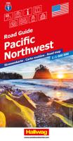
Wegenkaart - landkaart 1 Pacific Northwest USA | Hallwag

0
Uitstekende wegenkaart waarbij de Europese kleurstelling de kaart zeer prettig leesbaar maken i.v.m. met Amerikaanse kaartenmakers. Deze kaart is eenzijdig bedrukt. Op de kaart is informatie te vinden waar allerlei voorzieningen te vinden zijn (d.m.v. symbolen), zoals campings, picknickplaatsen, informatiecentra, luchthavens enz. Bij de kaart zit ...

Verkopers met dit product

Verkoper
Bezorging
Prijs
DeZwerver.nl logo
DeZwerver.nl
2,95
14,95

Anderen bekeken ook

Wegenkaart - landkaart 1 Pacific Northwest USA | Hallwag
Uitstekende wegenkaart waarbij de Europese kleurstelling de kaart zeer prettig leesbaar maken i.v.m. met Amerikaanse kaartenmakers. Deze kaart is eenzijdig bedrukt. Op de kaart is informatie te vinden waar allerlei voorzieningen te vinden zijn (d.m.v. symbolen), zoals campings, picknickplaatsen, informatiecentra, luchthavens enz. Bij de kaart zit een apart boekje met een aantal kleine stadsplattegronden, informatie over Nationale Parken en overige informatie voor toeristen. Met Washington, Oregon, Idaho and parts of Utah, Montana and California These new, region by region "USA Road Guides", on a scale of 1 : 1 mio, provide up-to-date, detailed road maps with lots of tourist information. Transit and city maps, as well as detailed maps of national parks, are included in the map layout. The map package also includes a mileage chart with travelling times between major cities, and a brochure with an index of places, travel information from A to Z, top attractions and travel tips. Plaatsen …
14,95
Wegenkaart - landkaart 3118 Pacific Northwest | National Geographic
Mooie kaart van de bekende kaartenmaker National Geographic. Veel details door kleurgebruik. De wegen zijn met kleuren verdeeld in drukke en minder drukke, de wegnummers zijn goed terug te vinden. De kaart onderscheidt zich van andere series door de hoeveelheid topografische details als counties, plaatsnamen en waterwegen en het bevat een register waarin het eenvoudig zoeken is. Daarnaast is de kaart gedrukt op scheur- en watervast papier. The United States Pacific Northwest Adventure Map will guide you through one of the most stunning regions in North America. The states of Washington, Oregon and Idaho contain Olympic, Mt. Rainier, Crater Lake, and North Cascades National Parks, Mt. Saint Helens and Mount Hood volcanoes, Columbia River Gorge, and dozens of magnificent National Monuments, Forests, and Wilderness Areas. The map includes the cities of Seattle, Portland, Boise, Spokane, and Eugene as well as Puget Sound and the spectacular Pacific coastline of Washington and Oregon. It c…
17,50
Wegenkaart - landkaart 3 Great Lakes USA | Hallwag
Uitstekende wegenkaart waarbij de Europese kleurstelling de kaart zeer prettig leesbaar maken i.v.m. met Amerikaanse kaartenmakers. Deze kaart is eenzijdig bedrukt. Op de kaart is informatie te vinden waar allerlei voorzieningen te vinden zijn (d.m.v. symbolen), zoals campings, picknickplaatsen, informatiecentra, luchthavens enz. Bij de kaart zit een apart boekje met een aantal kleine stadsplattegronden, informatie over Nationale Parken en overige informatie voor toeristen.   Grote Meren Gebied, Wisconsin en Michigan, North Illinois   These new, region by region "USA Road Guides", on a scale of 1 : 1 mio, provide up-to-date, detailed road maps with lots of tourist information. Transit and city maps, as well as detailed maps of national parks, are included in the map layout. The map package also includes a mileage chart with travelling times between major cities, and a brochure with an index of places, travel information from A to Z, top attractions and travel tips.   Plaatsen op de ka…
14,50
Wegenkaart - landkaart 2 North Central USA | Hallwag
North & South Dakota, Minnesota, Nebraska, Iowa, Montana, Colorado, Kansas en Missouri   Uitstekende wegenkaart waarbij de Europese kleurstelling de kaart zeer prettig leesbaar maken i.v.m. met Amerikaanse kaartenmakers. Deze kaart is eenzijdig bedrukt. Op de kaart is informatie te vinden waar allerlei voorzieningen te vinden zijn (d.m.v. symbolen), zoals campings, picknickplaatsen, informatiecentra, luchthavens enz. Bij de kaart zit een apart boekje met een aantal kleine stadsplattegronden, informatie over Nationale Parken en overige informatie voor toeristen.   These new, region by region "USA Road Guides", on a scale of 1 : 1 mio, provide up-to-date, detailed road maps with lots of tourist information. Transit and city maps, as well as detailed maps of national parks, are included in the map layout. The map package also includes a mileage chart with travelling times between major cities, and a brochure with an index of places, travel information from A to Z, top attractions and tra…
14,50
Wegenkaart - landkaart 4 New England & Atlantic Noordoost USA | Hallwag
Uitstekende wegenkaart waarbij de Europese kleurstelling de kaart zeer prettig leesbaar maken i.v.m. met Amerikaanse kaartenmakers. Deze kaart is eenzijdig bedrukt. Op de kaart is informatie te vinden waar allerlei voorzieningen te vinden zijn (d.m.v. symbolen), zoals campings, picknickplaatsen, informatiecentra, luchthavens enz. Bij de kaart zit een apart boekje met een aantal kleine stadsplattegronden, informatie over Nationale Parken en overige informatie voor toeristen. Met Maine, New Hampshire, Vermont, New York, Massachusetts, Rhode Island, Connecticut, Pennsylvania, New Jersey and large Maryland and Delaware. These new, region by region "USA Road Guides", on a scale of 1 : 1 mio, provide up-to-date, detailed road maps with lots of tourist information. Transit and city maps, as well as detailed maps of national parks, are included in the map layout. The map package also includes a mileage chart with travelling times between major cities, and a brochure with an index of places, t…
14,95
Wegenkaart - landkaart 1 Noordwest USA - Northwest USA | Borch
Mooie geplasticieerde kaart van het Noordwesten van de USA. Deze kaart biedt een goed overzicht van het land met detailkaarten. Our soft-laminated map of USA Northwest - USA 1 includes: Pacific Northwest 1:3 000 000, San Francisco 1:15 000, San Francisco Bay Area 1:400 000, San Francisco & Region 1:1 000 000, Seattle 1:13 000 and Greater Seattle 1:350 000, Seattle & Region 1:1 000 000,  Portland 1:20 000, Denver & Region 1:1 000 000, Salt Lake City & Region 1:1 000 000, Yellowstone National Park 1:1 000 000, USA administrative & time zones, interesting statistics, conversion chart for temperatures, weights and measures, climate chart with temperatures, sunshine hours, precipitation and humidity and much more.   The beautiful landscape of Oregon and Washington includes rugged coastline, mountain ranges, lakes, rivers, rich farmland and burgeoning wine country, as well as the magnificent cities of Portland and Seattle with their bustling cosmopolitan flair. While Seattle is renowned as …
11,50
Wegenkaart - landkaart 8 Southeast USA zuidoost | Hallwag
Uitstekende wegenkaart waarbij de Europese kleurstelling de kaart zeer prettig leesbaar maken i.v.m. met Amerikaanse kaartenmakers. Deze kaart is eenzijdig bedrukt. Op de kaart is informatie te vinden waar allerlei voorzieningen te vinden zijn (d.m.v. symbolen), zoals campings, picknickplaatsen, informatiecentra, luchthavens enz. Bij de kaart zit een apart boekje met een aantal kleine stadsplattegronden, informatie over Nationale Parken en overige informatie voor toeristen. Middle Atlantic & Appalachen, Indiana, South Illinois,  Ohio, Pennsylvania, New Jersey, Virginia, North & South Carolina These new, region by region "USA Road Guides", on a scale of 1 : 1 mio, provide up-to-date, detailed road maps with lots of tourist information. Transit and city maps, as well as detailed maps of national parks, are included in the map layout. The map package also includes a mileage chart with travelling times between major cities, and a brochure with an index of places, travel information from A…
14,50
Reisgids Eyewitness Travel USA- Canada the Pacific Northwest | Dorling Kindersley
Three-dimensional cutaway illustrations and floor plans of key landmarks complement these richly illustrated, fully updated travel handbooks that also include enhanced maps, street-by-street guides, background information on a host of popular sights and an expanded traveler's survival guide providing tips on hotels, restaurants, local customs, transportation, medical services, museums, entertainment and more. Marrying vibrant cities with impeccable wilderness, the Pacific Northwest is as rich as it is diverse. Whether you want to drive along epic coastal highways, hike the pristine paths of Yoho National Park, or tuck into succulent street food in Portland, your DK Eyewitness travel guide makes sure you experience all that the Pacific Northwest has to offer. Straddling the USA and Canada, the Pacific Northwest is a region of epic proportions, dotted with deep gorges, lofty mountains and rolling vineyards.   It's also a cultural colossus - think Seattle's musical legacy, Vancouver's…
20,95
Reisgids Road Trip USA Pacific Northwest | Moon Travel Guides
De Amerikaanse uitgever Moon is een vergelijkbare gids met uitgever Lonely Planet > veel praktische informatie met veel diepgang! Het feit dat het een Amerikaanse uitgever is, maken deze gidsen zeer aantrekkelijk voor de staten en nabije landen afzonderlijk. De Lonely Planet haalt dat nivo niet! Discover vibrant cities like Seattle, Vancouver, and Portland, and explore the emerald wilderness in between with Moon Pacific Northwest Road Trip. Inside you'll find: Maps and Driving Tools: 31 easy-to-use maps keep you oriented on and off the highway, along with site-to-site mileage, driving times, detailed directions for the entire route, and full-color photos throughout Eat, Sleep, Stop and Explore: With lists of the best hikes, views, and more, you can climb Mount Rainier or relax in Seattle with a freshly brewed cup of coffee or a local craft beer. Hike the temperate rainforests of Oregon, kayak the Puget Sound in Washington, hit the ski slopes in Whistler, or take the ferry to Canada …
23,95
Wegenkaart - landkaart 171 Pacific Northwest - Washington Oregon | Michelin
Bijzonder goed leesbare kaart van een deel van de Verenigde Staten - USA, in dit geval het gebied van de staten Washington en Oregen - Pacific Northwest.   Op deze kaart zijn de Nationale Parken goed zichtbaar ingetekend met een heldere achtergrondkleur. Wegnummers, register, afstanden tussen steden en bijvoorbeeld de beroemde groene wegenaanduiding van Michelin ontbreken niet.    Met  kleine stadsplattegronden (alleen het centrum) van Boise, Portland, Seatlle, Vancouver en Victoria   Boise, Etats-Unis, Portland, Seattle, Vancouver, Victoria
10,95

Klanten-reviews van Wegenkaart - landkaart 1 Pacific Northwest USA | Hallwag

Er zijn nog geen beoordelingen voor dit productBen jij de eerste die een review plaatst?

Meer over Wegenkaart - landkaart 1 Pacific Northwest USA | Hallwag

Productomschrijving

Uitstekende wegenkaart waarbij de Europese kleurstelling de kaart zeer prettig leesbaar maken i.v.m. met Amerikaanse kaartenmakers. Deze kaart is eenzijdig bedrukt. Op de kaart is informatie te vinden waar allerlei voorzieningen te vinden zijn (d.m.v. symbolen), zoals campings, picknickplaatsen, informatiecentra, luchthavens enz. Bij de kaart zit een apart boekje met een aantal kleine stadsplattegronden, informatie over Nationale Parken en overige informatie voor toeristen.

Met Washington, Oregon, Idaho and parts of Utah, Montana and California

These new, region by region "USA Road Guides", on a scale of 1 : 1 mio, provide up-to-date, detailed road maps with lots of tourist information. Transit and city maps, as well as detailed maps of national parks, are included in the map layout. The map package also includes a mileage chart with travelling times between major cities, and a brochure with an index of places, travel information from A to Z, top attractions and travel tips.

Plaatsen op de kaart

Vancouver, Port Angeles, Everett, Seattle, Wenatchee, Ellensburg, Spokane, Portland, Biggs, Pendleton, Eugene, Bend, Grants Pass, Klamath Falls, Lakeview, Boise, Burns, Twin Falls, Idaho Falls, Winnemucca, Eureka, Wells, Oden, Glacier N.P. (West Glacier), Great Falls, Missoula, Helena, Livingston, Billings, Cody, Yellowstone N.P. (Mammoth Hot Springs), Riverton, Rock Springs.        

Productinformatie

    Verken gerelateerde categorieën

    Webshop.nl maakt gebruik van cookies. Ga je verder op onze website, ga dan akkoord met het plaatsen van cookies en de verwerking van deze data door ons en vermelde partners.