webshop.nl
Categorieën
  Sluiten

Meer MapStudio

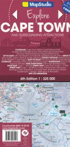
Wegenkaart - landkaart 01 Kaapstad - Cape Town and Surrounding Attract

Het overzicht is soms misschien een beetje onduidelijk. maar de details in de inzetten en delen van de kaart zijn prima en voldoen goed voor het rondrijden met een eigen auto. Double-sided map, with a general road map on one side, plus numerous street plans and descriptions of four special routes on the reverse. The main map covers an area within r...
16,95

Webshops met dit product

Webshop
Bezorging
Prijs

Anderen bekeken ook

Wegenkaart - landkaart 01 Kaapstad - Cape Town and Surrounding Attract
Het overzicht is soms misschien een beetje onduidelijk. maar de details in de inzetten en delen van de kaart zijn prima en voldoen goed voor het rondrijden met een eigen auto. Double-sided map, with a general road map on one side, plus numerous street plans and descriptions of four special routes on the reverse. The main map covers an area within reach as day trips from Cape Town, extending east to Swellendam and north to Langebaan. Road classification includes unsurfaced roads, intermediate driving distances on main and secondary roads, toll routes with gates, and mountain passes. Railways are shown with local stations. An impression of relief is provided by elevation tinting (perhaps somewhat confusing for regular map users - the higher the altitude, the greener the colour!), spot heights for main peaks, and names of mountain ranges. Nature and forest reserves, plus salt pans and marshes are indicated. Symbols mark local airfields, historical sites, caravan parks, many wine estates, …
16,95
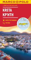
Wegenkaart - landkaart Kreta | Marco Polo
Goede wegenkaart voorzien van alle noodzakelijke aanduidingen. Daarnaast bijvoorbeeld ook campings, mooie wegen e.d. Crete on a double-sided, indexed map in MairDumont's Marco Polo series, with four street plans, plus special features to make route planning and navigating easier: a fold-out flap in the jacket shows the whole island highlighting popular locations, with the grid reference system in the margins making it easier to find various places on the main map.  Road network shows main and secondary roads with driving distances and highlights scenic routes. Smaller country roads or tracks, presented in white on a background with relief shading, are perhaps less clear to see than on maps with altitude colouring. In addition to the shading, topography is presented by numerous peaks and names of mountain ranges. E4 long-distance hiking route is marked, both the section across the central mountains and the variant along the south coast. Picturesque towns, places of interest and landscap…
12,95
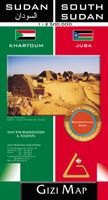
Wegenkaart - landkaart Sudan and South Sudan | Gizi Map
Sudan and South Sudan as separate countries on an excellent indexed map at 1:2,500,000 from Gizi Maps with detailed presentation of the topography, administrative divisions, street plans of Khartoum and Juba, etc. Excellent presentation of the terrain in the publisher’s characteristic style provides a vivid picture of the region’s geography: bold altitude colouring with plenty of spot heights and names of peaks, mountain ranges, etc, plus additional graphics for flood plains, swamps, salt flats, deserts, lava fields, wadis and water wells. National parks or other protected areas and interesting natural sites are highlighted. The map indicates the boundary of the disputed Abyei area and shows the internal administrative boundaries and names of the provinces. Within North Sudan names of larger towns and of the provinces are also given in Arabic. Where appropriate, alternative versions of town names are provided (Khartoum/Al Khartum, Omdurman/Umm Durman, etc). The map shows the road ne…
15,95
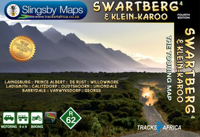
Wegenkaart - landkaart South Africa: Swartberg & Klein-Karoo | Slingsb
All roads from National Highways to minor gravel roads are shown; the many classifications that indi- cate the quality of each road help you plan your route No less than 28 mountain passes are shown — all are public roads! Distances are clearly shown; comprehensive 4 x 4 information GPS coordinates in DD MM SS format are provided for every road-junction All tourism facilities and accommodation establishments are shown in the out-of-town areas; there are insets of the major towns The map links to our maps of the Baviaanskloof, the Garden Route, Overberg and the Tankwa-Karoo Additional info:   Swartberg and Klein-Karoo region on a contoured and GPS compatible, double-sided, waterproof and   tear-resistant map at 1:160,000 from Slingsby Maps, with excellent topographic detail and plenty of tourist information, including street plans of ten main towns.   The map provides a very detailed picture of this mountainous terrain, with altitude colouring, shading, con- tours at 20m intervals and n…
29,95
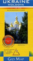
Wegenkaart - landkaart Ukraine - Moldova | Gizi Map
Kaart van Oekraïne met Moldavië, met een uitbreiding met de Krim in meer detail, plus plattegronden van het centrum van Kiev en Lviv. Wegennet is ingedeeld in zes typen, rij-afstanden aangegeven op hoofd-en secundaire routes, en verder worden grensovergangen weergegeven. Ukraine with Moldova on an indexed road map at 1:1,100,000 from Gizi Map, with an enlargement showing southern Crimea in greater detail, plus street plans of central Kiev and Lviv. All place names are shown transliterated into Latin alphabet, with those of major cities also given in their Cyrillic versions. Altitude colouring with relief shading indicates the mountainous regions, with the marshlands of northern Ukraine also marked. National parks and other protected areas are highlighted. Road network is graded into six types, driving distances are marked on main and secondary routes, and border crossings are shown. Railway lines, ferry routes on the Black Sea and Azov Sea, and local airports are included. Symbols high…
15,95
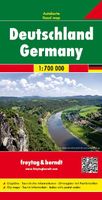
Wegenkaart - landkaart Deutschland - Duitsland | Freytag & Berndt
Gedetailleerde, eenzijdige landkaart van de Duitsland. De berijdbare wegen zijn goed weergeven, zowel de hoofdwegen als provinciale en lokale wegen; wegnummers worden vermeld. Afstanden tussen plaatsen zijn in kilometers op de kaart ingetekend, daarnaast worden ook op belangrijke plekken benzinepompen gemarkeerd. In het kaartbeeld wordt door middel van schaduw het reliëf weergegeven en soms enkele punten in het landschap met de daadwerkelijke hoogte. Provinciegrenzen zijn goed terug te vinden, nationale parken en reservaten ook. Met allerhande symbolen worden toeristische bezienswaardigheden weergegeven als monumenten, historisch belangrijke plekken en uitzichtpunten. In bepaalde plaatsen zijn hotels en campings te vinden, luchthavens, treinverbindingen en havens vindt u er ook op! Germany at 1:700,000 on a large, single-sided road map from Freytag & Berndt, with a separate extensive index booklet listing locations with postcodes and providing street plans of 18 town centres in the cou…
14,95
Wegenkaart - landkaart Cuba | Freytag & Berndt
Uitstekende kaart van Cuba. Met index, toeristische informatie en afstanden in kilometers.De berijdbare wegen zijn goed weergeven, zowel de hoofdwegen als provinciale en lokale wegen; wegnummers worden vermeld. Afstanden tussen plaatsen zijn in kilometers op de kaart ingetekend. In het kaartbeeld wordt door middel van schaduw het reliëf weergegeven en soms enkele punten in het landschap met de daadwerkelijke hoogte. Provinciegrenzen zijn goed terug te vinden, nationale parken en reservaten ook. Met allerhande symbolen worden toeristische bezienswaardigheden weergegeven als monumenten, historisch belangrijke plekken en uitzichtpunten. In bepaalde plaatsen zijn hotels en campings te vinden, luchthavens, treinverbindingen en havens vindt u er ook op! Overview map with street plans of Havana, Cienfuegos, Camagüey and Santiago de Cuba, plus enlargements of the Playa del Este area east of the capital and the Varadero Peninsula. The main map presents the island’s topography by bold relief sha…
14,95

Klanten-reviews van Wegenkaart - landkaart 01 Kaapstad - Cape Town and Surrounding Attract

Er zijn nog geen beoordelingen voor dit productBen jij de eerste die een review plaatst?

Meer over Wegenkaart - landkaart 01 Kaapstad - Cape Town and Surrounding Attract

Productomschrijving

Het overzicht is soms misschien een beetje onduidelijk. maar de details in de inzetten en delen van de kaart zijn prima en voldoen goed voor het rondrijden met een eigen auto. Double-sided map, with a general road map on one side, plus numerous street plans and descriptions of four special routes on the reverse. The main map covers an area within reach as day trips from Cape Town, extending east to Swellendam and north to Langebaan. Road classification includes unsurfaced roads, intermediate driving distances on main and secondary roads, toll routes with gates, and mountain passes. Railways are shown with local stations. An impression of relief is provided by elevation tinting (perhaps somewhat confusing for regular map users - the higher the altitude, the greener the colour!), spot heights for main peaks, and names of mountain ranges. Nature and forest reserves, plus salt pans and marshes are indicated. Symbols mark local airfields, historical sites, caravan parks, many wine estates, selected hotels and other accommodation, whale watching and diving sites, and other places of interest. The map has an index of localities, and shows no geographical coordinates. Four suggested scenic routes are highlighted on the map: the Cape Winelands, the Breede River Valley, the Whale Route, and the Heart of Route 62. All four are described on the reverse of the map, with street plans at 1:20,000 for main town along each route and lists of places of interest with their contact numbers. Each street plan highlights museums and other places of interest, plus selected accommodation and services. Also included is a street plan of central Cape Town itself at 1:17,500. In addition to the information provided on other street plans it also includes traffic lights and one way streets.

Productspecificaties

Artikelnummer(s)
Brand
MapStudio
Webshop.nl maakt gebruik van cookies. Ga je verder op onze website, ga dan akkoord met het plaatsen van cookies en de verwerking van deze data door ons en vermelde partners.