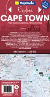
Wegenkaart - landkaart 01 Kaapstad - Cape Town and Surrounding Attractions | MapStudio

0
Het overzicht is soms misschien een beetje onduidelijk. maar de details in de inzetten en delen van de kaart zijn prima en voldoen goed voor het rondrijden met een eigen auto. Double-sided map, with a general road map on one side, plus numerous street plans and descriptions of four special routes on the reverse. The main map covers an area within ...

Verkopers met dit product

Verkoper
Bezorging
Prijs
DeZwerver.nl logo
DeZwerver.nl
2,95
16,95

Anderen bekeken ook

Wegenkaart - landkaart 01 Kaapstad - Cape Town and Surrounding Attractions | MapStudio
Het overzicht is soms misschien een beetje onduidelijk. maar de details in de inzetten en delen van de kaart zijn prima en voldoen goed voor het rondrijden met een eigen auto. Double-sided map, with a general road map on one side, plus numerous street plans and descriptions of four special routes on the reverse. The main map covers an area within reach as day trips from Cape Town, extending east to Swellendam and north to Langebaan. Road classification includes unsurfaced roads, intermediate driving distances on main and secondary roads, toll routes with gates, and mountain passes. Railways are shown with local stations. An impression of relief is provided by elevation tinting (perhaps somewhat confusing for regular map users - the higher the altitude, the greener the colour!), spot heights for main peaks, and names of mountain ranges. Nature and forest reserves, plus salt pans and marshes are indicated. Symbols mark local airfields, historical sites, caravan parks, many wine estates,…
16,95
Stadsplattegrond Streetmap Cape Town - Kaapstad | MapStudio
Uitgebreide stadsplattegrond van Kaapstad en directe omgeving.    The Cape Town & Peninsula Street Map is the ideal travel companion to find your way around Cape Town.   Coverage includes:   North : Milnerton West : Hout Bay East : Jakes Gerwel (Vanguard Drive) South : Muizenberg   Great content which includes a detailed map of Cape Town CBD and Waterfront insert map.   The main map is in detailed 1: 25 000 street level scale, which depicts parks and reserves, golf courses, sports fields and stadiums, intersections, route numbers and interchange names. The map also includes places of interest, historical sites and hotels, suburb names and boundaries, schools and sporting venues, industrial areas, wine estates and heritage sites as well as bird sanctuaries and post offices and libaries.  
16,95
Wegenkaart - landkaart 10 Western Cape Road Map | MapStudio
Road map of the Western Cape Province with an enlargement for the Cape Peninsula and 27 street plans of the central areas in main towns. The map is annotated numerous places of interest, vineyards, etc. GPS coordinates are provides for main road junctions. This new edition Western Cape Road Map covers the whole of the Western Cape. It features easy-to-read full colour maps with GPS co-ordinates. The map provides tourist-friendly text, highlights places of interest and lists accommodation information. This map is perfect for scenic drives and includes information boxes on activities of interest.   Coverage includes the Garden Route & Route 62, South Western Cape, Winelands and Overberg, West Coast Flower Region and Little Karoo. The map features small detailed street plans of Cape Town CBD, Montagu, Barrydale, Ladismith, Oudtshoorn, Mossel Bay, Knysna, Plettenberg Bay, Humansdorp, George, Stellenbosch, Franschhoek, Paarl, Wellington, Hermanus, Swellendam, Robertson, Ceres, Tulbagh, Lan…
16,95
Wegenkaart - landkaart - Stadsplattegrond Bloemfontein | MapStudio
Uitgebreide stadsplattegrond van Bloemfontein  en directe omgeving. The Bloemfontein Street Map is a 1st edition street map providing coverage of Bloemfontein and surrounds, plus includes the latest interchange layouts, names and route numbers. The main map is at a 1:25 000 street-level scale and includes a detailed Bloemfontein map.   The map features reserves, parks and fields; golf courses, sports fields and stadiums; retail areas and shopping malls; intersection layouts, route numbers and interchange names; places of interest, historic sites and hotels; suburb names with boundaries; schools and sporting venue locations; a detailed index booklet with all street names and suburbs; industrial areas; hospitals and clinic locations; police station locations; wine estates and heritage sites; traffic light positions; bird sanctuaries; detailed sport symbols for sport venues; parks and public open-areas; post office and library locations.   Coverage Extent: Batho, Brandwag, Fichardt Park,…
7,95
Stadsplattegrond Cape Town - Kaapstad | Borch
Borch Kaapstad is een duidelijke, geplastificeerde plattegrond van het centrum met informatie over openbaar vervoer en bezienswaardigheden. Inclusief straatnamenregister.   Our soft-laminated folded map of Cape Town shows: Cape Town 1:15 000, Cape Peninsula 1:140 000, Cape Town and Region 1:635 000, Garden Route 1:3 000 000, Robben Island 1:40 000, South Africa administrative & time zones, Public Transport Cape Town. Borch Maps are easy to fold, durable and water-repellent with a wipeable surface. Borch Maps show hotels, museums, monuments, markets, public transport, top sights and points of interest, useful statistics, conversion charts for temperatures, weights and measurements, climate charts showing temperatures, sunshine hours, precipitation and humidity, overview maps, time zones, and much more...   Cape Town, the legislative capital and second most populous city of South Africa and the provincial capital of the Western Cape, is also renowned as one of the world's most beautiful…
9,95
Wegenkaart - landkaart 04 Mpumalanga, Kruger National Park & Panorama Route | MapStudio
Toeristische wegenkaart met veel aanduidingen van interessante punten. Heldere kaart, goed leesbaar. speciaal stukje Africa: Mpumalanga, Kruger National Park and Panorama Route Road Map covers the entire Kruger National Park, includes a detailed exploring map of Mpumalanga and the Panorama Route, plans of camps in the Kruger National Park and is up-to-date with all research compiled and updated in Africa   Detailed streetmaps and site maps with text and photography of Pilgrims Rest, Mashishing (Lydenburg), Dullstroom, Sudwala Caves, eMakhazeni (Belfast), eNtokozweni (Machadodorp), White River, Sabie, eMgwenya (Waterval Boven), Hazyview, Mbombela (Nelspruit) and Barberton   Easy-to-use map symbols showing hotel, lodges, rest camps, campsites, concession areas, bush camps, private rest camps and lodges, caravan facilities, caves, lookout points, waterholes, hides and much more. Information on hiking, trekking, walking and fly-fishing areas. Along with an alphabetised index, enlarged map…
16,95
Reisgids Cape Town, Winelands & Garden Route - Kaapstad | Rough Guides
Zeer goede reisgids voor zowel de georganiseerde maar vooral voor de zelfstandige reiziger. Boordevol informatie over reizen, slapen, eten, maar ook musea en cultuur. Voor veel landen meestal completer en beter dan de Lonely Planet! This Cape Town, the Winelands & the Garden Route guidebook is perfect for independent travellers planning a longer trip. It features all of the must-see sights and a wide range of off-the-beaten-track places. It also provides detailed practical information on preparing for a trip and what to do on the ground. And this Cape Town, the Winelands & the Garden Route travel guidebook is printed on paper from responsible sources, and verified to meet the FSC's strict environmental and social standards.   This Cape Town, the Winelands & the Garden Route guidebook covers: The City Centre; V&A Waterfront, Robben Island and De Waterkant; Table Mountain and the City Bowl, Southern Suburbs and Cape Flats; Atlantic seaboard; The False Bay seaboard to Cape Point; The Win…
22,50
Reisgids Cape Town & Garden Route - Kaapstad | Lonely Planet
De perfecte reisgids voor zowel de georganiseerde als de zelfstandige reiziger. Naast een algemene inleiding van de stad vol met praktische informatie over hoe je er het beste kunt reizen: slapen, eten, vervoer, excursies ... alles kun je er in vinden. Engelstalig. Lonely Planet Lonely Planet's Cape Town and the Garden Route is our most comprehensive guide that extensively covers all the region has to offer, with recommendations for both popular and lesser-known experiences. Climb the impressive Table Mountain, visit historic Robben Island and walk the colourful streets of Bo-Kaap; all with your trusted travel companion.   Inside Lonely Planet's Cape Town and the Garden Route Travel Guide:     Lonely Planet's Top Picks - a visually inspiring collection of the destination's best experiences and where to have them   Itineraries help you build the ultimate trip based on your personal needs and interests Local insights give you a richer, more rewarding travel experience - wheth…
24,95
Wegenkaart - landkaart Zuid-Afrika - South Africa, Lesotho & Swaziland | MapStudio
Duidelijke overzichtskaart van Zuid Afrika, Lesotho en Swaziland. Met gedetailleerde kaarten van de regio's Gauteng, Kaapse Schiereiland en Durban. South Africa Lesotho and Swaziland map is a  new edition which includes major and minor routes with route markers, tourist regions and has an index to place names.   Content includes places of interest, mountain passes, topography, national parks & reserves, historic sites, railway lines & stations, route numbers, distance table and the latest toll routes and all route classifications.   Coverage includes a detailed map of South Africa at a scale of 1 : 1 500 000 along with detailed area maps of Gauteng, Durban and Cape Peninsula.
16,95
Wegenkaart - landkaart 02 Garden route & Route 62 Road Map | MapStudio
Wegenkaart van een deel van Zuid Afrika met inzetten van de meest belangrijke gebieden. Het overzicht is soms misschien een beetje onduidelijk. maar de details in de inzetten en delen van de kaart zijn prima en voldoen goed voor het rondrijden met een eigen auto. This newly updated Garden Route & Route 62 Road Map is a detailed road map of the Garden Route which covers the N2 from Riviersonderend to Port Elizabeth, Route 62 section from Montagu to Jeffrey’s Bay.   Includes information boxes on activities and places of interest that include watersports, bird watching, horse trails, canoe trails, 4×4 trails, hiking, arts & crafts, mountain biking, wine estates and much more. Full colour photos of various regions, places of interest sites, national parks reserves. Includes a detailed 1 : 20 000 street maps of Montagu, Barrydale, Ladysmith, Oudtshoorn, Mossel Bay, Knysna, Plettenberg Bay, Humansdorp, Jeffreys Bay, George. Includes GPS co-ordinates at major intersections.
16,95

Klanten-reviews van Wegenkaart - landkaart 01 Kaapstad - Cape Town and Surrounding Attractions | MapStudio

Er zijn nog geen beoordelingen voor dit productBen jij de eerste die een review plaatst?

Meer over Wegenkaart - landkaart 01 Kaapstad - Cape Town and Surrounding Attractions | MapStudio

Productomschrijving

Het overzicht is soms misschien een beetje onduidelijk. maar de details in de inzetten en delen van de kaart zijn prima en voldoen goed voor het rondrijden met een eigen auto.

Double-sided map, with a general road map on one side, plus numerous street plans and descriptions of four special routes on the reverse. The main map covers an area within reach as day trips from Cape Town, extending east to Swellendam and north to Langebaan. Road classification includes unsurfaced roads, intermediate driving distances on main and secondary roads, toll routes with gates, and mountain passes. Railways are shown with local stations. An impression of relief is provided by elevation tinting (perhaps somewhat confusing for regular map users - the higher the altitude, the greener the colour!), spot heights for main peaks, and names of mountain ranges. Nature and forest reserves, plus salt pans and marshes are indicated. Symbols mark local airfields, historical sites, caravan parks, many wine estates, selected hotels and other accommodation, whale watching and diving sites, and other places of interest. The map has an index of localities, and shows no geographical coordinates.

Four suggested scenic routes are highlighted on the map: the Cape Winelands, the Breede River Valley, the Whale Route, and the Heart of Route 62. All four are described on the reverse of the map, with street plans at 1:20,000 for main town along each route and lists of places of interest with their contact numbers. Each street plan highlights museums and other places of interest, plus selected accommodation and services. Also included is a street plan of central Cape Town itself at 1:17,500. In addition to the information provided on other street plans it also includes traffic lights and one way streets.


Productinformatie

    Verken gerelateerde categorieën

    Webshop.nl maakt gebruik van cookies. Ga je verder op onze website, ga dan akkoord met het plaatsen van cookies en de verwerking van deze data door ons en vermelde partners.