Wegenatlas USA Canada Mexico Road Atlas | A4-Formaat | National Geographic

0
National Geographic's Road Atlas: Scenic Drives Edition, is the ideal companion for the next time you hit the road for an unforgettable road trip. Includes up-to-date road maps for all 50 U.S. States, plus Canada, Mexico, and Puerto Rico. Major cities and metropolitan areas are shown in detail with inset maps that include popular attractions, infr...

Verkopers met dit product

Verkoper
Bezorging
Prijs
DeZwerver.nl logo
DeZwerver.nl
2,95
17,95

Anderen bekeken ook

Wegenatlas Road Atlas 2025 USA - Canada - Mexico - Verenigde Staten groot formaat | Michelin
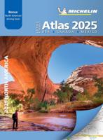
De beroemde wegenatlas van Rand McNally nu als Michelin atlas op groot formaat, bijna dubbel A4. Elke staat een eigen, of soms zelfs twee pagina's. Uitgebreid register. Zoals de Amerikanen zelf zeggen: America's number 1 Road Atlas! Canada en Mexico staan er zeer beperkt in. Highlighting 51 road trips and scenic drives the Michelin's updated Large Format North America Road Atlas 2025 helps you enjoy the planning and the journey. Large-format maps and larger lettering for towns and sites (compared to the midsize atlas) make for easier reading while the tiled format flows maps from page to page—the ideal complement to GPS and online directions. Four jam-packed pages highlight selected US and Canadian national parks, with points of interest, hikes and drives.   Covers US, Canada & Mexico. Large grid map to quickly locate atlas pages. Easy-read text and mapping. Map pages are 36% larger than midsize atlas. Inspired ideas for outdoor fun and road trip adventures in the US and Canada…
19,95
Wegenatlas Road Atlas USA Canada Mexico 2025 | A4-Formaat | Ringband | Michelin
De beroemde wegenatlas van Rand McNally nu als Michelin atlas. Super handige atlas van Michelin in A4 formaat met stevige ringband. Let op: Canada en Mexico staan er zeer beperkt in. For inspiring road trips and scenic drives, Michelin's updated, spiral-bound North America Road Atlas 2024 suggests 52 routes. The tiled atlas, with its clear, accurate mapping, complements online navigation while its big picture and road details aid in advance planning and en route decisions. For outdoor fun and adventure, look for inspiration among the highlights from national and provincial parks, including the parks' GPS coordinates.   Rely with confidence on Michelin's deluxe atlas to get you there. Covers USA, Canada and Mexico. Scale 1:625,000 - 1:9,018,000.   Spiral bound for lay-flat convenience. More than 240 large-scale city maps for navigating in and around urban areas. Bonus Northeast Corridor maps provide extra detail between Boston and Washington DC for easier driving.   Six-page tra…
21,95
Wegenatlas Adventure Edition USA - Amerika - Canada - Mexico - Puerto Rico | A3-Formaat | Ringband | National Geographic
Duidelijk leesbare wegenatlas van de USA, Mexico, Canada, en Puerto Rico, met groot register en ook kleine plattegronden van centra van belangrijke steden. Ook met informatie over nationale parken en avontuurlijke bestemmingen. Duidelijke kaarten in stevig ringband model.   National Geographic's Road Atlas: Adventure Edition, is the ideal companion for the next time you hit the road. Includes up-to-date road maps for all 50 U.S. States, plus Canada, Mexico, and Puerto Rico. Major cities and metropolitan areas are shown in detail with inset maps that include popular attractions, infrastructure and points-of-interest.   Setting this atlas apart from all other road atlases are the inclusion of detailed maps and guidebook-like recommendations on the top 100 destinations for adventure, plus the top 24 most visited National Parks. An additional resources section provides contact information for local tourism offices, plus a place name index to help easily locate a specific city.   The …
32,95
Reisgids USA National Parks | Moon Travel Guides
They've been dubbed America's best idea for a reason: get inspired, get outdoors, and discover the wild beauty of the United States with Moon USA National Parks. Inside you'll find: Coverage of all 63 national parks, from the misty mountains of the east and the redwoods of the west to the glaciers of Alaska and volcanoes of Hawaii, organized by region Strategic lists and itineraries: Choose from lists of the best parks for hiking, wildlife, families, and scenic drives or make your way down the list of the top ten national parks experiences across the country The best outdoor adventures in every park, including backpacking, biking, climbing, kayaking, rafting, and more, plus detailed hike descriptions and trail maps marked with distance, duration, effort level, and trailheads National parks road trips with driving times and advice for linking multiple parks, interesting stops between them, and nearby attractions and state parks Comprehensive planning resources: With maps and trans…
24,50
Wegenatlas Great British Road Trip Atlas : Easy to Read Edition | Philip's Maps
Looking for inspiration to hit the open road? Fancy exploring the best routes Britain and Ireland has to offer? This user-friendly atlas is designed to make your road trips both effortless and exhilarating. Why not embark on an unforgettable adventure with Philip's Great Road Trip Atlas and satisfy your inner explorer? Or perhaps you fancy a delightful meander through valleys and dales, or skirting snow-capped mountains and ending up cruising along the coast? Wherever you want to travel, we have the inspirational mapping, route planning tools and essential information that you need to set off on the open road. * Featuring specially easy-to-read maps and clear directions * Navigating through scenic routes and bustling cities has never been easier * Discover charming roadside attractions and picturesque villages alongside dramatic scenery and wildly thrilling drives. * From the North Coast 500 in the Highlands to the Atlantic Highway in Devon and Cornwall, or the Wild Atlantic Way in I…
12,95
Wegenatlas Australia Road & 4WD Touring Atlas A4 | Hema Maps
Uitstekende wegenatlas van heel Australië met goed leesbare kaarten, met stadsplattegronden en afstandstabel. A4-formaat in ringband, Engelstalig. Featuring trusted Hema mapping for all of Australia, the Hema Road & 4WD Touring Atlas is the definitive travel guide for tourers and adventurers. Hema atlases feature more information useful to travellers, including 4WD tracks, campsites, caravan parks, rest areas, 24-hour fuel and points of interest.   This edition contains more mapping than ever before, which is enhanced by a striking new cartographic style that's incredibly easy to read. Included in this is up-to-date mapping for Australia's biggest 4WD destinations: Cape York, Fraser Island, the Top End, the Kimberley, the Pilbara, Central Australia, High Country Victoria and the Flinders Ranges.   A handy distance grid, national park guide, list of accredited information centres and a complete index are also included to assist with trip planning and navigation, making it the perf…
39,95
Wegenatlas Road Atlas Britain and Ireland 2025 | Ringband | A4-Formaat | Philip's Maps
Let op! Ierland en een gedeelte van Schotland hebben een andere schaal dan de rest van de atlas.   'Good balance between detail and clarity with excellent town maps' What Car?PHILIP'S - Market leader and No. 1 in the UK for clear maps 2025 Philip's Road Atlas of Britain and Ireland is a top-of-the-range, A4-sized, spiral-bound atlas, featuring fully updated maps from the Philip's digital database. Voted Britain's clearest and most detailed in an independent consumer survey, the mapping is super-clear.   * 160 pages of fully updated super-clear road maps * Top tips for better and safer driving and the easiest way to parallel park * Detailed route-planning maps, to help plan your route in advance * 88 fully indexed and detailed town-centre maps throughout the British Isles * Major city approach maps with named arterial roads including the expanded London ULEZ * Clear road map showing all of Ireland * Mapping at a scale of 3 miles to 1 inch = 1:200,000 for easy use * Handy lie-f…
23,95
Reisgids Best Road Trips Southwest USA | Lonely Planet
Naast de gewone Lonely Planet hebben ze ook een titel uitgegeven met de mooiste rondritten in deze regio. De tochten gaan door mooie landschappen, over rustige wegen en doen 's lands meest bezienswaardige plaatsen aan. Natuurlijk met de nodige praktsche informatie voor onderweg omtrent eten, drinken en slapen.  Discover the freedom of the open road with Lonely Planet's Southwest USA's Best Road Trips. This trusted travel companion features 32 amazing drives, from 2-day escapes to 2-week adventures. Marvel at the Grand Canyon, soak up the beauty of Sedona, and stop off in Moab for some rafting. Get to Southwest USA, rent a car, and hit the road!           Inside Lonely Planet's Southwest USA's Best Road Trips:   Itineraries for classic road trips plus other lesser-known drives with expert advice to pick the routes that suit your interests and needs Full-color route maps - easy-to-read, detailed directions Detours - delightful diversions to see the USA's highlights along the …
23,95
Wegenatlas Australia - Road en 4WD Atlas - Australie | Hema Maps
Gebonden versie, geen spriraalbinding leverbaar van deze atlas.  Schaal is variabel per kaart. Deze editie bevat meer kaarten dan ooit tevoren,met t verneiuwd klerugebruik en daardor nog beter leesbaar.. Met detailkaarten voor Australië's belangrijkstre 4WD bestemmingen: Cape York, Fraser Island, de Top End, de Kimberley, de Pilbara, Centraal-Australië, High Country Victoria en de Flinders Ranges. Zeer volledig met een handig coördinatenstelsel, afstandstabel, een gids voor de nationale parken, een lijst met geaccrediteerde informatiecentra en een volledige index zijn ook opgenomen om te helpen bij de planning extra excursies.  Featuring trusted Hema mapping for all of Australia, the perfect bound Hema Road & 4WD Atlas is the definitive travel guide for tourers and adventurers. Hema atlases feature more information useful to travellers, including 4WD tracks, campsites, caravan parks, rest areas, 24-hour fuel and points of interest.   The new edition contains more mapping than ever bef…
30,95
Reisgids Road Trip USA Yellowstone to Glacier National Park | Moon Travel Guides
From stunning waterfalls, glaciers, and geysers to wide open spaces, answer the call of the wild with Moon Yellowstone to Glacier National Park Road Trip. Inside you'll find: Flexible itineraries: Drive the entire two-week route or explore the region on shorter trips to Glacier, Yellowstone, or Grand Teton Eat, sleep, stop and explore: With lists of the best hikes, views, places for wildlife-watching, and more, you can watch Old Faithful from Observation Point, drive the 50-mile Going-to-the-Sun Road, spot everything from bighorn sheep to bears on a wildlife tour of Yellowstone's Lamar and Hayden valleys, and kick back with a craft beer in Bozeman Outdoor adventures: Hike the trails in Glacier or ski in Whitefish. Admire the reflection of the Grand Tetons as you kayak Jenny Lake or set up camp and stargaze late into the night The best hikes: Detailed descriptions, trail maps, mileage and elevation gains, and backpacking options Maps and driving tools: Easy-to-use maps keep you or…
23,95

Klanten-reviews van Wegenatlas USA Canada Mexico Road Atlas | A4-Formaat | National Geographic

Er zijn nog geen beoordelingen voor dit productBen jij de eerste die een review plaatst?

Meer over Wegenatlas USA Canada Mexico Road Atlas | A4-Formaat | National Geographic

Productomschrijving

National Geographic's Road Atlas: Scenic Drives Edition, is the ideal companion for the next time you hit the road for an unforgettable road trip. Includes up-to-date road maps for all 50 U.S. States, plus Canada, Mexico, and Puerto Rico. Major cities and metropolitan areas are shown in detail with inset maps that include popular attractions, infrastructure and points-of-interest.

Setting this atlas apart from all others is the inclusion of selection of 20 carefully researched scenic drives to help you plan the road trip of a lifetime. A map and guide section is also included for the 20 most popular National Parks. Take the guesswork out of traveling and trip planning with a comprehensive index, mileage charts, and cross-referenced pages.

The Road Atlas: Scenic Drives Edition is printed in North America and it is a convenient letter-size format that fits comfortably into glove compartments or car side door pockets.

Productinformatie

    Verken gerelateerde categorieën

    Webshop.nl maakt gebruik van cookies. Ga je verder op onze website, ga dan akkoord met het plaatsen van cookies en de verwerking van deze data door ons en vermelde partners.