webshop.nl
Categorieën
  Sluiten

Meer ITMB
Meer ITMB in Literatuur boeken

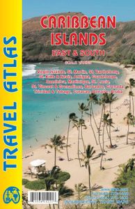
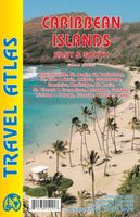
Wegenatlas Travel Atlas Caribbean Island East Half | ITMB

The Caribbean is difficult to map as an entity. It consists of vast amounts of water with dozens of micro-level islands. Last year, ITMB introduced the islands of the Western Caribbean (essentially, Cuba, Hispaniola, Jamaica, Puerto Rico, and the Bahamas). Now we are completing the area with the release of this book atlas, covering the eastern and ...
16,50

Webshops met dit product

Webshop
Bezorging
Prijs

Anderen bekeken ook

Wegenatlas Travel Atlas Caribbean Island East Half | ITMB
The Caribbean is difficult to map as an entity. It consists of vast amounts of water with dozens of micro-level islands. Last year, ITMB introduced the islands of the Western Caribbean (essentially, Cuba, Hispaniola, Jamaica, Puerto Rico, and the Bahamas). Now we are completing the area with the release of this book atlas, covering the eastern and southern island countries. Traditionally, these were called the Leeward and Windward Islands, but we feel that the term Eastern Caribbean is more commonly used by cruise ships and we made up the name South to include Trinidad/Tobago and the Dutch colonies of Aruba, Bonaire, and Curacao. The list of islands included in this atlas is lengthy and includes Barbados, Grenada,Guadeloupe/Martinique, St. Kitts/Nevis, St. Lucia, St. Vincent, and both sets of Virgin Islands, in detail. Like its counterpart, this atlas would be an excellent travel companion for anyone cruising the Caribbean (on a huge liner or in a yacht). It has 160 pages of maps and i…
16,50
Wegenatlas Travel Atlas Caribbean Island West Half | ITMB
Wegenatlas voor de westelijke Caraïbische eilanden - verschillende schalen : Bahamas, Turks- en Caicoseilanden, Cuba, Kaaimaneilanden, Jamaica, Dominikaanse Republiek, Puerto Rico. Met inzetjes van Freeport, Nassau, Havana, Varadero, Georgetown, Kingston, Port-au-Prince, Santo Domingo, San Juan   The Caribbean is a particularly difficult part of the world to map effectively. It is a combination of larger islands in the west and a string of small islands in the east. Some can be shown as separate maps, but others are too small (or too lacking in market appeal) to be mapped adequately as folded paper maps. This atlas covers the Bahamas and the Turks and Caicos Islands in the north with Cuba, the Cayman Islands, Jamaica, the Dominican Republic, and Puerto Rico in scales ranging from 1:18,000 for Puerto Rico to 1:600,000 for Cuba The atlas is the same size as all ITM atlases (8''x5'' or 21x13.5cm) and has a straight spine edge with title for displaying spine outwards on store shelves, if d…
16,50
Waterkaart Caribbean Cruising | ITMB
The Caribbean Sea is one of the most popular cruising destinations in the world. This colourful double-sided map starts just north of Orlando/Tampa in order to show the northernmost Bahamian islands and south as far as the Panama Canal at Colon and the coast of Venezuela. The map shows good detail for each island and the legal boundaries of each island nation. Side 1 concentrates on the western Caribbean, essentially the Bahamas, Cuba, Jamaica, and the Cayman Islands. Here’s a fun fact most of you won’t know: tiny Navassa Island between Haiti and Jamaica is claimed by both the USA and Haiti! Side 2 concentrates on the eastern islands of the Caribbean, such as Hispaniola (Haiti and the Dominican Republic), Puerto Rico and the US and British Virgin Islands, Turks & Caicos, and the Lesser Antilles chain of island countries, such as Antigua, Guadeloupe, Barbados, and Trinidad/Tobago, among others. Coverage then extends westward along the Venezuelan coastline to include the Dutch possession…
14,95
Reisgids The Caribbean | Rough Guides
Zeer goede reisgids voor zowel de georganiseerde maar vooral voor de zelfstandige reiziger. Boordevol informatie over reizen, slapen, eten, maar ook musea en cultuur. Voor veel landen meestal completer en beter dan de Lonely Planet ! This practical travel guide to the Caribbean features detailed factual travel tips and points-of-interest structured lists of all iconic must-see sights as well as some off-the-beaten-track treasures. Our itinerary suggestions and expert author picks of things to see and do will make it a perfect companion both, ahead of your trip and on the ground. This Caribbean guide book is packed full of details on how to get there and around, pre-departure information and top time-saving tips, including a visual list of things not to miss.   Our colour-coded maps make the Caribbean easier to navigate while you're there. This guide book to the Caribbean has been fully updated post-COVID-19 and it comes with a free eBook. The Rough Guide to the Caribbean covers: The Ba…
27,95
Waterkaart Caribbean Cruising | ITMB
The Caribbean Sea is one of the most popular cruising destinations in the world. This colourful double-sided map starts just north of Orlando/Tampa in order to show the northernmost Bahamian islands and south as far as the Panama Canal at Colon and the coast of Venezuela. The map shows good detail for each island and the legal boundaries of each island nation. Side 1 concentrates on the western Caribbean, essentially the Bahamas, Cuba, Jamaica, and the Cayman Islands. Here’s a fun fact most of you won’t know: tiny Navassa Island between Haiti and Jamaica is claimed by both the USA and Haiti! Side 2 concentrates on the eastern islands of the Caribbean, such as Hispaniola (Haiti and the Dominican Republic), Puerto Rico and the US and British Virgin Islands, Turks & Caicos, and the Lesser Antilles chain of island countries, such as Antigua, Guadeloupe, Barbados, and Trinidad/Tobago, among others. Coverage then extends westward along the Venezuelan coastline to include the Dutch possession…
14,95
Wegenatlas Travel Atlas Indian Subcontinent | ITMB
Handzame wegenatlas op A5 formaat, helaas geen spiraalbinding. Maar voor deze regio is er op dit moment geen andere atlas beschikbaar.   This is our biggest atlas ever, with 152 pages of maps and 51 pages of place names indexing. The Indian Sub-Continent consists of Pakistan, India, Nepal, Bhutan, Bangladesh, Sri Lanka and Kashmir. Each country (Kashmir being considered shared) is presented as an entity, so Pakistan occupies 30 pages at 1:1,200,000 scale, and Nepal occupies 32 pages at 1:530,000 scale. In short, each country is shown in detail, but at scales appropriate for each country. The amount of detail on each page is impressive; equal to buying six maps at $12.95 each. The market is the traveller to the region, visiting several of these areas and wanting a compact way to have detailed mapping without having to carry half a dozen maps or spend a large amount of money on maps. Eleven city inset maps are included, as well as basic insets for the Andaman and Nicobar island chains. T…
16,50
Wegenatlas Travel Atlas Africa West Route: from Tangier to Cape Town |
Handzame wegenatlas, formaat A5, van de hele route van Tanger naar Kaapstad langs de westelijke kant van Afrika. Naast de wegenkaarten bevat deze atlas ook een aantal centrumkaarten van de belangrijkste steden die je onderweg tegenkomt.  There are three routes one can follow on an overland expedition from Europe to Cape Town (or the reverse). Last year, ITMB published the eastern route, via Cairo and Sudan to Ethiopia and Kenya. This year, we are pleased to announce the publication of a more practical route to follow, via Tangier, Morocco, Mauritania, Senegal, Mali and Ghana, through the Congo to Uganda, and then south over a variety of options to Namibia and South Africa. The advantage of this route is that it avoids the conflict-ridden countries closest to infection from the extremist Islam movement. It also avoids the current difficulties of the central route through Algeria (the Hoggar route) and Niger. We do have to caution that all routes through Africa contain risks. Routes are …
16,50
Reisgids Mini Rough Guide Caribbean Ports of Call | Rough Guides
Een kleinere versie in zakformaat van de grotere versies van de Rough Guides. Als altijd weer vol met goede informatie over cultuur en praktische zaken. Achterin kleine plattegronden.   his pocket-sized guide is a convenient, quick-reference companion to discovering the beauty of Caribbean cruising. From the glitzy ships to islands as different as Barbados and St-Barthélemy, this guide aims to cover the popular ports of call, including places not considered part of the region, such as the Bahamas, Mexico and Central America, but which are often found on Caribbean cruise itineraries. This title has been fully updated post-COVID-19.   This Mini Rough Guide to Caribbean Ports of Call covers: Mexico and Central America, the Bahamas, the Western Caribbean, Eastern Caribbean, St-Martin, the Southern Caribbean.   In this travel guide you will find:   RECOMMENDATIONS FOR EVERY TYPE OF TRAVELLER Whether you want to slap on the sun lotion, read a good book and bask in the sun, dive in th…
12,50

Klanten-reviews van Wegenatlas Travel Atlas Caribbean Island East Half | ITMB

Er zijn nog geen beoordelingen voor dit productBen jij de eerste die een review plaatst?

Meer over Wegenatlas Travel Atlas Caribbean Island East Half | ITMB

Productomschrijving

The Caribbean is difficult to map as an entity. It consists of vast amounts of water with dozens of micro-level islands. Last year, ITMB introduced the islands of the Western Caribbean (essentially, Cuba, Hispaniola, Jamaica, Puerto Rico, and the Bahamas). Now we are completing the area with the release of this book atlas, covering the eastern and southern island countries. Traditionally, these were called the Leeward and Windward Islands, but we feel that the term Eastern Caribbean is more commonly used by cruise ships and we made up the name South to include Trinidad/Tobago and the Dutch colonies of Aruba, Bonaire, and Curacao. The list of islands included in this atlas is lengthy and includes Barbados, Grenada,Guadeloupe/Martinique, St. Kitts/Nevis, St. Lucia, St. Vincent, and both sets of Virgin Islands, in detail. Like its counterpart, this atlas would be an excellent travel companion for anyone cruising the Caribbean (on a huge liner or in a yacht). It has 160 pages of maps and includes 18 town plans. This is definitely the most detailed mapping of the world in existence.   Legend Includes: Road by classification, Motorways, Main Roads, Ferry Routes, Railways, Lakes, Deserts, Swamps, Hospitals, Walterfalls, Motels, Hotels, Beaches and much more...

Productspecificaties

Artikelnummer(s)
Brand
ITMB

Verken gerelateerde categorieën

Webshop.nl maakt gebruik van cookies. Ga je verder op onze website, ga dan akkoord met het plaatsen van cookies en de verwerking van deze data door ons en vermelde partners.