webshop.nl
Categorieën
  Sluiten

Meer ITMB
Meer ITMB in Literatuur boeken

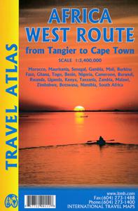
Wegenatlas Travel Atlas Africa West Route: from Tangier to Cape Town |

0
Handzame wegenatlas, formaat A5, van de hele route van Tanger naar Kaapstad langs de westelijke kant van Afrika. Naast de wegenkaarten bevat deze atlas ook een aantal centrumkaarten van de belangrijkste steden die je onderweg tegenkomt.  There are three routes one can follow on an overland expedition from Europe to Cape Town (or the reverse). Last ...

Webshops met dit product

Webshop
Bezorging
Prijs

Anderen bekeken ook

Wegenatlas Travel Atlas Afrika Africa Overland: Cairo to Cape Town | I
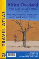
Handzame wegenatlas, formaat A5, van de hele route van Cairo naar Kaapstad langs de oostelijke kant van Afrika. Naast de wegenkaarten bevat deze atlas ook een aantal centrumkaarten van de belangrijkste steden die je onderweg tegenkomt.  There are three possible routes to traverse Africa top to bottom. From the east, the only route is via Egypt and Sudan to Ethiopia and East Africa. The route through Algeria, known as the Hoggar (or Haager) route is next, with the route through Morocco to West Africa third. Traversing Africa is one of the great adventure trips in the world. I did it in 1969/70 in an epic journey that took a year and proved to be one of those fundamental acts shaping ones life. None of the routes are completely safe. That applied in the 1960s and it applies equally now, but life consists of determining acceptable risks and doing ones best not to be hit by a Number 10 bus by liking the wrong way when crossing a London street. This atlas portrays the eastern route from Cai…
16,50
Wegenkaart - landkaart SC1&SC2 Cape Town to Montagu | Tracks4Africa
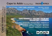
We start in Cape Town in the west and move along the southern coast through the Overberg, Winelands, Garden Route, Klein Karoo R62, Baviaanskloof to eventually arrive in the Addo National Park up to Gqeberha (Port Elizabeth) in the east.   The maps are highly detailed and well researched. Our map scale is 1:200 000 which allows us to show a lot of detail including minor gravel roads, hiking trails, farm boundaries and points of interest which are relevant to self-drive tourists.   The size of the paper is kept small enough to allow this to be the perfect road tripping map. We use Duraflex paper and print two maps per sheet of A1 paper, making this a four-sheet series. Each map sheet is individually packed in a plastic protective sleeve.   The maps are perfect for day drives, overlanding or just doing road trips in your sedan, 4WD or motorbike along our beautiful southern coast, Klein Karoo and parts of the proper Karoo. Mountain passes form a prominent feature in this area, and these a…
29,95
Reisgids Africa Overland - Afrika | Bradt Travel Guides
Bradt's Africa Overland is the result of over 40 years' experience on the roads of Africa, Asia and South America, combining everything you need to know about the Africa with all the practical advice needed for tackling long-distance journeys under often challenging conditions, be it by 4X4 or public transport. A massive amount of background detail is included, from suggested routes for reaching Africa - including via Asia or Saudi Arabia - to selecting and shipping your vehicle, budgeting, equipment and spares, organised tours, public transport, red tape and heaps of information about issues likely to arise on the road: driving and recovery techniques, maintenance, motorbike driving, bureaucracy, borders and police checks. This new, fully updated edition covers over 50 countries, as well as offering a focus on aspects such as geography, vegetation and climate, natural history and conservation, cultural interaction, religion and festivals.   There's lots of guidance about where to find…
27,95
Wegenatlas Traveller's Atlas Southern Africa - Zuidelijk Afrika | A3-F
Deze atlas omvat tien landen in zuidelijk Afrika en is speciaal gericht op reizigers die zelf rijden. De betrokken landen zijn: Angola, Botswana, Lesotho, Malawi, Mozambique, Namibië, Zuid-Afrika, Swaziland, Zambia en Zimbabwe.   De Atlas bevat 223 kaartpagina's met hetzelfde vertrouwde kaartdetail waarvoor Tracks4Africa bekend is.   De wegenatlas is afgedrukt in A3 formaat, weegt 2750g, heeft een stevige omslag, spiraal gebonden en de pagina's zijn afgedrukt op dik papier.   Bigger coverage than ever before: 1:4m maps for Southern and Eastern Africa – ideal for macro planning. 1:1m maps for Southern Africa, covering the following countries: Angola, Botswana, eSwatini, Lesotho, Malawi, Mozambique, Namibia, South Africa, Zambia and Zimbabwe. 1:500k maps for South Africa, Malawi, most part of Zambia and the area around Moremi/Chobe in Botswana. Road coverage: This Atlas is designed for overland travel and compiled from the same data used on our famous GPS maps. Use it for trip pl…
79,95
Fietskaart 01 Cycling guides Cornwall | Goldeneye
Our maps are double-sided, printed on an A2 sheet with a concertina fold. This allows for easy folding and folding, and an ease of access to the mapping. The material is rain and tear-resistant. Our early maps were designed at the scale of 2 miles to 1 inch/1:126,720. The later designs along with digitalisation are 1: 100,000. We were encouraged by the Cycle Touring Club to convert our cartography toward the cycle market (to replace the out-of-print Bartholomew series). As time and the series progressed we have added more data: The National Cycle Network routes, Regional Routes, and Traffic-Free Family Routes, as and when they are developed. These routes are in addition to the Circular Routes Goldeneye Commissioned at the outset of our publishing schedule. We are also adding to new editions; bike shops, cycle hire, and tea rooms, along with the tourist attractions already featured. Our plan is to make available digital versions for cell phones and tablets and to update, on an annual ba…
15,95
Wandelgids Via Francigena Pilgrim Route Part 1 | Cicerone
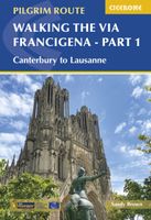
The 2000km Via Francigena from Canterbury to Rome is one of the world's great pilgrim routes, with a history spanning well over a millennium. This guide describes the first section, from Canterbury to Lausanne on the shores of Lake Geneva, a journey of 1090km passing through England, France and Switzerland. The route is suitable for walkers of all levels of ability, and the section from Canterbury to Besancon is also suitable for cyclists (mountain or hybrid/gravel bike).   There are various options for accommodation, ranging from hotels and B&Bs to camping (although it is not essential to carry a tent), and the French section offers a unique opportunity to lodge with host families in welcoming chambres d'hotes. The guide has all the information you need to plan and prepare for a journey on the Via Francigena. You'll find a wealth of detail about facilities on route and accommodation, as well as tips on training, kit, travel and pilgrim credentials.   The route is presented in 52 stage…
26,50

Klanten-reviews van Wegenatlas Travel Atlas Africa West Route: from Tangier to Cape Town |

Er zijn nog geen beoordelingen voor dit productBen jij de eerste die een review plaatst?

Meer over Wegenatlas Travel Atlas Africa West Route: from Tangier to Cape Town |

Productomschrijving

Handzame wegenatlas, formaat A5, van de hele route van Tanger naar Kaapstad langs de westelijke kant van Afrika. Naast de wegenkaarten bevat deze atlas ook een aantal centrumkaarten van de belangrijkste steden die je onderweg tegenkomt.  There are three routes one can follow on an overland expedition from Europe to Cape Town (or the reverse). Last year, ITMB published the eastern route, via Cairo and Sudan to Ethiopia and Kenya. This year, we are pleased to announce the publication of a more practical route to follow, via Tangier, Morocco, Mauritania, Senegal, Mali and Ghana, through the Congo to Uganda, and then south over a variety of options to Namibia and South Africa. The advantage of this route is that it avoids the conflict-ridden countries closest to infection from the extremist Islam movement. It also avoids the current difficulties of the central route through Algeria (the Hoggar route) and Niger. We do have to caution that all routes through Africa contain risks. Routes are not well-developed and are subject to disruption; also, by the nature of extremist Islam, those countries with a sizeable Muslim population tend to be under threat, although at this time the route should be considered safer than the other two routes. Having used this route myself many years ago, I can attest to its attractiveness. Crossing the Sahara is challenging, due to shifting sand dunes, but the new coastal highway through Morocco and Mauritania makes reaching Senegal much easier than previously. Crossing the Congo also remains a challenge, due to poor infrastructure, but once one reaches Uganda several options are available for southward travel. As we focused on the eastern routes in our first volume (Africa Overland), in this volume we provide more westerly routes. We have chosen to ignore Angola for now, due to lack of knowledge of travel conditions in that country, but we know of no reason for travellers to avoid that country. In addition to providing route maps through all the countries involved (shown on the back cover of the book), 43 full-page maps of cities along the route are included, such as Casablanca, Nouakchott, Banjul, Bobo Diolasso, Lome, Douala, Kigali, Abuja, Livingstone and other cities never before included in a travel atlas of Africa.   Legend Includes: Roads by classification, UNESCO World Heritage, National Parks, Hotels, Point of interest, Airports, Tourist information, Hospitals, Shopping centre, Lake, River, Golf course, museums, and much more.
Productspecificaties

Artikelnummer(s)
Brand
ITMB

Verken gerelateerde categorieën

Webshop.nl maakt gebruik van cookies. Ga je verder op onze website, ga dan akkoord met het plaatsen van cookies en de verwerking van deze data door ons en vermelde partners.