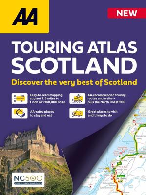
Wegenatlas Touring Atlas Scotland 2026 | Ringband | A4-Formaat | AA Publishing

0
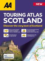
Updated and new for 2025 the AA Touring Atlas Scotland, is your trusted travel companion for discovering the very best of Scotland. Expertly designed for travellers, this easy-to-read, 176-page atlas combines premium quality with unbeatable value.   Main Features: Easy-to-read mapping and super-detailed plans of major, towns and cities Official ...

Verkopers met dit product

Verkoper
Bezorging
Prijs
DeZwerver.nl logo
DeZwerver.nl
niet bekend
2,95
15,50

Anderen bekeken ook

Wegenatlas Touring Atlas Scotland 2026 | Ringband | A4-Formaat | AA Publishing
Updated and new for 2025 the AA Touring Atlas Scotland, is your trusted travel companion for discovering the very best of Scotland. Expertly designed for travellers, this easy-to-read, 176-page atlas combines premium quality with unbeatable value.   Main Features: Easy-to-read mapping and super-detailed plans of major, towns and cities Official North Coast 500 route and information AA-rated places to stay and eat and AA-recommended touring routes and walks Large-scale district maps of Edinburgh and Glasgow with extra detail Great places to visit and useful locations including golf courses, distilleries, and scenic landscapes User-friendly spiral bound with a durable cover The atlas makes exploring Scotland easy with road mapping consisting of mainland Scotland at giant 2.3 miles to 1 inch scale, and Scottish islands at a minimum of 7.6 miles to 1 inch. Featuring scores of wonderful places to visit as well as AA-recommended tours and the iconic North Coast 500 route this practic…
15,50
Wegenatlas Glovebox Atlas Scotland - Schotland | AA Publishing
This handy road atlas fits the glovebox of your car, perfect for quick referencing on the move. Including information on route planning, car ferry routes and operators, restricted motorway junctions, county map, and a mileage chart, this is the perfect glovebox companion for traveling through Scotland. New features on the mapping include award winning beaches, soccer stadiums, lighthouses, and waterfalls. The 4th edition of this AA glovebox atlas for Scotland has been fully revised and updated for November 2017. This handy, flexibound A5 road atlas is designed specifically for the motorist in Scotland. There is a distance and journey time chart between 40 destinations. The atlas legend is in English, French, Spanish, Italian, German and Dutch. 1:250 000 (1 inch=4 miles, 1cm=2.5km) Symbols indicating: places of interest, motorways, dual carriageways, toll areas, prohibited roads, rail lines, road numbers and boundaries Multilingual key to the symbols Distance matrix which shows distanc…
9,95
Wegenatlas Navigator Scotland | A4-Formaat | Ringband | Philip's Maps
Duidelijke en gedetailleerde atlas van Schotland met enkele stadsplattegronden en register. Zuid Schotland is van schaal 1:100.000 en het noorden met schaal 1:200.000   Philip's Navigator Scotland is part of the Navigator brand, the UK's best-selling road atlases. The Navigator maps provide highly detailed coverage of the Scotland's road network, including minor country lanes and rural tracks. Most of the Central Lowlands and Scottish Borders are shown at the unique Navigator scale of 1.5 miles to 1 inch, Northern Scotland at 3 miles to 1 inch.   Navigator Scotland offers so much more than road maps: hundreds of individually named farms, houses and hamlets, airports, airfields, stations, ferries, canals, marinas, tourist information centres, and a wide range of places of interest. The atlas has a comprehensive index and includes indexed town plans of major regional centres. The front of the atlas contains a 15-page guide to regional leisure facilities and listings of a wide variety…
15,95
Wegenatlas Collins Handy Road Atlas Scotland | A5-Formaat | Collins
Discover new places with handy road atlases from Collins. Your ideal companion for navigating around Scotland. It has extremely clear, route planning maps of Scotland, detailed city plans of the major cities and towns and fits neatly into your glovebox, briefcase or bag. Main features Clear, attractive route planning maps of the whole of Scotland supported by comprehensive, fully indexed city centre street maps of Aberdeen, Dundee, Edinburgh, Glasgow, Inverness and Perth. Scale of main maps: 1:625,000 (9.9 miles to 1 inch). Also includes * Places of tourist interest are highlighted * Attractive layer colouring showing land height * Road network fully classified and colour coded * Detailed street mapping of Edinburgh, including the Royal Mile with all its attractions clearly marked, Leith and Holyrood Park * Detailed street mapping of Glasgow, including the West End, city centre and M74 extension * Detailed street mapping of Aberdeen, including the bypass * Street maps, with i…
12,95
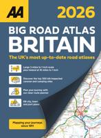
Wegenatlas Big Road Atlas Britain 2025 - A3 | Ringband | AA Publishing
This best-selling A3 format atlas is available in two binding styles; paperback and spiral bound. Up-to-date mapping from the experts at the AA this atlas has large 3 miles to 1 inch scale including Ireland at 16 miles to 1 inch. Each page has been titled with its geographical location so you can turn to the page you need more easily. Wide minor roads (more than and less than 4m wide), National Trust, English and World Heritage sites, crematorium locations and other hard-to-find places are indicated on the mapping. 4 page clear route planner map. There are 68 city, town and port plans including central London and a list of tourist sites with satnav friendly post codes. Top 300 AA-Inspected caravan and camping sites listed and marked on map, over 1,800 golf courses, plus scenic routes and over 240 service areas.  
21,95
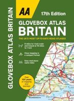
Wegenatlas AA Glovebox Atlas Britain | AA Publishing
This handy atlas fits in the glovebox of your car, perfect for quick referencing on the move. The clear mapping includes a range of essential motoring and useful touring information so you can find your way and discover places to visit whilst on your travels. Including information such as road tolls, service areas, road distances, national parks, places to visit and viewpoints this is the perfect glovebox companion for travelling through Britain and Ireland.
8,50
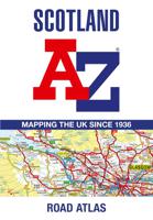
Wegenatlas Scotland - Schotland | A-Z Map Company
Handzame gedetailleerde wegenatlas van Schotland. Navigate your way around Scotland with this detailed, full-colour and easy-to-use A-Z Road Atlas. From the border to the north coast, the mainland pages scale is 3.5 miles to 1 inch and the Western Isles, Shetland Islands and Orkney Islands scale is 4.5 miles to 1 inch.   Covering the entire country, this road atlas includes the following features: • Motorways with full junction detail, primary routes and destinations, A & B roads, under construction and proposed roads, service areas, tolls, mileages, national, county and unitary authority boundaries • Cairngorms and Loch Lomond & The Trossachs National Park boundaries • Selected places of interest and tourist information centres   20 city and town street maps are included for Aberdeen, Aviemore, Ayr, Dumfries, Dundee, Dunfermline, Edinburgh, Glasgow, Falkirk, Fort William, Hamilton, Inverness, Kilmarnock, Kirkcaldy, Motherwell, Oban, Paisley, Perth, St Andrews and Stirling. A…
13,50
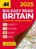
Wegenatlas Big Easy Read Britain 2026 | A3 | Ringband | AA Publishing
This A3 format atlas provides giant scale mapping and type throughout making it very easy to use. It is available in two binding styles; paperback and spiral bound. Each page has been titled with its geographical location so you can turn to the page you need more easily.   Wide minor roads (more than and less than 4m wide), National Trust, English and World Heritage sites, crematorium locations and other hard-to-find places are indicated on the mapping. There are 72 city, town and port plans including a central district map of London and a full-colour admin map showing all the latest unitary authority areas. Plus, scenic routes and tourist sites with satnav friendly post codes.
23,95
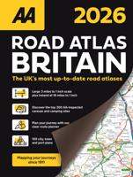
Wegenatlas Road Atlas Britain 2026 - A4 | AA Publishing
AA Road Atlas Britain 2026 – Wegenatlas Groot-Brittannië (Spiraalgebonden) De AA Road Atlas Britain 2026 is de meest uitgebreide en praktische wegenatlas voor iedereen die met de auto door Engeland, Schotland en Wales reist. Met actuele kaarten, toeristische info en meer dan 31.000 plaatsnamen is dit dé gids voor onderweg in het Verenigd Koninkrijk. Wat biedt deze atlas? Gedetailleerde kaarten met hoofdwegen, snelwegen en kleine binnenwegen Aanduidingen van National Trust-locaties, World Heritage Sites en moeilijk vindbare plaatsen 112 plattegronden van steden, dorpen, havens en luchthavens Volledig kleurenoverzicht van graafschappen, regio’s en administratieve gebieden Index met 31.500 vermeldingen, inclusief luchthavens, toeristische topattracties en snelwegvoorzieningen Symbolen voor scenische routes, golfbanen, campings en caravanplaatsen Extra kaarten voor snelwegen, ferryverbindingen en 5 districten Spiraalbinding – blijft plat open liggen tijdens gebruik …
24,95
Wegenatlas Road Atlas Ireland - Ierland | AA Publishing
Handige wegenatlas van Ierland en Noord-Ierland, schaal 1:200.000. Met 10 stadsplattegronden: Belfast, Cork, Londonderry, Dublin, Galway, Killarney, Kilkenny, Limerick, Sligo and Waterford. Created from brand new mapping data, this atlas includes AA inspected camping sites and AA listed golf courses, picnic sites, port plans and ferry routes. Plus, motorway strip maps detailing all of Ireland's motorway junctions. Toll motorways are clearly highlighted.There are 10 detailed city and town plans with street indexes: Belfast, Cork, Londonderry, Dublin, Galway, Killarney, Kilkenny, Limerick, Sligo and Waterford and an easy-to-read place name index, with top tourist sites highlighted.New district maps of Dublin and Belfast show the surrounding area in more detail.
11,95

Klanten-reviews van Wegenatlas Touring Atlas Scotland 2026 | Ringband | A4-Formaat | AA Publishing

Er zijn nog geen beoordelingen voor dit productBen jij de eerste die een review plaatst?

Meer over Wegenatlas Touring Atlas Scotland 2026 | Ringband | A4-Formaat | AA Publishing

Productomschrijving

Updated and new for 2025 the AA Touring Atlas Scotland, is your trusted travel companion for discovering the very best of Scotland. Expertly designed for travellers, this easy-to-read, 176-page atlas combines premium quality with unbeatable value.   Main Features:
  • Easy-to-read mapping and super-detailed plans of major, towns and cities
  • Official North Coast 500 route and information
  • AA-rated places to stay and eat and AA-recommended touring routes and walks
  • Large-scale district maps of Edinburgh and Glasgow with extra detail
  • Great places to visit and useful locations including golf courses, distilleries, and scenic landscapes
  • User-friendly spiral bound with a durable cover
  • The atlas makes exploring Scotland easy with road mapping consisting of mainland Scotland at giant 2.3 miles to 1 inch scale, and Scottish islands at a minimum of 7.6 miles to 1 inch. Featuring scores of wonderful places to visit as well as AA-recommended tours and the iconic North Coast 500 route this practical atlas ensures you get the most out of every journey.
Numerous useful features are located throughout the mapping using distinctive symbols including golf courses, distilleries, Highland Games locations, picnic sites, viewpoints and ferry routes. All AA-rated places to stay and eat are clearly marked and named for easy cross-referencing. The location of steep gradients, snow roads and narrow roads are included to help each journey go smoothly, enabling you to choose the best route for your journey all-year round.   Other handy sections in the atlas offer AA-recommended touring routes and walks, all with clear maps and directions, things to do and towns to explore, plus listings of AA-rated places to stay and eat where you can find out more information, including AA ratings and awards, addresses and contact details.   From rolling hills and stunning scenery to historic landmarks and more, the AA Touring Atlas of Scotland ensures you’ll uncover the very best Scotland has to offer at a price that delivers incredible value. Don’t just visit Scotland – experience it to the fullest.

Productinformatie

    Verken gerelateerde categorieën

    Webshop.nl maakt gebruik van cookies. Ga je verder op onze website, ga dan akkoord met het plaatsen van cookies en de verwerking van deze data door ons en vermelde partners.