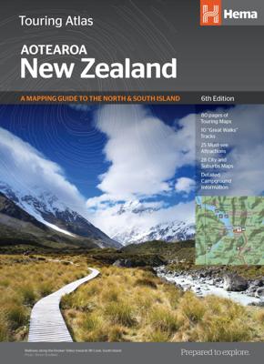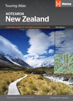
Wegenatlas Touring Atlas New Zealand - roadatlas - Nieuw Zeeland | A4 Ringband | Hema Maps

0
Uitstekende wegenatlas van zowel Noord als Zuid eiland met goed leesbare kaarten, met stadsplattegronden en afstandstabel. In ringband, A4 formaat / Engelstalig. Met 80 pagina's wegenkaarten, 26 stadsplattegronden, volledig ge-updated, met campings en veel ingetekende details.  Tour the land of the long white cloud with New Zealand’s clearest and...

Verkopers met dit product

Verkoper
Bezorging
Prijs
DeZwerver.nl logo
DeZwerver.nl
2,95
34,95

Anderen bekeken ook

Nieuw
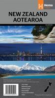
Wegenatlas Handy atlas New Zealand Aotearoa - Nieuw Zeeland | B5 Ringband | Hema Maps
Kleine handzame wegenatlas van Nieuw Zeeland. Tour the land of the long white cloud with New Zealand’s clearest and most up-to-date maps – the hard work's all taken care of. There's something for every kind of traveller among these meticulously crafted maps and guides, with more than 1500 motorhome parks, adventure activity locations, camping grounds and additional city and national park maps. All presented in an easy to read, easy to store format – finally putting an end to back-road map rage. With so much to see and do you'll be glad to have this comprehensive travel companion at your side, helping you cut down the planning time so you have time to explore!       Key Features • 80 pages of touring maps   • 10 “Great Walks” tracks   • 25 must-see attractions   • 28 City Maps   • Detailed campground information    • Extensive and updated information on the NZ “Great Walks”
22,50
Wegenatlas Touring Atlas Scotland 2026 | Ringband | A4-Formaat | AA Publishing
Updated and new for 2025 the AA Touring Atlas Scotland, is your trusted travel companion for discovering the very best of Scotland. Expertly designed for travellers, this easy-to-read, 176-page atlas combines premium quality with unbeatable value.   Main Features: Easy-to-read mapping and super-detailed plans of major, towns and cities Official North Coast 500 route and information AA-rated places to stay and eat and AA-recommended touring routes and walks Large-scale district maps of Edinburgh and Glasgow with extra detail Great places to visit and useful locations including golf courses, distilleries, and scenic landscapes User-friendly spiral bound with a durable cover The atlas makes exploring Scotland easy with road mapping consisting of mainland Scotland at giant 2.3 miles to 1 inch scale, and Scottish islands at a minimum of 7.6 miles to 1 inch. Featuring scores of wonderful places to visit as well as AA-recommended tours and the iconic North Coast 500 route this practic…
15,50
Nieuw
Wegenatlas Navigator Scotland | A4-Formaat | Ringband | Philip's Maps
Duidelijke en gedetailleerde atlas van Schotland met enkele stadsplattegronden en register. Zuid Schotland is van schaal 1:100.000 en het noorden met schaal 1:200.000   Philip's Navigator Scotland is part of the Navigator brand, the UK's best-selling road atlases. The Navigator maps provide highly detailed coverage of the Scotland's road network, including minor country lanes and rural tracks. Most of the Central Lowlands and Scottish Borders are shown at the unique Navigator scale of 1.5 miles to 1 inch, Northern Scotland at 3 miles to 1 inch.   Navigator Scotland offers so much more than road maps: hundreds of individually named farms, houses and hamlets, airports, airfields, stations, ferries, canals, marinas, tourist information centres, and a wide range of places of interest. The atlas has a comprehensive index and includes indexed town plans of major regional centres. The front of the atlas contains a 15-page guide to regional leisure facilities and listings of a wide variety…
15,95
Reisgids New Zealand - Nieuw Zeeland | Rough Guides
Zeer goede reisgids voor zowel de georganiseerde maar vooral voor de zelfstandige reiziger. Boordevol informatie over reizen, slapen, eten, maar ook musea en cultuur. Voor veel landen meestal completer en beter dan de Lonely Planet ! This practical travel guide to New Zealand features detailed factual travel tips and points-of-interest structured lists of all iconic must-see sights as well as some off-the-beaten-track treasures. Our itinerary suggestions and expert author picks of things to see and do will make it a perfect companion both, ahead of your trip and on the ground. This New Zealand guide book is packed full of details on how to get there and around, pre-departure information and top time-saving tips, including a visual list of things not to miss. Our colour-coded maps make New Zealand easier to navigate while you're there. This guide book to New Zealand has been fully updated post-COVID-19 and it comes with a free eBook.   The Rough Guide to New Zealand covers: Auckland…
27,95
Nieuw
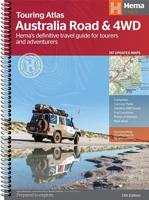
Wegenatlas Australia Road & 4WD Touring Atlas A4 | Hema Maps
Uitstekende wegenatlas van heel Australië met goed leesbare kaarten, met stadsplattegronden en afstandstabel. A4-formaat in ringband, Engelstalig. Featuring trusted Hema mapping for all of Australia, the Hema Road & 4WD Touring Atlas is the definitive travel guide for tourers and adventurers. Hema atlases feature more information useful to travellers, including 4WD tracks, campsites, caravan parks, rest areas, 24-hour fuel and points of interest.   This edition contains more mapping than ever before, which is enhanced by a striking new cartographic style that's incredibly easy to read. Included in this is up-to-date mapping for Australia's biggest 4WD destinations: Cape York, Fraser Island, the Top End, the Kimberley, the Pilbara, Central Australia, High Country Victoria and the Flinders Ranges.   A handy distance grid, national park guide, list of accredited information centres and a complete index are also included to assist with trip planning and navigation, making it the perf…
39,95
Nieuw
Wegenkaart - landkaart South Island (Zuider Eiland - Nieuw Zeeland) | Hema Maps
Uitstekende overzichtskaart met index, afstandstabel, nationale parken en toeristische informatie. Gedetailleerder dan de gehele Nieuw - Zeeland kaart. This map is easy to read and feature clear, easy to read cartography, reliefshading, National Parks, Points of Interest, Tourist Routes, Distance Grid and Walking Tracks. Printed one sided and complete with index these are an ideal planning tool as well as an ideal travel companion. This regional map of the South Island of New Zealand (NZ) is at a scale of 1:1,000,000 and shows points of interests, tourist routes, walking tracks and national parks for touring the island. On the reverse side are handy city maps of Christchurch, Picton, Nelson, Queenstown, Dunedin, Blenheim and Invercargill, and suburb maps of Christchurch and Dunedin. It also includes detailed maps of Fiordland, Kahurangi, Arthur’s Pass and Aoraki National Parks along with a distance grid.   PRODUCT FEATURES   • National parks • Topographic maps • Tourist routes • Dista…
17,50
Wandelgids Best Day Walks New Zealand - Nieuw Zeeland | Lonely Planet
Lonely Planet heeft een nieuwe serie uitgebracht: Best Day Walks in verschillende landen. Het zijn de - door Lonely Planet uitgekozen - mooiste wandelingen verspreid over het land. Goed beschreven, met een schetsmatige kaart erbij ... het werkt heel stimulerend met mooie foto's! Lonely Planet's Best Day Walks New Zealand is your passport to 60 easy escapes into nature. Stretch your legs outside the city by picking a hike that works for you, from a few hours to a full day, from easy to hard. Climb ancient volcanoes, view amazing vistas, and scale tall mountains. Get to the heart of New Zealand and begin your journey now!       Inside Lonely Planet's Best Day Walks New Zealand Travel Guide:   Up-to-date information - all businesses were rechecked before publication to ensure they are still open after 2020’s COVID-19 outbreak   Colour maps and images throughout   Special features - on New Zealand's highlights for walkers, kid-friendly walks, accessible trails and what to take   Best for……
22,50
Nieuw
Wegenkaart - landkaart 790 New Zealand - Nieuw Zeeland | Michelin
Zoals je van Michelin mag verwachten is deze kaart zeer overzichtelijk en heeft een duidelijk helder kaartbeeld. De kaart geeft uitgebreide toeristische informatie weer. De perfecte overzichtskaart!   This New Zealand map from Michelin is part of their red national map series. These are perfect for route planning as well as getting around by car once you're there. They clearly mark out major roads and also show many of the more important minor roads.    The map's simple folding design with durable paper cover, allows it to be read like a book and easily folded back together. Road numbers and intermediate distances are clearly displayed with the more scenic routes highlighted in green.   The map also features:   Political boundaries Regional and National Parks Important sights (points of interest, historic sites, etc.) Driving Times and Distances Road Safety Information A legend in multiple languages (Dutch, English, French, German and Spanish) Michelin New Zealand Map 790 is a new add…
12,95
Wegenatlas Road Atlas USA Canada Mexico 2025 | A4-Formaat | Ringband | Michelin
De beroemde wegenatlas van Rand McNally nu als Michelin atlas. Super handige atlas van Michelin in A4 formaat met stevige ringband. Let op: Canada en Mexico staan er zeer beperkt in. For inspiring road trips and scenic drives, Michelin's updated, spiral-bound North America Road Atlas 2024 suggests 52 routes. The tiled atlas, with its clear, accurate mapping, complements online navigation while its big picture and road details aid in advance planning and en route decisions. For outdoor fun and adventure, look for inspiration among the highlights from national and provincial parks, including the parks' GPS coordinates.   Rely with confidence on Michelin's deluxe atlas to get you there. Covers USA, Canada and Mexico. Scale 1:625,000 - 1:9,018,000.   Spiral bound for lay-flat convenience. More than 240 large-scale city maps for navigating in and around urban areas. Bonus Northeast Corridor maps provide extra detail between Boston and Washington DC for easier driving.   Six-page tra…
21,95
Wegenatlas Road Atlas Britain and Ireland 2025 | Ringband | A4-Formaat | Philip's Maps
Let op! Ierland en een gedeelte van Schotland hebben een andere schaal dan de rest van de atlas.   'Good balance between detail and clarity with excellent town maps' What Car?PHILIP'S - Market leader and No. 1 in the UK for clear maps 2025 Philip's Road Atlas of Britain and Ireland is a top-of-the-range, A4-sized, spiral-bound atlas, featuring fully updated maps from the Philip's digital database. Voted Britain's clearest and most detailed in an independent consumer survey, the mapping is super-clear.   * 160 pages of fully updated super-clear road maps * Top tips for better and safer driving and the easiest way to parallel park * Detailed route-planning maps, to help plan your route in advance * 88 fully indexed and detailed town-centre maps throughout the British Isles * Major city approach maps with named arterial roads including the expanded London ULEZ * Clear road map showing all of Ireland * Mapping at a scale of 3 miles to 1 inch = 1:200,000 for easy use * Handy lie-f…
23,95

Klanten-reviews van Wegenatlas Touring Atlas New Zealand - roadatlas - Nieuw Zeeland | A4 Ringband | Hema Maps

Er zijn nog geen beoordelingen voor dit productBen jij de eerste die een review plaatst?

Meer over Wegenatlas Touring Atlas New Zealand - roadatlas - Nieuw Zeeland | A4 Ringband | Hema Maps

Productomschrijving

Uitstekende wegenatlas van zowel Noord als Zuid eiland met goed leesbare kaarten, met stadsplattegronden en afstandstabel. In ringband, A4 formaat / Engelstalig.

Met 80 pagina's wegenkaarten, 26 stadsplattegronden, volledig ge-updated, met campings en veel ingetekende details. 

Tour the land of the long white cloud with New Zealand’s clearest and most up-to-date maps – the hard work's all taken care of. There's something for every kind of traveller among these meticulously crafted maps and guides, with more than 1500 motorhome parks, adventure activity locations, camping grounds and additional city and national park maps. All presented in an easy to read, easy to store format – finally putting an end to back-road map rage. With so much to see and do you'll be glad to have this comprehensive travel companion at your side, helping you cut down the planning time so you have time to explore!   Product Features   • 80 pages of touring maps   • 10 “Great Walks” tracks   • 25 must-see attractions   • 28 City Maps   • Detailed campground information   What's New in This Edition   • New cartographic look and feel   • Updated parks and facilities   • 8 additional regional maps (NZ Atlas)   • Extensive and updated information on the NZ “Great Walks”


Verken gerelateerde categorieën

Webshop.nl maakt gebruik van cookies. Ga je verder op onze website, ga dan akkoord met het plaatsen van cookies en de verwerking van deze data door ons en vermelde partners.